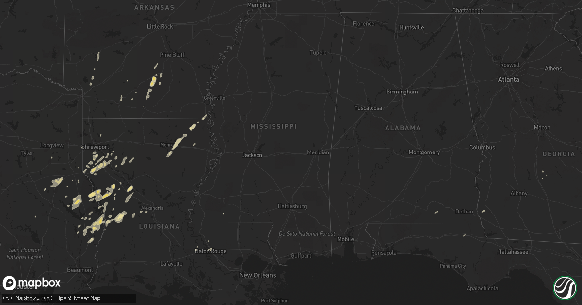
Hail Map in Alabama on February 1, 2011
Get this storm
February 1 map
$229
one time, instant access
Download today. No call, no setup
Keep the $229
Bought the map and want the full workflow? Apply the entire $229 to a subscription within 7 days. None of it is wasted.
Every map, not just this one
This buys you this map. Subscription and you get every map we run, in the markets you choose from a few cities to whole states to nationwide. Plus real-time alerts the moment a storm fires.
Contact data
Name, contact info, occupancy, even credit band for addresses in the footprint. You go from where it hit to who to call.
Become the source they trust
Unlimited branding weather history reports on demand. You already have the documented answer ready for the property owner, and you are the one who showed up with it.
Property data and RoofTrace estimates
Pull up any address you have got, its value and the exact code rules for that jurisdiction, straight from One Click Code. Then RoofTrace estimates the squares, pitch, and roof value, priced the way you price.
Storm reports in Alabama
Alabama
| Date | Description |
|---|---|
| 02/01/20115:51 PM CST | Large metal awning attached to the front of a home was destroyed. |
| 02/01/20115:20 PM CST | Tree and power lines blown down. |
| 01/31/20118:06 PM CST | Several trees down...one on vehicle. |
| 01/31/20118:06 PM CST | Ef-0 tornado damage confirmed east of abbeville near the intersection of state highway 10 and county road 57. Damage limited primarily to trees and barns. Path width of |
| 01/31/20118:06 PM CST | Two trees reported down across western houston county. A car ran into one of the downed trees. Minor damage to one garage door. Time of damage estimated. |
| 01/31/20117:15 PM CST | Cable and telephone lines down near the intersetion of 231 and george wallace drive. Asos estimated wind speed of 50 mph. |
| 01/31/20117:12 PM CST | Damage to the roof of a local business. Trees and a few power poles blown down. |
| 01/31/20117:07 PM CST | Several trees reported blown down around the lockhart area. |
| 01/31/20117:02 PM CST | A few trees down around the city of andalusia. |
All States Impacted by Hail Map on February 1, 2011
Cities Impacted by Hail Map on February 1, 2011
- Nacogdoches, TX
- Garrison, TX
- Mount Enterprise, TX
- Jasper, TX
- Hineston, LA
- Leesville, LA
- Coushatta, LA
- Milam, TX
- Robeline, LA
- Chireno, TX
- Carthage, TX
- Mansfield, LA
- Cottondale, FL
- Ringgold, LA
- Shreveport, LA
- Grand Cane, LA
- Hampton, AR
- Kingsland, AR
- Montgomery, LA
- Natchez, LA
- Natchitoches, LA
- Melrose, LA
- Cloutierville, LA
- Frierson, LA
- Stonewall, LA
- Nashville, AR
- Otis, LA
- Elmer, LA
- Benton, LA
- Many, LA
- Zwolle, LA
- Noble, LA
- Florien, LA
- Groveton, TX
- Collinston, LA
- Monroe, LA
- Oak Ridge, LA
- Jones, LA
- Oak Grove, LA
- Bronson, TX
- Hemphill, TX
- Eudora, AR
- Douglass, TX
- Elm Grove, LA
- Logansport, LA
- Kirbyville, TX
- Newton, TX
- Wiergate, TX
- Burkeville, TX
- Evans, LA
- San Augustine, TX
- Broaddus, TX
- Cordele, GA
- Oscar, LA
- Brookeland, TX
- Keatchie, LA
- Gloster, LA
- Center, TX
- Call, TX
- Fort Polk, LA
- Fordyce, AR
- Thornton, AR
- Anacoco, LA
- Merryville, LA
- Belmont, LA
- El Dorado, AR
- Castor, LA
- Warren, AR
- Banks, AR
- Fulton, AR
- McNeil, AR
- Stephens, AR
- Magnolia, AR
- Waskom, TX
- Greenwood, LA
- Zachary, LA
- Liberty, MS
- Henderson, TX
- Keithville, LA
- Baton Rouge, LA
- Mer Rouge, LA
- Rayville, LA
- Heflin, LA
- West Monroe, LA
- Woodworth, LA
- Columbus, AR
- Washington, AR
- Deville, LA
- Bon Wier, TX
- Bienville, LA
- Saline, LA
- Kirby, AR
- Amity, AR
- Murfreesboro, AR
- Blakely, GA
- Port Allen, LA
- Rosedale, LA
- Louann, AR
- Rison, AR
- Etoile, TX
- Lena, LA
- Provencal, LA
- Samson, AL
- Coffee Springs, AL
- Ashland, LA
- Delhi, LA
- Pitts, GA
- Slagle, LA
- Pitkin, LA
- Deridder, LA
- Camden, AR
- New Edinburg, AR
- Chidester, AR


