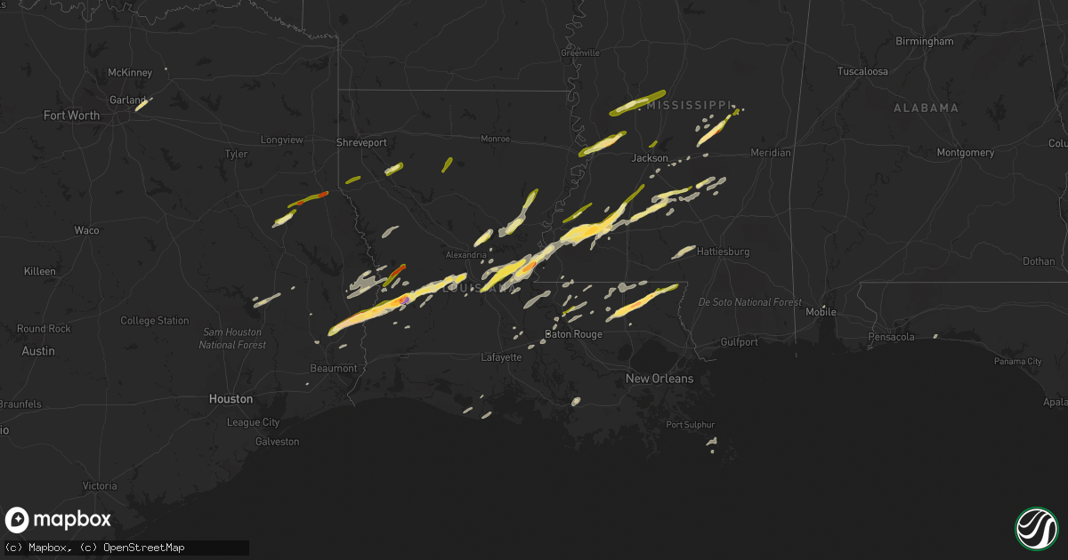
Hail Map in Louisiana on January 21, 2016
Get this storm
January 21 map
$229
one time, instant access
Download today. No call, no setup
Keep the $229
Bought the map and want the full workflow? Apply the entire $229 to a subscription within 7 days. None of it is wasted.
Every map, not just this one
This buys you this map. Subscription and you get every map we run, in the markets you choose from a few cities to whole states to nationwide. Plus real-time alerts the moment a storm fires.
Contact data
Name, contact info, occupancy, even credit band for addresses in the footprint. You go from where it hit to who to call.
Become the source they trust
Unlimited branding weather history reports on demand. You already have the documented answer ready for the property owner, and you are the one who showed up with it.
Property data and RoofTrace estimates
Pull up any address you have got, its value and the exact code rules for that jurisdiction, straight from One Click Code. Then RoofTrace estimates the squares, pitch, and roof value, priced the way you price.
Storm reports in Louisiana
Louisiana
| Date | Description |
|---|---|
| 01/21/20165:55 PM CST | Baseball size hail reported near wilmer. Event time estimated by radar. Photo relayed by broadcast media. |
| 01/21/20165:54 PM CST | Two inch hail reported about 10 miles east of amite. Several small hail reports near independence. Report relayed through tangipahoa parish emergency manager. |
| 01/21/20165:45 PM CST | Golf ball size hail reported 3 miles east of amite. Picture relayed through broadcast media. Event time estimated by radar. |
| 01/21/20165:35 PM CST | Golf ball size hail reported in amite. Picture relayed through broadcast media. Event time estimated by radar. |
| 01/21/20164:55 PM CST | A local report indicates 1.00 inch wind near 4 N ZACHARY |
| 01/21/20164:50 PM CST | Tree reported blown down onto eastbound side of us highway 190 on the four mile bridge near lottie. |
| 01/21/20164:45 PM CST | Porch roof blown off a home at louisiana highway 447 and courtney road in walker. |
| 01/21/20163:11 PM CST | Half of mobile home roof blown off. Time estimated by radar. |
| 01/21/20163:10 PM CST | Rapides sheriff reports powerlines down... A cattle trailer thrown across a road and sheds destroyed along powell dr in ball... La. |
| 01/21/20162:52 PM CST | Public posted a photo of hail at plainview high school in glenmora. Time estimated by radar. |
| 01/21/20162:51 PM CST | A local report indicates 1.00 inch wind near JONESVILLE |
| 01/21/20162:45 PM CST | Report from sheriffs office. |
| 01/21/20162:44 PM CST | Public posted facebook photo of half dollar size hail in bordelonville. Time estimated by radar |
| 01/21/20162:30 PM CST | Report from sheriffs office. |
| 01/21/20162:30 PM CST | Public posted photo of half dollar size hail to social media. |
| 01/21/20162:23 PM CST | Public posted a photo on facebook of quarter size hail near pitkin |
| 01/21/20161:48 PM CST | Public posted photo to facebook of a tree down in simpson... La. Time estimated by radar. |
| 01/21/20161:45 PM CST | Public sent in photo of hail south of deridder with ruler for measurement. Time estimated by radar |
| 01/21/20161:45 PM CST | Beauregard sheriff reports golf ball size hail in de ridder. |
| 01/21/20167:29 AM CST | A local report indicates 1.00 inch wind near SICILY ISLAND |
| 01/21/20166:52 AM CST | Quarter sized hail reported |
| 01/20/20166:05 PM CST | Golfball sized hail in downtown franklinton. |
| 01/20/20166:03 PM CST | Quarter size hail reported 4 miles southeast of kentwood. Report relayed by broadcast media. |
| 01/20/20166:00 PM CST | A weak tornado touched down just northwest of the community of tangipahoa. Approximately a dozen large hardwood trees..mainly oaks...were uprooted or trunks snapped. Pa |
All States Impacted by Hail Map on January 21, 2016
Cities Impacted by Hail Map on January 21, 2016
- Kentwood, LA
- Raleigh, MS
- Marksville, LA
- Rockwall, TX
- Glenmora, LA
- Forest Hill, LA
- Jasper, TX
- Florence, MS
- Wiergate, TX
- Many, LA
- Merryville, LA
- Deridder, LA
- Buna, TX
- Call, TX
- Kirbyville, TX
- Bon Wier, TX
- Redwood, MS
- Vicksburg, MS
- Jena, LA
- Pineville, LA
- Pollock, LA
- Deville, LA
- Amite, LA
- Franklinton, LA
- Loranger, LA
- Mount Olive, MS
- Mendenhall, MS
- Mize, MS
- Magee, MS
- Forney, TX
- Sunnyvale, TX
- Morton, MS
- Pelahatchie, MS
- Lecompte, LA
- Mary Esther, FL
- Fort Walton Beach, FL
- Livingston, TX
- Onalaska, TX
- Moreauville, LA
- Simmesport, LA
- Bentonia, MS
- Natchez, MS
- Pinola, MS
- Mount Hermon, LA
- Tylertown, MS
- Ringgold, LA
- Coushatta, LA
- Hall Summit, LA
- Hessmer, LA
- Cottonport, LA
- Bunkie, LA
- Mansura, LA
- Philadelphia, MS
- Forest, MS
- Union, MS
- Walnut Grove, MS
- Kaplan, LA
- Pearl, MS
- Royse City, TX
- Yazoo City, MS
- Roxie, MS
- Brandon, MS
- Abbeville, LA
- Wesson, MS
- McCall Creek, MS
- Meadville, MS
- Brookhaven, MS
- Hazlehurst, MS
- Union Church, MS
- Ethel, LA
- Jackson, LA
- Lettsworth, LA
- Braxton, MS
- Effie, LA
- Husser, LA
- Independence, LA
- Morgan City, LA
- Gloster, MS
- Nacogdoches, TX
- Ville Platte, LA
- Newton, TX
- Centreville, MS
- Norwood, LA
- Pride, LA
- Baker, LA
- Zachary, LA
- Pitkin, LA
- Saint Francisville, LA
- Buras, LA
- Venice, LA
- Batchelor, LA
- Monterey, LA
- Benton, MS
- Anacoco, LA
- Evans, LA
- Sugartown, LA
- Dry Creek, LA
- Clinton, LA
- Carthage, MS
- Leesville, LA
- Monticello, MS
- Newhebron, MS
- Greenville, TX
- Harrisville, MS
- Sumrall, MS
- Foxworth, MS
- Columbia, MS
- Jonesville, LA
- Oakdale, LA
- Silsbee, TX
- Burkeville, TX
- Slaughter, LA
- Taylorsville, MS
- Bay Springs, MS
- Port Allen, LA
- Woodville, MS
- Grant, LA
- Florien, LA
- Fisher, LA
- Greensburg, LA
- Chester, TX
- Rosedale, LA
- Longville, LA
- Krotz Springs, LA
- Maringouin, LA
- Grosse Tete, LA
- Kountze, TX
- Acme, LA
- Fayette, MS
- Mobile, AL
- Lena, MS
- Holden, LA
- Angie, LA
- Pattison, MS
- Arnaudville, LA
- Georgetown, MS
- Vidalia, LA
- Plaucheville, LA
- Bude, MS
- Cheneyville, LA
- Beaumont, TX
- Sicily Island, LA
- Harrisonburg, LA
- Woodworth, LA
- Port Barre, LA
- Pickens, MS
- Prentiss, MS
- Ball, LA
- Saint Martinville, LA
- Warren, TX
- Hillister, TX
- Clinton, MS
- Jonesboro, LA
- Louin, MS
- Glynn, LA
- Erwinville, LA
- Ragley, LA
- Greenwell Springs, LA
- Hammond, LA
- Lorman, MS
- Gilbert, LA
- Lexington, MS
- Vaughan, MS
- Evergreen, LA
- Ridgeland, MS
- Madison, MS
- Tallulah, LA
- Crystal Springs, MS
- New Llano, LA
- Joaquin, TX
- Garrison, TX
- Tenaha, TX
- Timpson, TX
- Logansport, LA
- Grand Cane, LA
- Douglass, TX
- Quitman, LA


