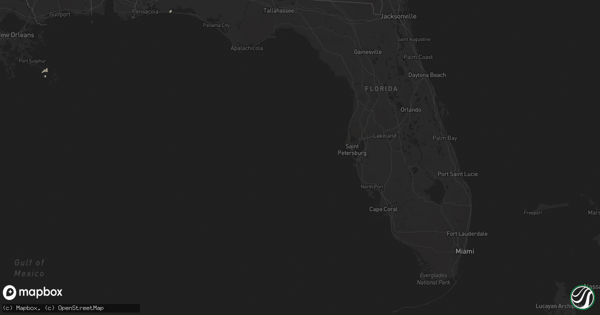
Hail Map in Florida on January 21, 2016
Get this storm
January 21 map
$229
one time, instant access
Download today. No call, no setup
Keep the $229
Bought the map and want the full workflow? Apply the entire $229 to a subscription within 7 days. None of it is wasted.
Every map, not just this one
This buys you this map. Subscription and you get every map we run, in the markets you choose from a few cities to whole states to nationwide. Plus real-time alerts the moment a storm fires.
Contact data
Name, contact info, occupancy, even credit band for addresses in the footprint. You go from where it hit to who to call.
Become the source they trust
Unlimited branding weather history reports on demand. You already have the documented answer ready for the property owner, and you are the one who showed up with it.
Property data and RoofTrace estimates
Pull up any address you have got, its value and the exact code rules for that jurisdiction, straight from One Click Code. Then RoofTrace estimates the squares, pitch, and roof value, priced the way you price.
Storm reports in Florida
Florida
| Date | Description |
|---|---|
| 01/21/20164:30 AM CST | Tree down in the rock bluff area |
| 01/21/20163:15 AM CST | Roof damage to two buildings in bonifay. Time estimated by radar. |
| 01/21/20163:05 AM CST | Large tree down near millville. |
| 01/21/20163:05 AM CST | Power lines down on east fourth court in panama city. |
| 01/21/20162:42 AM CST | Power lines down on east fourth court in panama city. |
| 01/21/20161:41 AM CST | Trees down on highway 2 west near highway 331. |
| 01/21/20161:30 AM CST | Gas station awning peeled off. Minor awning/roof damage sustained to building at harborwalk village. |
| 01/21/201612:54 AM CST | County 911 reports damage to an equestrian center and an out building on bobby brown rd. Time via radar. |
| 01/21/201612:52 AM CST | Whiting field asos gusted to 58mph with thunderstorm passage. |
| 01/21/201612:43 AM CST | Whiting field asos gusted to 58mph with thunderstorm passage. |
| 01/21/201612:40 AM CST | Trees down. Roof and shingle damage to numerous houses. Garage doors blown out on 2 houses. Some siding on a house removed and windows broken on a house. Wooden fence b |
| 01/21/201612:31 AM CST | Multiple reports of trees and powerlines down along with structural damage to residences in the gulf breeze area near hickory shores and gulf breeze parkway. Time via r |
| 01/21/201612:24 AM CST | Pensacola naval air station asos reported a 73mph wind gust with thunderstorm passage. |
| 01/20/201611:24 PM CST | Metal barn destroyed on hwy4a. |
All States Impacted by Hail Map on January 21, 2016
Cities Impacted by Hail Map on January 21, 2016
- Kentwood, LA
- Raleigh, MS
- Marksville, LA
- Rockwall, TX
- Glenmora, LA
- Forest Hill, LA
- Jasper, TX
- Florence, MS
- Wiergate, TX
- Many, LA
- Merryville, LA
- Deridder, LA
- Buna, TX
- Call, TX
- Kirbyville, TX
- Bon Wier, TX
- Redwood, MS
- Vicksburg, MS
- Jena, LA
- Pineville, LA
- Pollock, LA
- Deville, LA
- Amite, LA
- Franklinton, LA
- Loranger, LA
- Mount Olive, MS
- Mendenhall, MS
- Mize, MS
- Magee, MS
- Forney, TX
- Sunnyvale, TX
- Morton, MS
- Pelahatchie, MS
- Lecompte, LA
- Mary Esther, FL
- Fort Walton Beach, FL
- Livingston, TX
- Onalaska, TX
- Moreauville, LA
- Simmesport, LA
- Bentonia, MS
- Natchez, MS
- Pinola, MS
- Mount Hermon, LA
- Tylertown, MS
- Ringgold, LA
- Coushatta, LA
- Hall Summit, LA
- Hessmer, LA
- Cottonport, LA
- Bunkie, LA
- Mansura, LA
- Philadelphia, MS
- Forest, MS
- Union, MS
- Walnut Grove, MS
- Kaplan, LA
- Pearl, MS
- Royse City, TX
- Yazoo City, MS
- Roxie, MS
- Brandon, MS
- Abbeville, LA
- Wesson, MS
- McCall Creek, MS
- Meadville, MS
- Brookhaven, MS
- Hazlehurst, MS
- Union Church, MS
- Ethel, LA
- Jackson, LA
- Lettsworth, LA
- Braxton, MS
- Effie, LA
- Husser, LA
- Independence, LA
- Morgan City, LA
- Gloster, MS
- Nacogdoches, TX
- Ville Platte, LA
- Newton, TX
- Centreville, MS
- Norwood, LA
- Pride, LA
- Baker, LA
- Zachary, LA
- Pitkin, LA
- Saint Francisville, LA
- Buras, LA
- Venice, LA
- Batchelor, LA
- Monterey, LA
- Benton, MS
- Anacoco, LA
- Evans, LA
- Sugartown, LA
- Dry Creek, LA
- Clinton, LA
- Carthage, MS
- Leesville, LA
- Monticello, MS
- Newhebron, MS
- Greenville, TX
- Harrisville, MS
- Sumrall, MS
- Foxworth, MS
- Columbia, MS
- Jonesville, LA
- Oakdale, LA
- Silsbee, TX
- Burkeville, TX
- Slaughter, LA
- Taylorsville, MS
- Bay Springs, MS
- Port Allen, LA
- Woodville, MS
- Grant, LA
- Florien, LA
- Fisher, LA
- Greensburg, LA
- Chester, TX
- Rosedale, LA
- Longville, LA
- Krotz Springs, LA
- Maringouin, LA
- Grosse Tete, LA
- Kountze, TX
- Acme, LA
- Fayette, MS
- Mobile, AL
- Lena, MS
- Holden, LA
- Angie, LA
- Pattison, MS
- Arnaudville, LA
- Georgetown, MS
- Vidalia, LA
- Plaucheville, LA
- Bude, MS
- Cheneyville, LA
- Beaumont, TX
- Sicily Island, LA
- Harrisonburg, LA
- Woodworth, LA
- Port Barre, LA
- Pickens, MS
- Prentiss, MS
- Ball, LA
- Saint Martinville, LA
- Warren, TX
- Hillister, TX
- Clinton, MS
- Jonesboro, LA
- Louin, MS
- Glynn, LA
- Erwinville, LA
- Ragley, LA
- Greenwell Springs, LA
- Hammond, LA
- Lorman, MS
- Gilbert, LA
- Lexington, MS
- Vaughan, MS
- Evergreen, LA
- Ridgeland, MS
- Madison, MS
- Tallulah, LA
- Crystal Springs, MS
- New Llano, LA
- Joaquin, TX
- Garrison, TX
- Tenaha, TX
- Timpson, TX
- Logansport, LA
- Grand Cane, LA
- Douglass, TX
- Quitman, LA


