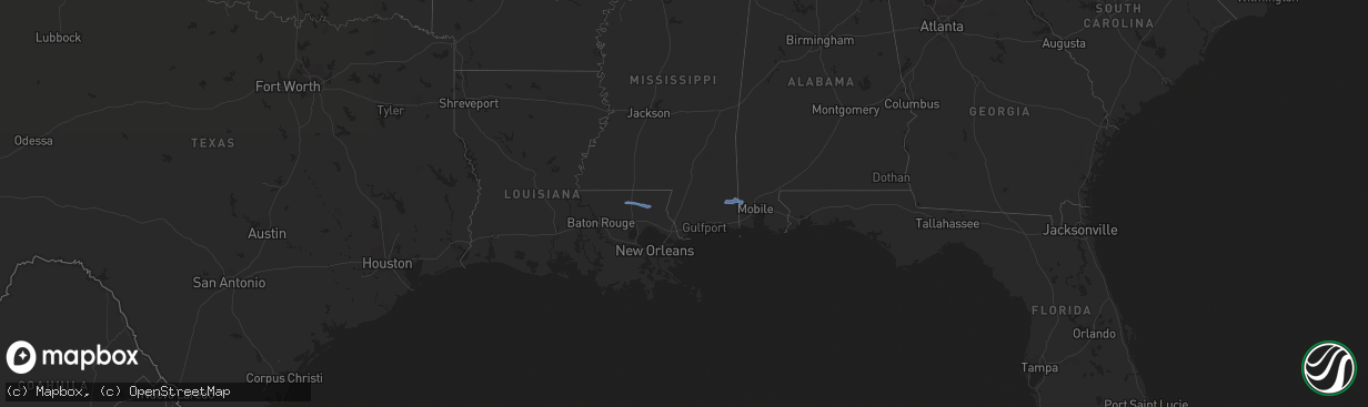
Hail Map in Louisiana on December 30, 2022
The weather event in Louisiana on December 30, 2022 includes Hail and Wind maps. 3 states and 9 cities were impacted and suffered possible damage. The total estimated number of properties impacted is 0.
Want more than just the map?
Turn this storm into a full workflow.
- Owner + property data so you know who to knock
- OnDemand branded weather history reports to win the "did we even have hail?" argument
- RoofTrace estimate so reps stop guessing numbers at the door
Bought this map? Upgrade within 7 days and we'll credit the $230. (10-15 min setup call)
Hail
Wind
0
Estimated number of impacted properties by a 1.00" hail or larger0
Estimated number of impacted properties by a 1.75" hail or larger0
Estimated number of impacted properties by a 2.50" hail or largerStorm reports in Louisiana
Louisiana
| Date | Description |
|---|---|
| 12/30/20228:29 AM CST | Mandeville lakefront observation measured a 68 mph wind gust. |
| 12/30/20228:25 AM CST | St tammany parish government reported a tree downed by thunderstorm winds on lowe davis road. Time estimated by radar. |
| 12/30/20228:23 AM CST | Thunderstorm winds downed a tree onto a powerline on river road near covington point neighborhood. Time estimated by radar. |
| 12/30/20227:30 AM CST | Pine tree blocking road near intersection of hwy 16 and strahan rd. Time estimated by radar. |
| 12/30/20221:13 AM CST | At 712 AM CST, a severe thunderstorm was located near Roseland, or near Amite, moving northeast at 35 mph. HAZARD...60 mph wind gusts and penny size hail. SOURCE...Radar indicated. IMPACT...Expect damage to roofs, siding, and trees. Locations impacted include... Franklinton, Amite, Amite City, Roseland, Mount Herman, Wilmer and Tangipahoa.This includes Interstate 55 in Louisiana between mile markers 47 and57. |
| 12/30/202212:25 AM CST | At 625 AM CST, severe thunderstorms were located along a line extending from 6 miles southwest of Yokena to near Peyton, moving northeast at 55 mph. HAZARD...60 mph wind gusts. SOURCE...Radar indicated. IMPACT...Expect damage to roofs, siding, and trees. Severe thunderstorms will be near... Barlow around 630 AM CST. Rocky Springs and Carpenter around 635 AM CST. Dentville and Reganton around 640 AM CST. Newman around 645 AM CST. Crystal Springs and Gallman around 650 AM CST. Edwards and Dry Grove around 655 AM CST. Terry around 700 AM CST. Bolton around 705 AM CST.Other locations impacted by these severe thunderstorms includeLearned. |
| 12/29/202211:17 PM CST | At 517 AM CST, a severe thunderstorm was located near Black Hawk, or 10 miles northeast of Simmesport, moving east at 40 mph. HAZARD...60 mph wind gusts. SOURCE...Radar indicated. IMPACT...Expect damage to roofs, siding, and trees. This severe thunderstorm will be near... Black Hawk around 525 AM CST. |
| 12/29/202211:05 PM CST | At 505 AM CST, a severe thunderstorm was located near Lettsworth, or near Bayou Current, moving east at 90 mph. HAZARD...60 mph wind gusts and quarter size hail. SOURCE...Radar indicated. IMPACT...Hail damage to vehicles is expected. Expect wind damage to roofs, siding, and trees. Locations impacted include... Simmesport, Melville, Palmetto, Bayou Current, Morrow, Plaucheville, Big Cane, Goudeau, Dupont and Lebeau.This includes Interstate 49 between mile markers 33 and 34. |
| 12/29/202210:40 PM CST | At 440 AM CST, a severe thunderstorm was located near Cheneyville, moving east at 50 mph. HAZARD...60 mph wind gusts and nickel size hail. SOURCE...Radar indicated. IMPACT...Expect damage to roofs, siding, and trees. Locations impacted include... Marksville, Bunkie, Moreauville, Cheneyville, Bordelonville, Cottonport, Mansura, Hessmer, Echo, Brouillette and Hamburg.This includes Interstate 49 between mile markers 53 and 63. |
| 12/29/20229:35 PM CST | At 335 AM CST, a severe thunderstorm was located near Dry Creek, moving northeast at 45 mph. HAZARD...60 mph wind gusts and nickel size hail. SOURCE...Radar indicated. IMPACT...Expect damage to roofs, siding, and trees. Locations impacted include... Glenmora, Elizabeth, Dry Creek, Pitkin, Mittie, Grant, Harmony and Union Hill. |
| 12/29/20229:05 PM CST | At 305 AM CST, a severe thunderstorm was located near Port Arthur, moving northeast at 40 mph. HAZARD...60 mph wind gusts and quarter size hail. SOURCE...Radar indicated. IMPACT...Hail damage to vehicles is expected. Expect wind damage to roofs, siding, and trees. Locations impacted include... Port Arthur, Groves, Port Neches, Bridge City, Sabine Pass and Sea Rim State Park. |
| 12/29/20228:45 PM CST | At 245 AM CST, a severe thunderstorm was located over Orange, moving northeast at 80 mph. HAZARD...60 mph wind gusts and quarter size hail. SOURCE...Radar indicated. IMPACT...Hail damage to vehicles is expected. Expect wind damage to roofs, siding, and trees. Locations impacted include... Sulphur, Orange, Bridge City, Westlake, West Orange, Vinton, De Quincy, Moss Bluff, Pinehurst, Buhler, Toomey, Orangefield, Edgerly, Forest Heights and Carlyss.This includes the following highways... Interstate 10 in Texas between mile markers 880 and 867. Interstate 10 in Louisiana between mile markers 1 and 21. |
| 12/29/20228:28 PM CST | At 228 AM CST, severe thunderstorms were located along a line extending from near Bridge City to near High Island, moving east at 20 mph. HAZARD...60 mph wind gusts and quarter size hail. SOURCE...Radar indicated. IMPACT...Hail damage to vehicles is expected. Expect wind damage to roofs, siding, and trees. Locations impacted include... Beaumont, Port Arthur, Nederland, Groves, Port Neches, Bridge City, Hamshire, Central Gardens, Sabine Pass, Port Acres, La Belle, Southeast Texas Regional Airport and Sea Rim State Park. |
| 12/29/20228:10 PM CST | At 210 AM CST, a severe thunderstorm was located near Mauriceville, moving northeast at 50 mph. HAZARD...60 mph wind gusts and quarter size hail. SOURCE...Radar indicated. IMPACT...Hail damage to vehicles is expected. Expect wind damage to roofs, siding, and trees. Locations impacted include... Sulphur, Orange, Vidor, Bridge City, West Orange, Vinton, Deweyville, Starks, Mauriceville, De Quincy, Pinehurst, Lunita, Buhler, Hartburg, Forest Heights, Toomey, Orangefield and Edgerly.This includes the following highways... Interstate 10 in Texas between mile markers 880 and 863. Interstate 10 in Louisiana between mile markers 1 and 18. |
| 12/29/20227:56 PM CST | At 156 AM CST, a severe thunderstorm was located over Fannett, or near Hamshire, moving northeast at 55 mph. HAZARD...60 mph wind gusts and nickel size hail. SOURCE...Radar indicated. IMPACT...Expect damage to roofs, siding, and trees. Locations impacted include... Beaumont, Port Arthur, Orange, Nederland, Groves, Port Neches, Vidor, Bridge City, West Orange, Hamshire, Central Gardens, Mauriceville, Rose City, Pine Forest, Pinehurst, Port Acres, Orangefield, Fannett, La Belle and Southeast Texas Regional Airport.This includes Interstate 10 in Texas between mile markers 876 and832. |


