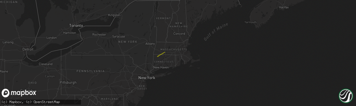
Hail Map in Massachusetts on December 30, 2019
The weather event in Massachusetts on December 30, 2019 includes Hail map. 2 states and 13 cities were impacted and suffered possible damage. The total estimated number of properties impacted is 5,884.
Want more than just the map?
Turn this storm into a full workflow.
- Owner + property data so you know who to knock
- OnDemand branded weather history reports to win the "did we even have hail?" argument
- RoofTrace estimate so reps stop guessing numbers at the door
Bought this map? Upgrade within 7 days and we'll credit the $230. (10-15 min setup call)
Hail
5,884
Estimated number of impacted properties by a 1.00" hail or larger0
Estimated number of impacted properties by a 1.75" hail or larger0
Estimated number of impacted properties by a 2.50" hail or largerStorm reports in Massachusetts
Massachusetts
| Date | Description |
|---|---|
| 12/30/20192:44 PM CST | A local report indicates 1.00 inch wind near WESTFIELD |
| 12/30/20192:43 PM CST | A local report indicates 1.00 inch wind near WESTFIELD |
| 12/30/20192:42 PM CST | Quarter hail reported from 342 pm through 344 pm. |
| 12/30/20192:40 PM CST | A local report indicates 1.00 inch wind near WESTFIELD |
| 12/30/20192:34 PM CST | A local report indicates 1.00 inch wind near SOUTHWICK |
| 12/29/20199:39 PM CST | At 337 PM EST, a severe thunderstorm was located over Westfield, moving northeast at 55 mph. Quarter size hail was observed in Norfolk and Hartland, CT and in Southwick, MA. HAZARD...Quarter size hail. SOURCE...Radar indicated. IMPACT...Minor hail damage to vehicles is possible. Locations impacted include... Springfield, Chicopee, Westfield, Holyoke, Amherst, Agawam, West Springfield, Ludlow, South Hadley, Easthampton, Belchertown, Wilbraham, Palmer, Spencer, Ware, Southwick, Rutland, Granby, Southampton and Barre. |


