Hail Map in Florida on December 24, 2020
Get this storm
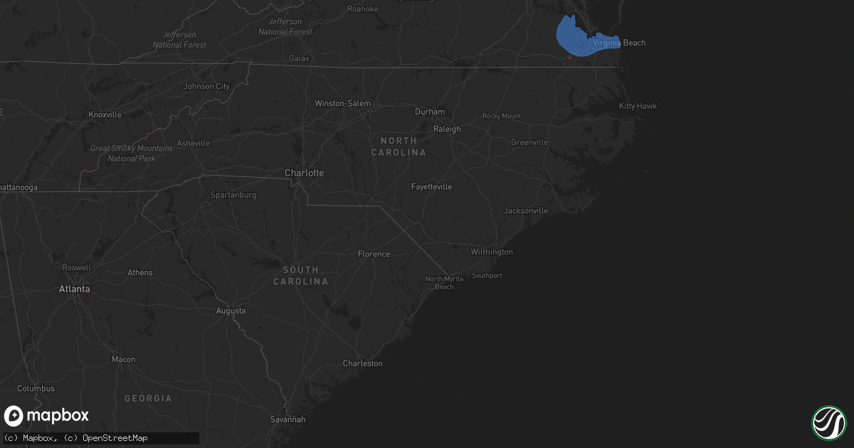
December 24 map
$229
one time, instant access
Download today. No call, no setup
Keep the $229
Bought the map and want the full workflow? Apply the entire $229 to a subscription within 7 days. None of it is wasted.
Every map, not just this one
This buys you this map. Subscription and you get every map we run, in the markets you choose from a few cities to whole states to nationwide. Plus real-time alerts the moment a storm fires.
Contact data
Name, contact info, occupancy, even credit band for addresses in the footprint. You go from where it hit to who to call.
Become the source they trust
Unlimited branding weather history reports on demand. You already have the documented answer ready for the property owner, and you are the one who showed up with it.
Property data and RoofTrace estimates
Pull up any address you have got, its value and the exact code rules for that jurisdiction, straight from One Click Code. Then RoofTrace estimates the squares, pitch, and roof value, priced the way you price.
Storm reports in Florida
Florida
| Date | Description |
|---|---|
| 12/24/20205:55 PM CST | Power line downed across road south of green cove springs. |
| 12/24/20205:55 PM CST | Tree of 3 to 4 inch diameter knocked down near southside and interstate 95. |
| 12/24/20205:54 PM CST | Shortly before 7 pm on christmas eve... A qlcs tornado developed along a squall line moving through the area. The tornado caused damage to trees near and just south of |
| 12/24/20205:50 PM CST | Tree down near southside and i-295 reported via social media. |
| 12/24/20205:47 PM CST | Mesonet station xwki weeki wachee. |
| 12/24/20205:45 PM CST | Shortly before 7 pm on christmas eve... A qlcs tornado developed along a squall line moving through the area. The tornado caused damage to trees with minor damage to on |
| 12/24/20205:30 PM CST | Multiple trees and power lines down in the melrose... Fl area including a large tree blocking price rd near the solar plant. |
| 12/24/20205:29 PM CST | Multiple reports of trees and power lines down in east hampton along with a reported runaway inflatable snowman. |
| 12/24/20205:18 PM CST | Tree down on sr 121 near baker-union county line. |
| 12/24/20205:18 PM CST | Tree down on sr-121 near saw mill rd north of macclenny... Fl. |
| 12/24/20205:16 PM CST | *** 2 inj *** shortly after 6 pm on christmas eve... A qlcs tornado developed along a squall line moving through the area. The tornado caused damage to trees... Fences. |
| 12/24/20205:10 PM CST | Tree down and debris including roof shingles and small branches at condo complex near uf. Timing estimated from radar data. |
| 12/24/20204:56 PM CST | Tree branch breached wall of home due to strong winds in the area of lake butler. No injuries reported. |
| 12/24/20204:40 PM CST | Multiple trees down in lake city... Fl. |
| 12/24/20204:37 PM CST | Report received of tree downed near nw 10th ave. And nw 150th st. Time estimated from radar. |
| 12/24/20204:35 PM CST | Report received of tree downed along cr 345 near cr 347. Time estimated from radar. |
| 12/24/20204:30 PM CST | Report received of tree downed onto power line near intersection of nw 170th st. And nw 60th ave. Time estimated from radar. |
| 12/24/20204:30 PM CST | Numerous trees reported down just south of highway 232. Time estimated by radar. |
| 12/24/20204:27 PM CST | Strong winds dropped a tree onto a house resulting in major damage. No injuries reported. |
| 12/24/20204:21 PM CST | Trees down between branford... Fl and lake city... Fl reported by the public via social media. |
| 12/24/20204:20 PM CST | Dixie county dispatch reports several trees and power lines down across old town. |
| 12/24/20204:10 PM CST | Dixie county dispatch reports trees and power lines down across cross city. |
| 12/24/20204:05 PM CST | Fallen trees and limbs resulted in a power outage along highway 27 via duke energy outage map. |
| 12/24/20204:00 PM CST | Multiple trees down across lafayette county. |
| 12/24/20203:10 PM CST | Scattered trees down in madison county. |
| 12/24/20202:00 PM CST | Trees reported down on brock rd. |
| 12/24/20201:35 PM CST | 911 dispatcher reports several trees uprooted along i-10 near exit 217. |
| 12/24/20201:10 PM CST | Power outage due to a tree down was reported by the duke power outage map. |
| 12/24/202012:33 PM CST | Gadsden county dispatch reports a tree town in quincy on e king st near airport dr. |
| 12/24/20206:43 AM CST | At 1243 PM EST/1143 AM CST/, severe thunderstorms were located along a line extending from 6 miles east of Mexico Beach to 54 miles southwest of Port St. Joe, moving east at 40 mph. HAZARD...60 mph wind gusts. SOURCE...Radar indicated. IMPACT...Expect damage to roofs, siding, and trees. Locations impacted include... Carrabelle, Eastpoint, Apalachicola, Crawfordville, St George Island, Port St. Joe, Mexico Beach, Wewahitchka, Franklin, Sopchoppy, Honeyville, Jewel Fire Tower, Shadeville, Royal Bluff, Chipola Cutoff, St George Island St Pk, Central City, Cape San Blas, Beverly and Panacea. |
| 12/24/20201:12 AM CST | At 711 PM EST, severe thunderstorms were located along a line extending from near Largo to 9 miles west of Fort Desoto Park, moving east at 40 mph. HAZARD...60 mph wind gusts. SOURCE...Radar indicated. IMPACT...Expect damage to roofs, siding, and trees. Locations impacted include... Clearwater, Largo, Pinellas Park, Seminole, Downtown Saint Petersburg, Fort Desoto Park, Saint Petersburg, St. Petersburg, St. Pete Beach, Bay Pines, South Highpoint, Tierra Verde, Gandy, Feather Sound, West And East Lealman, Ridgecrest, Harbor Bluffs, Gulfport, Treasure Island and Kenneth City. |
| 12/24/202012:24 AM CST | At 624 PM EST, severe thunderstorms were located along a line extending from 16 miles west of Homosassa to 18 miles west of Beacon Square to 25 miles west of Harbor Bluffs, moving east at 50 mph. HAZARD...60 mph wind gusts. SOURCE...Radar indicated. IMPACT...Expect damage to roofs, siding, and trees. Locations impacted include... Spring Hill, Clearwater, Largo, New Port Richey, Brooksville, Inverness, Homosassa Springs, Hudson, Beverly Hills, Holiday, Weeki Wachee, Palm Harbor, South Highpoint, New Port Richey East, Black Diamond, North Brooksville, Hernando County Airport, Timber Pines, Ridgecrest and Crystal River Airport. |
| 12/24/202012:08 AM CST | At 608 PM EST, a severe thunderstorm was located over Gainesville, moving east at 50 mph. HAZARD...60 mph wind gusts. SOURCE...Radar indicated. IMPACT...Expect damage to roofs, siding, and trees. Locations impacted include... Gainesville, Melrose, Hawthorne, University Of Florida, Orange Heights, Gainesville Airport, Newnans Lake, Rochelle and Grove Park. |
| 12/23/202011:33 PM CST | At 533 PM EST, severe thunderstorms were located along a line extending from 8 miles west of Donald to near Patterson to near Stephen Foster State Park, moving east at 55 mph. HAZARD...60 mph wind gusts. SOURCE...Radar indicated. IMPACT...Expect damage to roofs, siding, and trees. Locations impacted include... Kingsland, Brunswick, St. Simons Island, Jesup, Folkston, Woodbine, Nahunta, Patterson, Dock Junction and Kings Bay Base. |
| 12/23/202011:00 PM CST | At 500 PM EST, severe thunderstorms were located along a line extending from 14 miles northeast of Steinhatchee to 21 miles southwest of Horseshoe Point, moving northeast at 30 mph. HAZARD...60 mph wind gusts. SOURCE...Radar indicated. IMPACT...Expect damage to roofs, siding, and trees. Locations impacted include... Cross City, Horseshoe Point, Suwannee, Horseshoe Beach, Tennille, Shamrock, Clara, Cross City Airport, Shired Island, Old Town, Jena, Hines, Jonesboro, Eugene, Fletcher, Yellow Jacket, Fanning Springs and Guaranto Springs. |
| 12/23/202010:39 PM CST | At 439 PM EST, severe thunderstorms were located along a line extending from near Homerville to 7 miles east of Statenville to 13 miles southeast of Perry, moving east at 45 mph. HAZARD...60 mph wind gusts. SOURCE...Radar indicated. IMPACT...Expect damage to roofs, siding, and trees. Locations impacted include... Waycross, Lake City, Live Oak, Jasper, Homerville, Jennings, White Springs, Fargo, Argyle and Stephen Foster State Park. |
| 12/23/202010:10 PM CST | At 409 PM EST, severe thunderstorms were located along a line extending from 12 miles south of Madison to 46 miles southwest of Steinhatchee, moving east at 45 mph. HAZARD...60 mph wind gusts. SOURCE...Radar indicated. IMPACT...Expect damage to roofs, siding, and trees. Locations impacted include... Mayo, Perry, Steinhatchee, Pinland, Jug Island, Buckville, Dekle Beach, Jack Lee Island, Grady, Hatch Bend, Foley, Salem, Perry-Foley Airport, San Pedro Junction, Hampton Springs, Cedar Island, Fish Creek, Cooks Hammock, Howell Place and Chancey. |
| 12/23/202010:02 PM CST | At 401 PM EST, severe thunderstorms were located along a line extending from Valdosta to 14 miles southwest of Madison, moving east at 30 mph. HAZARD...60 mph wind gusts. SOURCE...Radar indicated. IMPACT...Expect damage to roofs, siding, and trees. Locations impacted include... Jasper, Homerville, Jennings, Argyle, Statenville, Suwannee River State Park, Du Pont, Mayday, Manor and Blue Springs. |
| 12/23/20209:59 PM CST | At 359 PM EST, severe thunderstorms were located along a line extending from 7 miles southwest of Lake Park to 12 miles southwest of Madison, moving northeast at 35 mph. HAZARD...60 mph wind gusts. SOURCE...Radar indicated. IMPACT...Expect damage to roofs, siding, and trees. Locations impacted include... Madison, Lee, Hanson, Pinetta and Hopewell. |
| 12/23/20207:58 PM CST | At 158 PM EST, a severe thunderstorm was located 7 miles south of Whigham, or 9 miles southwest of Cairo, moving northeast at 25 mph. HAZARD...60 mph wind gusts. SOURCE...Radar indicated. IMPACT...Expect damage to roofs, siding, and trees. Locations impacted include... Cairo, Thomasville, Ochlocknee, Reno, Grady Co A/p, Princes Still, Dawesville, Moncrief, Pine Park, Nickleville, Rocky Hill and Beachton. |
| 12/23/20207:29 PM CST | At 129 PM EST, severe thunderstorms were located along a line extending from 7 miles northwest of Havana to 22 miles southeast of Blountstown, moving east at 30 mph. HAZARD...60 mph wind gusts. SOURCE...Radar indicated. IMPACT...Expect damage to roofs, siding, and trees. Locations impacted include... Monticello, Tallahassee, St. Marks, Woodville, Crawfordville, Florida State University, Tallahassee Comm College, Doak Campbell Stadium, Florida A And M, Wakulla, Sopchoppy, Lake Bradford, Alma, Cody, Wakulla Springs, Medart, Tallahassee Mall, Bloxham, Tallahassee Regional A/P and Natural Bridge. |
| 12/23/20206:50 PM CST | Tree down on powerline along fellowship dr... Palm coast... Fl. |
| 12/23/20206:45 PM CST | Tree down on a power line on fellowship drive. Time estimated by radar |
| 12/23/20206:31 PM CST | Asos station ktpa tampa. |
| 12/23/20206:20 PM CST | *** 2 inj *** severe weather damages reported to three homes in the starke area due to a possible tornado touchdown. Two of the home4s have sustained moderate damage an |
| 12/23/20206:16 PM CST | Updates previous tstm wnd dmg report from 2 sw highpoint along ulmerton rd. Reports received of multiple structures collapsed at ranchero village mobile home park... Wi |
| 12/23/20206:15 PM CST | Car hit downed tree in rd on us-1 in st. Augustine... Fl. No injuries reported. |
| 12/23/20206:05 PM CST | Tree down at seagate ln and puryear st. |
| 12/23/20206:00 PM CST | Large tree down on central pkwy just north of unf campus. |
| 12/23/20206:00 PM CST | Light pole blown knocked down in winn dixie parking in baymeadows. |
Cities Impacted by Hail Map on December 24, 2020
- Clayton, DE
- Townsend, DE
- Marydel, DE
- Marydel, MD
- Milton, DE
- Trappe, MD
- Crocheron, MD
- Secretary, MD
- Ridgely, MD
- Barclay, MD
- Goldsboro, MD
- Cambridge, MD
- Denton, MD
- Rhodesdale, MD
- Ingleside, MD
- Sudlersville, MD
- Lincoln, DE
- Hartly, DE
- Toddville, MD
- Greensboro, MD
- Vienna, MD
- Harrington, DE
- East New Market, MD
- Houston, DE
- Georgetown, DE
- Wingate, MD
- Milford, DE
- Camden Wyoming, DE
- Greenwood, DE
- Church Creek, MD
- Bridgeville, DE
- Easton, MD
- Queen Anne, MD
- Dover, DE
- Felton, DE
- Henderson, MD
- Cordova, MD
- Church Hill, MD
- Hurlock, MD
- Centreville, MD
- Federalsburg, MD
- Smyrna, DE
- Preston, MD
- Viola, DE
- Linkwood, MD
- Ellendale, DE
- Crapo, MD
- Cheswold, DE
- Harbeson, DE
- Woodside, DE
- Stevensville, MD
- Crumpton, MD
- Claiborne, MD
- Hillsboro, MD
- Mcdaniel, MD
- Saint Michaels, MD
- Oxford, MD
- Chester, MD
- Millington, MD
- Royal Oak, MD
- Chestertown, MD
- Wittman, MD
- Sherwood, MD
- Rock Hall, MD
- Worton, MD
- Bozman, MD
- Grasonville, MD
- Queenstown, MD
- Wye Mills, MD
- Neavitt, MD
- Tilghman, MD
- Hampton, FL
- Starke, FL
- Jacksonville, FL
- Chesapeake, VA
- Elberon, VA
- Dendron, VA
- Carrsville, VA
- Zuni, VA
- Portsmouth, VA
- Wakefield, VA
- Carrollton, VA
- Ivor, VA
- Suffolk, VA
- Windsor, VA
- Virginia Beach, VA
- Surry, VA
- Spring Grove, VA
- Norfolk, VA
- Smithfield, VA


