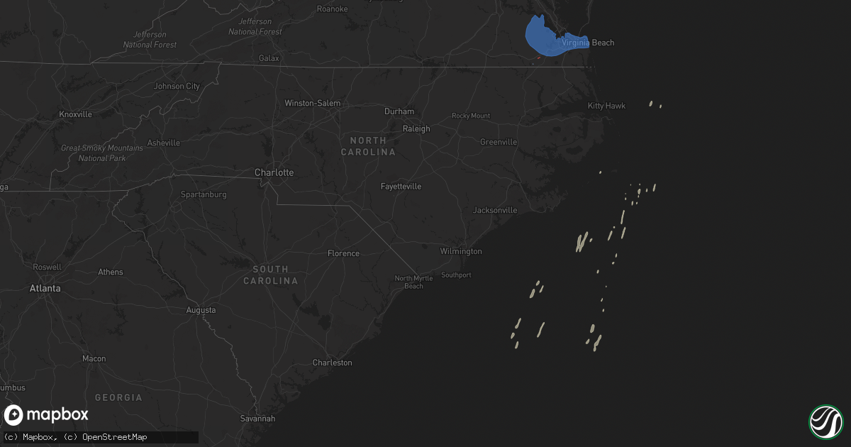
Hail Map on December 24, 2020
Get this storm
December 24 map
$229
one time, instant access
Download today. No call, no setup
Keep the $229
Bought the map and want the full workflow? Apply the entire $229 to a subscription within 7 days. None of it is wasted.
Every map, not just this one
This buys you this map. Subscription and you get every map we run, in the markets you choose from a few cities to whole states to nationwide. Plus real-time alerts the moment a storm fires.
Contact data
Name, contact info, occupancy, even credit band for addresses in the footprint. You go from where it hit to who to call.
Become the source they trust
Unlimited branding weather history reports on demand. You already have the documented answer ready for the property owner, and you are the one who showed up with it.
Property data and RoofTrace estimates
Pull up any address you have got, its value and the exact code rules for that jurisdiction, straight from One Click Code. Then RoofTrace estimates the squares, pitch, and roof value, priced the way you price.
Storm reports
Mississippi
| Date | Description |
|---|---|
| 12/24/20206:20 AM CST | At 1220 AM CST, a severe thunderstorm was located near Progress, or 20 miles south of Pinola, moving east at 50 mph. HAZARD...60 mph wind gusts. SOURCE...Radar indicated. IMPACT...Expect damage to roofs, siding, and trees. This severe thunderstorm will be near... Prentiss and Carson around 1230 AM CST. Clem around 1235 AM CST. Lone Star around 1240 AM CST. Mount Olive around 1245 AM CST. Collins around 1250 AM CST.Other locations impacted by this severe thunderstorm includeBassfield and Silver Creek. |
Maryland
| Date | Description |
|---|---|
| 12/24/202012:06 AM CST | Wind-driven debris was blown onto state highway 480 at sunset avenue. Time based on radar. |
| 12/23/202011:52 PM CST | Wind-driven debris was blown onto state highway 566 at still pond road. Time based on dispatch report. |
| 12/23/202011:44 PM CST | Us 50 west at landing neck road closed due to debris in roadway. |
| 12/23/202011:42 PM CST | U.s. Highway 50 at barber road had wind-driven debris blocking portions of the road. Time based on radar. |
| 12/23/20209:36 PM CST | At 335 PM EST, a severe thunderstorm was located near Fredericksburg, moving northeast at 55 mph. HAZARD...60 mph wind gusts. SOURCE...Radar indicated. IMPACT...Damaging winds will cause some trees and large branches to fall. This could injure those outdoors, as well as damage homes and vehicles. Roadways may become blocked by downed trees. Localized power outages are possible. Unsecured light objects may become projectiles. Locations impacted include... Stafford, Centreville, Dale City, Fredericksburg, Fort Belvoir, Woodbridge, Quantico, Aquia Creek, Lake Ridge, Burke, Chantilly, Montclair, Lorton, Newington, Triangle, Dumfries, Spotsylvania, Manassas, Cherry Hill and Manassas Park. |
Virginia
| Date | Description |
|---|---|
| 12/24/20205:58 AM CST | At 1157 PM EST, severe thunderstorms were located along a line extending from near Blakes to near Hampton University, moving northeast at 55 mph. HAZARD...60 mph wind gusts. SOURCE...Radar indicated. IMPACT...Expect damage to trees and powerlines. Severe thunderstorms will be near, Deltaville, Blakes and Gwynn around 1205 AM EST.Other locations impacted by these severe thunderstorms include Ruff,Beulah, Moon, Laban, Glass, Naxera, Fort Nonsense, Messick, North andSoles. |
| 12/24/20205:30 AM CST | At 1130 PM EST, severe thunderstorms were located along a line extending from near Jamestown to near Isle Of Wight to near Holland, moving northeast at 50 mph. HAZARD...60 mph wind gusts. SOURCE...Radar indicated. IMPACT...Expect damage to trees and powerlines. Severe thunderstorms will be near, Williamsburg, Smithfield, College Of William And Mary, Kings Point, Jamestown and Scotland around 1135 PM EST. Queens Lake, York Terrace, Carver Gardens, Rescue, Busch Gardens and Grove around 1140 PM EST. Fort Eustis and Wicomico around 1145 PM EST. Newport News, Gloucester Courthouse, Patrick Henry Field, Christopher Newport University, Gloucester Point, Northampton, Hayes, Denbigh, Beaconsdale and Crittenden around 1150 PM EST. Hampton, Seaford, Langley AFB, Suffolk and Tabb around 1155 PM EST.Other locations impacted by these severe thunderstorms include Pons,Carrollton, Chippokes State Park, Lackey, Beulah, Longview, CampPeary, Naxera, Oriana and Chuckatuck. |
| 12/23/202011:50 PM CST | Trees downed at indian trail rd and scarboroughs neck rd. |
| 12/23/202011:10 PM CST | Awos station kngu norfolk nas cham. |
| 12/23/202011:10 PM CST | The gilmerton bridge was damaged due to high wind. The bridge was inoperable for several days following the storm. |
| 12/23/202010:50 PM CST | Trees down along manning rd. |
| 12/23/202010:28 PM CST | A nws survey confirmed an ef1 tornado with peak winds estimated between 95 to 100 mph. The tornado caused significant damage to at least 6 homes along dutch road... Wit |
| 12/23/202010:27 PM CST | Trees down near central hill. |
| 12/23/202010:26 PM CST | Report of a barn destroyed along with damage to several buildings and vehicles near dutch rd. |
| 12/23/202010:21 PM CST | Corrects previous tornado report from 1 sw cleopus. A nws survey confirmed an ef1 tornado with peak winds around 90 mph. The tornado caused significant damage to at lea |
| 12/23/202010:19 PM CST | Report of a house damaged and a vehicle overturned along corinth chapel rd. Several trees twisted off. |
| 12/23/202010:01 PM CST | Multiple trees and large branches as well as power lines down from just north of barrow rd to north of rt 58 in southampton... Va. Winds estimated around 70 mph. |
| 12/23/20209:28 PM CST | At 327 PM EST, a severe thunderstorm was located over Wyndham, or near Tuckahoe, moving northeast at 35 mph. HAZARD...60 mph wind gusts. SOURCE...Radar indicated. IMPACT...Expect damage to trees and powerlines. This severe thunderstorm will be near, Randolph Macon College around 340 PM EST. Ashland around 345 PM EST. Kings Dominion and Dawn around 350 PM EST.Other locations impacted by this severe thunderstorm include Gilman,Oliver, Burruss Corner, Gum Tree, Doswell, Elmont and Short Pump. |
South Carolina
| Date | Description |
|---|---|
| 12/24/20205:59 PM CST | Construction scaffolding blown into roadway shutting down hwy 21 northbound for 50 minutes. |
| 12/24/20205:51 PM CST | Tree down in roadway along fording island rd at moss creek village. Resulted in a vehicle accident. |
| 12/24/20205:43 PM CST | Highway patrol reported tree down at benton farm road and pine grove road. Time estimated from radar. |
| 12/24/20205:42 PM CST | Tree down on may river rd at okatie hwy. |
| 12/24/20205:40 PM CST | Tree in roadway at coosaw scenic drive and old house road. Time estimated from radar. |
| 12/24/20205:40 PM CST | Tree in roadway at scuffletown rd and garnsey ln. |
| 12/24/20205:40 PM CST | Tree in roadway at lowcountry hwy and trenton ln. Time estimated from radar. |
| 12/24/20205:33 PM CST | Tree in roadway at logan st and woodlawn dr. Time estimated from radar. |
| 12/24/20205:23 PM CST | Tree in roadway at fitts st and rouse ave. Time estimated from radar. |
| 12/24/20205:23 PM CST | Tree in roadway at sc68 near the cummings area. Time estimated from radar. |
| 12/24/20205:18 PM CST | Tree in roadway at us601 and lake warren rd. Time estimated from radar. |
| 12/24/20205:16 PM CST | Tree in roadway at fitts st and rouse ave. Time estimated from radar. |
| 12/24/20201:38 AM CST | At 738 PM EST, severe thunderstorms were located along a line extending from near Saint Stephen to near Kiawah Island, moving east at 50 mph. HAZARD...60 mph wind gusts. SOURCE...Radar indicated. IMPACT...Expect damage to trees and powerlines. Locations impacted include... North Charleston, Mount Pleasant, Goose Creek, Hanahan, Moncks Corner, McClellanville, Downtown Charleston, Daniel Island, Naval Weapons Station Charleston, West Ashley, Johns Island, Isle Of Palms, Folly Beach, Saint Stephen and Kiawah Island.This warning includes... I-26 between mile markers 215 and 221. I-526 between mile markers 19 and 31. |
| 12/24/202012:23 AM CST | At 622 PM EST, severe thunderstorms were located along a line extending from Eden to near Cox, moving east at 30 mph. HAZARD...60 mph wind gusts. SOURCE...Public. IMPACT...Expect damage to trees and powerlines. Locations impacted include... Hilton Head Island, Pooler, Bluffton, Richmond Hill, Darien, Bellinger Hill Area, Savannah International Airport, Wilmington Island, Midtown Savannah, Downtown Savannah, Coffee Bluff, I-16/I-95 Interchange, Hunter Army Airfield, Godley Station and Jones.This warning includes... I-16 between mile markers 147 and 168. I-516 between mile markers 3 and 9. I-95 in Georgia between mile markers 50 and 111. |
| 12/23/20208:05 PM CST | Straightline winds removed several pieces of metal roofing from one home... And deposited them 20 to 30 yards away. Minor damage to aluminum trim occurred to a neighbor |
| 12/23/20206:30 PM CST | Berkeley county 911 reported trees down at cane bay blvd at daybreak blvd. |
| 12/23/20206:30 PM CST | A national weather service storm survey confirmed a weak ef-1 tornado with estimated maximum wind speeds around 90 mph near baggette crossroads in clarendon county... S |
| 12/23/20206:21 PM CST | Highway patrol reported tree down at dorchester road and highway 17a. Time estimated from radar. |
| 12/23/20206:10 PM CST | Highway patrol reported tree down at mcdanieltown road and cottageville highway. Time estimated from radar. |
Florida
| Date | Description |
|---|---|
| 12/24/20205:55 PM CST | Tree of 3 to 4 inch diameter knocked down near southside and interstate 95. |
| 12/24/20205:55 PM CST | Power line downed across road south of green cove springs. |
| 12/24/20205:54 PM CST | Shortly before 7 pm on christmas eve... A qlcs tornado developed along a squall line moving through the area. The tornado caused damage to trees near and just south of |
| 12/24/20205:50 PM CST | Tree down near southside and i-295 reported via social media. |
| 12/24/20205:47 PM CST | Mesonet station xwki weeki wachee. |
| 12/24/20205:45 PM CST | Shortly before 7 pm on christmas eve... A qlcs tornado developed along a squall line moving through the area. The tornado caused damage to trees with minor damage to on |
| 12/24/20205:30 PM CST | Multiple trees and power lines down in the melrose... Fl area including a large tree blocking price rd near the solar plant. |
| 12/24/20205:29 PM CST | Multiple reports of trees and power lines down in east hampton along with a reported runaway inflatable snowman. |
| 12/24/20205:18 PM CST | Tree down on sr-121 near saw mill rd north of macclenny... Fl. |
| 12/24/20205:18 PM CST | Tree down on sr 121 near baker-union county line. |
| 12/24/20205:16 PM CST | *** 2 inj *** shortly after 6 pm on christmas eve... A qlcs tornado developed along a squall line moving through the area. The tornado caused damage to trees... Fences. |
| 12/24/20205:10 PM CST | Tree down and debris including roof shingles and small branches at condo complex near uf. Timing estimated from radar data. |
| 12/24/20204:56 PM CST | Tree branch breached wall of home due to strong winds in the area of lake butler. No injuries reported. |
| 12/24/20204:40 PM CST | Multiple trees down in lake city... Fl. |
| 12/24/20204:37 PM CST | Report received of tree downed near nw 10th ave. And nw 150th st. Time estimated from radar. |
| 12/24/20204:35 PM CST | Report received of tree downed along cr 345 near cr 347. Time estimated from radar. |
| 12/24/20204:30 PM CST | Numerous trees reported down just south of highway 232. Time estimated by radar. |
| 12/24/20204:30 PM CST | Report received of tree downed onto power line near intersection of nw 170th st. And nw 60th ave. Time estimated from radar. |
| 12/24/20204:27 PM CST | Strong winds dropped a tree onto a house resulting in major damage. No injuries reported. |
| 12/24/20204:21 PM CST | Trees down between branford... Fl and lake city... Fl reported by the public via social media. |
| 12/24/20204:20 PM CST | Dixie county dispatch reports several trees and power lines down across old town. |
| 12/24/20204:10 PM CST | Dixie county dispatch reports trees and power lines down across cross city. |
| 12/24/20204:05 PM CST | Fallen trees and limbs resulted in a power outage along highway 27 via duke energy outage map. |
| 12/24/20204:00 PM CST | Multiple trees down across lafayette county. |
| 12/24/20203:10 PM CST | Scattered trees down in madison county. |
| 12/24/20202:00 PM CST | Trees reported down on brock rd. |
| 12/24/20201:35 PM CST | 911 dispatcher reports several trees uprooted along i-10 near exit 217. |
| 12/24/20201:10 PM CST | Power outage due to a tree down was reported by the duke power outage map. |
| 12/24/202012:33 PM CST | Gadsden county dispatch reports a tree town in quincy on e king st near airport dr. |
| 12/24/20206:43 AM CST | At 1243 PM EST/1143 AM CST/, severe thunderstorms were located along a line extending from 6 miles east of Mexico Beach to 54 miles southwest of Port St. Joe, moving east at 40 mph. HAZARD...60 mph wind gusts. SOURCE...Radar indicated. IMPACT...Expect damage to roofs, siding, and trees. Locations impacted include... Carrabelle, Eastpoint, Apalachicola, Crawfordville, St George Island, Port St. Joe, Mexico Beach, Wewahitchka, Franklin, Sopchoppy, Honeyville, Jewel Fire Tower, Shadeville, Royal Bluff, Chipola Cutoff, St George Island St Pk, Central City, Cape San Blas, Beverly and Panacea. |
| 12/24/20201:12 AM CST | At 711 PM EST, severe thunderstorms were located along a line extending from near Largo to 9 miles west of Fort Desoto Park, moving east at 40 mph. HAZARD...60 mph wind gusts. SOURCE...Radar indicated. IMPACT...Expect damage to roofs, siding, and trees. Locations impacted include... Clearwater, Largo, Pinellas Park, Seminole, Downtown Saint Petersburg, Fort Desoto Park, Saint Petersburg, St. Petersburg, St. Pete Beach, Bay Pines, South Highpoint, Tierra Verde, Gandy, Feather Sound, West And East Lealman, Ridgecrest, Harbor Bluffs, Gulfport, Treasure Island and Kenneth City. |
| 12/24/202012:24 AM CST | At 624 PM EST, severe thunderstorms were located along a line extending from 16 miles west of Homosassa to 18 miles west of Beacon Square to 25 miles west of Harbor Bluffs, moving east at 50 mph. HAZARD...60 mph wind gusts. SOURCE...Radar indicated. IMPACT...Expect damage to roofs, siding, and trees. Locations impacted include... Spring Hill, Clearwater, Largo, New Port Richey, Brooksville, Inverness, Homosassa Springs, Hudson, Beverly Hills, Holiday, Weeki Wachee, Palm Harbor, South Highpoint, New Port Richey East, Black Diamond, North Brooksville, Hernando County Airport, Timber Pines, Ridgecrest and Crystal River Airport. |
| 12/24/202012:08 AM CST | At 608 PM EST, a severe thunderstorm was located over Gainesville, moving east at 50 mph. HAZARD...60 mph wind gusts. SOURCE...Radar indicated. IMPACT...Expect damage to roofs, siding, and trees. Locations impacted include... Gainesville, Melrose, Hawthorne, University Of Florida, Orange Heights, Gainesville Airport, Newnans Lake, Rochelle and Grove Park. |
| 12/23/202011:33 PM CST | At 533 PM EST, severe thunderstorms were located along a line extending from 8 miles west of Donald to near Patterson to near Stephen Foster State Park, moving east at 55 mph. HAZARD...60 mph wind gusts. SOURCE...Radar indicated. IMPACT...Expect damage to roofs, siding, and trees. Locations impacted include... Kingsland, Brunswick, St. Simons Island, Jesup, Folkston, Woodbine, Nahunta, Patterson, Dock Junction and Kings Bay Base. |
| 12/23/202011:00 PM CST | At 500 PM EST, severe thunderstorms were located along a line extending from 14 miles northeast of Steinhatchee to 21 miles southwest of Horseshoe Point, moving northeast at 30 mph. HAZARD...60 mph wind gusts. SOURCE...Radar indicated. IMPACT...Expect damage to roofs, siding, and trees. Locations impacted include... Cross City, Horseshoe Point, Suwannee, Horseshoe Beach, Tennille, Shamrock, Clara, Cross City Airport, Shired Island, Old Town, Jena, Hines, Jonesboro, Eugene, Fletcher, Yellow Jacket, Fanning Springs and Guaranto Springs. |
| 12/23/202010:39 PM CST | At 439 PM EST, severe thunderstorms were located along a line extending from near Homerville to 7 miles east of Statenville to 13 miles southeast of Perry, moving east at 45 mph. HAZARD...60 mph wind gusts. SOURCE...Radar indicated. IMPACT...Expect damage to roofs, siding, and trees. Locations impacted include... Waycross, Lake City, Live Oak, Jasper, Homerville, Jennings, White Springs, Fargo, Argyle and Stephen Foster State Park. |
| 12/23/202010:10 PM CST | At 409 PM EST, severe thunderstorms were located along a line extending from 12 miles south of Madison to 46 miles southwest of Steinhatchee, moving east at 45 mph. HAZARD...60 mph wind gusts. SOURCE...Radar indicated. IMPACT...Expect damage to roofs, siding, and trees. Locations impacted include... Mayo, Perry, Steinhatchee, Pinland, Jug Island, Buckville, Dekle Beach, Jack Lee Island, Grady, Hatch Bend, Foley, Salem, Perry-Foley Airport, San Pedro Junction, Hampton Springs, Cedar Island, Fish Creek, Cooks Hammock, Howell Place and Chancey. |
| 12/23/202010:02 PM CST | At 401 PM EST, severe thunderstorms were located along a line extending from Valdosta to 14 miles southwest of Madison, moving east at 30 mph. HAZARD...60 mph wind gusts. SOURCE...Radar indicated. IMPACT...Expect damage to roofs, siding, and trees. Locations impacted include... Jasper, Homerville, Jennings, Argyle, Statenville, Suwannee River State Park, Du Pont, Mayday, Manor and Blue Springs. |
| 12/23/20209:59 PM CST | At 359 PM EST, severe thunderstorms were located along a line extending from 7 miles southwest of Lake Park to 12 miles southwest of Madison, moving northeast at 35 mph. HAZARD...60 mph wind gusts. SOURCE...Radar indicated. IMPACT...Expect damage to roofs, siding, and trees. Locations impacted include... Madison, Lee, Hanson, Pinetta and Hopewell. |
| 12/23/20207:58 PM CST | At 158 PM EST, a severe thunderstorm was located 7 miles south of Whigham, or 9 miles southwest of Cairo, moving northeast at 25 mph. HAZARD...60 mph wind gusts. SOURCE...Radar indicated. IMPACT...Expect damage to roofs, siding, and trees. Locations impacted include... Cairo, Thomasville, Ochlocknee, Reno, Grady Co A/p, Princes Still, Dawesville, Moncrief, Pine Park, Nickleville, Rocky Hill and Beachton. |
| 12/23/20207:29 PM CST | At 129 PM EST, severe thunderstorms were located along a line extending from 7 miles northwest of Havana to 22 miles southeast of Blountstown, moving east at 30 mph. HAZARD...60 mph wind gusts. SOURCE...Radar indicated. IMPACT...Expect damage to roofs, siding, and trees. Locations impacted include... Monticello, Tallahassee, St. Marks, Woodville, Crawfordville, Florida State University, Tallahassee Comm College, Doak Campbell Stadium, Florida A And M, Wakulla, Sopchoppy, Lake Bradford, Alma, Cody, Wakulla Springs, Medart, Tallahassee Mall, Bloxham, Tallahassee Regional A/P and Natural Bridge. |
| 12/23/20206:50 PM CST | Tree down on powerline along fellowship dr... Palm coast... Fl. |
| 12/23/20206:45 PM CST | Tree down on a power line on fellowship drive. Time estimated by radar |
| 12/23/20206:31 PM CST | Asos station ktpa tampa. |
| 12/23/20206:20 PM CST | *** 2 inj *** severe weather damages reported to three homes in the starke area due to a possible tornado touchdown. Two of the home4s have sustained moderate damage an |
| 12/23/20206:16 PM CST | Updates previous tstm wnd dmg report from 2 sw highpoint along ulmerton rd. Reports received of multiple structures collapsed at ranchero village mobile home park... Wi |
| 12/23/20206:15 PM CST | Car hit downed tree in rd on us-1 in st. Augustine... Fl. No injuries reported. |
| 12/23/20206:05 PM CST | Tree down at seagate ln and puryear st. |
| 12/23/20206:00 PM CST | Light pole blown knocked down in winn dixie parking in baymeadows. |
| 12/23/20206:00 PM CST | Large tree down on central pkwy just north of unf campus. |
Georgia
| Date | Description |
|---|---|
| 12/24/20205:38 PM CST | Tree down on power lines in the 600 block of kline street. |
| 12/24/20205:38 PM CST | The brunswick glyco airport asos measured a wind gust to 59 mph. |
| 12/24/20205:35 PM CST | Tree fell on a house in the 2200 block of pecan drive. |
| 12/24/20205:31 PM CST | Numerous trees down along rose dhu road and rose dhu glen drive. One tree on a house... Another house experienced window damage. One power line down. A chain link fence |
| 12/24/20205:20 PM CST | Old sunbury road impassable due to trees down on the roadway. |
| 12/24/20205:12 PM CST | Tree in roadway on lynn st near w main st. |
| 12/24/20205:00 PM CST | Old sunbury road impassable due to trees down on the roadway. |
| 12/24/20204:45 PM CST | Several trees reported down in jesup. Time estimated by radar. |
| 12/24/20204:10 PM CST | Multiple trees down near waycross... Ga. |
| 12/24/20203:15 PM CST | Tree on road near the intersection of hwy 135 n and howell rd. |
| 12/24/20203:00 PM CST | A few trees and power lines down near moore road and lakeland highway. |
| 12/24/20202:20 PM CST | Brooks county 911 reports a tree down on dry lake rd near barwick rd. |
| 12/24/20202:10 PM CST | Tift county 911 reports a tree down on love ave near e 22nd street. |
| 12/24/202012:28 AM CST | At 627 PM EST, severe thunderstorms were located along a line extending from 10 miles west of Woodbine to near Orange Heights, moving northeast at 55 mph. HAZARD...60 mph wind gusts. SOURCE...Radar indicated. IMPACT...Expect damage to roofs, siding, and trees. Locations impacted include... Jacksonville, St. Marys, Kingsland, Brunswick, Saint Augustine, St. Simons Island, Fernandina Beach, Orange Park, Green Cove Springs and Starke. |
| 12/23/202011:42 PM CST | At 542 PM EST, severe thunderstorms were located along a line extending from 6 miles southeast of Fargo to near Watertown to 6 miles northeast of Trenton, moving east at 55 mph. HAZARD...60 mph wind gusts. SOURCE...Radar indicated. IMPACT...Expect damage to roofs, siding, and trees. Locations impacted include... Lake City, Starke, Hilliard, Trenton, Lake Butler, Keystone Heights, Callahan, Raiford, Worthington Spring and Taylor. |
| 12/23/20209:02 PM CST | At 302 PM EST, severe thunderstorms were located along a line extending from near Omega to 9 miles southeast of Boston, moving northeast at 35 mph. HAZARD...60 mph wind gusts. SOURCE...Radar indicated. IMPACT...Expect damage to roofs, siding, and trees. Locations impacted include... Nashville, Adel, Valdosta, Lake Park, Lakeland, Quitman, Tifton, Hahira, Sparks, Enigma, Omega, Ray City, Lenox, Alapaha, I-75 At Exit 16, Moody Air Force Base, Remerton, Meigs, Dasher and Morven. |
| 12/23/20207:09 PM CST | At 109 PM EST, severe thunderstorms were located along a line extending from near Greensboro to 15 miles southeast of Blountstown, moving northeast at 50 mph. HAZARD...60 mph wind gusts. SOURCE...Radar indicated. IMPACT...Expect damage to roofs, siding, and trees. Locations impacted include... Quincy, Midway, Havana, Tallahassee, Greensboro, Gretna, Freemont, Rock Bluff, Jewel Fire Tower, Littman, Brown House, Juniper, Douglas City, Darsey, Vilas, Florence, Hosford, Scotland, Jensen Place and Jamieson. |
North Carolina
| Date | Description |
|---|---|
| 12/24/20205:48 PM CST | Multiple trees and powerlines down at south pine and west 7th near hobgood. |
| 12/24/202011:21 AM CST | Apparent tornado near silver spoon rd moving towards bladen county... Captured in pictures and video. |
| 12/24/202011:16 AM CST | Nws storm survery confirmed that an ef0 tornado with winds approximately 65 mph briefly touched down north of chadbourn in columbus county... Nc on decmeber 24... 2020. |
| 12/24/20205:32 AM CST | At 1131 PM EST, severe thunderstorms were located along a line extending from 13 miles south of Cape Hatteras Lighthouse to Ocracoke Ferry Terminal, moving northeast at 70 mph. HAZARD...70 mph wind gusts. SOURCE...Radar indicated. IMPACT...Expect considerable tree damage. Damage is likely to mobile homes, roofs, and outbuildings. Locations impacted include... Frisco, Buxton, Salvo, Avon, Waves, Rodanthe, Hatteras Island Fishing Pier, Hatteras Ferry Terminal, Ocracoke Ferry Terminal, Ocracoke Lighthouse, Avon Pier and Cape Hatteras Lighthouse. |
| 12/24/20205:04 AM CST | At 1103 PM EST, severe thunderstorms were located along a line extending from 7 miles southeast of Homeville to Courtland to near Como, moving northeast at 60 mph. HAZARD...60 mph wind gusts. SOURCE...Radar indicated. IMPACT...Expect damage to trees and powerlines. Severe thunderstorms will be near, Sedley around 1110 PM EST. Wakefield around 1115 PM EST. Holland, Ivor, Dendron, Carrsville and Zuni around 1120 PM EST. Elberon around 1125 PM EST. Windsor, Surry, Isle Of Wight and Scotland around 1130 PM EST.Other locations impacted by these severe thunderstorms includeVicksville, Booth Fork, Pons, Bethel Church, Ellis Fork, Dory,Sunbeam, Lees Mill, Poolesville and Riverdale. |
| 12/24/20204:39 AM CST | At 1038 PM EST, severe thunderstorms were located along a line extending from near Cypress Creek to 7 miles southeast of Johnny Mercer Pier, moving northeast at 65 mph. HAZARD...60 mph wind gusts. SOURCE...Radar indicated. IMPACT...Expect damage to roofs, siding, and trees. Locations impacted include... Jacksonville, New Bern, Havelock, Morehead City, North Topsail Beach, Newport, Pumpkin Center, Piney Green, New River Station, Half Moon, Camp Lejeune Center, James City, Trent Woods, River Bend, Stella, Swansboro, Phillips Crossroads, Hubert, Cape Carteret and Richlands. |
| 12/24/20204:28 AM CST | At 1028 PM EST, severe thunderstorms were located along a line extending from White Stocking to Johnny Mercer Pier, moving northeast at 70 mph. HAZARD...60 mph wind gusts. SOURCE...Trained weather spotters. IMPACT...Expect wind damage to trees and power lines. Locations impacted include... Wilmington, Burgaw, Wrightsville Beach, Surf City, Rich Inlet, Figure Eight Island, Hampstead, Topsail Beach, Maple Hill, Cape Fear Community College North Campus, Ashton, Rocky Point, Murrayville, Scotts Hill, Ogden, Woodside, White Stocking, Mayfaire, Murray Town and Topsail. |
| 12/24/20204:22 AM CST | At 1022 PM EST, severe thunderstorms were located along a line extending from 11 miles southwest of Tarboro to Dawson, moving northeast at 70 mph. HAZARD...60 mph wind gusts. SOURCE...Radar indicated. IMPACT...Expect damage to roofs, siding, and trees. Locations impacted include... Greenville, Kinston, Washington, Winterville, Williamston, Ayden, Farmville, La Grange, Bethel, Grifton, Stokes, Snow Hill, Bell Arthur, Robersonville, House, Shelmerdine, Pactolus, Black Jack, Bruce and Graingers. |
| 12/24/20203:46 AM CST | At 945 PM EST, severe thunderstorms were located along a line extending from near Gasburg to near Bailey to near Bowdens, moving east at 35 mph. HAZARD...60 mph wind gusts. SOURCE...Radar indicated. IMPACT...Expect damage to roofs, siding, and trees. Locations impacted include... Rocky Mount, Goldsboro, Roanoke Rapids, Tarboro, Nashville, Halifax, Wilson, Mount Olive, Scotland Neck and Elm City. |
| 12/24/20202:58 AM CST | At 857 PM EST, severe thunderstorms were located along a line extending from 6 miles southeast of Raleigh to 6 miles northwest of Godwin to near Tolarsville, moving northeast at 70 mph. HAZARD...60 mph wind gusts. SOURCE...Radar indicated. IMPACT...Expect damage to roofs, siding, and trees. Locations impacted include... Raleigh, Smithfield, Clinton, Nashville, Louisburg, Wake Forest, Garner, Clayton, Dunn and Zebulon. |
| 12/23/202011:05 PM CST | Hse asos reports gust of 55 kt. |
| 12/23/202011:02 PM CST | At 501 PM EST, severe thunderstorms were located along a line extending from 6 miles southwest of Mount Olive to Exum, moving northeast at 25 mph. HAZARD...60 mph wind gusts. SOURCE...Radar indicated. IMPACT...Expect damage to roofs, siding, and trees. Locations impacted include... Kinston, Wallace, Warsaw, La Grange, Mount Olive, Kornegay, Rose Hill, Snow Hill, Beulaville, Deep Run, Bowdens, Cypress Creek, Beautancus, Kenansville, Chinquapin, Potters Hill, Institute, Jason, Albertson and Harrells. |
| 12/23/202010:50 PM CST | At 450 PM EST, a severe thunderstorm was located over Bruce, or 8 miles northeast of Farmville, moving northeast at 50 mph. HAZARD...60 mph wind gusts. SOURCE...Radar indicated. IMPACT...Expect damage to roofs, siding, and trees. Locations impacted include... Greenville, Williamston, Bethel, Stokes, Bell Arthur, Robersonville, House, Bruce, East Carolina University, Pitt Greenville Airport, Gold Point, Hamilton, Oak City, Parmele, Everetts, Falkland, Hassell and Beargrass. |
| 12/23/202010:40 PM CST | Large tree limb down on road near fairfield harbor. |
| 12/23/202010:30 PM CST | At 429 PM EST, a severe thunderstorm was located near Bowdens, or 8 miles northwest of Warsaw, moving northeast at 45 mph. HAZARD...60 mph wind gusts. SOURCE...Radar indicated. IMPACT...Expect damage to roofs, siding, and trees. Locations impacted include... Goldsboro, Clinton, Wilson, Mount Olive, Fremont, Walnut Creek, Micro, Selma, Pine Level and Kenly. |
| 12/23/202010:27 PM CST | At 427 PM EST, a severe thunderstorm was located near Elm City, or 10 miles south of Nashville, moving northeast at 50 mph. HAZARD...60 mph wind gusts. SOURCE...Radar indicated. IMPACT...Expect damage to roofs, siding, and trees. Locations impacted include... Rocky Mount, Roanoke Rapids, Nashville, Halifax, Wilson, Elm City, Dortches, Red Oak, Enfield and Sharpsburg. |
| 12/23/202010:08 PM CST | Roof blown off house... Pine trees down... Fencing down. Extremely strong and loud wind gust lasting roughly 20-30 seconds. |
| 12/23/202010:06 PM CST | Lifted section of roof off down to rafters and dropped in yard. Took down sections of treated wood fence... Snapping 2 posts. Snapped pine tree across street. Moved hea |
| 12/23/20209:46 PM CST | Jones em reports carport on wyse fork rd scattered as far as 300 yd from house. Additionally light pole near property was broken and home across the street sustained da |
| 12/23/20209:45 PM CST | At 345 PM EST, a severe thunderstorm was located 7 miles southwest of Clayton, or 9 miles west of Smithfield, moving north at 60 mph. HAZARD...60 mph wind gusts and quarter size hail. SOURCE...Radar indicated. IMPACT...Hail damage to vehicles is expected. Expect wind damage to roofs, siding, and trees. Locations impacted include... Raleigh, Garner, Clayton, Zebulon, Bunn, Knightdale, Wendell, Rolesville, Youngsville and Pilot. |
| 12/23/20209:36 PM CST | 8 inch diamater tree snapped at base. Other large limbs down in the area. |
| 12/23/20209:25 PM CST | Nws storm survey found evidence of concentrated thunderstorm wind damage in the kings grant neighborhood of wilmington... Nc. Large limbs were found on the ground and a |
| 12/23/20209:24 PM CST | Damage to a sunroom in the king's grant area. Debris was scattered across kings grant and shelley drive. |
| 12/23/20208:50 PM CST | Multiple trees... Powerlines... And debris reported down with damage to vehicle and houses on nc 222 west near fremont... Nc. |
| 12/23/20208:09 PM CST | Several trees reported down along us hwy 70... Near the pep boys in clayton. |
Cities Impacted by Hail Map on December 24, 2020
- Clayton, DE
- Townsend, DE
- Marydel, DE
- Marydel, MD
- Milton, DE
- Trappe, MD
- Crocheron, MD
- Secretary, MD
- Ridgely, MD
- Barclay, MD
- Goldsboro, MD
- Cambridge, MD
- Denton, MD
- Rhodesdale, MD
- Ingleside, MD
- Sudlersville, MD
- Lincoln, DE
- Hartly, DE
- Toddville, MD
- Greensboro, MD
- Vienna, MD
- Harrington, DE
- East New Market, MD
- Houston, DE
- Georgetown, DE
- Wingate, MD
- Milford, DE
- Camden Wyoming, DE
- Greenwood, DE
- Church Creek, MD
- Bridgeville, DE
- Easton, MD
- Queen Anne, MD
- Dover, DE
- Felton, DE
- Henderson, MD
- Cordova, MD
- Church Hill, MD
- Hurlock, MD
- Centreville, MD
- Federalsburg, MD
- Smyrna, DE
- Preston, MD
- Viola, DE
- Linkwood, MD
- Ellendale, DE
- Crapo, MD
- Cheswold, DE
- Harbeson, DE
- Woodside, DE
- Stevensville, MD
- Crumpton, MD
- Claiborne, MD
- Hillsboro, MD
- Mcdaniel, MD
- Saint Michaels, MD
- Oxford, MD
- Chester, MD
- Millington, MD
- Royal Oak, MD
- Chestertown, MD
- Wittman, MD
- Sherwood, MD
- Rock Hall, MD
- Worton, MD
- Bozman, MD
- Grasonville, MD
- Queenstown, MD
- Wye Mills, MD
- Neavitt, MD
- Tilghman, MD
- Hampton, FL
- Starke, FL
- Jacksonville, FL
- Chesapeake, VA
- Elberon, VA
- Dendron, VA
- Carrsville, VA
- Zuni, VA
- Portsmouth, VA
- Wakefield, VA
- Carrollton, VA
- Ivor, VA
- Suffolk, VA
- Windsor, VA
- Virginia Beach, VA
- Surry, VA
- Spring Grove, VA
- Norfolk, VA
- Smithfield, VA