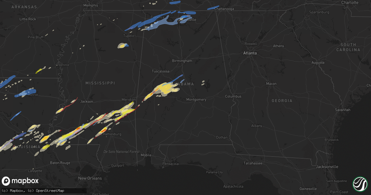
Hail Map in Alabama on December 16, 2019
Get this storm
December 16 map
$229
one time, instant access
Download today. No call, no setup
Keep the $229
Bought the map and want the full workflow? Apply the entire $229 to a subscription within 7 days. None of it is wasted.
Every map, not just this one
This buys you this map. Subscription and you get every map we run, in the markets you choose from a few cities to whole states to nationwide. Plus real-time alerts the moment a storm fires.
Contact data
Name, contact info, occupancy, even credit band for addresses in the footprint. You go from where it hit to who to call.
Become the source they trust
Unlimited branding weather history reports on demand. You already have the documented answer ready for the property owner, and you are the one who showed up with it.
Property data and RoofTrace estimates
Pull up any address you have got, its value and the exact code rules for that jurisdiction, straight from One Click Code. Then RoofTrace estimates the squares, pitch, and roof value, priced the way you price.
Storm reports in Alabama
Alabama
| Date | Description |
|---|---|
| 12/16/20195:58 PM CST | Report from mping: 1-inch tree limbs broken; shingles blown off. |
| 12/16/20195:57 PM CST | 70 mph wind gust reported near nick davis/capshaw road areas. |
| 12/16/20195:57 PM CST | 70 mph wind gust reported on capshaw road and nick davis road. |
| 12/16/20195:57 PM CST | 70 mph wind gusts reported near the intersection of capshaw/nick davis road. |
| 12/16/20195:54 PM CST | Home completely destroyed in this location. Possible tornado damage. |
| 12/16/20195:54 PM CST | Corrects previous tstm wnd dmg report from 5 sse harvest. Reporting structural damage at homes on portions of jasmine drive. Possible tornado damage. |
| 12/16/20195:54 PM CST | Four large trees were knocked down in the chadrick neighborhood. Reported via social media. |
| 12/16/20195:54 PM CST | Corrects previous tstm wnd dmg report from 5 sse harvest. Corrects previous tstm wnd dmg report from 5 sse harvest. Reporting structural damage at homes on portions of |
| 12/16/20195:53 PM CST | A roof was blown from house near sarah jane drive and mt zion road. Possible tornado damage. |
| 12/16/20195:52 PM CST | A hardwood tree was knocked down. |
| 12/16/20195:52 PM CST | A traffic light was knocked out due to thunderstorm winds at the intersection of church street and mill road. Time estimated by radar. |
| 12/16/20195:52 PM CST | Peak wind gust from 280 degrees at 62 mph... Recorded at 552 pm cst. |
| 12/16/20195:51 PM CST | Report from mping: half dollar |
| 12/16/20195:50 PM CST | Eight foot section of wooden fence blown over and stripped off of support posts. Off chadwick dr near the french mill community. Time estimated from radar. |
| 12/16/20195:47 PM CST | Some large pines snapped... And damage to a barn off cambridge rd in tanner. Trees were down pointing toward north... With parts of the barn roof scattered ene across t |
| 12/16/20195:42 PM CST | Report from mping: quarter |
| 12/16/20195:41 PM CST | Woodmont drive was shutdown at 5:41 pm due to debris and damage south of colbert heights high school. |
| 12/16/20195:40 PM CST | Tree reported down on a trailer at this location. |
| 12/16/20195:27 PM CST | A power pole was knocked down across the road at cr 530 at cr 52. |
| 12/16/20195:26 PM CST | A tree was knocked down onto power lines at 190 mcgraw circle. Time estimated by radar. |
| 12/16/20195:24 PM CST | Power poles were knocked down on cr 555 just south of cr 92. Time estimated by radar. |
| 12/16/20195:23 PM CST | Numerous large trees were snapped and knocked down in joe wheeler state park. Time estimated by radar. |
| 12/16/20195:23 PM CST | A power pole was snapped with a transformer hanging at cr 555 at cr 26. Time estimated by radar. |
| 12/16/20195:23 PM CST | Power lines were knocked down on cr 91... About 1.5 miles south of u.s. 72. |
| 12/16/20195:23 PM CST | Five homes were damaged on cr 91 at braden cove. Time estimated by radar. |
| 12/16/20195:22 PM CST | A tree was knocked down at 1339 cr 559. Time estimated by radar. |
| 12/16/20195:21 PM CST | A trampoline and street signs were blown into the road blocking it at 4543 cr 51. Time estimated by radar. |
| 12/16/20195:17 PM CST | Trees down on highway 101 at big nance bridge. |
| 12/16/20195:17 PM CST | Lots of tree down in joe wheeler state park. |
| 12/16/20195:16 PM CST | 18 wheeler was overturned on highway 20 at the intersection of cr 150 by wind. |
| 12/16/20195:15 PM CST | A tree ad power lines were knocked down on cr 31 one mile off of u.s. 72. Time estimated by radar. |
| 12/16/20195:15 PM CST | A tree was knocked down onto the road at 4701 cr 33. A vehicle ran into the tree shortly after. Time estimated by radar. |
| 12/16/20195:15 PM CST | A tree was knocked down on cr 33 south of pleasant valley church. Time estimated by radar. |
| 12/16/20195:12 PM CST | Corrects previous tstm wnd dmg report from 5 ne killen. Tree down on cr 31 between cr 34 and cr 432. |
| 12/16/20195:12 PM CST | Corrects previous tstm wnd dmg report from 2 ese town creek. Reports of two mobile homes damaged on cr 265. |
| 12/16/20195:12 PM CST | A tree was knocked down on power lines on cr 25 north of highway 64. Time estimated by radar. |
| 12/16/20195:12 PM CST | *** 2 fatal... 1 inj *** corrects previous tstm wnd dmg report from 2 ese town creek. Corrects previous tstm wnd dmg report from 2 ese town creek. Reports of two mobile |
| 12/16/20195:10 PM CST | Reports of two mobile homes damaged on cr 265. |
| 12/16/20195:10 PM CST | Reports of two mobile homes damaged on cr 265. Possible tornado damage. |
| 12/16/20195:09 PM CST | Tree reported down on kendell gardens on hickory cove road near taylor drive. |
| 12/16/20195:09 PM CST | Trees down on river road and point road. |
| 12/16/20195:08 PM CST | A tree was knocked down at cr 170 and cr 71. Time estimated by radar. |
| 12/16/20195:08 PM CST | A tree was knocked down at 2237 sky park road. Time estimated by radar. |
| 12/16/20195:08 PM CST | A tree was knocked down at cr 27 near cr 30. Time estimated by radar. |
| 12/16/20195:08 PM CST | A tree was knocked down on koger street. Time estimated by radar. |
| 12/16/20195:05 PM CST | Power lines and a power pole were knocked down at 165 cr 122. Time estimated by radar. |
| 12/16/20195:04 PM CST | Trees reported down on river road and hillcrest ave. |
| 12/16/20195:02 PM CST | Power lines were knocked down on east tombigbee street at walnut street. Time estimated by radar. |
| 12/16/20195:02 PM CST | A tree was knocked down at 1758 eunice avenue. Time estimated by radar. |
| 12/16/20195:02 PM CST | A power line was knocked down on cloverdale road around heathrow. Time estimated by radar. |
| 12/16/20195:02 PM CST | A tree was knocked down on wildwood park road. |
| 12/16/20194:59 PM CST | Tree down on ricks lane. |
| 12/16/20194:58 PM CST | A tree was knocked down in the road at cr 14 and cr 15... Causing a vehicle wreck at that location. Time estimated by radar. |
| 12/16/20194:58 PM CST | Power lines knocked down in the road on cr 137. Time estimated by radar. |
| 12/16/20194:58 PM CST | Trees down on west 10th stree and north raleigh avenue. |
| 12/16/20194:57 PM CST | A power pole was knocked down at cr 137 at cr 4. Time estimated by radar. |
| 12/16/20194:56 PM CST | Power pole laying across the road with live wires at the intersection of cr 4 and cr 137. |
| 12/16/20194:56 PM CST | Trees down on woodmont drive and milk springs road. |
| 12/16/20194:55 PM CST | Trees reported down near colbert heights daycare. |
| 12/16/20194:53 PM CST | Corrects previous tstm wnd dmg report from 5 ssw tuscumbia. Several structures damaged in the colbert heights area. Time estimated from radar. |
| 12/16/20194:53 PM CST | Several structures damaged in the colbert heights area. Possible tornado. Time estimated from radar. |
| 12/16/20194:52 PM CST | On underwood mountain road several small hardwood trees were snapped and residential structures sustained at least minor roof damage. |
| 12/16/20194:51 PM CST | A house under construction partially collapsed. |
| 12/16/20194:48 PM CST | Trees down on claunch loop and ligon springs road. |
| 12/16/20194:46 PM CST | Report from mping: 3-inch tree limbs broken; power poles broken. |
| 12/16/20194:42 PM CST | Tree down on old memphis pike. |
| 12/16/20194:34 PM CST | Multiple trees down near allsboro... 2 miles south of hwy 72. |
| 12/16/20194:30 AM CST | 1 tree down reported in geneva city. |
| 12/16/20194:21 AM CST | At 1021 PM CST, severe thunderstorms were located along a line extending from Gap Of The Mountain to Clanton to Pooles Crossroads, moving northeast at 75 mph. HAZARD...60 mph wind gusts. SOURCE...Radar indicated. IMPACT...Expect damage to roofs, siding, and trees. Locations impacted include... Rockford, Weogufka, Equality, Stewartville, Hanover, Lyle, Pentonville, Dollar, Bradford, Cottage Grove, Strickland Crossroads, Bentleyville, Marble Valley, Moriah, Hatchet, Nixburg, Speed, Highway 9 and Highway 22, Unity and Parkdale. |
| 12/16/20193:38 AM CST | At 938 PM CST, severe thunderstorms were located along a line extending from near Ashby to 6 miles northwest of Potter Station, moving east at 45 mph. HAZARD...60 mph wind gusts. SOURCE...Radar indicated. IMPACT...Expect damage to roofs, siding, and trees. Locations impacted include... Calera, Clanton, Valley Grande, Jemison, Thorsby, Maplesville, Billingsley, Vida Junction, Gap Of The Mountain, Parnell, Verbena, Plecher, Lawley, Marbury, Ashby, Paul M Grist State Park, Lay Lake Dam, Talladega National Forest, Chilton County Motor Sports Park and Higgins Ferry Park. |
| 12/16/20193:34 AM CST | At 934 PM CST, a severe thunderstorm was located near Fyffe, or 9 miles southwest of Rainsville, moving northeast at 50 mph. HAZARD...60 mph wind gusts. SOURCE...Radar indicated. IMPACT...Expect damage to roofs, siding, and trees. Locations impacted include... Fort Payne, Rainsville, Henagar, Sylvania, Fyffe, Powell, Geraldine, Valley Head, Hammondville and Mentone. |
| 12/16/20193:25 AM CST | Roof and pole damage along county road 719. |
| 12/16/20193:25 AM CST | Roof damage along county road 708. |
| 12/16/20193:23 AM CST | At 923 PM CST, severe thunderstorms were located along a line extending from near Harrisburg to near Vaiden, moving east at 40 mph. HAZARD...60 mph wind gusts and quarter size hail. SOURCE...Radar indicated. IMPACT...Hail damage to vehicles is expected. Expect wind damage to roofs, siding, and trees. Locations impacted include... Marion, Uniontown, Heiberger, Vaiden, Suttle, Oakmulgee, Perry County Correctional Center, Judson College, Radford, Sprott, Vaiden Field Airport and Ellards. |
| 12/16/20192:56 AM CST | At 856 PM CST, severe thunderstorms were located along a line extending from 3 miles west of Myrtlewood to 7 miles south of Crandall, moving east at 40 mph. HAZARD...60 mph wind gusts. SOURCE...Radar indicated. IMPACT...Expect damage to roofs, siding, and trees. Locations impacted include... Waynesboro, Butler, Lisman, Silas, Pennington, Gilbertown and Toxey. |
| 12/16/20192:15 AM CST | At 815 PM CST, severe thunderstorms were located along a line extending from 4 miles northeast of Snell to near Laurel, moving east at 40 mph. HAZARD...60 mph wind gusts and quarter size hail. SOURCE...Radar indicated. IMPACT...Hail damage to vehicles is expected. Expect wind damage to roofs, siding, and trees. Locations impacted include... Butler, Lisman, Pennington, Gilbertown and Toxey. |
| 12/16/20191:51 AM CST | At 751 PM CST, severe thunderstorms were located along a line extending from near Paulding to near Sandersville, moving east at 45 mph. HAZARD...60 mph wind gusts and penny size hail. SOURCE...Radar indicated. IMPACT...Expect damage to roofs, siding, and trees. Severe thunderstorms will be near... Barnett around 755 PM CST. Goodwater around 805 PM CST. Quitman around 810 PM CST. Sykes and De Soto around 820 PM CST. Crandall around 830 PM CST.Other locations impacted by these severe thunderstorms includePachuta and Shubuta. |
| 12/16/20191:09 AM CST | At 709 PM CST, a severe thunderstorm was located over Stonewall, or 7 miles north of Quitman, moving northeast at 45 mph. HAZARD...60 mph wind gusts and nickel size hail. SOURCE...Radar indicated. IMPACT...Expect damage to roofs, siding, and trees. This severe thunderstorm will be near... Sable around 715 PM CST. Middleton around 720 PM CST. Zero around 725 PM CST. Increase and Snell around 730 PM CST. Alamucha around 740 PM CST. |
| 12/16/201912:46 AM CST | At 645 PM CST, severe thunderstorms were located along a line extending from near Lynchburg to near New Market, moving east at 55 mph. HAZARD...60 mph wind gusts. SOURCE...Radar indicated. IMPACT...Expect damage to roofs, siding, and trees. Locations impacted include... Jasper, South Pittsburg, Whitwell, Kimball, Monteagle, Powells Crossroads, Orme, Martin Springs, Fiery Gizzard State Park and Griffith Creek. |
| 12/16/201912:03 AM CST | At 602 PM CST, severe thunderstorms were located along a line extending from near Petersburg to Huntsville to Triana, moving northeast at 70 mph. Wind gusts of 60 to 70 mph have been measured. HAZARD...70 mph wind gusts and quarter size hail. SOURCE...Radar indicated. IMPACT...Hail damage to vehicles is expected. Expect considerable tree damage. Wind damage is also likely to mobile homes, roofs, and outbuildings. Locations impacted include... Huntsville, Scottsboro, Winchester, Fayetteville, Moores Mill, Meridianville, Lynchburg, Redstone Arsenal, Hazel Green and Decherd. |
| 12/15/201911:30 PM CST | Trees down on power lines along horseshoe bend rd. Pea size hail also reported nearby on hwy 280. |
| 12/15/201911:15 PM CST | At 514 PM CST, severe thunderstorms were located along a line extending from near Summertown to 6 miles northeast of Lawrenceburg to 11 miles northeast of Loretto to near Lexington, moving northeast at 40 mph. HAZARD...60 mph wind gusts and penny size hail. SOURCE...Radar indicated. IMPACT...Expect damage to roofs, siding, and trees. Locations impacted include... Lawrenceburg, Pulaski, Loretto, Ardmore, Cornersville, Elkton, Minor Hill, Ethridge, Lynnville, Culleoka, Goodspring, Leoma, Frankewing and Prospect.This includes Interstate 65 between mile markers 1 and 36. |
| 12/15/201910:34 PM CST | At 434 PM CST, a severe thunderstorm was located near Collinwood, or 14 miles south of Waynesboro, moving east at 45 mph. HAZARD...60 mph wind gusts and penny size hail. SOURCE...Radar indicated. IMPACT...Expect damage to roofs, siding, and trees. Locations impacted include... Lawrenceburg, Loretto, Collinwood, St. Joseph, Ethridge, Leoma, Westpoint, Iron City and Cypress Inn. |
| 12/15/201910:25 PM CST | At 424 PM CST, a severe thunderstorm was located over Okolona, moving east at 55 mph. HAZARD...60 mph wind gusts. SOURCE...Radar indicated. IMPACT...Expect damage to roofs, siding, and trees. Locations impacted include... Tupelo, Amory, Aberdeen, Fulton, Houston, Verona, Okolona, Tombigbee State Park, Shannon, Plantersville, Mantachie, Smithville, Tremont, Prairie, Fairview, New Salem, New Wren, Trebloc, Evergreen and Clay. |
| 12/15/201910:25 PM CST | Power line down near county rd 56. |
| 12/15/201910:11 PM CST | Sheriff deputy confirms tornado is on the ground and knocking down power poles... Along hwy 25. |
| 12/15/201910:07 PM CST | A tornado touched down se of montevallo and moved northeast across hwy 25 before lifting east of county road 23. Along the 2.29 mile path... Several homes were damaged |
| 12/15/201910:07 PM CST | Minor structural damage to homes and barn on clay pit rd. Possible tornado. |
| 12/15/201910:04 PM CST | Damage to a building along hwy 139. Trees down and damage to homes along county road 106 and in brierfield estates. Possible tornado. |
| 12/15/201910:03 PM CST | Trees down in and around jemison. |
| 12/15/201910:00 PM CST | A tornado touched down on the east side of brierfield ironworks park and tracked eastward... Crossing al 139... Knocking down dozens of trees with winds of 90 mph. A ba |
| 12/15/20199:54 PM CST | Trees down in and around maplesville. |
| 12/15/20199:49 PM CST | A tornado touched down northeast of centreville and tracked eastward for 3.12 miles... Knocking down numerous trees. Max wind speeds were 70 mph and the width at the wi |
| 12/15/20199:48 PM CST | Unknown damage reported by so near 6400 block of montevallo rd. Possible tornado. |
| 12/15/20199:20 PM CST | A few trees down along county rd 47... 49... And highway 5 from heiberger north to the bibb county line. Power outages reported in this area as well. |
| 12/15/20199:03 PM CST | A tornado touched down 5 miles wnw of morgan springs in hale county and tracked northeast into perry county... Knocking down at least 100 trees along its 5.38 mile path |
| 12/15/20198:11 PM CST | *** 3 inj *** several homes damaged... Numerous trees down... And truck overturned along hwy 80 at county road 57. Possible tornado. |
| 12/15/20198:07 PM CST | *** 3 inj *** a tornado with winds of 120 mph touched down 2 miles sse of us 80 along al 28 and tracked northeast toward the salt well community. Many well built homes |
| 12/15/20197:56 PM CST | Several trees down in the whitfield community... Along county road 42. Possible tornado. |
| 12/15/20197:42 PM CST | Trees down in the yantley community. Time estimated by radar. |
| 12/15/20197:30 PM CST | Broadcast media reported trees down along highway 10 2 miles north of lisman. Possible tornado damage. Time estimated by radar. |
| 12/15/20197:17 PM CST | Mobile home reported flipped/damaged in the hinton area. Possible tornado damage. Time estimated by radar. |
| 12/15/20196:33 PM CST | Tree reported down at this location. |
| 12/15/20196:17 PM CST | Trees down on highway 101 at big nance bridge. |
| 12/15/20196:12 PM CST | Tree down on cr 31 between cr 34 and cr 432. |
| 12/15/20196:08 PM CST | Five homes damaged |
| 12/15/20196:06 PM CST | Structural damage reported on home along spencer lakes drive. Possible tornado damage. |
| 12/15/20196:06 PM CST | Power lines downed on meridian st ne and wholesale ave ne. |
| 12/15/20196:06 PM CST | A building damaged at this location and picked up and moved 10 feet. Possible tornado damage. |
| 12/15/20196:05 PM CST | At this location... Numerous trees were downed in a wooded area on a farm. |
| 12/15/20196:04 PM CST | Corrects previous tstm wnd dmg report from 1 s meridianville. Carport reported on powerlines in the area of monroe road and highway 431. |
All States Impacted by Hail Map on December 16, 2019
Cities Impacted by Hail Map on December 16, 2019
- Evergreen, LA
- Elizabeth, LA
- Glenmora, LA
- Pitkin, LA
- Oakdale, LA
- Jena, LA
- Bogue Chitto, MS
- Deridder, LA
- Leesville, LA
- Stringer, MS
- Meridian, MS
- Enterprise, MS
- Pachuta, MS
- Louin, MS
- Quitman, MS
- Paulding, MS
- Taylorsville, MS
- Bay Springs, MS
- Rose Hill, MS
- Vossburg, MS
- Shubuta, MS
- Stonewall, MS
- Moselle, MS
- Seminary, MS
- Hattiesburg, MS
- Mendenhall, MS
- Mount Olive, MS
- Mize, MS
- Prentiss, MS
- Magee, MS
- Newhebron, MS
- Bernice, LA
- Smithdale, MS
- Summit, MS
- Liberty, MS
- Ruth, MS
- London, KY
- Monticello, MS
- Edwards, MS
- Deville, LA
- Homer, LA
- Athens, LA
- Charleston, MS
- Greensboro, AL
- Newbern, AL
- Brent, AL
- Marion, AL
- Alexandria, LA
- Jonesville, LA
- Center Point, LA
- Pineville, LA
- Pollock, LA
- Tylertown, MS
- Centreville, MS
- Gloster, MS
- Woodville, MS
- McCall Creek, MS
- Saint Francisville, LA
- Meadville, MS
- Sontag, MS
- Brookhaven, MS
- Natchez, MS
- Marksville, LA
- Moreauville, LA
- Monterey, LA
- Sumrall, MS
- Bassfield, MS
- Columbia, MS
- Heidelberg, MS
- Laurel, MS
- Collins, MS
- Soso, MS
- Rosepine, LA
- Foxworth, MS
- Kokomo, MS
- Almyra, AR
- Holly Springs, MS
- Lake Village, AR
- Woodworth, LA
- Choudrant, LA
- Houston, MS
- Okolona, MS
- Plaucheville, LA
- Palmetto, LA
- Washington, LA
- Livingston, AL
- York, AL
- Forkland, AL
- Bellamy, AL
- Demopolis, AL
- Russellville, AL
- Tuscumbia, AL
- Uniontown, AL
- Sawyerville, AL
- Plantersville, AL
- Stanton, AL
- Equality, AL
- Alexander City, AL
- Roxie, MS
- Lettsworth, LA
- Batchelor, LA
- Marion Junction, AL
- Rockford, AL
- Kellyton, AL
- Spearsville, LA
- Dequincy, LA
- Ruston, LA
- Eros, LA
- Downsville, LA
- Calhoun, LA
- Golden, MS
- Fulton, MS
- Jamestown, LA
- Greensburg, LA
- Farmerville, LA
- Angola, LA
- Melville, LA
- Simmesport, LA
- Stuttgart, AR
- Boyce, LA
- Houlka, MS
- Collinwood, TN
- Lutts, TN
- Effie, LA
- Hickory Flat, MS
- Tutwiler, MS
- Ellisville, MS
- Norwood, LA
- Silver Creek, MS
- Raleigh, MS
- Crosby, MS
- Newellton, LA
- Saint Joseph, LA
- Port Gibson, MS
- Moundville, AL
- Lawley, AL
- Maplesville, AL
- Selma, AL
- Centreville, AL
- Gallion, AL
- Akron, AL
- Clinton, LA
- Ville Platte, LA
- Minden, LA
- Acme, LA
- Faunsdale, AL
- Call, TX
- Kirbyville, TX
- Jamestown, KY
- Gibsland, LA
- Toney, AL
- Otis, LA
- Sieper, LA
- Elmer, LA
- Merryville, LA
- Fort Polk, LA
- Hineston, LA
- Sugartown, LA
- Vicksburg, MS
- Waynesboro, TN
- Shongaloo, LA
- Haynesville, LA
- Forest Hill, LA
- Lecompte, LA
- Lisman, AL
- Butler, AL
- Harvest, AL
- Athens, AL
- Madison, AL
- Bronson, TX
- Senatobia, MS
- Como, MS
- Pinola, MS
- Jachin, AL
- Ward, AL
- Red Bay, AL
- Bienville, LA
- Belmont, LA
- Zwolle, LA
- Many, LA
- Marthaville, LA
- West Monroe, LA
- Strong, AR
- Vina, AL
- Hamburg, AR
- Crossett, AR
- Orange, TX
- Purvis, MS
- Bunkie, LA
- Thomaston, AL
- Montrose, AR
- Tanner, AL
- Ashland, MS
- Sterlington, LA
- Cleveland, MS
- Cheneyville, LA
- Saltillo, MS
- Guntown, MS
- Savannah, TN
- Marion, LA
- Scott, LA
- Lafayette, LA
- Huntsville, AL
- Haughton, LA
- Cotton Valley, LA
- Junction City, AR
- Princeton, LA
- Benton, LA
- Bossier City, LA
- Montgomery, LA
- Winnfield, LA
- Atlanta, LA
- Monroe, LA
- Trinity, AL
- Moulton, AL
- Courtland, AL
- Rogersville, AL
- Town Creek, AL
- Decatur, AL
- Hodges, AL
- Spruce Pine, AL
- Meridianville, AL
- Hillsboro, AL
- Leighton, AL
- Brownsboro, AL
- Cherokee, AL
- New Site, MS
- Belmont, MS
- Lexington, AL
- Anderson, AL
- Muscle Shoals, AL
- Killen, AL
- Florence, AL
- Dennis, MS
- Sheffield, AL
- Tishomingo, MS
- Lester, AL
- Elkmont, AL
- New Market, AL
- Ardmore, AL
- Hazel Green, AL
- Brierfield, AL
- Montevallo, AL
- Calera, AL
- Thorsby, AL
- Jemison, AL
- Pulaski, TN
- Lynnville, TN
- Leoma, TN
- Lawrenceburg, TN
- Cornersville, TN
- Lewisburg, TN
- Belfast, TN
- Whitwell, TN
- Sherwood, TN
- South Pittsburg, TN
- Sequatchie, TN
- Jasper, TN
- Bolton, MS
- Wesson, MS
- Marietta, MS
- Blue Springs, MS
- Booneville, MS
- Baldwyn, MS


