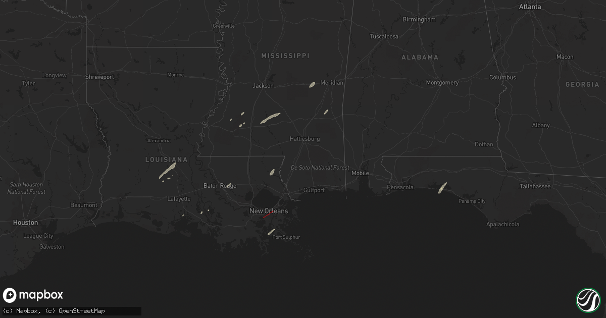
Hail Map in Mississippi on December 14, 2022
Get this storm
December 14 map
$229
one time, instant access
Download today. No call, no setup
Keep the $229
Bought the map and want the full workflow? Apply the entire $229 to a subscription within 7 days. None of it is wasted.
Every map, not just this one
This buys you this map. Subscription and you get every map we run, in the markets you choose from a few cities to whole states to nationwide. Plus real-time alerts the moment a storm fires.
Contact data
Name, contact info, occupancy, even credit band for addresses in the footprint. You go from where it hit to who to call.
Become the source they trust
Unlimited branding weather history reports on demand. You already have the documented answer ready for the property owner, and you are the one who showed up with it.
Property data and RoofTrace estimates
Pull up any address you have got, its value and the exact code rules for that jurisdiction, straight from One Click Code. Then RoofTrace estimates the squares, pitch, and roof value, priced the way you price.
Storm reports in Mississippi
Mississippi
| Date | Description |
|---|---|
| 12/14/20225:56 PM CST | Reports of heavy tree damage near the va hospital. |
| 12/14/20225:20 PM CST | Reports of powerlines down on enchanted ave... Near mystic circle. |
| 12/14/20222:35 PM CST | Multiple structures damaged on clarke county road 4191. |
| 12/14/20222:33 PM CST | Two mobile homes damaged on 670 east of quitman. Numerous homes with minor damage and a house with partial roof removal. |
| 12/14/20222:33 PM CST | Heavy structural damage east of quitman on county road 670 and another structure is completely gone. |
| 12/14/20222:31 PM CST | Possible tornado damage at the intersection of county road 660 and county road 511. Heavy tree damage and roads blocked. |
| 12/14/20222:10 PM CST | Roof damage to structures and shed damage on shelby gressett rd. Possible tornado. |
| 12/14/20222:09 PM CST | Several trees down in the fellowship community. |
| 12/14/20221:56 PM CST | Utility lines downed near camp binachi rd and old hwy 19. Possible tornado. |
| 12/14/20221:55 PM CST | Roof blown off trailer near toomsuba. |
| 12/14/20221:43 PM CST | Trees and powerlines down. |
| 12/14/20221:20 PM CST | Corrects previous tstm wnd dmg report from 1 se heidelberg. Power pole down in heidelburg. |
| 12/14/202212:59 PM CST | Structural damage to houses at the intersection of pop runnels road and macedonia road in petal. |
| 12/14/202212:35 PM CST | Several trees uprooted and snapped along rose road in hickory... Just north of i-20. |
| 12/14/202212:35 PM CST | Trees uprooted and homes damaged about 1 mile north of hickory ms along edwards road. |
| 12/14/20227:11 AM CST | Poultry houses destroyed in open field. |
| 12/14/20226:48 AM CST | Four poultry homes destroyed on gaddis myers rd. |
| 12/14/20226:48 AM CST | At 1247 AM CST, a severe thunderstorm was located near Tolarville, or near Thornton, moving east at 35 mph. HAZARD...60 mph wind gusts and quarter size hail. SOURCE...Radar indicated. IMPACT...Hail damage to vehicles is expected. Expect wind damage to roofs, siding, and trees. This severe thunderstorm will be near... Brozville, Howard and Ebenezer around 100 AM CST. Lexington around 110 AM CST. Franklin around 115 AM CST. Bowling Green around 125 AM CST. Durant around 130 AM CST. Possumneck around 140 AM CST.Other locations impacted by this severe thunderstorm include Eden,West and Sallis. |
| 12/14/20226:34 AM CST | 4 greenhouses and 2 hay barns were damaged in the area near the intersection of rock hill rd and ms highway 18. Possible tornado. |
| 12/14/20226:21 AM CST | Damage to mobile homes off reservoir... Some destroyed. |
| 12/14/20226:16 AM CST | At 1216 AM CST, a severe thunderstorm was located near Wallace Ridge, or 15 miles northwest of Ferriday, moving northeast at 35 mph. HAZARD...60 mph wind gusts. SOURCE...Radar indicated. IMPACT...Expect damage to roofs, siding, and trees. This severe thunderstorm will be near... Lee Bayou around 1235 AM CST. Cooter Point around 1250 AM CST. Helena around 1255 AM CST.Other locations impacted by this severe thunderstorm include Gilbertand Sicily Island. |
| 12/14/20226:00 AM CST | Mobile homes damaged off of rock road. |
| 12/14/20221:17 AM CST | At 717 AM CST, a severe thunderstorm was located 10 miles southeast of Leakesville, moving northeast at 25 mph. HAZARD...60 mph wind gusts. SOURCE...Radar indicated. IMPACT...Expect damage to roofs, siding, and trees. Locations impacted include... Deer Park. |
| 12/14/20221:04 AM CST | At 704 AM CST, severe thunderstorms were located along a line extending from White Oak to near Magee, moving northeast at 45 mph. HAZARD...60 mph wind gusts. SOURCE...Radar indicated. IMPACT...Expect damage to roofs, siding, and trees. Severe thunderstorms will be near... White Oak around 710 AM CST. Burns around 720 AM CST. Raleigh and Homewood around 725 AM CST. Pineville around 740 AM CST.Other locations impacted by these severe thunderstorms includeSylvarena and Lake. |
| 12/13/202211:15 PM CST | At 514 AM CST, a severe thunderstorm was located 5 miles southeast of Tuckers Crossing, or 10 miles east of Ellisville, moving northeast at 25 mph. HAZARD...60 mph wind gusts. SOURCE...Radar indicated. IMPACT...Expect damage to roofs, siding, and trees. This severe thunderstorm will remain over mainly rural areas of northwestern Wayne County. |
| 12/13/202210:58 PM CST | At 457 PM CST, a severe thunderstorm was located 6 miles southwest of State Line, or 15 miles north of Leakesville, moving northeast at 40 mph. HAZARD...60 mph wind gusts. SOURCE...Radar indicated. IMPACT...Expect damage to roofs, siding, and trees. Locations impacted include... Millry and State Line. |
| 12/13/202210:43 PM CST | At 443 PM CST, severe thunderstorms were located along a line extending from 11 miles southwest of McLain to 4 miles east of Saucier, moving east at 45 mph. HAZARD...60 mph wind gusts. SOURCE...Radar indicated. IMPACT...Expect damage to roofs, siding, and trees. Locations impacted include... Lucedale, Leakesville and McLain. |
| 12/13/20229:56 PM CST | At 355 PM CST, a severe thunderstorm was located 13 miles southeast of Poplarville, moving northeast at 35 mph. HAZARD...60 mph wind gusts. SOURCE...Radar indicated. IMPACT...Expect damage to roofs, siding, and trees. Locations impacted include... Wiggins, Perkinston and McHenry. |
| 12/13/20229:43 PM CST | At 343 AM CST, severe thunderstorms were located along a line extending from 6 miles northwest of New Hope to near Garden City, moving east at 25 mph. HAZARD...60 mph wind gusts and penny size hail. SOURCE...Radar indicated. IMPACT...Expect damage to roofs, siding, and trees. Locations impacted include... Bude, Kirby, Garden City, New Hope, Hamburg, Roxie and Meadville. |
| 12/13/20229:35 PM CST | At 335 PM CST, a severe thunderstorm was located 5 miles south of Rock Hill, or 13 miles northwest of Wiggins, moving northeast at 30 mph. HAZARD...60 mph wind gusts and quarter size hail. SOURCE...Radar indicated. IMPACT...Hail damage to vehicles is expected. Expect wind damage to roofs, siding, and trees. Locations impacted include... Beaumont and New Augusta. |
| 12/13/20229:13 PM CST | At 312 PM CST, a severe thunderstorm was located over Lumberton, or 11 miles northeast of Poplarville, moving northeast at 35 mph. HAZARD...60 mph wind gusts. SOURCE...Radar indicated. IMPACT...Expect damage to roofs, siding, and trees. This severe thunderstorm will be near... Rock Hill around 335 PM CST. Brooklyn around 340 PM CST. Mclaurin around 345 PM CST. |
| 12/13/20228:36 PM CST | At 236 AM CST, severe thunderstorms were located along a line extending from near Fayette to near Natchez to 6 miles north of Big Bend, moving northeast at 35 mph. HAZARD...60 mph wind gusts and penny size hail. SOURCE...Radar indicated. IMPACT...Expect damage to roofs, siding, and trees. Locations impacted include... Natchez, Vidalia, Fayette, Union Church, Stanton, Hamburg, Kingston, Black Hawk, Lorman, Sibley, Slocum, Mcbride, Cranfield, Stampley, Red Lick, Deer Park, Church Hill, Mcnair, Blue Hill and Kirby. |
| 12/13/20228:36 PM CST | At 236 PM CST, a severe thunderstorm was located over Madisonville, or 8 miles south of Covington, moving northeast at 40 mph. HAZARD...60 mph wind gusts. SOURCE...Radar indicated. IMPACT...Expect damage to roofs, siding, and trees. Locations impacted include... Slidell, Picayune, Covington, Pearl River, Abita Springs, Madisonville, Lacombe, Pearlington and Slidell Airport.This includes the following Interstates... Interstate 10 in Louisiana between mile markers 266 and 273. Interstate 10 in Mississippi between mile markers 1 and 2. Interstate 12 between mile markers 58 and 84. Interstate 59 in Louisiana between mile markers 1 and 11. |
| 12/13/20227:50 PM CST | At 150 AM CST, a severe thunderstorm was located near Vaiden, or 8 miles southeast of Winona, moving northeast at 40 mph. HAZARD...60 mph wind gusts. SOURCE...Radar indicated. IMPACT...Expect damage to roofs, siding, and trees. This severe thunderstorm will be near... Poplar Creek around 155 AM CST. Kilmichael around 200 AM CST. Lodi around 210 AM CST. Eupora around 225 AM CST. Bellefontaine around 230 AM CST. Sherwood around 235 AM CST.Other locations impacted by this severe thunderstorm include FrenchCamp, Walthall and Weir. |
| 12/13/20227:31 PM CST | At 131 AM CST, a severe thunderstorm was located near Black Hawk, or 18 miles south of Monterey, moving northeast at 45 mph. HAZARD...60 mph wind gusts. SOURCE...Radar indicated. IMPACT...Expect damage to roofs, siding, and trees. This severe thunderstorm will be near... Slocum around 135 AM CST. Deer Park around 150 AM CST. Sibley around 155 AM CST. Natchez and Vidalia around 210 AM CST.Other locations impacted by this severe thunderstorm includeRidgecrest. |
All States Impacted by Hail Map on December 14, 2022
Cities Impacted by Hail Map on December 14, 2022
- Franklinton, LA
- Bush, LA
- Bogalusa, LA
- Jeanerette, LA
- Mamou, LA
- Bunkie, LA
- Ville Platte, LA
- Eunice, LA
- Baton Rouge, LA
- Denham Springs, LA
- Walker, LA
- Opelousas, LA
- McCall Creek, MS
- Brookhaven, MS
- Mendenhall, MS
- Magee, MS
- Sontag, MS
- Newhebron, MS
- Pinola, MS
- Monticello, MS
- Silver Creek, MS
- Port Sulphur, LA
- Lafitte, LA
- New Iberia, LA
- Union Church, MS
- Miramar Beach, FL
- Santa Rosa Beach, FL
- Hazlehurst, MS
- Freeport, FL
- Shubuta, MS
- Newton, MS
- Hickory, MS
- Harrisville, MS
- Georgetown, MS
- Canton, MS
- Lake, MS
- Mount Olive, MS
- Chunky, MS
- Decatur, MS
- Folsom, LA
- Loranger, LA
- Hammond, LA
- Petal, MS
- Ovett, MS
- Quitman, MS
- La Place, LA
- Hahnville, LA
- Toomsuba, MS
- Meridian, MS
- Abita Springs, LA
- Gheens, LA
- Pelahatchie, MS
- Lumberton, MS
- Gretna, LA
- Harvey, LA
- Marrero, LA
- Arabi, LA
- New Orleans, LA
- Chalmette, LA
- Braithwaite, LA
- Beaumont, MS
- Silas, AL
- Eastpoint, FL
- Sopchoppy, FL
- Crawfordville, FL
- Tallahassee, FL
- Doerun, GA
- State Line, MS
- Coffeeville, AL
- Chatom, AL
- Frankville, AL
- Millry, AL
- Biloxi, MS
- Vancleave, MS
- Ocean Springs, MS
- Diberville, MS


