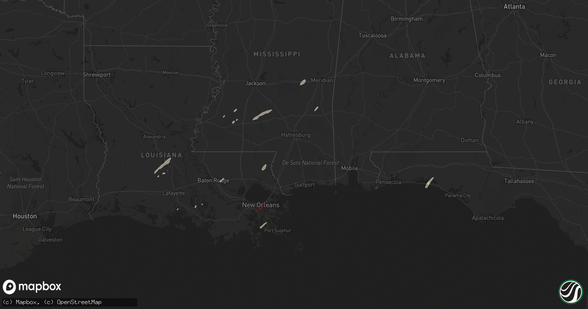
Hail Map in Louisiana on December 14, 2022
Get this storm
December 14 map
$229
one time, instant access
Download today. No call, no setup
Keep the $229
Bought the map and want the full workflow? Apply the entire $229 to a subscription within 7 days. None of it is wasted.
Every map, not just this one
This buys you this map. Subscription and you get every map we run, in the markets you choose from a few cities to whole states to nationwide. Plus real-time alerts the moment a storm fires.
Contact data
Name, contact info, occupancy, even credit band for addresses in the footprint. You go from where it hit to who to call.
Become the source they trust
Unlimited branding weather history reports on demand. You already have the documented answer ready for the property owner, and you are the one who showed up with it.
Property data and RoofTrace estimates
Pull up any address you have got, its value and the exact code rules for that jurisdiction, straight from One Click Code. Then RoofTrace estimates the squares, pitch, and roof value, priced the way you price.
Storm reports in Louisiana
Louisiana
| Date | Description |
|---|---|
| 12/14/20224:04 PM CST | Damage to buildings. |
| 12/14/20223:56 PM CST | Damage reported to structures. |
| 12/14/20223:56 PM CST | Reported powerlines down. |
| 12/14/20223:50 PM CST | *** 6 inj *** an ef2 tornado with a maximum wind speed of 125 mph and a maximum width of 175 yards touched down in jefferson parish and ended in st. Bernard. The tornad |
| 12/14/20223:05 PM CST | Reports of power poles snapped and trees down. |
| 12/14/20223:05 PM CST | Trees and powerlines down in the talisheek area. |
| 12/14/20223:05 PM CST | Reports of roof damage and powerlines down. |
| 12/14/20222:54 PM CST | Fire department reported trees across highway 36. |
| 12/14/20222:54 PM CST | Mesonet station xptn pontchartrain causeway. |
| 12/14/20222:23 PM CST | Law enforcement reporting calls about house damage in montz. |
| 12/14/20222:21 PM CST | *** 1 fatal... 8 inj *** confirmed ef2 tornado with max winds of 120 mph... Max width of 75 yards... And a length of 5 miles. Several mobile homes were damaged or destr |
| 12/14/20222:21 PM CST | Confirmed damage along schoolhouse road with a house damaged... Power poles and street lights down. |
| 12/14/202212:02 PM CST | Two large oak trees reported down and damage to outer buildings. Possible tor. |
| 12/14/202212:00 PM CST | Numerous parish roads flooded. |
| 12/14/202211:59 AM CST | Spotter confirms tornado touched down west of donaldsonville. |
| 12/14/202210:55 AM CST | Medical center in new iberia sustained damage. |
| 12/14/202210:51 AM CST | Debris detected on radar. Skycam video of large tornado crossing 90 and admiral doyle into the south side of new iberia. |
| 12/14/202210:50 AM CST | Tornado damaged numerous homes... Outbuilds and the hospital. Tornado was 4.5 miles long and 300 yards wide. |
| 12/14/20229:23 AM CST | Picture of tornado in a field just west of la 29. |
| 12/14/20229:23 AM CST | Picture of tornado in a field just west of la 29. Survey team surveyed the area and found the exact location in the photo... However the tornado was in an marshy area a |
| 12/14/20226:54 AM CST | At 1254 AM CST, a severe thunderstorm was located near Larto, moving northeast at 25 mph. HAZARD...60 mph wind gusts. SOURCE...Radar indicated. IMPACT...Expect damage to roofs, siding, and trees. This severe thunderstorm will be near... Larto around 105 AM CST. New Era around 110 AM CST. Mayna around 115 AM CST. Monterey around 130 AM CST. Jonesville around 140 AM CST. |
| 12/14/20226:26 AM CST | At 1226 PM CST, a severe thunderstorm was located over Natalbany, or near Hammond, moving northeast at 40 mph. HAZARD...60 mph wind gusts. SOURCE...Radar indicated. IMPACT...Expect damage to roofs, siding, and trees. Locations impacted include... Hammond, Franklinton, Folsom, Natalbany and Tickfaw. This includes Interstate 55 in Louisiana between mile markers 34 and38. |
| 12/14/20226:25 AM CST | At 1225 PM CST, a severe thunderstorm was located near Madisonville, or 9 miles southwest of Covington, moving northeast at 45 mph. HAZARD...60 mph wind gusts. SOURCE...Radar indicated. IMPACT...Expect damage to roofs, siding, and trees. Locations impacted include... Covington, Abita Springs, Madisonville, Sun and Bush. This includes Interstate 12 between mile markers 57 and 65. |
| 12/13/202210:57 PM CST | At 457 PM CST, a severe thunderstorm was located near Pearlington, or 9 miles southwest of Waveland, moving northeast at 40 mph. HAZARD...60 mph wind gusts. SOURCE...Radar indicated. IMPACT...Expect damage to roofs, siding, and trees. Locations impacted include... Gulfport, Biloxi, Ocean Springs, Long Beach, Bay St. Louis, Waveland, Diamondhead, St. Martin, D'iberville, Kiln, Pearlington, Lyman, Shoreline Park, Saucier and Gulfport Airport.This includes the following Interstates... Interstate 10 in Mississippi between mile markers 1 and 47. Interstate 110 in Mississippi between mile markers 1 and 4. |
| 12/13/20229:38 PM CST | At 338 PM CST, a severe thunderstorm was located near Stennis Space Center, or 8 miles northeast of Slidell, moving northeast at 35 mph. HAZARD...60 mph wind gusts. SOURCE...Radar indicated. IMPACT...Expect damage to roofs, siding, and trees. Locations impacted include... Gulfport, Bay St. Louis, Diamondhead, Kiln, Lyman, Stennis Space Center, Shoreline Park and Pearlington.This includes the following Interstates... Interstate 10 in Louisiana between mile markers 269 and 273. Interstate 10 in Mississippi between mile markers 1 and 34. Interstate 59 in Louisiana between mile markers 6 and 11. Interstate 59 in Mississippi between mile markers 1 and 2. |
| 12/13/20227:56 PM CST | At 156 AM CST, a severe thunderstorm was located near Port Gibson, or 25 miles southwest of Vicksburg, moving northeast at 40 mph. HAZARD...60 mph wind gusts and quarter size hail. SOURCE...Radar indicated. IMPACT...Hail damage to vehicles is expected. Expect wind damage to roofs, siding, and trees. This severe thunderstorm will be near... Port Gibson around 200 AM CST. Yokena around 215 AM CST. Rocky Springs around 220 AM CST. Reganton around 225 AM CST. |
| 12/13/20227:43 PM CST | At 142 AM CST, a severe thunderstorm was located over Poland, or 9 miles west of Effie, moving northeast at 50 mph. HAZARD...60 mph wind gusts and penny size hail. SOURCE...Radar indicated. IMPACT...Expect damage to roofs, siding, and trees. Locations impacted include... Effie, Deville, Poland, Centerpoint and Ruby. |
| 12/13/20227:11 PM CST | At 111 AM CST, a severe thunderstorm was located over Helena, or 19 miles northeast of Ferriday, moving east at 30 mph. HAZARD...60 mph wind gusts and half dollar size hail. SOURCE...Radar indicated. IMPACT...Hail damage to vehicles is expected. Expect wind damage to roofs, siding, and trees. This severe thunderstorm will be near... St. Joseph and Lake Bruin around 135 AM CST. Alcorn around 140 AM CST. |
All States Impacted by Hail Map on December 14, 2022
Cities Impacted by Hail Map on December 14, 2022
- Franklinton, LA
- Bush, LA
- Bogalusa, LA
- Jeanerette, LA
- Mamou, LA
- Bunkie, LA
- Ville Platte, LA
- Eunice, LA
- Baton Rouge, LA
- Denham Springs, LA
- Walker, LA
- Opelousas, LA
- McCall Creek, MS
- Brookhaven, MS
- Mendenhall, MS
- Magee, MS
- Sontag, MS
- Newhebron, MS
- Pinola, MS
- Monticello, MS
- Silver Creek, MS
- Port Sulphur, LA
- Lafitte, LA
- New Iberia, LA
- Union Church, MS
- Miramar Beach, FL
- Santa Rosa Beach, FL
- Hazlehurst, MS
- Freeport, FL
- Shubuta, MS
- Newton, MS
- Hickory, MS
- Harrisville, MS
- Georgetown, MS
- Canton, MS
- Lake, MS
- Mount Olive, MS
- Chunky, MS
- Decatur, MS
- Folsom, LA
- Loranger, LA
- Hammond, LA
- Petal, MS
- Ovett, MS
- Quitman, MS
- La Place, LA
- Hahnville, LA
- Toomsuba, MS
- Meridian, MS
- Abita Springs, LA
- Gheens, LA
- Pelahatchie, MS
- Lumberton, MS
- Gretna, LA
- Harvey, LA
- Marrero, LA
- Arabi, LA
- New Orleans, LA
- Chalmette, LA
- Braithwaite, LA
- Beaumont, MS
- Silas, AL
- Eastpoint, FL
- Sopchoppy, FL
- Crawfordville, FL
- Tallahassee, FL
- Doerun, GA
- State Line, MS
- Coffeeville, AL
- Chatom, AL
- Frankville, AL
- Millry, AL
- Biloxi, MS
- Vancleave, MS
- Ocean Springs, MS
- Diberville, MS


