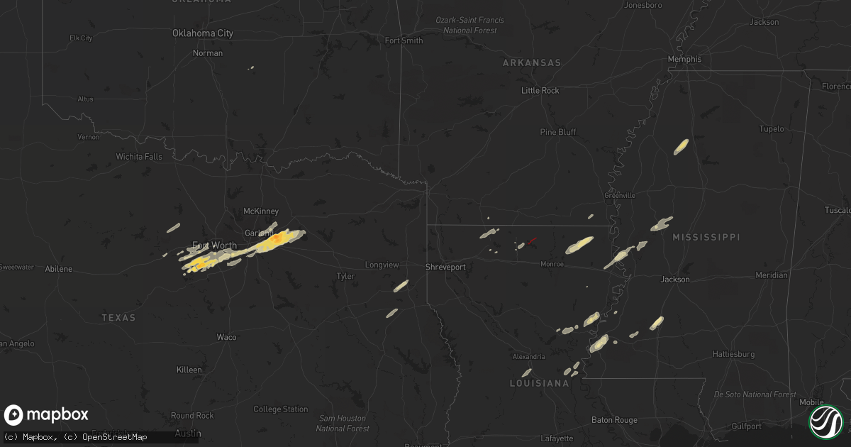
Hail Map in Mississippi on December 13, 2022
Get this storm
December 13 map
$229
one time, instant access
Download today. No call, no setup
Keep the $229
Bought the map and want the full workflow? Apply the entire $229 to a subscription within 7 days. None of it is wasted.
Every map, not just this one
This buys you this map. Subscription and you get every map we run, in the markets you choose from a few cities to whole states to nationwide. Plus real-time alerts the moment a storm fires.
Contact data
Name, contact info, occupancy, even credit band for addresses in the footprint. You go from where it hit to who to call.
Become the source they trust
Unlimited branding weather history reports on demand. You already have the documented answer ready for the property owner, and you are the one who showed up with it.
Property data and RoofTrace estimates
Pull up any address you have got, its value and the exact code rules for that jurisdiction, straight from One Click Code. Then RoofTrace estimates the squares, pitch, and roof value, priced the way you price.
Storm reports in Mississippi
Mississippi
| Date | Description |
|---|---|
| 12/13/20225:44 AM CST | Storm chaser reported tree branches down off hwy 28 and trees down on the roadway due to confirmed tornado. |
| 12/13/20225:34 AM CST | Mobile homes destroyed in sharkey county. |
| 12/13/20225:34 AM CST | *** 3 inj *** corrects previous tornado report from anguilla. Mobile homes destroyed in sharkey county. |
| 12/13/20225:25 AM CST | Emergency manager reported trees and power lines down on hwy 15 south at ed crowder rd due to possible tornado. |
| 12/13/20225:18 AM CST | Emergency manager reported tree top down at tank rd and terry rd due to possible tornado. Was raining sideways at 5:29 am. |
| 12/13/20225:16 AM CST | At 1116 PM CST, a severe thunderstorm was located over Burgess, or 9 miles west of Holly Springs National Forest, moving northeast at 65 mph. HAZARD...60 mph wind gusts. SOURCE...Radar indicated. IMPACT...Expect damage to roofs, siding, and trees. Locations impacted include... Oxford, Water Valley, Holly Springs National Forest, Cambridge, Etta, Springdale, Burgess, Bethlehem, Denmark, Pinedale, Thaxton, Potts Camp, Abbeville, Taylor, Malone, Keel, Esperanza, Waterford, Lake Center and College Hill Station. |
| 12/13/20225:14 AM CST | At 1114 PM CST, a severe thunderstorm was located over Indianola, moving northeast at 50 mph. HAZARD...60 mph wind gusts and quarter size hail. SOURCE...Radar indicated. IMPACT...Hail damage to vehicles is expected. Expect wind damage to roofs, siding, and trees. This severe thunderstorm will be near... Moorhead around 1120 PM CST. Sunflower around 1125 PM CST. Blaine around 1130 PM CST. Itta Bena around 1135 PM CST. Sunnyside around 1145 PM CST. Minter City and Money around 1150 PM CST.Other locations impacted by this severe thunderstorm includeSchlater. |
| 12/13/20223:55 AM CST | Emergency manager reported small debris on liberty rd. 8 residents were reported trapped inside a home on 24 nations rd... Cranfield area in adams county. First respond |
| 12/13/20223:42 AM CST | At 942 PM CST, a severe thunderstorm was located over Shaw, moving northeast at 40 mph. HAZARD...60 mph wind gusts. SOURCE...Radar indicated. IMPACT...Expect damage to roofs, siding, and trees. This severe thunderstorm will be near... Shaw around 945 PM CST. Cleveland and Boyle around 955 PM CST. Ruleville around 1005 PM CST. Drew around 1015 PM CST.Other locations impacted by this severe thunderstorm includeDoddsville. |
| 12/13/202212:09 AM CST | Tornado sighted near lake albemarle. |
| 12/12/202211:31 PM CST | Large transmission lines downed across us 61 and a home damaged east of us 61. |
| 12/12/202211:11 PM CST | Large tree uprooted... Several structures destroyed... Large tree limbs down. |
All States Impacted by Hail Map on December 13, 2022
Cities Impacted by Hail Map on December 13, 2022
- Arlington, TX
- Fort Worth, TX
- Burleson, TX
- Mansfield, TX
- Kennedale, TX
- Granbury, TX
- Dubach, LA
- Bernice, LA
- Sicily Island, LA
- Konawa, OK
- Roxie, MS
- Enid, MS
- Oakland, MS
- Charleston, MS
- Parkdale, AR
- Homer, LA
- Athens, LA
- Clayton, LA
- Weatherford, TX
- Rockwall, TX
- Royse City, TX
- Terrell, TX
- Forney, TX
- Jonesville, LA
- Harrisonburg, LA
- Sondheimer, LA
- Mayersville, MS
- Natchez, MS
- Yazoo City, MS
- Marksville, LA
- Moreauville, LA
- Poolville, TX
- Winnsboro, LA
- Grand Prairie, TX
- Joshua, TX
- Cresson, TX
- Godley, TX
- Mesquite, TX
- Sunnyvale, TX
- Oak Ridge, LA
- Mer Rouge, LA
- Oak Grove, LA
- Dallas, TX
- Cedar Hill, TX
- Duncanville, TX
- Santo, TX
- Brookhaven, MS
- Quinlan, TX
- Seagoville, TX
- Balch Springs, TX
- Garrison, TX
- Rolling Fork, MS
- Wesson, MS
- Emerson, AR
- Tchula, MS
- Belzoni, MS
- Beckville, TX
- Carthage, TX
- Aledo, TX
- Lipan, TX
- Naval Air Station Jrb, TX
- Louise, MS
- Silver City, MS
- Lorman, MS
- Port Gibson, MS
- Lone Oak, TX
- Wills Point, TX
- Crowley, TX
- Lancaster, TX
- Point, TX
- Desoto, TX
- Hutchins, TX
- Lecompte, LA
- Forest Hill, LA
- Woodworth, LA
- Waterproof, LA
- Ferriday, LA
- Meadville, MS
- McCall Creek, MS
- Bastrop, LA
- Collinston, LA
- Haynesville, LA
- Vidalia, LA
- Jena, LA
- Hazlehurst, MS
- Valley Park, MS
- Midlothian, TX
- Venus, TX
- Tallulah, LA
- Vicksburg, MS
- Garland, TX
- Lavon, TX
- Rowlett, TX
- Nevada, TX
- Wylie, TX
- Mount Enterprise, TX
- Nacogdoches, TX
- Whitt, TX
- Perrin, TX
- Mineral Wells, TX
- Fort Necessity, LA
- Enterprise, LA
- Columbia, LA
- Shelbyville, TX
- Pickens, MS
- Lexington, MS
- Benton, MS
- Cruger, MS
- Georgetown, MS
- Harrisville, MS
- Decatur, TX
- Grapevine, TX
- Leonard, TX
- Wolfe City, TX
- Blue Ridge, TX
- Longview, TX
- Henderson, TX
- Marshall, TX
- Waskom, TX
- De Berry, TX
- Keatchie, LA
- Keithville, LA
- Farmerville, LA
- Marion, LA
- Terry, MS


