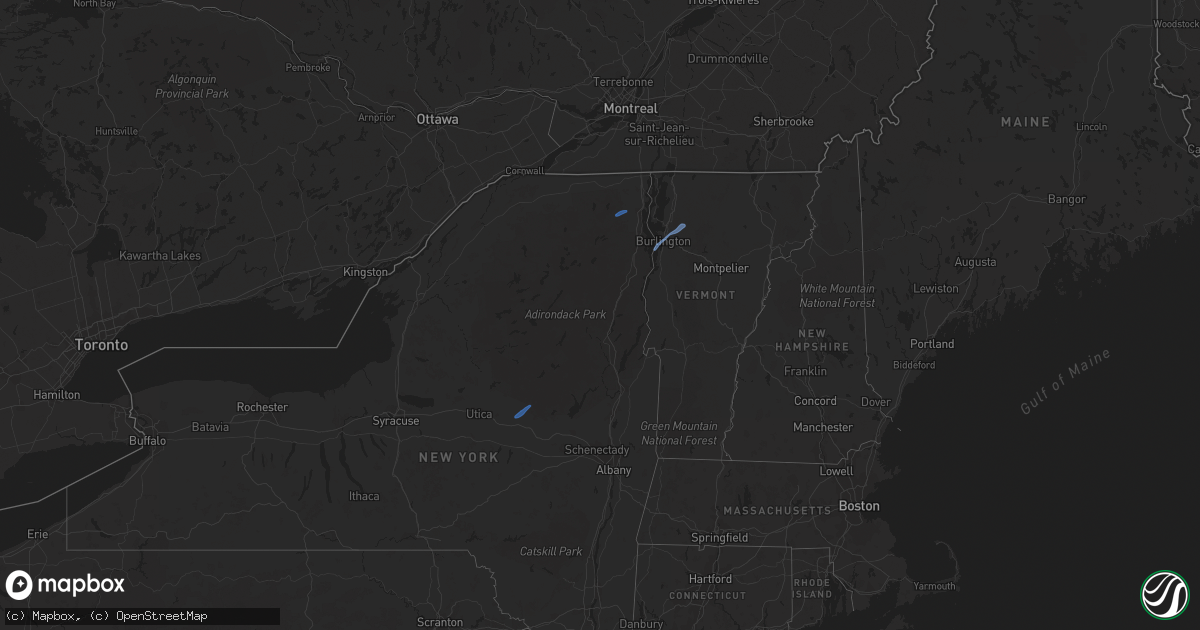
Hail Map in New York on October 16, 2021
Get this storm
October 16 map
$229
one time, instant access
Download today. No call, no setup
Keep the $229
Bought the map and want the full workflow? Apply the entire $229 to a subscription within 7 days. None of it is wasted.
Every map, not just this one
This buys you this map. Subscription and you get every map we run, in the markets you choose from a few cities to whole states to nationwide. Plus real-time alerts the moment a storm fires.
Contact data
Name, contact info, occupancy, even credit band for addresses in the footprint. You go from where it hit to who to call.
Become the source they trust
Unlimited branding weather history reports on demand. You already have the documented answer ready for the property owner, and you are the one who showed up with it.
Property data and RoofTrace estimates
Pull up any address you have got, its value and the exact code rules for that jurisdiction, straight from One Click Code. Then RoofTrace estimates the squares, pitch, and roof value, priced the way you price.
Storm reports in New York
New York
| Date | Description |
|---|---|
| 10/16/20212:57 PM CDT | Tree and wires down with transformer fire on foordmore rd. Time estimated from radar. |
| 10/16/20212:55 PM CDT | Tree and wires down at rt 28a and brodhead rd. Time stimated from radar. |
| 10/16/20212:54 PM CDT | Low hanging tree on wires. Time estimated from radar. |
| 10/16/20211:32 PM CDT | Trees down on w church st |
| 10/16/20211:30 PM CDT | Tree down on trout brook rd. |
| 10/16/20211:27 PM CDT | Trees down on porter rd |
| 10/16/20211:27 PM CDT | Trees down on ny rte 3. |
| 10/16/20211:24 PM CDT | Trees and powerlines down on bittersweet lane. |
| 10/16/20211:20 PM CDT | Route 9n closed at ben rosa road due to downed tree. |
| 10/16/20211:19 PM CDT | Trees down on bucks corners road. |
| 10/16/20211:13 PM CDT | Trees down on silver lake road. |
| 10/16/20211:13 PM CDT | Trees down on east hill rd near burnt hill rd |
| 10/16/202112:38 PM CDT | Several trees down on river road. |
| 10/16/202112:24 PM CDT | Trees down. Time estimated from radar. |
| 10/16/202112:15 PM CDT | Several trees down and some snapped 15 feet above the ground. Trees reported down in the same direction. Route 29a and seely road. |
| 10/16/202112:12 PM CDT | Spotter reports multiple trees and wires down near rt 29a between red school rd and mc clure rd. Time estimated based on radar. |
| 10/16/202112:10 PM CDT | Trees and wires down in village of dolgeville with some on residences. Trees down in salisbury also. |
| 10/16/202112:10 PM CDT | Structural damage to some houses on n. Helmer ave. Damage to roofs... Chimneys and fences blown down. |
| 10/16/202112:04 PM CDT | Tree and wires down on small bush road |
| 10/16/202112:01 PM CDT | Trees and wires down. Time estiamted from radar. |
| 10/16/202111:59 AM CDT | Spotter reports tree down blocking harter st near eastern gardens. |
| 10/16/20216:30 AM CDT | At 1130 AM EDT, a severe thunderstorm was located over Groton, or 10 miles northeast of Ithaca, moving east at 35 mph. HAZARD...60 mph wind gusts. SOURCE...Radar indicated. IMPACT...Expect damage to roofs, siding, and trees. Locations impacted include... Cortland, Lansing, Homer, Groton, Locke, Preble, Moravia, Scott, Truxton and Solon. |
| 10/16/20214:48 AM CDT | At 948 AM EDT, a severe thunderstorm was located near Taughannock Falls, or 8 miles north of Ithaca, moving northeast at 45 mph. HAZARD...60 mph wind gusts. SOURCE...Radar indicated. IMPACT...Expect damage to roofs, siding, and trees. Locations impacted include... Cortland, Pompey, Manlius, Fayetteville, Lansing, Homer, Otisco, Groton, Locke and Genoa. |
| 10/16/20213:47 AM CDT | At 846 AM EDT, severe thunderstorms were located along a line extending from 6 miles west of Betula to near East Branch Dam to 7 miles southwest of Elk River to near St. Marys, moving northeast at 50 mph. HAZARD...60 mph wind gusts. SOURCE...Radar indicated. IMPACT...Expect damage to roofs, siding, and trees. Severe thunderstorms will be near... Betula and Truman around 850 AM EDT. Emporium, Crosby, Elk River and Port Allegany around 900 AM EDT. Roulette, Keating Summit and Sizerville around 910 AM EDT. Coudersport around 920 AM EDT.Other locations impacted by these severe thunderstorms includeAustin, Oswayo, Sweden Valley, Ski Denton Ski Area and Ulysses. |
| 10/16/202112:31 AM CDT | At 531 AM EDT, a severe thunderstorm was located over Dundee, moving northeast at 40 mph. HAZARD...60 mph wind gusts. SOURCE...Radar indicated. IMPACT...Expect damage to roofs, siding, and trees. Locations impacted include... Penn Yan, Hector, Starkey, Urbana, Dundee, Pulteney, Wayne, Ovid, Interlaken and Dresden. |
| 10/15/202111:49 PM CDT | At 449 AM EDT, a severe thunderstorm was located near West Cameron, or 12 miles east of Hornell, moving northeast at 40 mph. HAZARD...60 mph wind gusts. SOURCE...Radar indicated. IMPACT...Expect damage to roofs, siding, and trees. Locations impacted include... Bath, Penn Yan, Campbell, Urbana, Watkins Glen, Dundee, Montour Falls, Tyrone, Howard and Thurston. |
| 10/15/202110:41 PM CDT | At 340 PM EDT, severe thunderstorms were located along a line extending from near Fleischmanns to 7 miles northeast of Grahamsville to near Phillipsport, moving northeast at 55 mph. HAZARD...60 mph wind gusts. SOURCE...Radar indicated. IMPACT...Expect damage to roofs, siding, and trees. Locations impacted include... Kingston, Ellenville, Catskill, Saugerties, Hunter, Hurley, Woodstock, New Baltimore, Coxsackie, Athens, Kerhonkson, West Hurley, Napanoch, Saugerties South, North-South Lake Campground, Woodland Valley Campground, West Shokan, Kenneth L Wilson Campground, Lake Katrine and Phoenicia. |
| 10/15/20218:48 PM CDT | At 148 PM EDT, severe thunderstorms were located along a line extending from near Indian Lake to near Northville to near Mayfield, moving east at 40 mph. HAZARD...60 mph wind gusts. SOURCE...Radar indicated. IMPACT...Expect damage to roofs, siding, and trees. Severe thunderstorms will be near... Day Center around 200 PM EDT. Lake Luzerne-Hadley, Lake Luzerne Campground, Scaroon Manor Public Campground and Eagle Point Campground around 215 PM EDT. Saratoga Springs, Glens Falls, Lake George Village, Corinth, Glens Falls North and West Glens Falls around 225 PM EDT. Hudson Falls around 230 PM EDT.Other locations impacted by these severe thunderstorms include LakeLuzerne, Wevertown, Grangerville, Glenwild, Northumberland,Greenfield Center, Wiley Corners, Conklingville, North River andPorter Corners. |
| 10/15/20218:32 PM CDT | At 132 PM EDT, severe thunderstorms were located along a line extending from near Onchiota to 6 miles south of Ray Brook to 8 miles southwest of Newcomb, moving northeast at 65 mph. HAZARD...60 mph wind gusts. SOURCE...Radar indicated. IMPACT...Expect damage to trees and powerlines. Locations impacted include... Saranac Lake, Lake Placid, Peru, Schuyler Falls, Saranac, Wilmington, Keene, Minerva, Newcomb, Lyon Mountain, Clayburg, Keene Valley, Au Sable Forks, Jericho, Mount Marcy, Dannemora, Peasleeville, Jay In Essex County, North Elba and Harrietstown. |
| 10/15/20218:08 PM CDT | At 108 PM EDT, severe thunderstorms were located along a line extending from 9 miles east of Ohio to near Little Falls, moving northeast at 50 mph. HAZARD...60 mph wind gusts. SOURCE...Radar indicated. IMPACT...Expect damage to roofs, siding, and trees. Severe thunderstorms will be near... Caroga Lake and Caroga Lake Public Campground around 130 PM EDT. Lake Pleasant and Moffitt Beach Campground around 135 PM EDT. Speculator and Northampton Beach Public Campground around 145 PM EDT. Northville, Wells and Sacandaga Campground around 150 PM EDT.Other locations impacted by these severe thunderstorms include InghamMills, Girards Sugarbush, Curtis, Sweets Crossing, Pinnacle,Lotville, Whitehouse, Rasbach Corner, Knappville and Shaker Place. |


