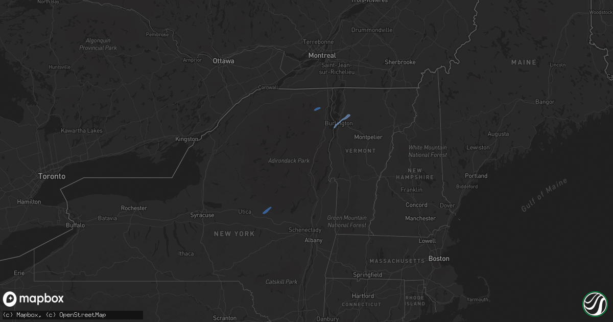
Hail Map on October 16, 2021
Get this storm
October 16 map
$229
one time, instant access
Download today. No call, no setup
Keep the $229
Bought the map and want the full workflow? Apply the entire $229 to a subscription within 7 days. None of it is wasted.
Every map, not just this one
This buys you this map. Subscription and you get every map we run, in the markets you choose from a few cities to whole states to nationwide. Plus real-time alerts the moment a storm fires.
Contact data
Name, contact info, occupancy, even credit band for addresses in the footprint. You go from where it hit to who to call.
Become the source they trust
Unlimited branding weather history reports on demand. You already have the documented answer ready for the property owner, and you are the one who showed up with it.
Property data and RoofTrace estimates
Pull up any address you have got, its value and the exact code rules for that jurisdiction, straight from One Click Code. Then RoofTrace estimates the squares, pitch, and roof value, priced the way you price.
Storm reports
Vermont
| Date | Description |
|---|---|
| 10/16/20212:55 PM CDT | Tree down on kate brook road. |
| 10/16/20212:06 PM CDT | Powerlines down on route 116 just north of ireland road. |
| 10/16/20212:02 PM CDT | Tree down on jericho road near sand hill road. |
| 10/16/20212:01 PM CDT | Trees and powerlines down on fairfield rd. |
| 10/16/20212:00 PM CDT | Tree down on powerline on rollin irish road between milton and westford. |
| 10/16/20211:58 PM CDT | Tree down on power lines on brigham hill road. |
| 10/16/20211:55 PM CDT | Tree down on beebee road. |
| 10/16/20211:45 PM CDT | Tree across mt philo road just north of the hinesburg road intersection. |
| 10/15/20219:55 PM CDT | At 255 PM EDT, severe thunderstorms were located along a line extending from Province Point to St. Albans City to West Milton, moving northeast at 55 mph. HAZARD...60 mph wind gusts. SOURCE...Radar indicated. IMPACT...Expect damage to trees and powerlines. Locations impacted include... Enosburg Falls, Franklin, Johnson Village, Jay, Jay In Franklin County, Cambridge, Montgomery Center, Hyde Park, Montgomery, St. Albans City, Fairfax, Troy, Sheldon, Belvidere Center, Georgia, Enosburg, Swanton, Waterville, St. Albans Town and Johnson. |
| 10/15/20219:40 PM CDT | At 239 PM EDT, severe thunderstorms were located along a line extending from Boquet River Point to Ironville to near Pharoah Mountain, moving east at 45 mph. There have been reports of downed trees near Schroon Lake in association with these storms. HAZARD...60 mph wind gusts. SOURCE...Emergency management. IMPACT...Expect damage to trees and powerlines. Locations impacted include... Essex Junction, Burlington International Airport, Montpelier, Middlebury, South Burlington, Burlington, Vergennes, Moriah, Willsboro, Crown Point, Morrisville, Westport, Braintree Hill, Cambridge, Salisbury, Waterbury Village, Orwell, Westford, Colchester and Essex Junction Village. |
| 10/15/20219:21 PM CDT | At 221 PM EDT, a severe thunderstorm was located over Jericho, moving northeast at 40 mph. HAZARD...60 mph wind gusts. SOURCE...Radar indicated. IMPACT...Expect damage to trees and powerlines. Locations impacted include... Plattsburgh, Beekmantown, Chazy, Alburgh Village, South Alburgh, Alburgh, Alburgh Dunes State Park, North Hero, Isle La Motte, Jericho, Dannemora, Rouses Point, Champlain, St. Albans Town, Swanton, Grand Isle, Wagner Point, Young Island, North Hero State Park and Scott Point. |
Kentucky
| Date | Description |
|---|---|
| 10/16/20217:00 AM CDT | At 1200 AM EDT, a severe thunderstorm was located over Alexandria, moving east at 35 mph. HAZARD...60 mph wind gusts. SOURCE...Radar indicated. IMPACT...Expect damage to trees and power lines. Locations impacted include... Alexandria, Claryville, Amelia, Bethel, New Richmond, Williamsburg, Cold Spring, Mentor, California, Lindale, Saltair, Aspen Grove, East Fork State Park, New Palestine, Gubser Mill, Nicholsville, Blairsville, Campbell County Lake, Point Isabel and Bantam. |
Delaware
| Date | Description |
|---|---|
| 10/15/202110:21 PM CDT | At 321 PM EDT, a severe thunderstorm was located over North East, or near Elkton, moving northeast at 40 mph. HAZARD...60 mph wind gusts. SOURCE...Radar indicated. IMPACT...Damaging winds will cause some trees and large branches to fall. This could injure those outdoors, as well as damage homes and vehicles. Roadways may become blocked by downed trees. Localized power outages are possible. Unsecured light objects may become projectiles. Locations impacted include... Newark, Elkton, North East, Charlestown, Barksdale, Andora, Pleasant Hill, Cherry Hill, Fair Hill, Glen Westover, Bay View, Appleton and Glasgow. |
West Virginia
| Date | Description |
|---|---|
| 10/16/202112:47 AM CDT | At 546 AM EDT, a severe thunderstorm was located over New Cumberland, or near Wellsville, moving northeast at 35 mph. HAZARD...60 mph wind gusts. SOURCE...Radar indicated. IMPACT...Expect damage to trees and power lines, resulting in some power outages. Locations impacted include... Weirton, Franklin Park, East Liverpool, Aliquippa, Beaver Falls, Monaca, Wellsville, Economy, Ambridge, New Brighton, Toronto, and Beaver. |
Massachusetts
| Date | Description |
|---|---|
| 10/16/20215:02 PM CDT | Report of rt 9 closed between dalton and windsor due to multiple trees down. Time estiamted from radar. |
| 10/16/20214:55 PM CDT | Tree and wires down on cleveland rd. Time estimated from radar. |
| 10/16/20214:54 PM CDT | Orchard rd closed due to downed trees near wahconah country club. Time estiamted from radar. |
| 10/16/20214:53 PM CDT | Public reported several large branches down and power flickering. Time estiamted based on radar. |
| 10/16/20214:53 PM CDT | Several multiple large branches down on marcella way. Time estimated based on radar. |
| 10/16/20211:00 AM CDT | At 559 PM EDT, a severe thunderstorm was located over Cheshire, or 9 miles south of North Adams, moving northeast at 40 mph. HAZARD...60 mph wind gusts. SOURCE...Radar indicated. IMPACT...Expect damage to trees and power lines. Locations impacted include... Greenfield, Monroe, Bernardston, Buckland, Shelburne, Ashfield, Colrain, Charlemont, Cummington, Leyden, Heath, Plainfield, Rowe and Hawley. |
| 10/16/202112:53 AM CDT | At 553 PM EDT, a severe thunderstorm was located near Cheshire, or near Pittsfield, moving northeast at 35 mph. HAZARD...60 mph wind gusts. SOURCE...Radar indicated. IMPACT...Expect damage to roofs, siding, and trees. This severe thunderstorm will be near... Adams and East Windsor around 605 PM EDT. Savoy around 610 PM EDT. Florida around 615 PM EDT.Other locations impacted by this severe thunderstorm include Windsor,Soldiers Memorial Field, Cheshire Harbor, Arnoldville, Town CrestVillage, Lakeview Terrace, Maple Grove, Eastern Summit, Berkshire andThe Boulders. |
Pennsylvania
| Date | Description |
|---|---|
| 10/16/202112:40 PM CDT | Numerous trees down north of sigel in clear creek state park. Time estimated based on radar. |
| 10/16/20218:29 AM CDT | Trees and wires down across kinney road... Completely blocking the road. |
| 10/16/20218:00 AM CDT | Tree down on a residence on allenhurst ave. |
| 10/16/20217:30 AM CDT | Corrects previous tstm wnd dmg report from ridgway. Tree down on a residence on allenhurst ave. |
| 10/16/20217:30 AM CDT | Multiple reports of trees and wires down in ridgway. |
| 10/16/20217:16 AM CDT | Report of eletrical lines down on mc vitty road in washington township. Time estimated based on radar. |
| 10/16/20217:14 AM CDT | Report of multiple phone lines and several poles down along route 949. Route closed at one point due to downed trees. Time estimated based on radar. |
| 10/16/20217:06 AM CDT | Multiple trees down in area... One tree on a house. Time estimated from radar. |
| 10/16/20217:05 AM CDT | Corrected time from 140 pm. Numerous trees down north of sigel in clear creek state park. Time estimated based on radar. |
| 10/16/20217:03 AM CDT | Report of multiple trees down in eldred township. Time estimated based on radar. |
| 10/16/20217:03 AM CDT | Report of multiple trees down in the area. Time estimated based on radar. |
| 10/16/20213:13 AM CDT | At 812 AM EDT, severe thunderstorms were located along a line extending from near Marienville to 7 miles west of Portland Mills to 9 miles west of Brockway to 7 miles northeast of Brookville, moving northeast at 50 mph. HAZARD...60 mph wind gusts. SOURCE...Radar indicated. IMPACT...Expect damage to roofs, siding, and trees. Severe thunderstorms will be near... Portland Mills around 820 AM EDT. Ridgway, Johnsonburg, Brandy Camp, Wilcox, James City and Brockport around 830 AM EDT. St. Marys and East Branch Dam around 840 AM EDT.Other locations impacted by these severe thunderstorms includeKersey. |
| 10/16/20213:13 AM CDT | At 813 AM EDT, severe thunderstorms were located along a line extending from 8 miles west of Portland Mills to near Brookville to near Reynoldsville, moving east at 45 mph. HAZARD...60 mph wind gusts. SOURCE...Radar indicated. IMPACT...Expect damage to trees and power lines, resulting in some power outages. Locations impacted include... Reynoldsville, Brockway, Sykesville, and Falls Creek. |
| 10/16/20212:40 AM CDT | At 739 AM EDT, Doppler radar detected a strong frontal squall line from Clarion to near Rimersburg to just southwest of New Bethlehem, moving east at 40 mph. HAZARD...60 mph wind gusts. SOURCE...Radar indicated. IMPACT...Expect damage to trees and power lines, resulting in some power outages. Locations impacted include... Clarion, Brookville, New Bethlehem, Strattanville, Summerville, Limestone, Hawthorn, Corsica, Sigel, Timblin, Worthville, and Anita. |
| 10/15/202111:52 PM CDT | At 451 AM EDT, a severe thunderstorm was located near Cadiz, moving northeast at 35 mph. HAZARD...60 mph wind gusts. SOURCE...Radar indicated. IMPACT...Expect damage to trees and power lines, resulting in some power outages. Locations impacted include... Weirton, Steubenville, Wellsville, Cadiz, Toronto, Wintersville, Mingo Junction, Follansbee, New Cumberland, Hopedale, Smithfield, and Jewett. |
Connecticut
| Date | Description |
|---|---|
| 10/16/202112:54 AM CDT | At 553 PM EDT, severe thunderstorms were located along a line extending from near Lake Carmel to Harrison, moving northeast at 40 mph. HAZARD...60 mph wind gusts. SOURCE...Radar indicated. IMPACT...Expect damage to trees and power lines. Severe thunderstorms will be near... Lake Carmel around 600 PM EDT. New Fairfield and Bedford around 605 PM EDT. Stamford and Darien around 610 PM EDT. Sherman around 615 PM EDT. Norwalk and New Canaan around 620 PM EDT. Wilton and Georgetown around 625 PM EDT. Westport and Weston around 630 PM EDT. Fairfield around 635 PM EDT. Trumbull and Monroe around 645 PM EDT. |
| 10/16/202112:20 AM CDT | At 520 PM EDT, severe thunderstorms were located along a line extending from Paramus to Todt Hill, moving northeast at 35 mph. HAZARD...60 mph wind gusts. SOURCE...Radar indicated. IMPACT...Expect damage to trees and power lines. Locations impacted include... Jersey City, Jamaica, Yonkers, Flatbush, New Rochelle, Flushing, Bayonne, White Plains, Mott Haven, Hoboken, East Tremont, Hackensack, Glen Cove, Bergenfield and Lyndhurst. |
New York
| Date | Description |
|---|---|
| 10/16/20212:57 PM CDT | Tree and wires down with transformer fire on foordmore rd. Time estimated from radar. |
| 10/16/20212:55 PM CDT | Tree and wires down at rt 28a and brodhead rd. Time stimated from radar. |
| 10/16/20212:54 PM CDT | Low hanging tree on wires. Time estimated from radar. |
| 10/16/20211:32 PM CDT | Trees down on w church st |
| 10/16/20211:30 PM CDT | Tree down on trout brook rd. |
| 10/16/20211:27 PM CDT | Trees down on porter rd |
| 10/16/20211:27 PM CDT | Trees down on ny rte 3. |
| 10/16/20211:24 PM CDT | Trees and powerlines down on bittersweet lane. |
| 10/16/20211:20 PM CDT | Route 9n closed at ben rosa road due to downed tree. |
| 10/16/20211:19 PM CDT | Trees down on bucks corners road. |
| 10/16/20211:13 PM CDT | Trees down on east hill rd near burnt hill rd |
| 10/16/20211:13 PM CDT | Trees down on silver lake road. |
| 10/16/202112:38 PM CDT | Several trees down on river road. |
| 10/16/202112:24 PM CDT | Trees down. Time estimated from radar. |
| 10/16/202112:15 PM CDT | Several trees down and some snapped 15 feet above the ground. Trees reported down in the same direction. Route 29a and seely road. |
| 10/16/202112:12 PM CDT | Spotter reports multiple trees and wires down near rt 29a between red school rd and mc clure rd. Time estimated based on radar. |
| 10/16/202112:10 PM CDT | Trees and wires down in village of dolgeville with some on residences. Trees down in salisbury also. |
| 10/16/202112:10 PM CDT | Structural damage to some houses on n. Helmer ave. Damage to roofs... Chimneys and fences blown down. |
| 10/16/202112:04 PM CDT | Tree and wires down on small bush road |
| 10/16/202112:01 PM CDT | Trees and wires down. Time estiamted from radar. |
| 10/16/202111:59 AM CDT | Spotter reports tree down blocking harter st near eastern gardens. |
| 10/16/20216:30 AM CDT | At 1130 AM EDT, a severe thunderstorm was located over Groton, or 10 miles northeast of Ithaca, moving east at 35 mph. HAZARD...60 mph wind gusts. SOURCE...Radar indicated. IMPACT...Expect damage to roofs, siding, and trees. Locations impacted include... Cortland, Lansing, Homer, Groton, Locke, Preble, Moravia, Scott, Truxton and Solon. |
| 10/16/20214:48 AM CDT | At 948 AM EDT, a severe thunderstorm was located near Taughannock Falls, or 8 miles north of Ithaca, moving northeast at 45 mph. HAZARD...60 mph wind gusts. SOURCE...Radar indicated. IMPACT...Expect damage to roofs, siding, and trees. Locations impacted include... Cortland, Pompey, Manlius, Fayetteville, Lansing, Homer, Otisco, Groton, Locke and Genoa. |
| 10/16/20213:47 AM CDT | At 846 AM EDT, severe thunderstorms were located along a line extending from 6 miles west of Betula to near East Branch Dam to 7 miles southwest of Elk River to near St. Marys, moving northeast at 50 mph. HAZARD...60 mph wind gusts. SOURCE...Radar indicated. IMPACT...Expect damage to roofs, siding, and trees. Severe thunderstorms will be near... Betula and Truman around 850 AM EDT. Emporium, Crosby, Elk River and Port Allegany around 900 AM EDT. Roulette, Keating Summit and Sizerville around 910 AM EDT. Coudersport around 920 AM EDT.Other locations impacted by these severe thunderstorms includeAustin, Oswayo, Sweden Valley, Ski Denton Ski Area and Ulysses. |
| 10/16/202112:31 AM CDT | At 531 AM EDT, a severe thunderstorm was located over Dundee, moving northeast at 40 mph. HAZARD...60 mph wind gusts. SOURCE...Radar indicated. IMPACT...Expect damage to roofs, siding, and trees. Locations impacted include... Penn Yan, Hector, Starkey, Urbana, Dundee, Pulteney, Wayne, Ovid, Interlaken and Dresden. |
| 10/15/202111:49 PM CDT | At 449 AM EDT, a severe thunderstorm was located near West Cameron, or 12 miles east of Hornell, moving northeast at 40 mph. HAZARD...60 mph wind gusts. SOURCE...Radar indicated. IMPACT...Expect damage to roofs, siding, and trees. Locations impacted include... Bath, Penn Yan, Campbell, Urbana, Watkins Glen, Dundee, Montour Falls, Tyrone, Howard and Thurston. |
| 10/15/202110:41 PM CDT | At 340 PM EDT, severe thunderstorms were located along a line extending from near Fleischmanns to 7 miles northeast of Grahamsville to near Phillipsport, moving northeast at 55 mph. HAZARD...60 mph wind gusts. SOURCE...Radar indicated. IMPACT...Expect damage to roofs, siding, and trees. Locations impacted include... Kingston, Ellenville, Catskill, Saugerties, Hunter, Hurley, Woodstock, New Baltimore, Coxsackie, Athens, Kerhonkson, West Hurley, Napanoch, Saugerties South, North-South Lake Campground, Woodland Valley Campground, West Shokan, Kenneth L Wilson Campground, Lake Katrine and Phoenicia. |
| 10/15/20218:48 PM CDT | At 148 PM EDT, severe thunderstorms were located along a line extending from near Indian Lake to near Northville to near Mayfield, moving east at 40 mph. HAZARD...60 mph wind gusts. SOURCE...Radar indicated. IMPACT...Expect damage to roofs, siding, and trees. Severe thunderstorms will be near... Day Center around 200 PM EDT. Lake Luzerne-Hadley, Lake Luzerne Campground, Scaroon Manor Public Campground and Eagle Point Campground around 215 PM EDT. Saratoga Springs, Glens Falls, Lake George Village, Corinth, Glens Falls North and West Glens Falls around 225 PM EDT. Hudson Falls around 230 PM EDT.Other locations impacted by these severe thunderstorms include LakeLuzerne, Wevertown, Grangerville, Glenwild, Northumberland,Greenfield Center, Wiley Corners, Conklingville, North River andPorter Corners. |
| 10/15/20218:32 PM CDT | At 132 PM EDT, severe thunderstorms were located along a line extending from near Onchiota to 6 miles south of Ray Brook to 8 miles southwest of Newcomb, moving northeast at 65 mph. HAZARD...60 mph wind gusts. SOURCE...Radar indicated. IMPACT...Expect damage to trees and powerlines. Locations impacted include... Saranac Lake, Lake Placid, Peru, Schuyler Falls, Saranac, Wilmington, Keene, Minerva, Newcomb, Lyon Mountain, Clayburg, Keene Valley, Au Sable Forks, Jericho, Mount Marcy, Dannemora, Peasleeville, Jay In Essex County, North Elba and Harrietstown. |
| 10/15/20218:08 PM CDT | At 108 PM EDT, severe thunderstorms were located along a line extending from 9 miles east of Ohio to near Little Falls, moving northeast at 50 mph. HAZARD...60 mph wind gusts. SOURCE...Radar indicated. IMPACT...Expect damage to roofs, siding, and trees. Severe thunderstorms will be near... Caroga Lake and Caroga Lake Public Campground around 130 PM EDT. Lake Pleasant and Moffitt Beach Campground around 135 PM EDT. Speculator and Northampton Beach Public Campground around 145 PM EDT. Northville, Wells and Sacandaga Campground around 150 PM EDT.Other locations impacted by these severe thunderstorms include InghamMills, Girards Sugarbush, Curtis, Sweets Crossing, Pinnacle,Lotville, Whitehouse, Rasbach Corner, Knappville and Shaker Place. |
New Jersey
| Date | Description |
|---|---|
| 10/16/20213:34 PM CDT | A few small trees were snapped in bound brook. Time estimated from radar. |
| 10/16/20213:24 PM CDT | Tree blown over on princeton rd. Time estimated from radar and the spotters report. |
| 10/15/202111:53 PM CDT | At 453 PM EDT, severe thunderstorms were located along a line extending from Chester to East Hanover, moving northeast at 45 mph. HAZARD...60 mph wind gusts. SOURCE...Radar indicated. IMPACT...Expect damage to trees and power lines. Locations impacted include... Paterson, Wayne, New City, Newburgh, Paramus, West Milford, Ossining, Ridgewood, Peekskill, Monsey, Nanuet, Ramsey, Ringwood, Haverstraw and Tarrytown. |
| 10/15/202111:02 PM CDT | At 402 PM EDT, severe thunderstorms were located along a line extending from near Clinton to near New Hope, moving northeast at 50 mph. HAZARD...60 mph wind gusts. SOURCE...Radar indicated. IMPACT...Damage to roofs, siding, trees, and power lines is possible. Locations impacted include... Somerville, Somerset, Bridgewater, South Brunswick, Middlesex, Bound Brook, Manville, Mendham, Flemington, Clinton, Pennington, Peapack And Gladstone, New Hope, Hopewell, Lebanon, Far Hills, Rocky Hill, Stockton, Millstone and Skillman.This includes the following highways... Interstate 78 in New Jersey between mile markers 16 and 38. Interstate 287 in New Jersey between mile markers 10 and 33. |
Maryland
| Date | Description |
|---|---|
| 10/15/202110:31 PM CDT | At 331 PM EDT, a severe thunderstorm was located over Barksdale, or over Newark, moving east at 35 mph. HAZARD...60 mph wind gusts. SOURCE...Radar indicated. IMPACT...Damage to roofs, siding, trees, and power lines is possible. Locations impacted include... Wilmington, Newark, Pennsville, Carneys Point, Elsmere, New Castle, Newport, Greenville, Stanton, North Star, Glasgow, Bear, Talleyville, Delaware Memorial Bridge, Wilmington Manor, Pike Creek, Hockessin, Ashland, Bellefonte and Edgemoor.This includes the following highways... Interstate 95 in Delaware between mile markers 0 and 18. Interstate 295 in New Jersey between mile markers 0 and 2. |