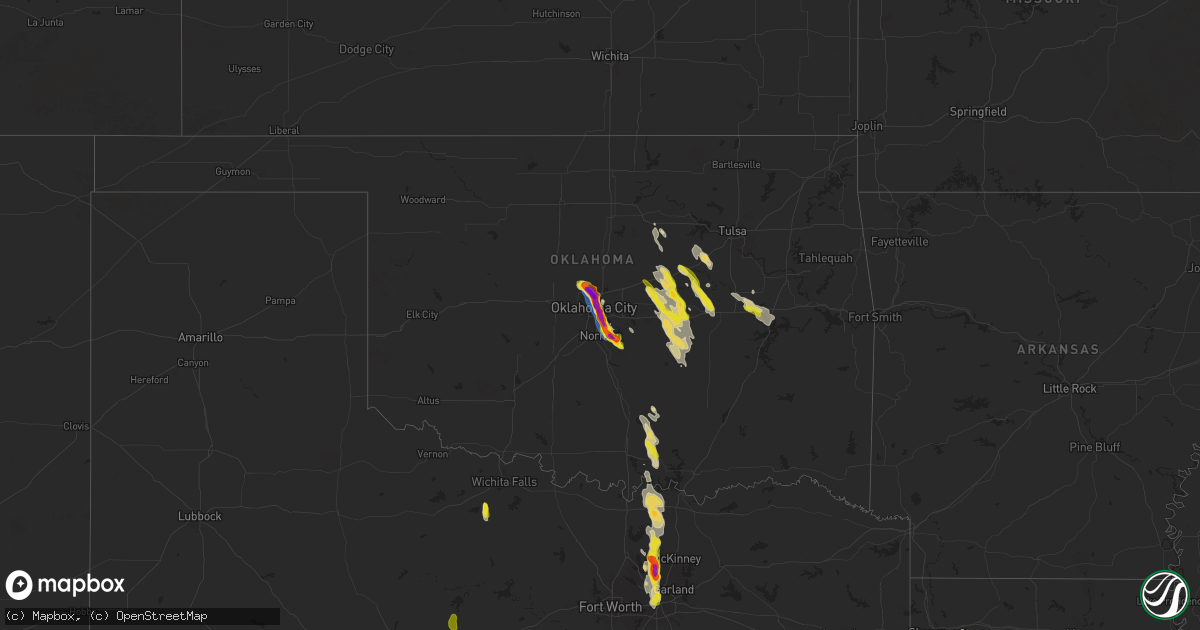
Hail Map on September 24, 2024
Get this storm
September 24 map
$229
one time, instant access
Download today. No call, no setup
Keep the $229
Bought the map and want the full workflow? Apply the entire $229 to a subscription within 7 days. None of it is wasted.
Every map, not just this one
This buys you this map. Subscription and you get every map we run, in the markets you choose from a few cities to whole states to nationwide. Plus real-time alerts the moment a storm fires.
Contact data
Name, contact info, occupancy, even credit band for addresses in the footprint. You go from where it hit to who to call.
Become the source they trust
Unlimited branding weather history reports on demand. You already have the documented answer ready for the property owner, and you are the one who showed up with it.
Property data and RoofTrace estimates
Pull up any address you have got, its value and the exact code rules for that jurisdiction, straight from One Click Code. Then RoofTrace estimates the squares, pitch, and roof value, priced the way you price.
States Impacted by Hail Map on September 24, 2024
Storm reports
Michigan
| Date | Description |
|---|---|
| 09/24/20245:22 PM CDT | Minor damage occurred to 2 barns on austin road... Between s edon rd and gilmore road. The circulation was only briefly on the ground with estimated wind speeds of arou |
Louisiana
| Date | Description |
|---|---|
| 09/24/20246:05 PM CDT | Trees down near columbia... Clarks... And grayson along with 1 inch hail. |
Indiana
| Date | Description |
|---|---|
| 09/24/20244:57 PM CDT | Report of many large branches down. Possible tornado. Time estimated by radar. |
| 09/24/20244:49 PM CDT | The combination of video relayed by local media and an nws storm survey concluded that a weak ef0 tornado occurred. The tornado began in the vicinity of the east side o |
| 09/24/20244:32 PM CDT | Delayed report. Numerous large tree limbs downed in the arlington heights subdivision... Along with some roof damage to a residence. Time estimated from radar. |
| 09/24/20244:01 PM CDT | *** 2 inj *** the storm that caused tornadic damage to noble county intensified again and moved northeast. After initially dropping down around the intersection of 300 |
| 09/24/20243:58 PM CDT | Spotter reports tornado has hit structures in this area. Time estimated by radar. |
| 09/24/20243:34 PM CDT | Roof ripped off of a pole barn. Time estimated by radar. |
| 09/24/20243:30 PM CDT | Trained spotter reports tornado on the ground. |
| 09/24/20243:16 PM CDT | Trained spotter reports tornado on the ground with trees down and debris kicked up. Time estimated by radar. |
| 09/24/20243:13 PM CDT | This tornado started just east of engle lake... Knocking down some trees in a residential area. As it continued northward... Some of the strongest damage was sustained |
| 09/24/20241:51 PM CDT | Large branches down on power lines. Time estimated from radar. |
| 09/24/202412:46 PM CDT | A few trees down near pine view court. |
| 09/24/202412:43 PM CDT | Dime size hail... 60 to 65 mph winds... Wall cloud sighted. |
| 09/24/202412:42 PM CDT | Tree on a house and power lines down at this location. |
| 09/24/202412:40 PM CDT | Nws storm survey found a ef-0 tornado touched down just ne of the i-65 and i-265 interchange. Sporadic tree damage... Power poles... And cross members were the main dam |
| 09/24/202412:32 PM CDT | A few trees down in floyds knobs. |
| 09/24/202412:18 PM CDT | Power outage with traffic lights out at the intersection of us150 and paoli pike. |
North Carolina
| Date | Description |
|---|---|
| 09/24/20246:35 PM CDT | Tree down with power lines near the intersection of riverside drive and jackson road in surry county north carolina. |
| 09/24/20245:42 PM CDT | Corrects previous tstm wnd dmg report from 4 wnw seagrove. Trees down at nc highway 134 and burney rd. |
| 09/24/20245:27 PM CDT | Corrects previous tstm wnd dmg report from 2 n flat rock. Tree down with power lines near the intersection of riverside drive and jackson road in surry county north car |
| 09/24/20245:22 PM CDT | Corrects previous tstm wnd dmg report from 2 n toast. Downed tree blocking both lanes on galax trail near twelve oaks nursing home. |
| 09/24/20245:08 PM CDT | Trees down at nc highway 49 s and salem church rd. |
| 09/24/20244:36 PM CDT | Powerlines and trees down in the 13000 block of bringle ferry road. |
| 09/24/20244:33 PM CDT | Trees down near the intersection of panther creek road and stokes ferry road. |
| 09/24/20241:07 PM CDT | A report of a tree down on new stock road. |
| 09/24/202412:01 AM CDT | Downed tree blocking both lanes on galax trail near twelve oaks nursing home. |
| 09/23/202411:25 PM CDT | Several trees either down or split off halfway up in the backyards of 2 adjacent properties on the south side of mocksville. |
Mississippi
| Date | Description |
|---|---|
| 09/24/20246:21 PM CDT | Tree downed on cadaretta rd near spring hill. |
| 09/24/20243:52 PM CDT | Trained spotter reported 1 inch hail just south of smithville. |
| 09/24/20243:52 PM CDT | Large tree uprooted near new chapel cemetery on highway 25. |
| 09/24/20242:02 PM CDT | Tree down on mount moriah church rd. |
| 09/24/20242:00 PM CDT | Tree down across highway 9 north of bruce. |
| 09/23/20248:00 PM CDT | A tree was downed on ms hwy 432. Report via social media. |
| 09/23/20247:57 PM CDT | Roof damage of mobile home. |
Texas
| Date | Description |
|---|---|
| 09/24/20243:17 AM CDT | Report from mping: quarter |
| 09/24/20243:15 AM CDT | Delayed report: 2 inch hail reported at parker road and midway. |
| 09/24/20243:08 AM CDT | Report from mping: ping pong ball |
| 09/24/20243:05 AM CDT | Delayed report - quarter size hail reported 1 mile north of the colony. |
| 09/24/20243:05 AM CDT | Report of 2 inch hail off of dallas north tollway. |
| 09/24/20243:04 AM CDT | Report from mping: quarter |
| 09/24/20243:01 AM CDT | Report from mping: quarter |
| 09/24/20243:00 AM CDT | Delayed report. Social media post with picture reported nickel to quarter hail in frisco. Time estimated by radar. |
| 09/24/20242:56 AM CDT | Report from mping: quarter |
South Carolina
| Date | Description |
|---|---|
| 09/24/20243:04 PM CDT | Tree down on power lines in the carlisle area. |
| 09/24/20242:40 PM CDT | Multiple trees down on hickory nut hollow road and eaves road... With one on a barn. |
| 09/23/20249:00 PM CDT | Emergency management reports numerous trees blown down and several power poles snapped in an area centered around n mountain st. This includes mt paran rd and hollyridg |
| 09/23/20247:50 PM CDT | Quarter size hail fell along north little river road. |
| 09/23/20247:13 PM CDT | Multiple trees and large limbs down on the east side of greenville in the overbrook neighborhood. At least one large tree fell on power lines. |
| 09/23/20247:10 PM CDT | Multiple trees down around the city of greenville... Including some on homes. |
Kansas
| Date | Description |
|---|---|
| 09/24/20245:52 PM CDT | A local report indicates 60 MPH wind near 6 WNW Pauline |
| 09/24/20245:51 PM CDT | Nws employee observed a 5 inch diameter tree branch down 0.5 miles east of his home. |
Iowa
| Date | Description |
|---|---|
| 09/24/20242:31 PM CDT | Via dispatch. 1 to 1.25 inch hail received between 232-245 pm near corning carl rd and 183rd. |
Kentucky
| Date | Description |
|---|---|
| 09/24/20246:10 PM CDT | Hail fell along ky 11 near the clay county border and was estimated to be between quarter and golf ball sized. |
| 09/24/20245:50 PM CDT | A local report indicates 1.75 inch wind near Gray |
| 09/24/20245:40 PM CDT | Video on social media of quarter-sized hail falling behind the kfc in north corbin. Time estimated via radar. |
| 09/24/20245:36 PM CDT | A picture of hail was received from southwest of corbin along cumberland falls hwy. The event time is radar estimated. |
| 09/24/20245:36 PM CDT | A tree was blown down onto lower wolfe creek road about 7 miles from the outskirts of booneville or between eddie marshall ln and ky 2024. The event time is radar estim |
| 09/24/20245:31 PM CDT | Social media report of trees down on power lines and a broken power pole. Time estimated via radar. |
| 09/24/20245:30 PM CDT | A public report with a picture was relayed by an amateur radio operator in the bee creek community southeast of bark camp. The event time is radar estimated. |
| 09/24/20245:28 PM CDT | A picture was received of at least 3 inch diameter hail from the bee creek community along ky 1193 in the vicinity of bark camp. The event time is radar estimated. |
| 09/24/20245:12 PM CDT | A picture was received via social media of hail of at least egg size near burning springs. |
| 09/24/20245:12 PM CDT | Photo on social media of golf ball sized hail in alpine. |
| 09/24/20245:11 PM CDT | Picture on social media of about 2 inch wide hailstones along laurel heights road. Time estimated via radar |
| 09/24/20245:11 PM CDT | A social media report with a picture was relayed by broadcast media of hail of 2 to 2.25 inches in diameter. |
| 09/24/20245:05 PM CDT | Social media picture of estimated 1.5 inch hail in fogertown |
| 09/24/20245:00 PM CDT | A tree was blown down near the intersection of us 27 and jeru knob road. |
| 09/24/20244:55 PM CDT | Jackson county dispatch reported a tree blown down across mccammon ridge road near the intersection with kim gay lane. Event time estimated from radar. |
| 09/24/20244:45 PM CDT | A public social media reported of quarter sized hail relayed by amateur radio. |
| 09/24/20244:31 PM CDT | Rockcastle county 911 center reported a tree down at the intersection of us 25 and upper calloway loop. Time estimated from radar. |
| 09/24/20244:25 PM CDT | Social media post of a snapped power pole along sam parker road in knox county. Time estimated via radar. Approximately |
| 09/24/20244:25 PM CDT | A local report indicates 1.75 inch wind near Cumberland City |
| 09/24/20244:25 PM CDT | Rockcastle county 911 center reported a down tree at the intersection of marler hollow rd and sand springs rd. Time estimated from radar. |
| 09/24/20244:22 PM CDT | Wayne county dispatch reported a tree blown down onto ky-834 west approximately a mile north of the intersection with ky-90. |
| 09/24/20244:20 PM CDT | Pictures on social media show snapped power pole beside a home near the intersection of hollen dale drive and ky-6. Time estimated from radar. |
| 09/24/20244:20 PM CDT | Trees and powerlines were down in the spruce pine and saylor communities of southwestern leslie county or in the general vicinity of the intersection of ky 1780 and ky |
| 09/24/20244:19 PM CDT | Half dollar sized hail reported near cumberland city. |
| 09/24/20244:15 PM CDT | Picture of a large uprooted tree on social media across from wilton pond along highway 6. Time estimated via radar. |
| 09/24/20244:14 PM CDT | Ham radio operator reports 2 inch estimated hail in rockholds... With a picture included. |
| 09/24/20243:00 PM CDT | A few large limbs and trees down in stanford. |
| 09/24/20242:58 PM CDT | Ongoing at report time. |
| 09/24/20242:36 PM CDT | A few trees down in hodgenville. |
| 09/24/20242:31 PM CDT | Trees down. Time estimated from radar. |
| 09/24/20242:10 PM CDT | Trees down near old glasgow road. |
| 09/24/20242:06 PM CDT | A few trees down in downtown scottsville. |
| 09/24/20241:55 PM CDT | Few trees down near barren river lake. |
| 09/24/20241:55 PM CDT | Corrects previous tstm wnd dmg report time from 1 ese austin. Tree down on austin tracy road. |
| 09/24/20241:53 PM CDT | Tree down on austin tracy road. |
| 09/24/20241:52 PM CDT | Few trees down within the city limits of campbellsville. |
| 09/24/20241:50 PM CDT | Trees down on jw york road. |
| 09/24/20241:46 PM CDT | Tree down. Time estimated from radar. |
| 09/24/20241:41 PM CDT | Multiple trees and power lines down. Time estimated from radar. |
| 09/24/20241:20 PM CDT | Large tree limbs and a tree down near maple avenue. |
| 09/24/20241:17 PM CDT | Tree damage and power lines down. |
| 09/24/202412:54 PM CDT | Tree on house at this location. |
| 09/24/202412:53 PM CDT | A few trees down in river bluff. |
| 09/24/202412:32 PM CDT | A few large limbs and trees down in idle hour park. Structural damage to baseball field. |
| 09/24/202412:30 PM CDT | Corrects previous tstm wnd dmg report with updated time from springfield. Tree damage and power lines down. |
| 09/24/202411:56 AM CDT | Power pole wires damaged. |
| 09/24/202411:53 AM CDT | 2 trees down on greensburg road. |
| 09/24/202411:33 AM CDT | Several large branches down across brackett cemetery road. |
| 09/24/20247:55 AM CDT | Uprooted tree at this location. |
Ohio
| Date | Description |
|---|---|
| 09/24/20245:50 PM CDT | A local report indicates 1.00 inch wind near Tiffin |
| 09/24/20243:47 PM CDT | Roofing off of a barn and other storm damage near the intersection of route 35 and yost/washington twin roads. |
| 09/24/20243:47 PM CDT | Ef0 tornado confirmed. Minor structure and tree damage. Estimated maximum wind speed up to 65 mph. Estimated track length 1.45 miles. |
| 09/24/20243:36 PM CDT | Time estimated from radar. |
| 09/24/20243:12 PM CDT | Tree limbs down on west elmore eastern road. |
| 09/24/20246:53 AM CDT | Trees down from big cola road/180 intersection all the way into laurelville. Time estimated from radar. |
| 09/24/20246:50 AM CDT | Several trees down near south perry... Ohio. A barn roof was also damaged. Time estimated from radar. |
Missouri
| Date | Description |
|---|---|
| 09/24/20244:57 PM CDT | Student at nw mo state sent in video of hail. Largest size appears to be about a quarter. Report relayed via social media. |
| 09/24/20244:48 PM CDT | Public reported ping pong ball sized hail that lasted for 5-7 minutes. |
| 09/24/20244:10 PM CDT | Caller reported dime to quarter size hail. |
Oklahoma
| Date | Description |
|---|---|
| 09/24/20246:55 PM CDT | Report from mping: quarter |
| 09/24/20246:55 PM CDT | Caliper measurement near se 89th and bryant. |
| 09/24/20246:45 PM CDT | Near interstate 240 and sunnylane road. |
| 09/24/20246:45 PM CDT | Delayed report. Social media image. Radar estimated time. |
| 09/24/20246:45 PM CDT | Near i-240 and sooner road. Measured 2.25 inch stone after the hail stopped but larger when falling. |
| 09/24/20246:40 PM CDT | Delayed report. Social media image with ruler measurement. |
| 09/24/20246:30 PM CDT | Larger than golf ball size hail near i-44 and mlk. |
| 09/24/20246:26 PM CDT | Intermittent golf ball size hail between 6:26 pm and 6:38 pm near ne 50th and mlk. |
| 09/24/20246:18 PM CDT | Report from mping: ping pong ball |
| 09/24/20246:17 PM CDT | Nw 122nd and penn. |
| 09/24/20246:17 PM CDT | Report from mping: ping pong ball |
| 09/24/20246:15 PM CDT | Near interstate 235 and wilshire from research meteorologist. |
| 09/24/20246:15 PM CDT | Report from mping: half dollar |
| 09/24/20246:15 PM CDT | Near 33rd street between bryant ave and boulevard street. |
| 09/24/20246:15 PM CDT | A local report indicates 2.50 inch wind near 4 WSW Edmond |
| 09/24/20246:14 PM CDT | Report from mping: ping pong ball |
| 09/24/20246:13 PM CDT | Report from mping: golf ball |
| 09/24/20246:13 PM CDT | Report from mping: golf ball |
| 09/24/20246:13 PM CDT | Near 15th street and santa fe. |
| 09/24/20246:12 PM CDT | Report from mping: half dollar |
| 09/24/20246:12 PM CDT | Report from mping: golf ball |
| 09/24/20246:10 PM CDT | Larger than golf ball size hail southwest of memorial and western. |
| 09/24/20246:10 PM CDT | Delayed report. Social media image. Radar estimated time. |
| 09/24/20246:10 PM CDT | Report from mping: golf ball |
| 09/24/20246:09 PM CDT | Near nw 150th and penn. Breaking car windows. |
| 09/24/20246:09 PM CDT | Report from mping: ping pong ball |
| 09/24/20246:08 PM CDT | Measured 2.33 inch hail near nw 122nd and penn. |
| 09/24/20246:05 PM CDT | Report from mping: quarter |
| 09/24/20246:05 PM CDT | Just northeast of quail springs mall. |
| 09/24/20246:05 PM CDT | A local report indicates 1.10 inch wind near 3 WSW Edmond |
| 09/24/20246:02 PM CDT | Report from mping: quarter |
| 09/23/202411:08 PM CDT | Social media image of tree branches blown down. Radar estimated time. |
| 09/23/20249:20 PM CDT | A local report indicates 1.00 inch wind near Pierce |
| 09/23/20247:25 PM CDT | Near sh-9 and clear bay area of lake thunderbird. |
| 09/23/20247:25 PM CDT | Near 60th avenue se and lindsey street. |
| 09/23/20247:22 PM CDT | Northeast of 72nd avenue se and lindsey in east norman just west of lake thunderbird. |
| 09/23/20247:20 PM CDT | Photo near 84th avenue se and blue jay road via twitter. |
| 09/23/20247:20 PM CDT | Report from mping: quarter |
| 09/23/20247:19 PM CDT | Report from mping: half dollar |
| 09/23/20247:16 PM CDT | Report from mping: half dollar |
| 09/23/20247:14 PM CDT | Near 12th avenue ne and rock creek road. |
Alabama
| Date | Description |
|---|---|
| 09/24/20244:45 PM CDT | A tree was reported down along silk st in hamilton. |
| 09/24/20244:23 PM CDT | A few trees were downed in the byrd area. |
Virginia
| Date | Description |
|---|---|
| 09/24/20244:12 PM CDT | Tree has fallen and brought down a wire in a yard and on the roadway. The time is estimated off of radar. |
| 09/24/20244:00 PM CDT | Tree along with communications line is down in their yard and driveway. Time is estimated from radar. |
| 09/24/20242:40 PM CDT | Quarter to half-dollar size hail. |
| 09/24/20242:16 PM CDT | Quarter to golf ball sized hailstone fell at mountain lake lodge. At least one large tree branch was blown down which blocked mountain lake road. |
| 09/24/20247:40 AM CDT | Tree down on berkley street in charlotte county virginia. |
| 09/24/20247:36 AM CDT | Tree down near the intersection of beechmont road and forest drive in halifax county virginia. |
| 09/23/20248:20 PM CDT | Tree down across the roadway at the intersection of new bethel and piney grove roads in halifax county virginia. |
| 09/23/20248:10 PM CDT | Tree was reported down across the road on jeb stuart highway in charlotte county virginia. |
| 09/23/20248:02 PM CDT | Tree down near the intersection of sunnyside road and craftons gate highway in charlotte county virginia. |
| 09/23/20247:38 PM CDT | 1 tree down near the intersection of beechmont road and forest drive in halifax county virginia. |
| 09/23/20247:30 PM CDT | Corrects previous tstm wnd dmg report from 2 ssw crystal hill. Tree down near the intersection of chaney lane and howard p anderson road in halifax county virginia. |
| 09/23/20247:23 PM CDT | Tree down across powerlines near the intersection of wyatts and evergreen roads in pittsylvania county virginia. |
| 09/23/20247:20 PM CDT | Tree down at the intersection of weal and marion roads. |
| 09/23/20247:18 PM CDT | Tree downed by thunderstorm winds and blocking weal road. |
| 09/23/20247:00 PM CDT | Tree on powerline at 480 melon road in pittsylvania county. |
Tennessee
| Date | Description |
|---|---|
| 09/24/20246:42 PM CDT | Public report of 1 inch diameter hail in bloomindale. Time estimated by radar. |
| 09/24/20245:23 PM CDT | Em officials relay reports of wind damage... Power outages... And trees down in the kyles ford vicinity. This was near a potential radar tds at 6:23pm et. |
| 09/24/20245:23 PM CDT | A storm survey confirmed an ef1 tornado that tracked for 6 miles along alder road and the clinch river between sneedville and kyles ford. Damage was mainly in the form |
| 09/24/20244:55 PM CDT | Tree down. |
| 09/24/20244:55 PM CDT | Delayed report. Tree down. |
| 09/24/20244:50 PM CDT | Delayed report. Tree down. |
| 09/24/20244:24 PM CDT | *** 3 inj *** downed power lines... A few structures with roofs off... Downed trees... And a tent collapsed. 3 injuries due to the tent collapse. |
| 09/24/20244:10 PM CDT | A few trees down in the gladdice area. |
| 09/24/20243:15 PM CDT | Trees down in the red boiling springs area. |
| 09/24/20243:13 PM CDT | Tree down over logue rd. |
| 09/24/20243:10 PM CDT | A tree was blown down on fall river road. |
| 09/24/20243:10 PM CDT | A power pole leaning. |
| 09/24/20243:03 PM CDT | Measured wind gust of 69 mph at bna. |
| 09/24/20243:00 PM CDT | Trees down in the lafayette area. |
| 09/24/20242:57 PM CDT | A couple trees down on harding place near i-24. |
| 09/24/20242:56 PM CDT | Tree down on veritas st. |
| 09/24/20242:55 PM CDT | Delayed social media report. Tree down. |
| 09/24/20242:55 PM CDT | Delayed report from social media. Several trees down in the crieve hall area. |
| 09/24/20242:53 PM CDT | Tree blown down on i-65 near harding place. |
| 09/24/20242:42 PM CDT | Multiple reports of trees down in the belle meade area. |
| 09/24/20242:40 PM CDT | Delayed report. |
| 09/24/20241:53 PM CDT | Delayed report on social media. Trees down on powerlines. |
| 09/24/20241:47 PM CDT | A few powerlines down. Time estimated from radar. Intersection of highland road and obrian road in ridgetop. |
| 09/23/20247:12 PM CDT | 911 call center report of a power pole down near highway 11w and seneker lane. |
| 09/23/20247:05 PM CDT | 911 call center report of 4 trees down in blountville area. |
West Virginia
| Date | Description |
|---|---|
| 09/24/20241:55 PM CDT | A very large tree was blocking the roadway near the intersection of todd lane and paradise campground circle. |
| 09/24/20241:28 PM CDT | Power lines down along cofran street. Time estimated from radar. |
| 09/24/20241:28 PM CDT | Tree down along thornton pike. Time estimated from radar. |
| 09/24/20241:15 PM CDT | Tree down along berry run road. |
| 09/24/20241:00 PM CDT | Tree down along lost creek romines mill road. Time estimated from radar. |
| 09/24/202412:59 PM CDT | Report from mping: quarter |
| 09/24/202412:58 PM CDT | Tree down along buckhannon pike. Time estimated from radar. |
| 09/24/202412:50 PM CDT | Tree reported down on mobile home. Time estimated from radar. |
| 09/24/202412:36 PM CDT | Power lines down in tanner rd... Big springs. |
| 09/24/202412:32 PM CDT | Power lines down along meathouse fork road. |
| 09/24/202412:28 PM CDT | County 911 reports a tree down blocking one lane of wv-47 east of wolfpen run road. Time estimated from radar. |
Cities Impacted by Hail Map on September 24, 2024
- Hopkinsville, KY
- Gracey, KY
- Dunmor, KY
- Lewisburg, KY
- Morgantown, KY
- Sonora, KY
- Upton, KY
- Hodgenville, KY
- Buffalo, KY
- Magnolia, KY
- Battletown, KY
- Corydon, IN
- New Haven, KY
- Campbellsville, KY
- New Hope, KY
- McEwen, TN
- Linn, WV
- Alum Bridge, WV
- Saint Francis, KY
- Loretto, KY
- Lebanon, KY
- Springfield, KY
- Raywick, KY
- Georgetown, IN
- Lanesville, IN
- Camden, WV
- Jane Lew, WV
- Weston, WV
- Swiss, WV
- Saint Catharine, KY
- Vanleer, TN
- Dickson, TN
- New Albany, IN
- Floyds Knobs, IN
- Lost Creek, WV
- Franklin, KY
- Harrodsburg, KY
- Mackville, KY
- Cumberland Furnace, TN
- Summersville, WV
- Charlestown, IN
- Clarksville, IN
- Sellersburg, IN
- Jeffersonville, IN
- Goshen, KY
- Mount Clare, WV
- Portland, TN
- Crestwood, KY
- Clarksville, TN
- Cunningham, TN
- Southside, TN
- Prospect, KY
- La Grange, KY
- Westport, KY
- Pendleton, KY
- Woodburn, KY
- Chapmansboro, TN
- Ashland City, TN
- White Bluff, TN
- Scottsville, KY
- Turners Station, KY
- Campbellsburg, KY
- Sulphur, KY
- Water Valley, MS
- New Castle, KY
- Greensburg, KY
- Charlotte, TN
- Springfield, TN
- Pleasant View, TN
- Cub Run, KY
- Munfordville, KY
- New Liberty, KY
- Owenton, KY
- Worthville, KY
- Perry Park, KY
- Orlinda, TN
- Greenbrier, TN
- Glasgow, KY
- Lucas, KY
- Clinton, SC
- Laurens, SC
- Cross Plains, TN
- Burns, TN
- Adolphus, KY
- Westmoreland, TN
- Clarkson, KY
- Corning, IA
- Banner, MS
- Bruce, MS
- Pembroke, VA
- Bonnieville, KY
- White House, TN
- Goodlettsville, TN
- Cottontown, TN
- Hendersonville, TN
- Kingston Springs, TN
- Randolph, MS
- Coffeeville, MS
- Gainesville, GA
- Dawsonville, GA
- Fountain Run, KY
- Williamstown, KY
- Dry Ridge, KY
- Eighty Eight, KY
- Summer Shade, KY
- Gallatin, TN
- Austin, KY
- Jonesville, KY
- Newport, VA
- Bethpage, TN
- Fort Davis, TX
- Tompkinsville, KY
- Etoile, KY
- Franklin, TN
- Nashville, TN
- Mount Pleasant, TN
- Murrayville, GA
- Houlka, MS
- Prescott, IA
- North Tazewell, VA
- Tazewell, VA
- Cedar Bluff, VA
- Bandy, VA
- Pounding Mill, VA
- Columbia, KY
- Ripplemead, VA
- Brentwood, TN
- Mount Hermon, KY
- Salem, WV
- Clarksburg, WV
- Gradyville, KY
- Walkersville, WV
- Hartsville, TN
- Narrows, VA
- Pleasureville, KY
- Bagdad, KY
- Mount Juliet, TN
- Nodaway, IA
- Lafayette, TN
- Lebanon, TN
- Sanders, KY
- Lula, GA
- Pontotoc, MS
- Taylorsville, KY
- Mount Washington, KY
- Mannsville, KY
- Columbia, TN
- Hermitage, TN
- Stanford, KY
- Antioch, TN
- Ligonier, IN
- Wawaka, IN
- Frankfort, KY
- Lockport, KY
- Clarinda, IA
- Red Boiling Springs, TN
- Bedford, IA
- New Market, IA
- Eggleston, VA
- Pearisburg, VA
- Crawfordville, GA
- Glencoe, KY
- Haviland, OH
- Eaton, OH
- West Alexandria, OH
- Amory, MS
- Okolona, MS
- Aberdeen, MS
- Nettleton, MS
- Smithville, MS
- Burkesville, KY
- Braddyville, IA
- Corinth, KY
- Sadieville, KY
- Stamping Ground, KY
- Cynthiana, KY
- Berry, KY
- Paulding, OH
- Rockholds, KY
- Williamsburg, KY
- Albany, KY
- Blacksburg, VA
- Hopkins, MO
- Clearmont, MO
- Fulton, MS
- Greenwood Springs, MS
- Tremont, MS
- Payne, OH
- Scott, OH
- Convoy, OH
- Monroeville, IN
- Woodbine, KY
- Corbin, KY
- Wolcottville, IN
- Lagrange, IN
- Alpha, KY
- Sheridan, MO
- Monticello, KY
- Carthage, TN
- Elmwood, TN
- Pleasant Shade, TN
- Gainesboro, TN
- Whitleyville, TN
- Granville, TN
- Brush Creek, TN
- Pickering, MO
- Burlington Junction, MO
- Maryville, MO
- Gold Hill, NC
- Salisbury, NC
- Gaffney, SC
- Marathon, TX
- Van Wert, OH
- Purmela, TX
- Rockwell, NC
- Gray, KY
- Richfield, NC
- Jamestown, KY
- Russell Springs, KY
- Watertown, TN
- London, KY
- Oakwood, OH
- Barbourville, KY
- Lily, KY
- Breeding, KY
- Ravenwood, MO
- Denton, NC
- Bronston, KY
- Allons, TN
- Hilham, TN
- Livingston, TN
- Cookeville, TN
- Rickman, TN
- Burnside, KY
- Manchester, KY
- Parkers Lake, KY
- Whitley City, KY
- Monroe, TN
- Alpine, TN
- Grover Hill, OH
- Tazewell, TN
- Harrogate, TN
- Cloverdale, OH
- Sneedville, TN
- Jonesville, VA
- Skidmore, MO
- Graham, MO
- Carey, OH
- Continental, OH
- Holgate, OH
- Coila, MS
- Vaiden, MS
- West, MS
- Byrdstown, TN
- Tyner, KY
- Winona, MS
- Alvada, OH
- Kyles Ford, TN
- Jamestown, TN
- Barnard, MO
- Murphy, NC
- Milton, KY
- Bedford, KY
- Troy, NC
- Keavy, KY
- Bolckow, MO
- Fillmore, MO
- Breckenridge, TX
- Piedmont, OK
- Edmond, OK
- Creston, IA
- Kilmichael, MS
- Tiffin, OH
- New Riegel, OH
- Elk Horn, KY
- Albemarle, NC
- Madison, IN
- Lorena, TX
- Blackwater, VA
- Moody, TX
- Kelly, LA
- Grayson, LA
- Columbia, LA
- Olla, LA
- Moran, TX
- Savannah, MO
- Rosendale, MO
- Topeka, KS
- Auburn, KS
- Oklahoma City, OK
- McGregor, TX
- McKee, KY
- Joelton, TN
- Duck Hill, MS
- Vincent, KY
- Wakarusa, KS
- Scranton, KS
- Carbondale, KS
- Cisco, TX
- Republic, OH
- Stewart, MS
- Stearns, KY
- Lovelady, TX
- North Fairfield, OH
- Eupora, MS
- Trinity, TX
- Erin, TN
- Gore Springs, MS
- Weber City, VA
- Gate City, VA
- Kingsport, TN
- Church Hill, TN
- Mount Carmel, TN
- Nacogdoches, TX
- San Augustine, TX
- Gower, MO
- Amazonia, MO
- Plattsburg, MO
- Spencer, OK
- Jones, OK
- Custar, OH
- Wakeman, OH
- Collins, OH
- Badin, NC
- Bethel Springs, TN
- Lathrop, MO
- Bellevue, OH
- Norman, OK
- Normangee, TX
- Huntsville, TX
- Hiltons, VA
- Milano, TX
- Caldwell, TX
- Bowling Green, KY
- Rockfield, KY
- Onalaska, TX
- Greenville, SC
- Piedmont, SC
- Chandler, OK
- Livingston, TX
- Mountain Rest, SC
- Noble, OK
- Meeker, OK
- Sparks, OK
- Tamassee, SC
- Roundhill, KY
- Salem, SC
- Prague, OK
- Shawnee, OK
- Vaughan, MS
- Brownsville, KY
- Kansas City, MO
- Liberty, MO
- Pickens, MS
- Benton, MS
- Fort Blackmore, VA
- Lexington, OK
- Conroe, TX
- Pegram, TN
- Blountville, TN
- Sunset, SC
- Earlsboro, OK
- Willis, TX
- Depew, OK
- Bristow, OK
- Mannford, OK
- Stroud, OK
- Seminole, OK
- Paden, OK
- Kellyville, OK
- Vicksburg, MS
- Independence, MO
- Pickens, SC
- Castle, OK
- Okemah, OK
- Wewoka, OK
- Yale, OK
- Maramec, OK
- Glencoe, OK
- Stillwater, OK
- Pawnee, OK
- Greenwood, MO
- Pleasant Hill, MO
- Lees Summit, MO
- Lone Jack, MO
- Morris, OK
- Okmulgee, OK
- Brenham, TX
- Industry, TX
- Shelby, NC
- Boley, OK
- Blacksburg, SC
- Council Hill, OK
- Henryetta, OK
- Grover, NC
- Weleetka, OK
- Ripley, OK
- Cushing, OK
- Kings Mountain, NC
- Eldorado, TX
- Checotah, OK
- Davenport, OK
- Eufaula, OK
- Maud, OK
- Bowlegs, OK
- Holdenville, OK
- Wetumka, OK
- Six Mile, SC
- Sasakwa, OK
- Holliday, TX
- Sulphur, OK
- Roff, OK
- Mcloud, OK
- Tecumseh, OK
- Mill Creek, OK
- Mannsville, OK
- Madill, OK
- Ardmore, OK
- Ewing, VA
- Rose Hill, VA
- Lebanon, OK
- Marietta, OK
- Gordonville, TX
- Sadler, TX
- Whitesboro, TX
- Sherman, TX
- Pottsboro, TX
- Howe, TX
- Collinsville, TX
- Tioga, TX
- Pilot Point, TX
- Gunter, TX
- Celina, TX
- Prosper, TX
- Aubrey, TX
- Little Elm, TX
- Frisco, TX
- Morton, MS
- Pelahatchie, MS
- The Colony, TX
- Plano, TX
- Carrollton, TX
- Dallas, TX
- Boynton, OK
- Addison, TX
- Coppell, TX
- Irving, TX
- Somerset, KY
- Haughton, LA
- Chillicothe, OH
- Bainbridge, OH
- Waverly, OH
- Lorman, MS
- Union Church, MS
- Rockbridge, OH
- Laurelville, OH
- Eidson, TN