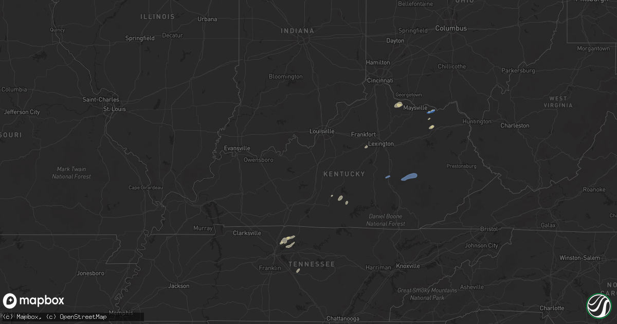
Hail Map in Kentucky on September 22, 2025
Get this storm
September 22 map
$229
one time, instant access
Download today. No call, no setup
Keep the $229
Bought the map and want the full workflow? Apply the entire $229 to a subscription within 7 days. None of it is wasted.
Every map, not just this one
This buys you this map. Subscription and you get every map we run, in the markets you choose from a few cities to whole states to nationwide. Plus real-time alerts the moment a storm fires.
Contact data
Name, contact info, occupancy, even credit band for addresses in the footprint. You go from where it hit to who to call.
Become the source they trust
Unlimited branding weather history reports on demand. You already have the documented answer ready for the property owner, and you are the one who showed up with it.
Property data and RoofTrace estimates
Pull up any address you have got, its value and the exact code rules for that jurisdiction, straight from One Click Code. Then RoofTrace estimates the squares, pitch, and roof value, priced the way you price.
Storm reports in Kentucky
Kentucky
| Date | Description |
|---|---|
| 09/22/20256:55 PM CDT | Tree on school property fell onto roadway and on to both of rps vehicles. |
| 09/22/20256:52 PM CDT | Tree fell into a residence on clay street. Powerlines involved. |
| 09/22/20256:13 PM CDT | Tree branch and power lines down. |
| 09/22/20256:10 PM CDT | Tree down on state route 5. |
| 09/22/20255:57 PM CDT | Tree reported down along south state highway one. Time and location are estimated by radar. |
| 09/22/20255:52 PM CDT | Corrects previous tstm wnd dmg report from 1 n grayson. Tree reported down on road. Time is estimated by radar. |
| 09/22/20255:52 PM CDT | Tree reported down on road. |
| 09/22/20255:47 PM CDT | Several tree limbs and tree debris reported to have been blown down onto ky route 7 near the morgan county line. The event time is radar estimated. |
| 09/22/20255:40 PM CDT | Tree damage resulting in 571 customers without power. |
| 09/22/20255:39 PM CDT | Corrects previous tstm wnd dmg report from 1 e south shore for time of occurrence. Tree on school property fell onto roadway and on to both of rps vehicles. Time is est |
| 09/22/20255:35 PM CDT | A tree was reported to have been blown down onto ky 7 about 0.5 miles from the sandy hook city limits. The event time is radar estimated. |
| 09/22/20255:33 PM CDT | A tree was reported to have been blown down onto ky 1812 very close to the breathitt county line. The event time is radar estimated. |
| 09/22/20255:31 PM CDT | A tree was blown onto ky 772 about one quarter of a mile from us 460. |
| 09/22/20255:27 PM CDT | Delayed report. A nws employee came across downed trees blocking shoal branch road on their way into work this morning. Time estimated via radar. |
| 09/22/20255:24 PM CDT | Tree down with wires. Blocking driveways near kentucky drive. Time estimated from radar. |
| 09/22/20255:19 PM CDT | A tree was reported to have been blown down onto little bloody creek road near the flat and mary communities. The even time is radar estimated. |
| 09/22/20255:18 PM CDT | Delayed report from the highway department in fleming county. Downed trees were blocking the intersection of big run road and suit lane. Time estimated via radar. |
| 09/22/20255:16 PM CDT | Tree down blocking east bound lane of kentucky 8. Time estimated from radar. |
| 09/22/20255:08 PM CDT | A tree was blown down onto ky 52 blocking the roadway approximately 1 mile east from the ky 11 and ky 52 intersection. The event time is radar estimated. |
| 09/22/20255:02 PM CDT | A tree was reported to have been blown down onto adams branch road. |
| 09/22/20254:50 PM CDT | Bath county em reported downed trees on mudlick road and slate lick road. Time estimated via radar. |
| 09/22/20254:49 PM CDT | Fleming county dispatch received multiple calls of tree damage blocking ky-32/morehead road around 6pm. Exact time estimated via radar. |
| 09/22/20254:47 PM CDT | A utility line was blown down at 6540 e hwy 36. The event time is radar estimated. |
| 09/22/20254:37 PM CDT | A tree was reported down near 100 pecks creek road near the intersection of pecks creek road and ky 11/15. The even time is radar estimated. |
| 09/22/20254:36 PM CDT | A tree was reported down onto ky 713 spencer pike at fortune cemetery lane. |
| 09/22/20254:30 PM CDT | Photos on social media of a large tree downed in the front yard of a house near the intersection of levee road and tonkin road south of mount sterling. Time provided by |
| 09/22/20254:30 PM CDT | A tree was reported down near 300 shady acre lane. The event time is estimated. |
| 09/22/20254:19 PM CDT | A tree was blown down onto ky 1326 withing the city limits of mount vernon. The event time is radar estimated. |
| 09/22/20254:07 PM CDT | Social media images showing damage to many trees... Outbuildings... And minor damage to homes along west miami street south of cooper lane. Possible tornado. |
| 09/22/20254:05 PM CDT | At ky-70 and estill hackney road a tree was reported to be down blocking all lanes of the roadway. The event time is radar estimated. |
| 09/22/20254:00 PM CDT | A tree and powerlines down blocking the right lane of ky-39 at petrey road. The event time is radar estimated. |
| 09/22/20253:46 PM CDT | Dispatch reported big tree down on shake rag rd. Time estimated from radar. |
| 09/22/20253:30 PM CDT | Dispatch reported tree blocking road near old pollys shoe store. Also a tree down on upper brush creek rd and another at intersection of angel ridge and ky 501. |
| 09/22/20253:11 PM CDT | Large limb fell on a school bus on raikes hill road in eastern taylor county. No injuries were reported. |
| 09/22/20253:11 PM CDT | Large l |
| 09/22/20253:08 PM CDT | Tree down across reeves rd. |
| 09/22/20253:05 PM CDT | Trees down at bull run and hutchinson rd... Bowen and greenburg... 200 block of chickadee ln... And knifley rd. |
| 09/22/20252:30 PM CDT | One tree reported across jarboe road in taylor county. |
| 09/22/20252:30 PM CDT | Two trees reported down on feather creek road in taylor county. |
All States Impacted by Hail Map on September 22, 2025
Cities Impacted by Hail Map on September 22, 2025
- Ontario, WI
- Kendall, WI
- Elroy, WI
- La Valle, WI
- Hillsboro, WI
- Wonewoc, WI
- Mauston, WI
- Lyndon Station, WI
- Reedsburg, WI
- Preston, MN
- Harmony, MN
- Lime Springs, IA
- Dowagiac, MI
- Kewaskum, WI
- Mabel, MN
- Canton, MN
- Jackson, WI
- West Bend, WI
- Random Lake, WI
- Fredonia, WI
- Adams, MN
- Taopi, MN
- Spring Grove, MN
- Dorchester, IA
- Caledonia, MN
- Eitzen, MN
- Lanesboro, MN
- Versailles, KY
- Lawrenceburg, KY
- Saint Johns, AZ
- Houston, MN
- Brownsville, MN
- Quemado, NM
- New Albin, IA
- De Soto, WI
- Pie Town, NM
- Genoa, WI
- Greensburg, KY
- Datil, NM
- Sparkman, AR
- Ferryville, WI
- Edmonton, KY
- Glens Fork, KY
- Columbia, KY
- Lansing, IA
- Park, KS
- Hoxie, KS
- Quinter, KS
- Grainfield, KS
- Mount Juliet, TN
- Northwood, IA
- Naples, FL
- Lebanon, TN
- Gallatin, TN
- Immokalee, FL
- Saint Ansgar, IA
- Castalian Springs, TN
- Carpenter, IA
- Gays Mills, WI
- Brooksville, KY
- Magdalena, NM
- Foster, KY
- Eastman, WI
- Soldiers Grove, WI
- Mount Vernon, KY
- Crab Orchard, KY
- Berea, KY
- Brodhead, KY
- Steuben, WI
- Boscobel, WI
- Forest City, IA
- Joice, IA
- Fertile, IA
- Augusta, KY
- Clarendon, AR
- Kensett, IA
- Clarksdale, MS
- Holly Grove, AR
- Osage, IA
- Hanlontown, IA
- Grafton, IA
- McKee, KY
- Vanceburg, KY
- Tollesboro, KY
- Vincent, KY
- Booneville, KY
- Beattyville, KY
- Vale, SD
- Wauzeka, WI
- Cheyenne Wells, CO
- Marvell, AR
- Green Valley, AZ
- Amado, AZ
- Garner, IA
- Clear Lake, IA
- Sturgis, SD
- New Hampton, IA
- Ventura, IA
- Mason City, IA
- Poplar Grove, AR
- Lascassas, TN
- Milton, TN
- Murfreesboro, TN
- Lexa, AR
- Plymouth, IA
- Nora Springs, IA
- Cheyenne, WY
- Morehead, KY
- Newell, SD
- Vail, AZ
- Moore Haven, FL
- Rudd, IA
- Rock Falls, IA
- Winona, KS
- Kyle, SD
- Arcadia, FL
- Waucoma, IA
- Lawler, IA
- Saint David, AZ
- Sonoita, AZ
- Rockford, IA
- Fennimore, WI
- Wallace, KS
- Grinnell, KS
- Blue River, WI
- Algona, IA
- Arapahoe, CO
- Floyd, IA
- Charles City, IA
- Truth Or Consequences, NM
- Carrizozo, NM
- Tularosa, NM
- Seymour, TX
- Waukon, IA
- Montfort, WI
- Livingston, WI
- Stitzer, WI
- Rockwell, IA
- Muscoda, WI
- Cobb, WI
- Highland, WI
- Swaledale, IA
- Avoca, WI
- Gove, KS
- Harpers Ferry, IA
- Pine Ridge, SD
- Mount Hope, WI
- Sutherland, IA
- Primghar, IA
- Platteville, WI
- Lancaster, WI
- Waterville, IA
- Monona, IA
- Woodman, WI
- Thornton, IA
- Plainfield, IA
- Kanawha, IA
- Hawkeye, IA
- Bode, IA
- McGregor, IA
- Prairie Du Chien, WI
- Porcupine, SD
- Linden, WI
- Mineral Point, WI
- Rewey, WI
- West Bend, IA
- Spencer, IA
- Royal, IA
- Dougherty, IA
- Waverly, IA
- Lu Verne, IA
- Livermore, IA
- Goodell, IA
- Klemme, IA
- Meservey, IA
- Belmond, IA
- Columbus, WI
- Beaver Dam, WI
- Manderson, SD
- Sheffield, IA
- Belmont, WI
- Bagley, WI
- Whittemore, IA
- Farmersburg, IA
- Wanblee, SD
- Denver, IA
- Reeseville, WI
- Ottosen, IA
- Alexander, IA
- Readlyn, IA
- Tripoli, IA
- Janesville, IA
- Bloomington, WI
- Patch Grove, WI
- Marquette, IA
- Stratton, CO
- Martin, SD
- Clarion, IA
- Cedar Falls, IA
- Allen, SD
- Watertown, WI
- Lowell, WI
- Elkader, IA
- Garnavillo, IA
- Saint Olaf, IA
- Juneau, WI
- Paullina, IA
- Hardy, IA
- Waterloo, IA
- Batesland, SD
- Animas, NM
- Brainard, NE
- Bruno, NE
- Dumont, IA
- Humboldt, IA
- Rowan, IA
- Maynard, IA
- Clyman, WI
- Dunkerton, IA
- Aplington, IA
- Thor, IA
- Blanding, UT
- Dows, IA
- Goldfield, IA
- Eagle Grove, IA
- Merriman, NE
- Linwood, NE
- Weston, NE
- Prague, NE
- Guttenberg, IA
- Garber, IA
- Dakota City, IA
- Platte Center, NE
- Oelwein, IA
- Rutland, IA
- Ixonia, WI
- Lebanon, WI
- Potosi, WI
- Cassville, WI
- Monument, KS
- Abie, NE
- Humphrey, NE
- Bethune, CO
- Vincent, IA
- Parkersburg, IA
- Wellsburg, IA
- Holland, IA
- Wounded Knee, SD
- Strawberry Point, IA
- Badger, IA
- Galt, IA
- Oconomowoc, WI
- Malmo, NE
- Colesburg, IA
- Columbus, NE
- Neosho, WI
- Ashippun, WI
- Woolstock, IA
- Morse Bluff, NE
- Cedar Bluffs, NE
- Burlington, CO
- Fort Dodge, IA
- Clare, IA
- Webster City, IA
- Colon, NE
- Oelrichs, SD
- Stanley, IA
- Aurora, IA
- Chadron, NE
- Dike, IA
- Grundy Center, IA
- Edgewood, IA
- Sherrill, IA
- Fremont, NE
- Duncombe, IA
- Blairsburg, IA
- Winthrop, IA
- New Vienna, IA
- Radcliffe, IA
- Holy Cross, IA
- Durango, IA
- Okauchee, WI
- Nashotah, WI
- Clarksville, IA
- Allison, IA
- Lamont, IA
- Williams, IA
- Reinbeck, IA
- Hartland, WI
- Delafield, WI
- Nickerson, NE
- Arlington, NE
- Craig, NE
- Cody, NE
- Oakland, NE
- Masonville, IA
- Traer, IA
- Buckingham, IA
- Alden, IA
- North Bend, NE
- Dubuque, IA
- Kamrar, IA
- Hudson, IA
- Oakley, KS
- Pewaukee, WI
- Otho, IA
- Jewell, IA
- Dundee, IA
- Walker, IA
- Manchester, IA
- Ames, NE
- Shelby, NE
- Hubbard, IA
- McCallsburg, IA
- East Dubuque, IL
- New Providence, IA
- Coggon, IA
- Center Point, IA
- Osceola, NE
- Eldora, IA
- Hugoton, KS
- Moscow, KS
- Ryan, IA
- Lehigh, IA
- Waukesha, WI
- Hooper, NE
- Blair, NE
- Tekamah, NE
- Modale, IA
- Ulysses, KS
- Conrad, IA
- Zearing, IA
- Gowrie, IA
- Paton, IA
- Harcourt, IA
- Saint Anthony, IA
- Clemons, IA
- Dayton, IA
- Central City, IA
- Weskan, KS
- Herman, NE
- Kennard, NE
- Wahoo, NE
- Stratford, IA
- New Berlin, WI
- Springville, IA
- Union, IA
- Bellwood, NE
- Whitten, IA
- Mondamin, IA
- Sharon Springs, KS
- Scott City, KS
- Hooker, OK
- Pisgah, IA
- Brookfield, WI
- Leoti, KS
- Satanta, KS
- Guymon, OK
- Anamosa, IA
- Monticello, IA
- Churdan, IA
- Rising City, NE
- Jefferson, IA
- Boxholm, IA
- Pilot Mound, IA
- Decatur, NE
- Blencoe, IA
- Scranton, IA
- Grand Junction, IA
- Tyrone, OK
- Little Sioux, IA
- Onawa, IA
- Goodland, KS
- Woodbine, IA
- Moorhead, IA
- Dunlap, IA
- Turpin, OK
- Forgan, OK
- Logan, IA
- Liberal, KS
- Missouri Valley, IA
- Magnolia, IA
- Castana, IA
- Soldier, IA
- Vail, IA
- Mead, NE
- Denison, IA
- Whitman, NE
- Fairfax, IA
- Carroll, IA
- Ute, IA
- Swisher, IA
- Amana, IA
- Superior, NE
- Charter Oak, IA
- Schleswig, IA
- Glidden, IA
- Valentine, NE
- Rippey, IA
- Ralston, IA
- Mapleton, IA
- North Liberty, IA
- Coon Rapids, IA
- Jamaica, IA
- Meade, KS
- Nelson, NE
- Bagley, IA
- Whiting, IA
- Hornick, IA
- Dedham, IA
- Yutan, NE
- Manilla, IA
- Perry, IA
- Templeton, IA
- Dawson, IA
- Tiffin, IA
- Oxford, IA
- Iowa City, IA
- Ashland, KS
- Scribner, NE
- Valley, NE
- Macy, NE
- Linden, IA
- Redfield, IA
- Tilden, NE
- Audubon, IA
- Meadow Grove, NE
- West Point, NE
- Janesville, WI
- Wisner, NE
- Healy, KS
- Gretna, NE
- Waterloo, NE
- Elkhorn, NE
- Ashland, NE
- Beemer, NE
- Fargo, OK
- Shattuck, OK
- Arnett, OK
- Gage, OK
- Sharon, OK
- Woodward, OK
- Mooreland, OK
- Fort Supply, OK
- Hamlin, IA
- Exira, IA
- Omaha, NE
- Bennington, NE
- Freedom, OK
- Waynoka, OK
- Thedford, NE
- Murdock, NE
- Stanton, NE
- Dighton, KS
- Avoca, NE
- Elmwood, NE
- Dodge, NE
- Newman Grove, NE
- Burlington, OK
- Weeping Water, NE
- Winslow, NE
- Waldron, KS
- Hazelton, KS
- Amorita, OK
- Medicine Lodge, KS
- Sharon, KS
- Lindsay, NE
- Kiowa, KS
- Alva, OK
- Cherokee, OK
- Dacoma, OK
- Aline, OK
- Carmen, OK
- Isabel, KS
- Madison, NE
- Clarkson, NE
- Anthony, KS
- Howells, NE
- Medford, OK
- Wakita, OK
- Nash, OK
- Jet, OK
- Hardtner, KS
- Manchester, OK
- Harper, KS
- Bluff City, KS
- Attica, KS
- Nashville, KS
- Zenda, KS
- Spivey, KS
- Buffalo, OK
- Argonia, KS
- Caldwell, KS
- Danville, KS
- Freeport, KS
- Nehawka, NE
- Otoe, NE
- Bassett, NE
- Nebraska City, NE
- Hendersonville, TN
- Milan, KS
- Cottontown, TN
- Mayfield, KS
- Goodlettsville, TN
- Washington, NE
- Wellington, KS
- South Haven, KS
- Norwich, KS
- Milton, KS
- Clearwater, KS
- Conway Springs, KS
- Ithaca, NE
- Union, NE
- Jetmore, KS
- Bethpage, TN
- Talmage, NE
- Percival, IA
- Burwell, NE
- Dunbar, NE
- Lorton, NE
- Spearville, KS
- Brock, NE
- Syracuse, NE
- Kremlin, OK
- Hunter, OK
- Julian, NE
- Auburn, NE
- Johnson, NE
- Peru, NE
- Chambers, NE
- Oneill, NE
- Hanston, KS
- Elk Creek, NE
- Tecumseh, NE
- Amelia, NE
- Atkinson, NE
- Ewing, NE
- Inman, NE
- Steinauer, NE
- Belle Plaine, KS
- Clearwater, NE
- Pawnee City, NE
- Burchard, NE
- Liberty, NE
- Wymore, NE
- Beloit, KS
- Belvue, KS
- Saint Marys, KS
- Elgin, NE
- Oxford, KS
- Geuda Springs, KS
- Arkansas City, KS
- Wamego, KS
- Winfield, KS
- Neligh, NE
- Petersburg, NE
- Chanute, KS
- Girard, KS
- Concordia, KS
- Reeds, MO
- Sarcoxie, MO
- La Russell, MO
- Talala, OK
- Viroqua, WI
- Stoddard, WI
- Waterloo, WI


