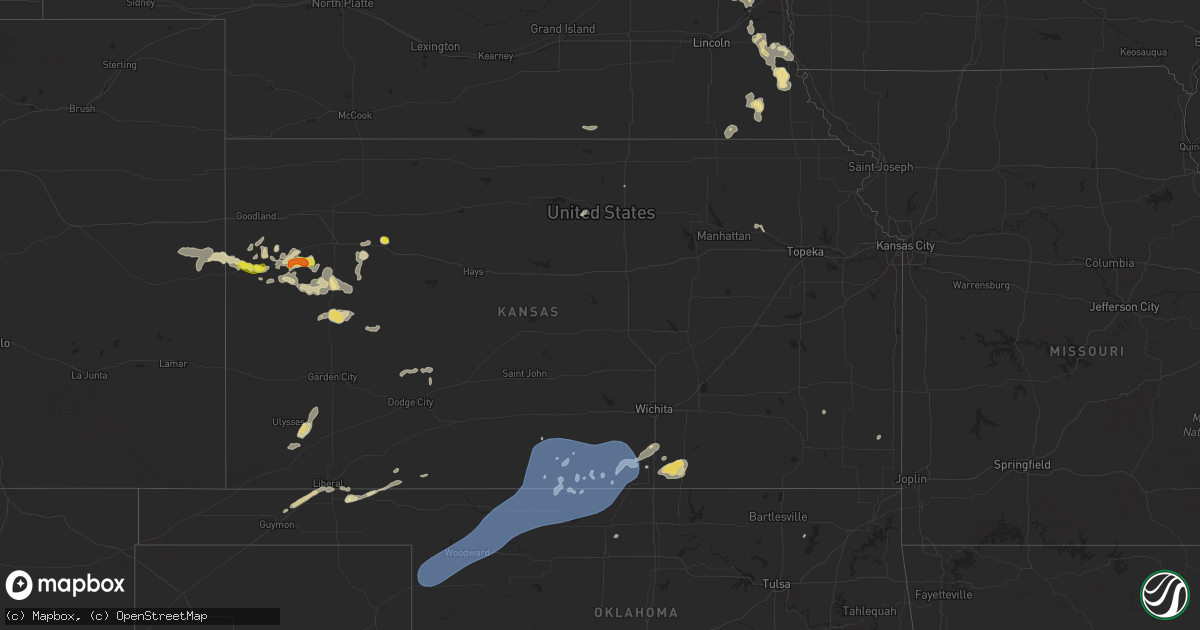
Hail Map in Kansas on September 22, 2025
Get this storm
September 22 map
$229
one time, instant access
Download today. No call, no setup
Keep the $229
Bought the map and want the full workflow? Apply the entire $229 to a subscription within 7 days. None of it is wasted.
Every map, not just this one
This buys you this map. Subscription and you get every map we run, in the markets you choose from a few cities to whole states to nationwide. Plus real-time alerts the moment a storm fires.
Contact data
Name, contact info, occupancy, even credit band for addresses in the footprint. You go from where it hit to who to call.
Become the source they trust
Unlimited branding weather history reports on demand. You already have the documented answer ready for the property owner, and you are the one who showed up with it.
Property data and RoofTrace estimates
Pull up any address you have got, its value and the exact code rules for that jurisdiction, straight from One Click Code. Then RoofTrace estimates the squares, pitch, and roof value, priced the way you price.
Storm reports in Kansas
Kansas
| Date | Description |
|---|---|
| 09/22/20255:14 PM CDT | Ambient weather site section 17 reported the wind gust. |
| 09/22/20255:22 AM CDT | Delayed report for one large tree blown down over the highway and damage to a road sign. |
| 09/22/20255:22 AM CDT | Delayed report fo |
| 09/22/20251:57 AM CDT | Wind gust measured from pws. |
| 09/22/20251:08 AM CDT | The awos reported a 61 mph wind gust. |
| 09/22/20251:08 AM CDT | The awos reported a 61 mph wind gust. |
| 09/21/202510:00 PM CDT | Facebook photo. |
| 09/21/20259:36 PM CDT | Weather link site delta dos. |
| 09/21/20257:38 PM CDT | Delayed report of quarter size hail 5 inches deep. Time estimated by radar. |
| 09/21/20257:22 PM CDT | A local report indicates 60 MPH wind near 3 E Grinnell |
All States Impacted by Hail Map on September 22, 2025
Cities Impacted by Hail Map on September 22, 2025
- Ontario, WI
- Kendall, WI
- Elroy, WI
- La Valle, WI
- Hillsboro, WI
- Wonewoc, WI
- Mauston, WI
- Lyndon Station, WI
- Reedsburg, WI
- Preston, MN
- Harmony, MN
- Lime Springs, IA
- Dowagiac, MI
- Kewaskum, WI
- Mabel, MN
- Canton, MN
- Jackson, WI
- West Bend, WI
- Random Lake, WI
- Fredonia, WI
- Adams, MN
- Taopi, MN
- Spring Grove, MN
- Dorchester, IA
- Caledonia, MN
- Eitzen, MN
- Lanesboro, MN
- Versailles, KY
- Lawrenceburg, KY
- Saint Johns, AZ
- Houston, MN
- Brownsville, MN
- Quemado, NM
- New Albin, IA
- De Soto, WI
- Pie Town, NM
- Genoa, WI
- Greensburg, KY
- Datil, NM
- Sparkman, AR
- Ferryville, WI
- Edmonton, KY
- Glens Fork, KY
- Columbia, KY
- Lansing, IA
- Park, KS
- Hoxie, KS
- Quinter, KS
- Grainfield, KS
- Mount Juliet, TN
- Northwood, IA
- Naples, FL
- Lebanon, TN
- Gallatin, TN
- Immokalee, FL
- Saint Ansgar, IA
- Castalian Springs, TN
- Carpenter, IA
- Gays Mills, WI
- Brooksville, KY
- Magdalena, NM
- Foster, KY
- Eastman, WI
- Soldiers Grove, WI
- Mount Vernon, KY
- Crab Orchard, KY
- Berea, KY
- Brodhead, KY
- Steuben, WI
- Boscobel, WI
- Forest City, IA
- Joice, IA
- Fertile, IA
- Augusta, KY
- Clarendon, AR
- Kensett, IA
- Clarksdale, MS
- Holly Grove, AR
- Osage, IA
- Hanlontown, IA
- Grafton, IA
- McKee, KY
- Vanceburg, KY
- Tollesboro, KY
- Vincent, KY
- Booneville, KY
- Beattyville, KY
- Vale, SD
- Wauzeka, WI
- Cheyenne Wells, CO
- Marvell, AR
- Green Valley, AZ
- Amado, AZ
- Garner, IA
- Clear Lake, IA
- Sturgis, SD
- New Hampton, IA
- Ventura, IA
- Mason City, IA
- Poplar Grove, AR
- Lascassas, TN
- Milton, TN
- Murfreesboro, TN
- Lexa, AR
- Plymouth, IA
- Nora Springs, IA
- Cheyenne, WY
- Morehead, KY
- Newell, SD
- Vail, AZ
- Moore Haven, FL
- Rudd, IA
- Rock Falls, IA
- Winona, KS
- Kyle, SD
- Arcadia, FL
- Waucoma, IA
- Lawler, IA
- Saint David, AZ
- Sonoita, AZ
- Rockford, IA
- Fennimore, WI
- Wallace, KS
- Grinnell, KS
- Blue River, WI
- Algona, IA
- Arapahoe, CO
- Floyd, IA
- Charles City, IA
- Truth Or Consequences, NM
- Carrizozo, NM
- Tularosa, NM
- Seymour, TX
- Waukon, IA
- Montfort, WI
- Livingston, WI
- Stitzer, WI
- Rockwell, IA
- Muscoda, WI
- Cobb, WI
- Highland, WI
- Swaledale, IA
- Avoca, WI
- Gove, KS
- Harpers Ferry, IA
- Pine Ridge, SD
- Mount Hope, WI
- Sutherland, IA
- Primghar, IA
- Platteville, WI
- Lancaster, WI
- Waterville, IA
- Monona, IA
- Woodman, WI
- Thornton, IA
- Plainfield, IA
- Kanawha, IA
- Hawkeye, IA
- Bode, IA
- McGregor, IA
- Prairie Du Chien, WI
- Porcupine, SD
- Linden, WI
- Mineral Point, WI
- Rewey, WI
- West Bend, IA
- Spencer, IA
- Royal, IA
- Dougherty, IA
- Waverly, IA
- Lu Verne, IA
- Livermore, IA
- Goodell, IA
- Klemme, IA
- Meservey, IA
- Belmond, IA
- Columbus, WI
- Beaver Dam, WI
- Manderson, SD
- Sheffield, IA
- Belmont, WI
- Bagley, WI
- Whittemore, IA
- Farmersburg, IA
- Wanblee, SD
- Denver, IA
- Reeseville, WI
- Ottosen, IA
- Alexander, IA
- Readlyn, IA
- Tripoli, IA
- Janesville, IA
- Bloomington, WI
- Patch Grove, WI
- Marquette, IA
- Stratton, CO
- Martin, SD
- Clarion, IA
- Cedar Falls, IA
- Allen, SD
- Watertown, WI
- Lowell, WI
- Elkader, IA
- Garnavillo, IA
- Saint Olaf, IA
- Juneau, WI
- Paullina, IA
- Hardy, IA
- Waterloo, IA
- Batesland, SD
- Animas, NM
- Brainard, NE
- Bruno, NE
- Dumont, IA
- Humboldt, IA
- Rowan, IA
- Maynard, IA
- Clyman, WI
- Dunkerton, IA
- Aplington, IA
- Thor, IA
- Blanding, UT
- Dows, IA
- Goldfield, IA
- Eagle Grove, IA
- Merriman, NE
- Linwood, NE
- Weston, NE
- Prague, NE
- Guttenberg, IA
- Garber, IA
- Dakota City, IA
- Platte Center, NE
- Oelwein, IA
- Rutland, IA
- Ixonia, WI
- Lebanon, WI
- Potosi, WI
- Cassville, WI
- Monument, KS
- Abie, NE
- Humphrey, NE
- Bethune, CO
- Vincent, IA
- Parkersburg, IA
- Wellsburg, IA
- Holland, IA
- Wounded Knee, SD
- Strawberry Point, IA
- Badger, IA
- Galt, IA
- Oconomowoc, WI
- Malmo, NE
- Colesburg, IA
- Columbus, NE
- Neosho, WI
- Ashippun, WI
- Woolstock, IA
- Morse Bluff, NE
- Cedar Bluffs, NE
- Burlington, CO
- Fort Dodge, IA
- Clare, IA
- Webster City, IA
- Colon, NE
- Oelrichs, SD
- Stanley, IA
- Aurora, IA
- Chadron, NE
- Dike, IA
- Grundy Center, IA
- Edgewood, IA
- Sherrill, IA
- Fremont, NE
- Duncombe, IA
- Blairsburg, IA
- Winthrop, IA
- New Vienna, IA
- Radcliffe, IA
- Holy Cross, IA
- Durango, IA
- Okauchee, WI
- Nashotah, WI
- Clarksville, IA
- Allison, IA
- Lamont, IA
- Williams, IA
- Reinbeck, IA
- Hartland, WI
- Delafield, WI
- Nickerson, NE
- Arlington, NE
- Craig, NE
- Cody, NE
- Oakland, NE
- Masonville, IA
- Traer, IA
- Buckingham, IA
- Alden, IA
- North Bend, NE
- Dubuque, IA
- Kamrar, IA
- Hudson, IA
- Oakley, KS
- Pewaukee, WI
- Otho, IA
- Jewell, IA
- Dundee, IA
- Walker, IA
- Manchester, IA
- Ames, NE
- Shelby, NE
- Hubbard, IA
- McCallsburg, IA
- East Dubuque, IL
- New Providence, IA
- Coggon, IA
- Center Point, IA
- Osceola, NE
- Eldora, IA
- Hugoton, KS
- Moscow, KS
- Ryan, IA
- Lehigh, IA
- Waukesha, WI
- Hooper, NE
- Blair, NE
- Tekamah, NE
- Modale, IA
- Ulysses, KS
- Conrad, IA
- Zearing, IA
- Gowrie, IA
- Paton, IA
- Harcourt, IA
- Saint Anthony, IA
- Clemons, IA
- Dayton, IA
- Central City, IA
- Weskan, KS
- Herman, NE
- Kennard, NE
- Wahoo, NE
- Stratford, IA
- New Berlin, WI
- Springville, IA
- Union, IA
- Bellwood, NE
- Whitten, IA
- Mondamin, IA
- Sharon Springs, KS
- Scott City, KS
- Hooker, OK
- Pisgah, IA
- Brookfield, WI
- Leoti, KS
- Satanta, KS
- Guymon, OK
- Anamosa, IA
- Monticello, IA
- Churdan, IA
- Rising City, NE
- Jefferson, IA
- Boxholm, IA
- Pilot Mound, IA
- Decatur, NE
- Blencoe, IA
- Scranton, IA
- Grand Junction, IA
- Tyrone, OK
- Little Sioux, IA
- Onawa, IA
- Goodland, KS
- Woodbine, IA
- Moorhead, IA
- Dunlap, IA
- Turpin, OK
- Forgan, OK
- Logan, IA
- Liberal, KS
- Missouri Valley, IA
- Magnolia, IA
- Castana, IA
- Soldier, IA
- Vail, IA
- Mead, NE
- Denison, IA
- Whitman, NE
- Fairfax, IA
- Carroll, IA
- Ute, IA
- Swisher, IA
- Amana, IA
- Superior, NE
- Charter Oak, IA
- Schleswig, IA
- Glidden, IA
- Valentine, NE
- Rippey, IA
- Ralston, IA
- Mapleton, IA
- North Liberty, IA
- Coon Rapids, IA
- Jamaica, IA
- Meade, KS
- Nelson, NE
- Bagley, IA
- Whiting, IA
- Hornick, IA
- Dedham, IA
- Yutan, NE
- Manilla, IA
- Perry, IA
- Templeton, IA
- Dawson, IA
- Tiffin, IA
- Oxford, IA
- Iowa City, IA
- Ashland, KS
- Scribner, NE
- Valley, NE
- Macy, NE
- Linden, IA
- Redfield, IA
- Tilden, NE
- Audubon, IA
- Meadow Grove, NE
- West Point, NE
- Janesville, WI
- Wisner, NE
- Healy, KS
- Gretna, NE
- Waterloo, NE
- Elkhorn, NE
- Ashland, NE
- Beemer, NE
- Fargo, OK
- Shattuck, OK
- Arnett, OK
- Gage, OK
- Sharon, OK
- Woodward, OK
- Mooreland, OK
- Fort Supply, OK
- Hamlin, IA
- Exira, IA
- Omaha, NE
- Bennington, NE
- Freedom, OK
- Waynoka, OK
- Thedford, NE
- Murdock, NE
- Stanton, NE
- Dighton, KS
- Avoca, NE
- Elmwood, NE
- Dodge, NE
- Newman Grove, NE
- Burlington, OK
- Weeping Water, NE
- Winslow, NE
- Waldron, KS
- Hazelton, KS
- Amorita, OK
- Medicine Lodge, KS
- Sharon, KS
- Lindsay, NE
- Kiowa, KS
- Alva, OK
- Cherokee, OK
- Dacoma, OK
- Aline, OK
- Carmen, OK
- Isabel, KS
- Madison, NE
- Clarkson, NE
- Anthony, KS
- Howells, NE
- Medford, OK
- Wakita, OK
- Nash, OK
- Jet, OK
- Hardtner, KS
- Manchester, OK
- Harper, KS
- Bluff City, KS
- Attica, KS
- Nashville, KS
- Zenda, KS
- Spivey, KS
- Buffalo, OK
- Argonia, KS
- Caldwell, KS
- Danville, KS
- Freeport, KS
- Nehawka, NE
- Otoe, NE
- Bassett, NE
- Nebraska City, NE
- Hendersonville, TN
- Milan, KS
- Cottontown, TN
- Mayfield, KS
- Goodlettsville, TN
- Washington, NE
- Wellington, KS
- South Haven, KS
- Norwich, KS
- Milton, KS
- Clearwater, KS
- Conway Springs, KS
- Ithaca, NE
- Union, NE
- Jetmore, KS
- Bethpage, TN
- Talmage, NE
- Percival, IA
- Burwell, NE
- Dunbar, NE
- Lorton, NE
- Spearville, KS
- Brock, NE
- Syracuse, NE
- Kremlin, OK
- Hunter, OK
- Julian, NE
- Auburn, NE
- Johnson, NE
- Peru, NE
- Chambers, NE
- Oneill, NE
- Hanston, KS
- Elk Creek, NE
- Tecumseh, NE
- Amelia, NE
- Atkinson, NE
- Ewing, NE
- Inman, NE
- Steinauer, NE
- Belle Plaine, KS
- Clearwater, NE
- Pawnee City, NE
- Burchard, NE
- Liberty, NE
- Wymore, NE
- Beloit, KS
- Belvue, KS
- Saint Marys, KS
- Elgin, NE
- Oxford, KS
- Geuda Springs, KS
- Arkansas City, KS
- Wamego, KS
- Winfield, KS
- Neligh, NE
- Petersburg, NE
- Chanute, KS
- Girard, KS
- Concordia, KS
- Reeds, MO
- Sarcoxie, MO
- La Russell, MO
- Talala, OK
- Viroqua, WI
- Stoddard, WI
- Waterloo, WI


