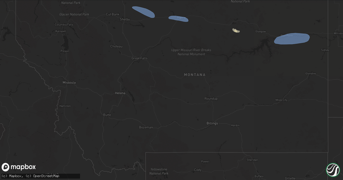
Hail Map in Montana on September 20, 2024
Get this storm
September 20 map
$229
one time, instant access
Download today. No call, no setup
Keep the $229
Bought the map and want the full workflow? Apply the entire $229 to a subscription within 7 days. None of it is wasted.
Every map, not just this one
This buys you this map. Subscription and you get every map we run, in the markets you choose from a few cities to whole states to nationwide. Plus real-time alerts the moment a storm fires.
Contact data
Name, contact info, occupancy, even credit band for addresses in the footprint. You go from where it hit to who to call.
Become the source they trust
Unlimited branding weather history reports on demand. You already have the documented answer ready for the property owner, and you are the one who showed up with it.
Property data and RoofTrace estimates
Pull up any address you have got, its value and the exact code rules for that jurisdiction, straight from One Click Code. Then RoofTrace estimates the squares, pitch, and roof value, priced the way you price.
Storm reports in Montana
Montana
| Date | Description |
|---|---|
| 09/20/20245:07 PM CDT | Asos station khvr havre airport. |
| 09/20/20245:07 PM CDT | Asos station khvr ha |
| 09/20/20244:57 PM CDT | Asos station khvr havre airport. |
| 09/20/20244:57 PM CDT | Corrects previous tstm wnd gst report from 4 w havre. Asos station khvr havre airport. |
| 09/20/20243:48 PM CDT | Delayed report. Ambient station northeast of chester measured a max gust of 60 mph. |
| 09/20/20243:30 PM CDT | Mesonet station gw4063 eagle creek colony. |
| 09/19/202410:00 PM CDT | Mtdot site at us-2 stateline. |
| 09/19/20249:45 PM CDT | Mesonet station mtsoo 16.0 sw bainville |
| 09/19/20249:45 PM CDT | Me |
| 09/19/20249:18 PM CDT | Mesonet station popm8 poplar raws. |
| 09/19/20248:43 PM CDT | Asos station kolf wolf point airport. |
| 09/19/20247:55 PM CDT | Also reported pea-sized hail... A tree limb 6 inches in diameter fallen off tree... Patio furniture blown away... And 0.37 inches of rain so far. Time estimated from ra |
All States Impacted by Hail Map on September 20, 2024
Cities Impacted by Hail Map on September 20, 2024
- Bartlesville, OK
- Warsaw, IN
- Milford, IN
- Leesburg, IN
- Pierceton, IN
- Larwill, IN
- Columbia City, IN
- Galata, MT
- Whitlash, MT
- Chester, MT
- Inverness, MT
- Joplin, MT
- Rudyard, MT
- Drury, MO
- Kokomo, IN
- Minneola, KS
- Wright, KS
- Ford, KS
- Spearville, KS
- Bucklin, KS
- Offerle, KS
- Vanzant, MO
- Neoga, IL
- Mattoon, IL
- Gays, IL
- Windsor, IL
- Kinsley, KS
- Lewis, KS
- Trilla, IL
- Toledo, IL
- Mountain Home, AR
- Gildford, MT
- Havre, MT
- Kremlin, MT
- Chinook, MT
- Greensburg, KS
- Macksville, KS
- Belpre, KS
- Haviland, KS
- Michigantown, IN
- Frankfort, IN
- Forest, IN
- Montrose, IL
- Eunice, MO
- Yukon, MO
- Elk Creek, MO
- Houston, MO
- Sigel, IL
- Jewett, IL
- Hartshorn, MO
- Summersville, MO
- Fillmore, IL
- Bingham, IL
- Larned, KS
- Newton, IL
- St John, KS
- Bexar, AR
- Viola, AR
- Ramsey, IL
- Sheridan, IN
- Kirklin, IN
- Kempton, IN
- Salem, AR
- Hidalgo, IL
- Wheeler, IL
- Marshall, IL
- Isabel, KS
- Nashville, KS
- Stafford, KS
- Sylvia, KS
- Ellsworth, KS
- Paris, IL
- Cunningham, KS
- Dennison, IL
- Kanopolis, KS
- Geneseo, KS
- Malta, MT
- Couch, MO
- Thayer, MO
- Chase, KS
- Lyons, KS
- Little River, KS
- Buhler, KS
- Hutchinson, KS
- Inman, KS
- Kingman, KS
- Luray, KS
- Lucas, KS
- Nickerson, KS
- Brookville, KS
- Marquette, KS
- Falun, KS
- Alton, MO
- Pretty Prairie, KS
- Cheney, KS
- Murdock, KS
- Salina, KS
- Beverly, KS
- Tescott, KS
- Moundridge, KS
- Burrton, KS
- Mcpherson, KS
- Sylvan Grove, KS
- Lindsborg, KS
- Sterling, KS
- Halstead, KS
- New Cambria, KS
- Solomon, KS
- Garden Plain, KS
- Haven, KS
- Mount Hope, KS
- Colwich, KS
- Andale, KS
- Maize, KS
- North Newton, KS
- Walton, KS
- Sedgwick, KS
- Hesston, KS
- Newton, KS
- Peabody, KS
- Teutopolis, IL
- Hunter, KS
- Fort Peck, MT
- Lincoln, KS
- Beloit, KS
- Galva, KS
- Valley Center, KS
- Bentley, KS
- Elbing, KS
- Whitewater, KS
- Wichita, KS
- Arlington, KS
- Florence, KS
- Goessel, KS
- Burns, KS
- Hillsboro, KS
- Marion, KS
- Cedar Point, KS
- Bennington, KS
- Chapman, KS
- Enterprise, KS
- Gypsum, KS
- Abilene, KS
- Junction City, KS
- Woodbine, KS
- Potwin, KS
- Benton, KS
- El Dorado, KS
- Towanda, KS
- Canton, KS
- Cassoday, KS
- Sainte Genevieve, MO
- Prairie Du Rocher, IL
- Greenwood, IN
- Indianapolis, IN
- Matfield Green, KS
- Elmdale, KS
- Cottonwood Falls, KS
- Whiteland, IN
- Eureka, KS
- Emporia, KS
- Olpe, KS
- Strong City, KS
- Madison, KS
- Hamilton, KS
- Wolf Point, MT
- Frazer, MT
- Franklin, IN
- Virgil, KS
- Vida, MT
- Poplar, MT
- Brockton, MT
- Clearwater, KS
- Viola, KS
- Conway Springs, KS
- Sumner, IL
- Claremont, IL
- Richey, MT
- Lambert, MT
- Haysville, KS
- Stapleton, NE
- Andover, KS
- Kechi, KS
- Mcconnell Afb, KS
- Augusta, KS
- Greenwich, KS
- Kenmare, ND
- Iola, KS
- Peck, KS
- Tolley, ND
- Mohall, ND
- Antler, ND
- Westhope, ND
- Canby, MN
- Porter, MN
- Minneota, MN
- Boyd, MN
- Granite Falls, MN
- Maynard, MN
- Montevideo, MN
- Clarkfield, MN
- Clara City, MN
- Hanley Falls, MN
- Raymond, MN
- Sacred Heart, MN
- Renville, MN
- Wood Lake, MN
- Madison, SD
- Kandiyohi, MN
- Willmar, MN
- Saint Joseph, MN
- Atwater, MN
- Echo, MN
- Danube, MN
- Flandreau, SD


