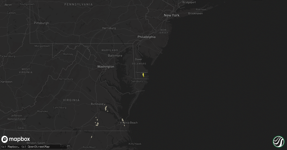
Hail Map on September 12, 2019
Get this storm
September 12 map
$229
one time, instant access
Download today. No call, no setup
Keep the $229
Bought the map and want the full workflow? Apply the entire $229 to a subscription within 7 days. None of it is wasted.
Every map, not just this one
This buys you this map. Subscription and you get every map we run, in the markets you choose from a few cities to whole states to nationwide. Plus real-time alerts the moment a storm fires.
Contact data
Name, contact info, occupancy, even credit band for addresses in the footprint. You go from where it hit to who to call.
Become the source they trust
Unlimited branding weather history reports on demand. You already have the documented answer ready for the property owner, and you are the one who showed up with it.
Property data and RoofTrace estimates
Pull up any address you have got, its value and the exact code rules for that jurisdiction, straight from One Click Code. Then RoofTrace estimates the squares, pitch, and roof value, priced the way you price.
States Impacted by Hail Map on September 12, 2019
Storm reports
Iowa
| Date | Description |
|---|---|
| 09/12/20196:04 PM CDT | A local report indicates 60 MPH wind near CLAYTON CENTER |
| 09/12/20195:34 PM CDT | An ef0 tornado touched down initially 5 mile west of farmersburg at 534 pm cdt and dissipated 2 miles southwest of monona at 541 pm cdt. Path length was 4.3 miles. Path |
| 09/12/20195:22 PM CDT | Trees and branches down near east main and d5x. |
| 09/12/20195:09 PM CDT | Trained spotter reported tops of trees blown down on roadway seven miles east of colwell. |
| 09/12/20194:55 PM CDT | Just spotted along hwy w14. |
| 09/12/20194:54 PM CDT | Possible tornado damage about 2.5 miles south southeast of ossian. |
| 09/12/20194:50 PM CDT | Report from mping: tree limbs broken. |
| 09/12/20194:45 PM CDT | Several tree limbs down in the road. Time estimate front radar. |
| 09/12/20194:40 PM CDT | Large tree limb down in driveway on clifton st ne... Relayed by broadcast media. |
| 09/12/20191:19 AM CDT | At 618 PM CDT, a severe thunderstorm was located near Lisbon, or 8 miles southwest of Mechanicsville, moving northeast at 50 mph. HAZARD...60 mph wind gusts and penny size hail. SOURCE...Radar indicated. IMPACT...Expect damage to roofs, siding, and trees. Locations impacted include... Anamosa, Mechanicsville, Stanwood, Mount Vernon, Monticello, Lisbon, Solon, Olin, Wyoming, Martelle, Onslow, Morley, Center Junction, Langworthy, Canton, Sutliff, Monticello Municipal Airport, Jones County Fairgrounds, Cedar Bluff and Pictured Rocks Wildlife Area. |
| 09/12/201912:04 AM CDT | At 503 PM CDT, a severe thunderstorm was located near Ossian, or 13 miles northeast of West Union, moving northeast at 20 mph. HAZARD...70 mph wind gusts and nickel size hail. SOURCE...Radar indicated. IMPACT...Expect considerable tree damage. Damage is likely to mobile homes, roofs, and outbuildings. This severe thunderstorm will be near... Postville around 515 PM CDT. Waukon around 545 PM CDT.Other locations impacted by this severe thunderstorm include CountyRoads X 16 And B 38, State Road 76 And County X 16, Frankville, StateRoad 51 And County W 48, Ludlow, Hardin and Castalia.This storm is also producing frequent dangerous lightning. |
| 09/11/201911:50 PM CDT | At 450 PM CDT, a severe thunderstorm was located over Alburnett, or 13 miles north of Cedar Rapids, moving north at 50 mph. HAZARD...60 mph wind gusts. SOURCE...Radar indicated. IMPACT...Expect damage to roofs, siding, and trees. Locations impacted include... Cedar Rapids, Manchester, Marion, Hiawatha, Robins, Central City, Springville, Edgewood, Earlville, Alburnett, Coggon, Lamont, Delhi, Colesburg, Ryan, Greeley, Prairieburg, Dundee, Delaware and Masonville.This includes Interstate 380 between mile markers 25 and 32. |
| 09/11/201911:11 PM CDT | At 411 PM CDT, a severe thunderstorm was located near Harmony, or near Preston, moving east at 40 mph. HAZARD...70 mph wind gusts. SOURCE...Trained weather spotters. A wind gust to 72 mph was recorded 4 miles south of Greenleafton around 410 PM. IMPACT...Expect considerable tree damage. Damage is likely to mobile homes, roofs, and outbuildings. This severe thunderstorm will be near... Harmony around 415 PM CDT. Canton around 420 PM CDT. Mabel around 435 PM CDT.Other locations impacted by this severe thunderstorm includeHenrytown, Forestville State Park, Choice, Carimona, York, Hutton andGreenleafton. |
| 09/11/20198:58 PM CDT | At 158 PM CDT, a severe thunderstorm was located near Glenville, or near Northwood, moving northeast at 40 mph. HAZARD...60 mph wind gusts and quarter size hail. SOURCE...Radar indicated. IMPACT...Hail damage to vehicles is expected. Expect wind damage to roofs, siding, and trees. Locations impacted include... Glenville, London, Hayward and Myrtle. This includes the following highways... Interstate 35 between mile markers 1 and 4. Interstate 90 between mile markers 163 and 173. |
| 09/11/20198:08 PM CDT | At 107 PM CDT, a severe thunderstorm was located 7 miles northwest of Eagle Lake, or 9 miles west of Forest City, moving northeast at 30 mph. HAZARD...Quarter size hail. SOURCE...Radar indicated. IMPACT...Damage to vehicles is expected. Locations impacted include... Forest City, Thompson, Leland, Crystal Lake, Woden, Hayfield, Pilot Knob State Park and Forest City Municipal Airport. |
Maryland
| Date | Description |
|---|---|
| 09/12/201912:51 AM CDT | At 550 PM EDT, a severe thunderstorm was located over Millsboro, or 7 miles southeast of Georgetown, moving south at 15 mph. HAZARD...60 mph wind gusts. SOURCE...Radar indicated. IMPACT...Damage to roofs, siding, trees, and power lines is possible. Locations impacted include... Millsboro, Selbyville, Dagsboro, Gumboro and Frankford. |
Texas
| Date | Description |
|---|---|
| 09/12/20193:33 AM CDT | At 833 PM CDT, a severe thunderstorm was located 5 miles west of Mackenzie Reservoir, or 13 miles east of Tulia, and is nearly stationary. HAZARD...60 mph wind gusts and quarter size hail. SOURCE...Radar indicated. IMPACT...Hail damage to vehicles is expected. Expect wind damage to roofs, siding, and trees. Locations impacted include... Mackenzie Reservoir. |
| 09/12/20192:44 AM CDT | At 743 PM CDT, a severe thunderstorm was located 5 miles north of Wayside, or 19 miles southwest of Claude, and is nearly stationary. HAZARD...60 mph wind gusts and quarter size hail. SOURCE...Radar indicated. IMPACT...Minor damage to roofs, siding, and trees is possible. Hail damage to vehicles is expected. Locations impacted include... Wayside and Palo Duro Canyon. |
| 09/12/20192:14 AM CDT | At 714 PM CDT, a severe thunderstorm was located 4 miles north of Wayside, or 19 miles southwest of Claude, and is nearly stationary. HAZARD...60 mph wind gusts and half dollar size hail. SOURCE...Radar indicated. IMPACT...Minor damage to roofs, siding, and trees is possible. Hail damage to vehicles is expected. Locations impacted include... Wayside and Palo Duro Canyon. |
| 09/12/20191:44 AM CDT | At 643 PM CDT, a severe thunderstorm was located 10 miles east of Wayside, or 19 miles south of Claude, and is nearly stationary. HAZARD...60 mph wind gusts and quarter size hail. SOURCE...Radar indicated. IMPACT...Minor damage to roofs, siding, and trees is possible. Hail damage to vehicles is expected. Locations impacted include... Wayside. |
| 09/12/20191:09 AM CDT | At 608 PM CDT, a severe thunderstorm was located near Lelia Lake, or 10 miles east of Clarendon, moving east at 10 mph. HAZARD...60 mph wind gusts and quarter size hail. SOURCE...Radar indicated. IMPACT...Minor damage to roofs, siding, and trees is possible. Hail damage to vehicles is expected. Locations impacted include... Hedley and Lelia Lake. |
Oklahoma
| Date | Description |
|---|---|
| 09/12/20196:35 PM CDT | Tree... Multiple large tree limbs down. |
| 09/12/20196:33 PM CDT | Large tree down. |
| 09/12/20196:12 PM CDT | A local report indicates 60 MPH wind near 2 N PAWNEE |
| 09/12/20194:29 PM CDT | Em reported in nwschat. |
| 09/12/20193:06 PM CDT | Trees and store signage down. Twitter picture. Time is radar estimate. |
| 09/12/20192:33 PM CDT | Asos report |
| 09/12/20192:31 PM CDT | Asos report |
| 09/12/20192:31 PM CDT | Asos report...corrected location |
| 09/12/20192:30 PM CDT | Mesonet report |
| 09/12/20194:08 AM CDT | At 908 PM CDT, a severe thunderstorm was located 4 miles southwest of Weatherford, moving south at 10 mph. HAZARD...70 mph wind gusts. SOURCE...Surface observations have indicated winds over 70 mph with this storm near Weatherford. IMPACT...Expect considerable tree damage. Damage is likely to mobile homes, roofs, and outbuildings. Locations impacted include... Weatherford and Corn. |
| 09/12/20192:50 AM CDT | At 748 PM CDT, a severe thunderstorm was located near Coyle, moving southeast at 15 mph. HAZARD...70 mph wind gusts and penny size hail. SOURCE...The local fire department reported tree and window damage in Coyle with this storm around 738 PM CDT. IMPACT...Expect considerable tree damage. Damage is likely to mobile homes, roofs, and outbuildings. Locations impacted include... Cushing, Perkins, Langston, Wellston, Carney, Tryon, Ripley, Agra, Coyle, Warwick, Meridian and Fallis. |
| 09/12/20192:03 AM CDT | At 703 PM CDT, a severe thunderstorm was located 6 miles south of Lake Carl Blackwell, moving east at 30 mph. HAZARD...60 mph wind gusts. SOURCE...Radar indicated. IMPACT...Expect damage to roofs, siding, and trees. Locations impacted include... Stillwater, Cushing, Perkins, Langston, Carney, Tryon, Ripley, Agra, Coyle, Mulhall, Lake Carl Blackwell and Ingalls. |
| 09/12/20191:29 AM CDT | At 628 PM CDT, severe thunderstorms were located along a line extending from 2 miles north of Cleveland to 4 miles northeast of Terlton to 5 miles east of Oilton to 3 miles northwest of Drumright, moving southeast at 45 mph. HAZARD...60 mph wind gusts. SOURCE...Radar indicated. IMPACT...Expect damage to roofs, siding, and trees. Locations in or near the path include... Tulsa... Sand Springs... Bixby... Sapulpa... Jenks... Glenpool... Skiatook... Hominy... Cleveland... Mannford... Drumright... Kiefer... Sperry... Mounds... Kellyville... Oilton... Jennings... Westport... Osage... Terlton...This includes Interstate 44 between mile markers 193 and 224. |
| 09/12/201912:20 AM CDT | At 520 PM CDT, severe thunderstorms were located along a line extending from 5 miles northwest of Marland to 5 miles southwest of Red Rock to near Lucien, moving east at 25 mph. HAZARD...60 mph wind gusts and penny size hail. SOURCE...Radar indicated. IMPACT...Expect damage to roofs, siding, and trees. Locations impacted include... Perry, Morrison, Billings, Red Rock, Marland, Lucien, Sooner Lake and Ceres. |
| 09/12/201912:03 AM CDT | At 502 PM CDT, a severe thunderstorm was located near Leedey, moving east at 20 mph. HAZARD...60 mph wind gusts and nickel size hail. SOURCE...Radar indicated. IMPACT...Expect damage to roofs, siding, and trees. Locations impacted include... Leedey. |
| 09/11/201911:47 PM CDT | At 447 PM CDT, severe thunderstorms were located along a line extending from near Billings to 3 miles east of Fairmont to near Bison, moving east at 25 mph. HAZARD...60 mph wind gusts and nickel size hail. SOURCE...Radar indicated. IMPACT...Expect damage to roofs, siding, and trees. Locations impacted include... Enid, Perry, Waukomis, Garber, Covington, Billings, Red Rock, Marshall, Breckenridge, Fairmont, Douglas, Lucien, Bison, Ceres and Hayward. |
| 09/11/201911:40 PM CDT | At 440 PM CDT, a severe thunderstorm was located 6 miles southeast of Lamont, moving east at 15 mph. HAZARD...60 mph wind gusts and nickel size hail. SOURCE...Radar indicated. IMPACT...Expect damage to roofs, siding, and trees. Locations impacted include... Tonkawa, Billings and Marland. |
| 09/11/201911:19 PM CDT | At 419 PM CDT, a severe thunderstorm was located 4 miles south of Carrier, moving east at 15 mph. HAZARD...60 mph wind gusts and nickel size hail. SOURCE...Radar indicated. IMPACT...Expect damage to roofs, siding, and trees. Locations impacted include... Enid, Waukomis, Garber, Lahoma, Drummond, Breckenridge, Fairmont, Carrier, Vance Air Force Base and North Enid. |
| 09/11/201911:09 PM CDT | At 409 PM CDT, a severe thunderstorm was located over Kremlin, moving east at 15 mph. HAZARD...Ping pong ball size hail and 60 mph wind gusts. SOURCE...Radar indicated. IMPACT...People and animals outdoors will be injured. Expect hail damage to roofs, siding, windows, and vehicles. Expect wind damage to roofs, siding, and trees. Locations impacted include... Enid, Kremlin, Hunter and North Enid. |
| 09/11/201911:02 PM CDT | At 402 PM CDT, severe thunderstorms were located along a line extending from near Orion to 6 miles southeast of Seiling to 8 miles northwest of Putnam, moving east at 20 mph. HAZARD...60 mph wind gusts and quarter size hail. SOURCE...Radar indicated. IMPACT...Hail damage to vehicles is expected. Expect wind damage to roofs, siding, and trees. Locations impacted include... Fairview, Taloga, Canton, Longdale, Canton Lake, Orion and Hucmac. |
| 09/11/201910:51 PM CDT | At 351 PM CDT, a severe thunderstorm was located 8 miles southeast of Camargo, moving northeast at 15 mph. HAZARD...60 mph wind gusts and quarter size hail. SOURCE...Radar indicated. IMPACT...Hail damage to vehicles is expected. Expect wind damage to roofs, siding, and trees. Locations impacted include... Taloga. |
| 09/11/201910:40 PM CDT | At 340 PM CDT, a severe thunderstorm was located near Cestos, moving east at 15 mph. HAZARD...60 mph wind gusts and quarter size hail. SOURCE...Radar indicated. IMPACT...Hail damage to vehicles is expected. Expect wind damage to roofs, siding, and trees. Locations impacted include... Seiling, Chester, Orion and Cestos. |
| 09/11/201910:27 PM CDT | At 327 PM CDT, a severe thunderstorm was located near Goltry, moving northeast at 15 mph. HAZARD...60 mph wind gusts and quarter size hail. SOURCE...Radar indicated. IMPACT...Hail damage to vehicles is expected. Expect wind damage to roofs, siding, and trees. Locations impacted include... Helena, Goltry, Nash and Hillsdale. |
| 09/11/201910:07 PM CDT | At 305 PM CDT, severe thunderstorms were located along a line extending from near Aline to 5 miles southeast of Vici, moving northeast at 25 to 35 mph. HAZARD...60 to 65 mph wind gusts and nickel size hail. SOURCE...Radar indicated. IMPACT...Expect damage to roofs, siding, and trees. Locations impacted include... Fairview, Helena, Seiling, Vici, Carmen, Cleo Springs, Aline, Sharon, Mutual, Orion, Chester, Orienta, Cestos, southwestern Great Salt Plains Lake and Bouse Junction. |
| 09/11/20199:55 PM CDT | At 253 PM CDT, a severe thunderstorm was located near Fairmont, moving northeast at 20 mph. Another severe storm was located between Garber and Billings. HAZARD...60 to 65 mph wind gusts and nickel size hail. SOURCE...Radar indicated. IMPACT...Expect damage to roofs, siding, and trees. Locations impacted include... Enid, Perry, Waukomis, Garber, Covington, Billings, Red Rock, Breckenridge, Marland, Hunter, Fairmont, Douglas, Lucien, Bison, North Enid, Ceres and Hayward. |
| 09/11/20199:18 PM CDT | At 217 PM CDT, a severe thunderstorm was located near Garber, moving northeast at 15 mph. Another strong to severe storm was located near Drummond. HAZARD...60 mph wind gusts and quarter size hail. SOURCE...Radar indicated. IMPACT...Hail damage to vehicles is expected. Expect wind damage to roofs, siding, and trees. Locations impacted include... Enid, Waukomis, Garber, Lahoma, Billings, Drummond, Breckenridge, Fairmont, Vance Air Force Base and North Enid. |
| 09/11/20199:08 PM CDT | At 208 PM CDT, a severe thunderstorm was located 5 miles northeast of Arnett, moving northeast at 15 mph. HAZARD...60 mph wind gusts and quarter size hail. SOURCE...Radar indicated. IMPACT...Hail damage to vehicles is expected. Expect wind damage to roofs, siding, and trees. Locations impacted include... Arnett and Harmon. |
| 09/11/20198:55 PM CDT | Mesonet report |
| 09/11/20197:40 PM CDT | Trees down in langston. |
| 09/11/20197:39 PM CDT | Trees down and a window blown out in coyle. |
New Mexico
| Date | Description |
|---|---|
| 09/12/20196:22 PM CDT | Hail ranged in size from half inch to golf ball size |
| 09/12/201912:22 AM CDT | At 522 PM MDT, a severe thunderstorm was located over McDonald, or 10 miles south of Tatum, moving south at 10 mph. HAZARD...Golf ball size hail. SOURCE...Trained weather spotters. IMPACT...People and animals outdoors will be injured. Expect damage to roofs, siding, windows, and vehicles. Locations impacted include... Lovington and McDonald. |
Illinois
| Date | Description |
|---|---|
| 09/12/20196:58 AM CDT | At 1157 PM CDT, severe thunderstorms were located along a line extending from near Kirkland to near Ashton to near Amboy, moving east at 45 mph. HAZARD...60 mph wind gusts. SOURCE...Radar indicated. IMPACT...Expect damage to roofs, siding, and trees. Locations impacted include... Sycamore, Rochelle, Genoa, Shabbona, DeKalb, Cortland, Kirkland, Waterman, Hillcrest, Maple Park, Kingston, Malta, Paw Paw, Davis Junction, Creston, Sublette, Lee, Compton, Steward and West Brooklyn.Including the following interstates... I-39 between mile markers 78 and 114. I-88 between mile markers 71 and 101.This includes...Northern Illinois University. |
| 09/12/20196:28 AM CDT | At 1128 PM CDT, a severe thunderstorm was located near Rock Falls, moving northeast at 45 mph. HAZARD...60 mph wind gusts. SOURCE...Radar indicated. IMPACT...Expect damage to roofs, siding, and trees. Locations impacted include... Dixon, Oregon, Walton, Amboy, Franklin Grove, Ashton, Nelson and Harmon.Including the following interstate... I-88 between mile markers 45 and 71. This includes...Castle Rock State Park, Lee County Fairgrounds, and Sauk Valley College. |
| 09/12/20191:00 AM CDT | Photo shared via social media of large tree snapped near base in north barrington. Time estimated by radar. |
| 09/11/201910:06 PM CDT | At 305 PM CDT, a severe thunderstorm was located near Shabbona, moving northeast at 20 mph. HAZARD...60 mph wind gusts and quarter size hail. SOURCE...Radar indicated. IMPACT...Hail damage to vehicles is expected. Expect wind damage to roofs, siding, and trees. Locations impacted include... Sycamore, Genoa, Shabbona, DeKalb, Cortland, Maple Park, Malta, Kingston, Lee and Steward.Including the following interstates... I-39 between mile markers 89 and 96. I-88 between mile markers 83 and 101.This includes... Northern Illinois University. |
| 09/11/20199:09 PM CDT | Small branches down. |
North Carolina
| Date | Description |
|---|---|
| 09/12/20191:22 AM CDT | At 621 PM EDT, a severe thunderstorm was located near Halifax, moving south at 10 mph. HAZARD...60 mph wind gusts. SOURCE...Radar indicated. IMPACT...Expect damage to roofs, siding, and trees. Locations impacted include... Halifax, Enfield, Whitakers, Leggett, Glenview and Tillery. |
| 09/11/20197:35 PM CDT | Metal carport destroyed. Measured wind gust 41 mph. Wind got up underneath the open end of the shed and lifted it up off the ground... Rolling it over onto its roof. |
Delaware
| Date | Description |
|---|---|
| 09/12/20194:51 PM CDT | Quarter size hail fell for about 10 minutes. |
Kansas
| Date | Description |
|---|---|
| 09/12/20193:05 AM CDT | At 805 PM CDT, a severe thunderstorm was located over Arma, or 8 miles northeast of Girard, moving east at 30 mph. HAZARD...60 mph wind gusts. SOURCE...Radar indicated. IMPACT...Expect damage to roofs, siding, and trees. Locations impacted include... Prairie State Park... Lamar... Liberal... Sheldon... Mindenmines... Bronaugh... Lamar Heights... Irwin... Burgess... Milford... Oakton... Iantha... Oskaloosa... Verdella... Hannon... This includes Interstate 49 between mile markers 64 and 82. |
| 09/11/20198:25 PM CDT | Tree down on n free kingshighway east of pittsburg per dispatch. |
Colorado
| Date | Description |
|---|---|
| 09/11/20198:45 PM CDT | A local report indicates 3.00 inch wind near 6 NW HOLYOKE |
| 09/11/20197:40 PM CDT | A local report indicates 3.00 inch wind near STONEHAM |
Indiana
| Date | Description |
|---|---|
| 09/12/20194:40 PM CDT | A local report indicates 1.00 inch wind near 3 SSW NAPPANEE |
| 09/12/20193:38 PM CDT | Photos submitted via social media of tree snapped at base and corn blow down on state road 114 west of north manchester. Time estimated from radar. |
| 09/12/20192:57 AM CDT | At 756 PM EDT, a severe thunderstorm was located near Redkey, or near Dunkirk, moving southeast at 5 mph. HAZARD...60 mph wind gusts and penny size hail. SOURCE...Radar indicated. IMPACT...Expect damage to roofs, siding, and trees. Locations impacted include... Portland, Redkey, College Corner, Boundary City, Blaine, Collett, Bluff Point, Powers, New Mount Pleasant, Como and Liber. |
| 09/12/201912:11 AM CDT | At 511 PM EDT, a severe thunderstorm was located near Bourbon, or 8 miles southwest of Nappanee, moving north at 10 mph. HAZARD...60 mph wind gusts and nickel size hail. SOURCE...Radar indicated. IMPACT...Expect damage to roofs, siding, and trees. Locations impacted include... Nappanee, Bremen, Bourbon, Wakarusa, Locke, Etna Green, Hoffman Lake, Atwood, Hastings, Southwest, Foraker, Gravelton and Wyatt. |
| 09/11/201911:58 PM CDT | At 457 PM EDT, a severe thunderstorm was located near Mexico, or 8 miles northwest of Peru, moving southeast at 10 mph. HAZARD...60 mph wind gusts and penny size hail. SOURCE...Radar indicated. IMPACT...Expect damage to roofs, siding, and trees. Locations impacted include... Peru, Mexico, Erie, Denver, Chili, Twelve Mile, Hoover, Nyena Lake and Deedsville. |
| 09/11/201911:37 PM CDT | At 437 PM EDT, a severe thunderstorm was located over North Manchester, moving southeast at 10 mph. HAZARD...60 mph wind gusts and penny size hail. SOURCE...Radar indicated. IMPACT...Expect damage to roofs, siding, and trees. Locations impacted include... Huntington, North Manchester, Andrews, Lagro, Ijamsville, Liberty Mills, Bracken, Goblesville, Urbana, Speicherville, Laketon, Bippus and Luther. |
Minnesota
| Date | Description |
|---|---|
| 09/12/20194:10 PM CDT | A local report indicates 70 MPH wind near 4 S GREENLEAFTON |
| 09/11/201911:31 PM CDT | At 430 PM CDT, a severe thunderstorm was located 9 miles north of Mabel, or 14 miles west of Caledonia, moving east at 45 mph. HAZARD...60 mph wind gusts. SOURCE...Radar indicated. IMPACT...Expect damage to roofs, siding, and trees. This severe thunderstorm will be near... Caledonia and Houston around 450 PM CDT. Hokah and Brownsville around 505 PM CDT.Other locations impacted by this severe thunderstorm include BeaverCreek Valley State Park, Highway 44 And Sanden Road, WillingtonGrove, Perkins, County Roads 3 And 24, Mound Prairie and Yucatan. |
Michigan
| Date | Description |
|---|---|
| 09/12/20191:30 AM CDT | At 630 PM EDT, a severe thunderstorm was located near Millersburg, or 7 miles east of Goshen, moving northeast at 30 mph. HAZARD...60 mph wind gusts and nickel size hail. SOURCE...Radar indicated. IMPACT...Expect damage to roofs, siding, and trees. Locations impacted include... Sturgis, Lagrange, Middlebury, White Pigeon, Centreville, Topeka, Millersburg, Nottawa, Scott, Fawn River, Burr Oak, Shipshewana, Orland, Honeyville, Flint, Brushy Prairie, Klinger Lake, Howe, Plato and Brighton.This includes Interstate 80 in Indiana between mile markers 107 and134. |
Nebraska
| Date | Description |
|---|---|
| 09/12/20193:30 PM CDT | Delayed report from overnight storms... Prema utility company reported 14 power poles down with power outages northeastern hyannis. |
Missouri
| Date | Description |
|---|---|
| 09/12/20192:43 AM CDT | At 743 PM CDT, a severe thunderstorm was located near Walnut, or 9 miles northwest of Girard, moving east at 30 mph. HAZARD...60 mph wind gusts. SOURCE...Radar indicated. IMPACT...Expect damage to roofs, siding, and trees. Locations impacted include... Pittsburg... Frontenac... Girard... Arma... Mulberry... Franklin... Arcadia... Walnut... Hepler... Beulah... Croweburg... Greenbush... Yale... Ringo... Pawnee Station... Farlington... Brazilton... Polk... Garland... Englevale... |
South Carolina
| Date | Description |
|---|---|
| 09/12/20194:42 PM CDT | Chesterfield county dispatch reported several trees down near the intersection of evans mill road and teals mill road. Time estimated from radar. |
| 09/12/20191:15 AM CDT | At 614 PM EDT, severe thunderstorms were located near Carolina Sandhills Wildlife Refuge and also just north of Jefferson. Movement was southwest at 10 mph. HAZARD...Ping pong ball size hail and 60 mph wind gusts. SOURCE...Radar indicated. IMPACT...People and animals outdoors will be injured. Expect hail damage to roofs, siding, windows, and vehicles. Expect wind damage to roofs, siding, and trees. Locations impacted include... Pageland, Carolina Sandhills Wildlife Refuge, Mt Pisgah, Mcbee, Jefferson, Ruby, Patrick, Bethune, Alligator Fire Station, Middendorf, Bay Springs Fire Station, Forty Acre Rock Preserve, Central High School and Chesterfield Ruby Middle School. |
| 09/12/201912:06 AM CDT | At 505 PM EDT, a severe thunderstorm was located near Goodale State Park, or 7 miles northeast of Camden, moving southwest at 8 mph. HAZARD...60 mph wind gusts and quarter size hail. SOURCE...Radar indicated. IMPACT...Hail damage to vehicles is expected. Expect wind damage to roofs, siding, and trees. Locations impacted include... Camden, Lake Wateree Dam, Lugoff, Cassatt, Goodale State Park, Pine Grove Fire Station, North Central High School, Dekalb, North Towne Square Shopping Center, Woodward Airfield and Midway Elementary School.This includes Interstate 20 in South Carolina between mile markers 92and 102 and Highway 1 between Camden and Cassatt. |
| 09/12/201912:02 AM CDT | At 501 PM EDT, a likely severe thunderstorm was near the northern Marlboro-Chesterfield county line. Movement was southwest near 8 mph and toward the Cheraw and Cheraw Airport area. HAZARD...60 mph wind gusts and quarter size hail. SOURCE...Radar indicated. IMPACT...Hail damage to vehicles is expected. Expect wind damage to roofs, siding, and trees. Locations impacted include... Cheraw, Chesterfield, Cheraw State Park, Cheraw Municipal Airport, Northeastern Technical College, Cheraw Fish Hatchery and Chesterfield Detention Center. |
| 09/11/201911:53 PM CDT | At 454 PM EDT, a severe thunderstorm was located over Wallace, or over Cheraw, moving southwest at 10 mph. HAZARD...60 mph wind gusts and quarter size hail. SOURCE...Radar indicated. IMPACT...Minor hail damage to vehicles is possible. Expect wind damage to trees and power lines. Locations impacted include... Chavistown and Wallace. |
Wisconsin
| Date | Description |
|---|---|
| 09/12/20193:14 AM CDT | At 813 PM CDT, a severe thunderstorm was located 7 miles southwest of Blanchardville, or 8 miles northeast of Darlington, moving northeast at 45 mph. HAZARD...60 mph wind gusts. SOURCE...Radar indicated. IMPACT...Expect damage to roofs, siding, and trees. Locations impacted include... Mount Horeb, Darlington, Belleville, New Glarus, Monticello, Argyle, Blanchardville, Barneveld, Blue Mounds, Dayton, Lamont, Hollandale, Blue Mound St Park, Mount Vernon and Yellowstone Lake St Park. |
| 09/12/20192:36 AM CDT | At 736 PM CDT, a severe thunderstorm was located over Hazel Green, or near Galena, moving northeast at 50 mph. HAZARD...60 mph wind gusts. SOURCE...Radar indicated. IMPACT...Expect damage to roofs, siding, and trees. Locations impacted include... Darlington, Shullsburg, Belmont, Benton, Somers, Wiota, New Diggings, Lamont, Gratiot, Yellowstone Lake St Park, Lead Mine and Woodford. |
| 09/12/20192:25 AM CDT | At 724 PM CDT, a severe thunderstorm was located 8 miles northeast of Muscoda, or 8 miles southeast of Richland Center, moving northeast at 30 mph. HAZARD...60 mph wind gusts. SOURCE...Radar indicated. IMPACT...Expect damage to roofs, siding, and trees. Locations impacted include... Spring Green, Plain, Avoca, Orion, Loganville, Lime Ridge, Leland and Hill Point. |
| 09/12/20191:16 AM CDT | At 615 PM CDT, a severe thunderstorm was located near Farmersburg, or 8 miles west of Prairie Du Chien, moving north at 35 mph. HAZARD...60 mph wind gusts. SOURCE...Radar indicated. Strong wind gusts to around 60 mph were also reported in Clayton Center around 6 PM. IMPACT...Expect damage to roofs, siding, and trees. This severe thunderstorm will be near... McGregor around 620 PM CDT. Prairie Du Chien and Marquette around 625 PM CDT. Harpers Ferry around 640 PM CDT.Other locations impacted by this severe thunderstorm include CountyRoads A 52 And X 52, Highway 35 And County D, Spook Cave Campground,Waterville, Giard, Watson and National. |
| 09/12/201912:36 AM CDT | At 535 PM CDT, a severe thunderstorm was located near Edgewood, or 12 miles northeast of Manchester, moving north at 40 mph. HAZARD...60 mph wind gusts. SOURCE...Public. This storm has produced wind damage across northern Delaware County. IMPACT...Expect damage to roofs, siding, and trees. This severe thunderstorm will be near... Guttenberg around 555 PM CDT. Garnavillo around 600 PM CDT. McGregor and Marquette around 615 PM CDT.Other locations impacted by this severe thunderstorm include CampC.S. Klaus, Mederville, Turkey River, Bixby State Park, Fairview,National and Pikes Peak State Park. |
| 09/11/20199:05 PM CDT | Report of multiple trees down. Time estimated by radar. |
| 09/11/20198:05 PM CDT | Several trees/large branches downed. |
Cities Impacted by Hail Map on September 12, 2019
- Cheraw, SC
- Monticello, WI
- Belleville, WI
- Albany, WI
- Warsaw, IN
- Jefferson, WI
- Edgewood, IA
- Tonkawa, OK
- Happy, TX
- North Manchester, IN
- Elma, IA
- Ionia, IA
- Alta Vista, IA
- New Hampton, IA
- Charles City, IA
- Mutual, OK
- Vici, OK
- Seiling, OK
- Chester, OK
- Quitaque, TX
- Argyle, WI
- Geneseo, IL
- Medford, OK
- Americus, KS
- Emporia, KS
- Marion, IN
- Van Buren, IN
- Darlington, WI
- Shullsburg, WI
- Cuba City, WI
- Palatine, IL
- Arlington Heights, IL
- Buffalo Grove, IL
- Lake Zurich, IL
- Dixon, IL
- Oregon, IL
- Garber, OK
- Fairmont, OK
- Leedey, OK
- Billings, OK
- Tulia, TX
- Braman, OK
- Tatum, NM
- Mcdonald, NM
- Lovington, NM
- Logansport, IN
- Goltry, OK
- Enid, OK
- Lahoma, OK
- Carrier, OK
- Marathon, TX
- Wayside, TX
- Claude, TX
- Barneveld, WI
- South Wayne, WI
- Gratiot, WI
- Harmon, IL
- Saint Paul, KS
- Ossian, IA
- Calmar, IA
- Decorah, IA
- Postville, IA
- Waucoma, IA
- West Union, IA
- Fort Atkinson, IA
- Saint Lucas, IA
- Springbrook, WI
- Denver, IN
- Peru, IN
- Livermore, IA
- Chesterton, IN
- Portage, IN
- Hepler, KS
- Girard, KS
- Walnut, KS
- Jones, OK
- Harrah, OK
- Choctaw, OK
- Spencer, OK
- Cassatt, SC
- Monroe, WI
- Chadwick, IL
- Lanark, IL
- Valparaiso, IN
- Crystal Lake, IA
- Leland, IA
- Britt, IA
- Woden, IA
- Thompson, IA
- Forest City, IA
- Wesley, IA
- Arnett, OK
- Georgetown, DE
- Millsboro, DE
- Hawkeye, IA
- Castalia, IA
- Clarendon, TX
- Winona Lake, IN
- North Webster, IN
- Leesburg, IN
- Millersburg, IN
- Goshen, IN
- Sterling, IL
- Farlington, KS
- Fort Scott, KS
- Uniontown, KS
- Rose Hill, KS
- Stony Creek, VA
- Mason City, IA
- Osco, IL
- Redkey, IN
- Preston, MN
- Lanesboro, MN
- Fountain, MN
- North Liberty, IN
- Poplar Grove, IL
- Capron, IL
- Milledgeville, IL
- Canyon, TX
- Dimmitt, TX
- Lena, IL
- Mount Hope, WI
- Woodman, WI
- Ashton, IL
- Chana, IL
- Lindenwood, IL
- Rochelle, IL
- Blanchard, OK
- Newcastle, OK
- New Glarus, WI
- Elsmore, KS
- Moran, KS
- Norfolk, VA
- Waterman, IL
- Dekalb, IL
- Stoughton, WI
- Cambridge, WI
- Fulton, IL
- Clinton, IA
- Yorktown, TX
- Garner, IA
- Elkader, IA
- Pawnee, OK
- Mocksville, NC
- Osage, IA
- Buchanan, MI
- Algona, IA
- Floyd, IA
- Rockford, IA
- Kress, TX
- Fairfax, MO
- Burlington Junction, MO
- Grand Meadow, MN
- Parsons, KS
- Waukomis, OK
- Roanoke, IN
- Coyle, OK
- Cherokee, OK
- Milford, IN
- Craig, MO
- Fort Atkinson, WI
- Whitewater, WI
- Riceville, IA
- Muleshoe, TX
- Nappanee, IN
- Etna Green, IN
- Oregon, WI
- Mcfarland, WI
- Madison, WI
- Corwith, IA
- Belmond, IA
- Jefferson, IA
- Fredonia, KS
- Benedict, KS
- Cambridge, IL
- Ponca City, OK
- Protivin, IA
- Cresco, IA
- Ridgeway, IA
- Twelve Mile, IN
- Rochester, IN
- Boscobel, WI
- Taloga, OK
- Browntown, WI
- Winslow, IL
- Alexis, IL
- Gerlaw, IL
- Apple River, IL
- Stockton, IL
- Galena, IL
- Hanover, IL
- Warren, IL
- Scales Mound, IL
- Elizabeth, IL
- Monmouth, IL
- Charles City, VA
- Camanche, IA
- Cordova, IL
- Red Rock, OK
- Marland, OK
- Hobart, IN
- Merrillville, IN
- Crown Point, IN
- Lake Station, IN
- Gary, IN
- Edgerton, WI
- Alpha, IL
- New Windsor, IL
- Trego, WI
- Pond Creek, OK
- Lime Springs, IA
- Beloit, WI
- Fall River, KS
- Ridgeville, IN
- Portland, IN
- Dunkirk, IN
- Milnesand, NM
- Crossroads, NM
- Severy, KS
- Kremlin, OK
- Lamont, OK
- Hunter, OK
- New Kent, VA
- Quinton, VA
- Leon, KS
- Douglass, KS
- Belmont, WI
- Woosung, IL
- Polo, IL
- Rock Falls, IL
- Little York, IL
- Greeley, IA
- Chesapeake, VA
- Virginia Beach, VA
- Northwood, IA
- Lake Mills, IA
- Bedford, IA
- Clearmont, MO
- Compton, IL
- Steward, IL
- Jefferson, SC
- Mount Croghan, SC
- Fairfax, OK
- Ralston, OK
- Sharon, OK
- Byron, IL
- Ottosen, IA
- Bradgate, IA
- Mineral Point, WI
- Atlanta, KS
- Providence Forge, VA
- Dinwiddie, VA
- Carson, VA
- Holton, KS
- Perry, OK
- Harmony, MN
- Lyle, MN
- Austin, MN
- Cascade, IA
- Monticello, IA
- Oakwood, OK
- Cheyenne, OK
- Tampico, IL
- Prophetstown, IL
- South Haven, KS
- Brooklyn, WI
- Meridian, OK
- Guthrie, OK
- Bourbon, IN
- Garber, IA
- Guttenberg, IA
- Niles, MI
- Davis Junction, IL
- Helena, OK
- Wallace, SC
- Buffalo, KS
- Delmar, IA
- Maquoketa, IA
- Winnebago, IL
- La Fontaine, IN
- Harpers Ferry, IA
- Morrison, IL
- Lyndon, IL
- Erie, IL
- Walkerton, IN
- Chester, IA
- Le Roy, MN
- Spring Valley, MN
- Kensett, IA
- Jarratt, VA
- Enfield, NC
- Littleton, NC
- Halifax, NC
- New Paris, IN
- Mount Morris, IL
- Shannon, IL
- Saint Ansgar, IA
- Grafton, IA
- Deerfield, IL
- Lincolnshire, IL
- Osage City, KS
- Patrick, SC
- Gilmore City, IA
- Chesterfield, SC
- Manly, IA
- Plymouth, IA
- Hinckley, IL
- Hedley, TX
- Mount Carroll, IL
- Durand, IL
- Emporia, VA
- Yale, VA
- Humboldt, IA
- Glenville, MN
- Fairview, OK
- Maple Park, IL
- Cortland, IL
- Sycamore, IL
- Princeton, IL
- Ohio, IL
- Malta, IL
- Lee, IL
- Shabbona, IL
- Bode, IA
- San Pierre, IN
- Mulhall, OK
- Bartlett, KS
- Edna, KS
- Farwell, TX
- Hazel Green, WI
- Platteville, WI
- Thomson, IL
- Savanna, IL
- Drummond, OK
- Maramec, OK
- Cleveland, OK
- Mabel, MN
- Rushford, MN
- Peterson, MN
- Canton, MN
- Spring Grove, MN
- Houston, MN
- Robins, IA
- Palo, IA
- Hiawatha, IA
- Cedar Rapids, IA
- Marion, IA
- Dagsboro, DE
- Frankford, DE
- Weatherford, OK
- Corn, OK