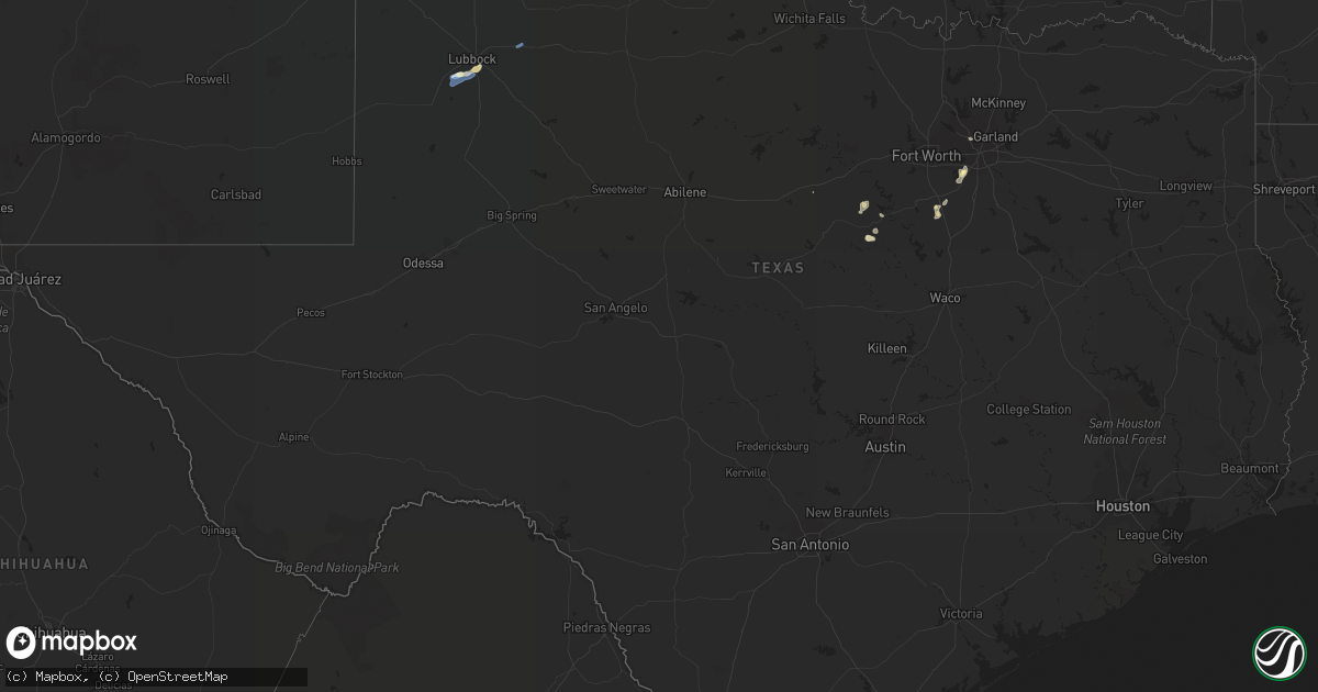
Hail Map in Texas on September 3, 2022
Get this storm
September 3 map
$229
one time, instant access
Download today. No call, no setup
Keep the $229
Bought the map and want the full workflow? Apply the entire $229 to a subscription within 7 days. None of it is wasted.
Every map, not just this one
This buys you this map. Subscription and you get every map we run, in the markets you choose from a few cities to whole states to nationwide. Plus real-time alerts the moment a storm fires.
Contact data
Name, contact info, occupancy, even credit band for addresses in the footprint. You go from where it hit to who to call.
Become the source they trust
Unlimited branding weather history reports on demand. You already have the documented answer ready for the property owner, and you are the one who showed up with it.
Property data and RoofTrace estimates
Pull up any address you have got, its value and the exact code rules for that jurisdiction, straight from One Click Code. Then RoofTrace estimates the squares, pitch, and roof value, priced the way you price.
Storm reports in Texas
Texas
| Date | Description |
|---|---|
| 09/03/20226:50 PM CDT | Delayed report of large and hollow oak tree branches broken onto the roof of a house near grandview. Time estimated via radar. |
| 09/03/20222:57 PM CDT | West texas mesonet |
| 09/03/20222:11 PM CDT | A local report indicates 84 MPH wind near 6 SSW WOLFFORTH |
| 09/03/20222:10 PM CDT | A local report indicates 59 MPH wind near 6 SSW WOLFFORTH |
| 09/03/20223:58 AM CDT | At 858 PM CDT, a severe thunderstorm was located near Iredell, or 21 miles southeast of Stephenville, moving west at 15 mph. HAZARD...60 mph wind gusts and quarter size hail. SOURCE...Radar indicated. IMPACT...Hail damage to vehicles is expected. Expect wind damage to roofs, siding, and trees. Locations impacted include... Hico and Iredell. |
| 09/03/20223:56 AM CDT | At 856 PM CDT, a severe thunderstorm was located 10 miles northwest of Dinosaur Valley State Park, or 13 miles southwest of Granbury, moving west at 10 mph. HAZARD...60 mph wind gusts and quarter size hail. SOURCE...Radar indicated. IMPACT...Hail damage to vehicles is expected. Expect wind damage to roofs, siding, and trees. Locations impacted include... Stephenville, Morgan Mill and Tolar. |
| 09/03/202212:36 AM CDT | At 535 PM CDT, a severe thunderstorm was located over Cedar Hill, moving southwest at 20 mph. HAZARD...60 mph wind gusts and penny size hail. SOURCE...Radar indicated. IMPACT...Expect damage to roofs, siding, and trees. Locations impacted include... Arlington, Grand Prairie, Mansfield, Desoto, Cedar Hill, Duncanville, Lancaster, Waxahachie, Midlothian, Glenn Heights, Red Oak, Alvarado, Ovilla, Venus, Oak Leaf, Maypearl and Cedar Hill State Park.This includes the following highways... Interstate 35E between mile markers 399 and 416. Interstate 20 between mile markers 454 and 465. |
| 09/02/20229:18 PM CDT | At 217 PM CDT, a severe thunderstorm was located 4 miles west of Slide, or 12 miles southwest of Lubbock, moving southwest at 10 mph. HAZARD...60 mph wind gusts. SOURCE...Radar indicated. IMPACT...Expect damage to roofs, siding, and trees. Locations impacted include... Slide, Meadow, Ropesville and New Home. |
All States Impacted by Hail Map on September 3, 2022
Cities Impacted by Hail Map on September 3, 2022
- Grandview, TX
- Okarche, OK
- Kingfisher, OK
- Newkirk, OK
- Kaw City, OK
- Dallas, TX
- Adairville, KY
- Russellville, KY
- Pinconning, MI
- Tonkawa, OK
- Billings, OK
- Hunter, OK
- Turners Station, KY
- Campbellsburg, KY
- Carrollton, KY
- Oklahoma City, OK
- Providence, KY
- Dawson Springs, KY
- Nebo, KY
- Alpha, IL
- Woodhull, IL
- Cerulean, KY
- Turner, MI
- Twining, MI
- Cedar Hill, TX
- Medford, OK
- Edmond, OK
- Alto, MI
- Middleville, MI
- Hastings, MI
- Freeport, MI
- Lodi, WI
- Dane, WI
- Arlington, WI
- Shelbyville, KY
- Eminence, KY
- Helena, OK
- Lamont, OK
- Pond Creek, OK
- Nash, OK
- Quitaque, TX
- Sterling, MI
- Watonga, OK
- Springfield, TN
- Herndon, KY
- Dexter, KY
- Murray, KY
- Slaton, TX
- Lubbock, TX
- Iredell, TX
- Pawhuska, OK
- Silverton, TX
- Marion, KY
- Clay, KY
- Trabuco Canyon, CA
- Shidler, OK
- Oak Grove, KY
- Dover, TN
- Indian Mound, TN
- Bumpus Mills, TN
- Big Rock, TN
- Sabina, OH
- Wilmington, OH
- Fairfax, OK
- Duncanville, TX
- Midlothian, TX
- Saint Croix, IN
- English, IN
- McCune, KS
- Magnolia, AR
- Wolfforth, TX
- Tolar, TX
- Bluff Dale, TX
- Ropesville, TX
- Black Oak, AR
- Spring Green, WI
- Arena, WI
- Ridgeway, WI
- Richland, IN
- Boonville, IN
- Hammon, OK
- Butler, OK
- Geary, OK
- Almo, KY
- Hardin, KY
- Cadiz, KY
- Chrisney, IN
- Gentryville, IN
- Yukon, OK
- Waunakee, WI
- Cross Plains, WI
- Whittemore, MI
- Prescott, MI
- Stockton, IL
- Sauk City, WI
- Mazomanie, WI
- Sturgis, KY
- Alexandria, TN
- Liberty, TN
- Clarksville, MI
- Chandler, OK
- Gracey, KY
- Cubero, NM
- Bethany, OK
- Alvarado, TX
- Wakita, OK
- Lenapah, OK
- Glen Rose, TX
- Tennyson, IN
- Lamar, IN
- Rockport, IN
- Hurricane Mills, TN
- Garber, OK
- Bowling Green, KY
- Clare, MI
- Mingus, TX
- Walnut Springs, TX
- Jones, OK
- Spencer, OK
- Stewart, TN
- Aline, OK
- Santa Claus, IN
- Wilson, TX
- Tahoka, TX
- Ralls, TX


