Hail Map on September 3, 2022
Get this storm
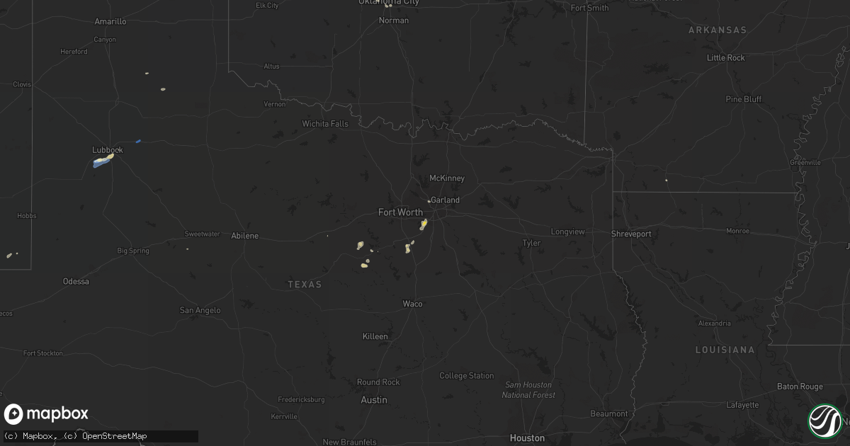
September 3 map
$229
one time, instant access
Download today. No call, no setup
Keep the $229
Bought the map and want the full workflow? Apply the entire $229 to a subscription within 7 days. None of it is wasted.
Every map, not just this one
This buys you this map. Subscription and you get every map we run, in the markets you choose from a few cities to whole states to nationwide. Plus real-time alerts the moment a storm fires.
Contact data
Name, contact info, occupancy, even credit band for addresses in the footprint. You go from where it hit to who to call.
Become the source they trust
Unlimited branding weather history reports on demand. You already have the documented answer ready for the property owner, and you are the one who showed up with it.
Property data and RoofTrace estimates
Pull up any address you have got, its value and the exact code rules for that jurisdiction, straight from One Click Code. Then RoofTrace estimates the squares, pitch, and roof value, priced the way you price.
States Impacted by Hail Map on September 3, 2022
Storm reports
Texas
| Date | Description |
|---|---|
| 09/03/20226:50 PM CDT | Delayed report of large and hollow oak tree branches broken onto the roof of a house near grandview. Time estimated via radar. |
| 09/03/20222:57 PM CDT | West texas mesonet |
| 09/03/20222:11 PM CDT | A local report indicates 84 MPH wind near 6 SSW WOLFFORTH |
| 09/03/20222:10 PM CDT | A local report indicates 59 MPH wind near 6 SSW WOLFFORTH |
| 09/03/20223:58 AM CDT | At 858 PM CDT, a severe thunderstorm was located near Iredell, or 21 miles southeast of Stephenville, moving west at 15 mph. HAZARD...60 mph wind gusts and quarter size hail. SOURCE...Radar indicated. IMPACT...Hail damage to vehicles is expected. Expect wind damage to roofs, siding, and trees. Locations impacted include... Hico and Iredell. |
| 09/03/20223:56 AM CDT | At 856 PM CDT, a severe thunderstorm was located 10 miles northwest of Dinosaur Valley State Park, or 13 miles southwest of Granbury, moving west at 10 mph. HAZARD...60 mph wind gusts and quarter size hail. SOURCE...Radar indicated. IMPACT...Hail damage to vehicles is expected. Expect wind damage to roofs, siding, and trees. Locations impacted include... Stephenville, Morgan Mill and Tolar. |
| 09/03/202212:36 AM CDT | At 535 PM CDT, a severe thunderstorm was located over Cedar Hill, moving southwest at 20 mph. HAZARD...60 mph wind gusts and penny size hail. SOURCE...Radar indicated. IMPACT...Expect damage to roofs, siding, and trees. Locations impacted include... Arlington, Grand Prairie, Mansfield, Desoto, Cedar Hill, Duncanville, Lancaster, Waxahachie, Midlothian, Glenn Heights, Red Oak, Alvarado, Ovilla, Venus, Oak Leaf, Maypearl and Cedar Hill State Park.This includes the following highways... Interstate 35E between mile markers 399 and 416. Interstate 20 between mile markers 454 and 465. |
| 09/02/20229:18 PM CDT | At 217 PM CDT, a severe thunderstorm was located 4 miles west of Slide, or 12 miles southwest of Lubbock, moving southwest at 10 mph. HAZARD...60 mph wind gusts. SOURCE...Radar indicated. IMPACT...Expect damage to roofs, siding, and trees. Locations impacted include... Slide, Meadow, Ropesville and New Home. |
Kansas
| Date | Description |
|---|---|
| 09/03/20221:10 AM CDT | At 610 PM CDT, a severe thunderstorm was located 3 miles north of Grainola, moving south at 15 mph. HAZARD...60 mph wind gusts and nickel size hail. SOURCE...Radar indicated. IMPACT...Expect damage to roofs, siding, and trees. Locations in or near the path include... Shidler... Grainola... Foraker... Webb City... Apperson... |
Arizona
| Date | Description |
|---|---|
| 09/03/202212:56 AM CDT | At 556 PM MST, a severe thunderstorm was located over Gadsden, moving northwest at 25 mph. HAZARD...60 mph wind gusts. SOURCE...Radar indicated. IMPACT...Expect damage to roofs, siding, and trees. Locations impacted include... Somerton, Gadsden and San Luis. This includes AZ Route 195 between mile markers 5 and 8. |
| 09/03/202212:30 AM CDT | At 530 PM MST, a severe thunderstorm was located 9 miles southeast of Somerton, moving northwest at 25 mph. HAZARD...60 mph wind gusts. SOURCE...Radar indicated. IMPACT...Expect damage to roofs, siding, and trees. Locations impacted include... Yuma, Somerton and Gadsden. This includes AZ Route 195 between mile markers 5 and 24. |
Nevada
| Date | Description |
|---|---|
| 09/03/20225:48 PM CDT | Ash meadows raws observed a peak wind gust of 71 mph. Time estimated based on radar. |
California
| Date | Description |
|---|---|
| 09/02/202211:36 PM CDT | At 436 PM PDT, a severe thunderstorm was located near Texas Springs Campground, or 7 miles east of Furnace Creek, moving south at 10 mph. HAZARD...60 mph wind gusts. SOURCE...Radar indicated. IMPACT...Expect damage to roofs and trees. Locations impacted include... Furnace Creek and Texas Springs Campground. |
| 09/02/20229:48 PM CDT | At 248 PM PDT, a severe thunderstorm was located near Temescal Valley, or near Lake Elsinore, moving west at 25 mph. HAZARD...60 mph wind gusts and penny size hail. SOURCE...Radar indicated. IMPACT...Expect damage to roofs, siding, and trees. Locations impacted include... Southern Corona, western Lake Elsinore, Perris, Temescal Valley and Lake Mathews. |
| 09/02/20229:32 PM CDT | At 232 PM PDT, a severe thunderstorm was located over Trabuco Canyon, or 8 miles northeast of Mission Viejo, moving west at 20 mph. HAZARD...60 mph wind gusts and penny size hail. SOURCE...Radar indicated. IMPACT...Expect damage to roofs, siding, and trees. Locations impacted include... Irvine, Mission Viejo, Rancho Santa Margarita, Foothill Ranch, Trabuco Canyon, Silverado, El Toro, Laguna Hills, El Toro Station Cdp and Limestone Canyon Regional Park. |
| 09/02/20229:08 PM CDT | At 208 PM PDT, a severe thunderstorm was located near Hesperia, moving west at 15 mph. HAZARD...60 mph wind gusts and penny size hail. SOURCE...Radar indicated. IMPACT...Expect damage to roofs, siding, and trees. Locations impacted include... Victorville, Hesperia, I-15 Through The Cajon Pass, Hwy 138 Between I-15 And Hwy 2, Silverwood Lake Rec Area and Phelan. |
| 09/02/20229:01 PM CDT | At 201 PM PDT, a severe thunderstorm was located near Lake Elsinore, moving west at 10 mph. HAZARD...60 mph wind gusts and penny size hail. SOURCE...Radar indicated. IMPACT...Expect damage to roofs, siding, and trees. Locations impacted include... Southwestern Lake Elsinore, Rancho Santa Margarita, Ortega Highway, Trabuco Canyon, Las Flores, Temescal Valley, Trabuco Highlands, Lakeland Village and Coto De Caza. |
Michigan
| Date | Description |
|---|---|
| 09/02/202210:34 PM CDT | At 334 PM EDT, a severe thunderstorm was located over Twining, or 8 miles northwest of Au Gres, moving east at 20 mph. HAZARD...Quarter size hail. SOURCE...Radar indicated. IMPACT...Damage to vehicles is expected. Locations impacted include... Au Gres, Maple Ridge, Omer, Twining and Turner. |
Tennessee
| Date | Description |
|---|---|
| 09/02/20229:15 PM CDT | Tree down on car in the bel-aire community in tullahoma. - twitter report-. |
Oklahoma
| Date | Description |
|---|---|
| 09/03/20222:09 AM CDT | At 709 PM CDT, a severe thunderstorm was located near Lenapah, moving south at 15 mph. HAZARD...60 mph wind gusts and nickel size hail. SOURCE...Radar indicated. IMPACT...Expect damage to roofs, siding, and trees. Locations in or near the path include... Nowata... Delaware... Lenapah... |
| 09/03/202212:54 AM CDT | At 554 PM CDT, a severe thunderstorm was located 7 miles southwest of Hardy, moving south at 20 mph. HAZARD...60 mph wind gusts and quarter size hail. SOURCE...Radar indicated. IMPACT...Hail damage to vehicles is expected. Expect wind damage to roofs, siding, and trees. Locations impacted include... Ponca City, Kaw City, Kildare and Kaw Lake. |
| 09/03/202212:07 AM CDT | At 507 PM CDT, a severe thunderstorm was located near Billings, moving southeast at 10 mph. HAZARD...60 mph wind gusts and quarter size hail. SOURCE...Radar indicated. IMPACT...Hail damage to vehicles is expected. Expect wind damage to roofs, siding, and trees. Locations impacted include... Garber, Billings and Ceres. |
| 09/02/202211:23 PM CDT | At 422 PM CDT, a cluster of severe thunderstorms were located from near Nash to near Jefferson to near Lamont, moving south at 15 mph. HAZARD...60 mph wind gusts and quarter size hail. SOURCE...Radar indicated. IMPACT...Hail damage to vehicles is expected. Expect wind damage to roofs, siding, and trees. Locations impacted include... Enid, Pond Creek, Garber, Billings, Lamont, Kremlin, Breckenridge, Nash, Hunter, Fairmont, Hillsdale, Carrier, Jefferson, Vance Air Force Base and North Enid. |
| 09/02/202210:38 PM CDT | At 338 PM CDT, a cluster of severe thunderstorms were located from 3 miles south of Wakita to near Medford to near Pond Creek, moving southwest at 25 mph. HAZARD...60 mph wind gusts and half dollar size hail. SOURCE...Radar indicated. IMPACT...Hail damage to vehicles is expected. Expect wind damage to roofs, siding, and trees. Locations impacted include... Enid, Medford, Pond Creek, Wakita, Kremlin, Jet, Nash, Hillsdale, Carrier, Jefferson, eastern Great Salt Plains Lake and North Enid. |
Montana
| Date | Description |
|---|---|
| 09/03/20225:48 AM CDT | At 1047 PM MDT, severe thunderstorms were located along a line extending from 30 miles northwest of Cut Bank to 7 miles south of Valier, moving northeast at 40 mph. HAZARD...60 mph wind gusts. SOURCE...Radar indicated. IMPACT...Expect damage to roofs, siding, and trees. Locations impacted include... Shelby, Cut Bank, Conrad, Valier, Sunburst, Kevin, Sweet Grass, Dupuyer, Ethridge, Oilmont, Ledger, Galata, Santa Rita, Ferdig, Devon and Dunkirk. |
| 09/03/20224:48 AM CDT | At 947 PM MDT, severe thunderstorms were located along a line extending from 28 miles north of North Browning to 13 miles northwest of Valier to 11 miles south of Choteau, moving east at 35 mph. HAZARD...60 mph wind gusts. SOURCE...Radar indicated. IMPACT...Expect damage to roofs, siding, and trees. Locations impacted include... Shelby, Cut Bank, Conrad, Choteau, Valier, Sunburst, Dutton, Kevin, Brady, Power, Ethridge, Oilmont, Ledger, Collins, Bynum, Santa Rita, Pendroy, Ferdig, Devon and Dunkirk. |
| 09/03/20223:15 AM CDT | Mesonet station gw0625 joplin 17 north. |
| 09/03/20223:05 AM CDT | Mesonet station mtinv inverness |
| 09/03/20223:02 AM CDT | Mesonet station gw0637 bears den 9 ene. |
| 09/03/20223:00 AM CDT | Mesonet station gw0416 joplin. |
| 09/03/20222:52 AM CDT | Mesonet station gw0718 joplin 25nnw. |
| 09/03/20222:45 AM CDT | Mesonet station ew9427 chester-5nw. |
| 09/03/20222:08 AM CDT | Ambient weather station. |
| 09/03/20222:05 AM CDT | Ambient weather station. |
| 09/03/20222:00 AM CDT | Mesonet station gw2112 chester nw. |
| 09/03/20221:57 AM CDT | Mesonet station gw0659 grassy butte 2se. |
| 09/03/20221:45 AM CDT | Delayed report. Trained spotter reports a 73 mph wind gust. Time estimated via radar. |
| 09/03/202212:44 AM CDT | Mesonet station mtswt sweetgrass |
| 09/02/202211:49 PM CDT | Mesonet station mtsun sunburst |
| 09/02/202211:34 PM CDT | Ambient weather station. Little lightning detected. |
| 09/02/202211:32 PM CDT | Asos station kctb cut bank airport. |
| 09/02/202211:19 PM CDT | Mesonet station fw8513 sunburst. |
| 09/02/202210:56 PM CDT | Asos station kctb cut bank airport. |
| 09/02/202210:55 PM CDT | Asos station kctb cut bank airport. |
| 09/02/202210:55 PM CDT | Lj johnson farms cut bank ambient weather station. |
| 09/02/202210:44 PM CDT | Corrects previous tstm wnd gst report from 3 sw cut bank. Asos station kctb cut bank airport. |
| 09/02/202210:42 PM CDT | Asos station kctb cut bank airport. |
Kentucky
| Date | Description |
|---|---|
| 09/03/20223:47 PM CDT | Trees down along galloway mills rd. |
| 09/03/20223:45 PM CDT | Trees down around the 2500 block of blue level providence rd. |
| 09/03/20223:42 PM CDT | Corrects previous tstm wnd dmg report from 3 nnw rockfield. Trees took down power lines around the 1700 block of browning rd near rockfield browning rd. |
| 09/03/20223:40 PM CDT | In the weather stone subdivision trees down knocking down power lines. |
| 09/03/20223:40 PM CDT | 300 block of windsor cir. Trees took down power lines with a report of one pole on fire. |
| 09/03/20223:14 PM CDT | Tree down on gold city road near franklin. Time estimated from radar. |
| 09/02/202210:43 PM CDT | At 342 PM CDT, a severe thunderstorm was located near Memphis Junction, moving north at 30 mph. HAZARD...60 mph wind gusts. SOURCE...Radar indicated. IMPACT...Expect damage to roofs, siding, and trees. This severe thunderstorm will remain over mainly rural areas of southeastern Butler and western Warren Counties, including the following locations... Barren River, Rockfield, Rich Pond, Benleo, Rockland, Guy, Browning, Hadley, Blue Level and Greencastle. |
| 09/02/20229:58 PM CDT | At 258 PM CDT, a severe thunderstorm was located 9 miles southeast of Russellville, moving northeast at 25 mph. HAZARD...60 mph wind gusts. SOURCE...Radar indicated. IMPACT...Expect damage to roofs, siding, and trees. This severe thunderstorm will remain over mainly rural areas of southeastern Logan and western Simpson Counties, including the following locations... Neosheo, South Union, Adairville, Salmons, Schochoh, Middleton, Schweizer, Oakville, Prices Mill and Peden Mill. |
| 09/02/20228:48 PM CDT | At 148 PM CDT, a severe thunderstorm was located 7 miles east of Cobb, or 10 miles south of Dawson Springs, moving north at 20 mph. HAZARD...60 mph wind gusts and half dollar size hail. SOURCE...Radar indicated. IMPACT...Hail damage to vehicles is expected. Expect wind damage to roofs, siding, and trees. Locations impacted include... Dawson Springs. |
| 09/02/20228:34 PM CDT | At 132 PM CDT, a severe thunderstorm was located 3 miles south of Aurora, or 8 miles south of Land Between The Lakes Area, moving northeast at 15 mph. HAZARD...60 mph wind gusts and half dollar size hail. SOURCE...Radar indicated. IMPACT...Hail damage to vehicles is expected. Expect wind damage to roofs, siding, and trees. This severe thunderstorm will be near... Land Between The Lakes Area around 135 PM CDT.Other locations in the path of this severe thunderstorm includeCanton, Fenton, Golden Pond. |
Cities Impacted by Hail Map on September 3, 2022
- Grandview, TX
- Okarche, OK
- Kingfisher, OK
- Newkirk, OK
- Kaw City, OK
- Dallas, TX
- Adairville, KY
- Russellville, KY
- Pinconning, MI
- Tonkawa, OK
- Billings, OK
- Hunter, OK
- Turners Station, KY
- Campbellsburg, KY
- Carrollton, KY
- Oklahoma City, OK
- Providence, KY
- Dawson Springs, KY
- Nebo, KY
- Alpha, IL
- Woodhull, IL
- Cerulean, KY
- Turner, MI
- Twining, MI
- Cedar Hill, TX
- Medford, OK
- Edmond, OK
- Alto, MI
- Middleville, MI
- Hastings, MI
- Freeport, MI
- Lodi, WI
- Dane, WI
- Arlington, WI
- Shelbyville, KY
- Eminence, KY
- Helena, OK
- Lamont, OK
- Pond Creek, OK
- Nash, OK
- Quitaque, TX
- Sterling, MI
- Watonga, OK
- Springfield, TN
- Herndon, KY
- Dexter, KY
- Murray, KY
- Slaton, TX
- Lubbock, TX
- Iredell, TX
- Pawhuska, OK
- Silverton, TX
- Marion, KY
- Clay, KY
- Trabuco Canyon, CA
- Shidler, OK
- Oak Grove, KY
- Dover, TN
- Indian Mound, TN
- Bumpus Mills, TN
- Big Rock, TN
- Sabina, OH
- Wilmington, OH
- Fairfax, OK
- Duncanville, TX
- Midlothian, TX
- Saint Croix, IN
- English, IN
- McCune, KS
- Magnolia, AR
- Wolfforth, TX
- Tolar, TX
- Bluff Dale, TX
- Ropesville, TX
- Black Oak, AR
- Spring Green, WI
- Arena, WI
- Ridgeway, WI
- Richland, IN
- Boonville, IN
- Hammon, OK
- Butler, OK
- Geary, OK
- Almo, KY
- Hardin, KY
- Cadiz, KY
- Chrisney, IN
- Gentryville, IN
- Yukon, OK
- Waunakee, WI
- Cross Plains, WI
- Whittemore, MI
- Prescott, MI
- Stockton, IL
- Sauk City, WI
- Mazomanie, WI
- Sturgis, KY
- Alexandria, TN
- Liberty, TN
- Clarksville, MI
- Chandler, OK
- Gracey, KY
- Cubero, NM
- Bethany, OK
- Alvarado, TX
- Wakita, OK
- Lenapah, OK
- Glen Rose, TX
- Tennyson, IN
- Lamar, IN
- Rockport, IN
- Hurricane Mills, TN
- Garber, OK
- Bowling Green, KY
- Clare, MI
- Mingus, TX
- Walnut Springs, TX
- Jones, OK
- Spencer, OK
- Stewart, TN
- Aline, OK
- Santa Claus, IN
- Wilson, TX
- Tahoka, TX
- Ralls, TX