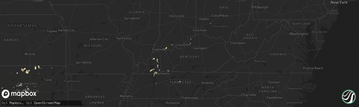
Hail Map in Kentucky on September 3, 2022
The weather event in Kentucky on September 3, 2022 includes Hail and Wind maps. 13 states and 125 cities were impacted and suffered possible damage. The total estimated number of properties impacted is 0.
Want more than just the map?
Turn this storm into a full workflow.
- Owner + property data so you know who to knock
- OnDemand branded weather history reports to win the "did we even have hail?" argument
- RoofTrace estimate so reps stop guessing numbers at the door
Bought this map? Upgrade within 7 days and we'll credit the $230. (10-15 min setup call)
Hail
Wind
0
Estimated number of impacted properties by a 1.00" hail or larger0
Estimated number of impacted properties by a 1.75" hail or larger0
Estimated number of impacted properties by a 2.50" hail or largerStorm reports in Kentucky
Kentucky
| Date | Description |
|---|---|
| 09/03/20223:47 PM CDT | Trees down along galloway mills rd. |
| 09/03/20223:45 PM CDT | Trees down around the 2500 block of blue level providence rd. |
| 09/03/20223:42 PM CDT | Corrects previous tstm wnd dmg report from 3 nnw rockfield. Trees took down power lines around the 1700 block of browning rd near rockfield browning rd. |
| 09/03/20223:40 PM CDT | In the weather stone subdivision trees down knocking down power lines. |
| 09/03/20223:40 PM CDT | 300 block of windsor cir. Trees took down power lines with a report of one pole on fire. |
| 09/03/20223:14 PM CDT | Tree down on gold city road near franklin. Time estimated from radar. |
| 09/02/202210:43 PM CDT | At 342 PM CDT, a severe thunderstorm was located near Memphis Junction, moving north at 30 mph. HAZARD...60 mph wind gusts. SOURCE...Radar indicated. IMPACT...Expect damage to roofs, siding, and trees. This severe thunderstorm will remain over mainly rural areas of southeastern Butler and western Warren Counties, including the following locations... Barren River, Rockfield, Rich Pond, Benleo, Rockland, Guy, Browning, Hadley, Blue Level and Greencastle. |
| 09/02/20229:58 PM CDT | At 258 PM CDT, a severe thunderstorm was located 9 miles southeast of Russellville, moving northeast at 25 mph. HAZARD...60 mph wind gusts. SOURCE...Radar indicated. IMPACT...Expect damage to roofs, siding, and trees. This severe thunderstorm will remain over mainly rural areas of southeastern Logan and western Simpson Counties, including the following locations... Neosheo, South Union, Adairville, Salmons, Schochoh, Middleton, Schweizer, Oakville, Prices Mill and Peden Mill. |
| 09/02/20228:48 PM CDT | At 148 PM CDT, a severe thunderstorm was located 7 miles east of Cobb, or 10 miles south of Dawson Springs, moving north at 20 mph. HAZARD...60 mph wind gusts and half dollar size hail. SOURCE...Radar indicated. IMPACT...Hail damage to vehicles is expected. Expect wind damage to roofs, siding, and trees. Locations impacted include... Dawson Springs. |
| 09/02/20228:34 PM CDT | At 132 PM CDT, a severe thunderstorm was located 3 miles south of Aurora, or 8 miles south of Land Between The Lakes Area, moving northeast at 15 mph. HAZARD...60 mph wind gusts and half dollar size hail. SOURCE...Radar indicated. IMPACT...Hail damage to vehicles is expected. Expect wind damage to roofs, siding, and trees. This severe thunderstorm will be near... Land Between The Lakes Area around 135 PM CDT.Other locations in the path of this severe thunderstorm includeCanton, Fenton, Golden Pond. |
All States Impacted by Hail Map on September 3, 2022
Cities Impacted by Hail Map on September 3, 2022
- Grandview, TX
- Okarche, OK
- Kingfisher, OK
- Newkirk, OK
- Kaw City, OK
- Dallas, TX
- Adairville, KY
- Russellville, KY
- Pinconning, MI
- Tonkawa, OK
- Billings, OK
- Hunter, OK
- Turners Station, KY
- Campbellsburg, KY
- Carrollton, KY
- Oklahoma City, OK
- Providence, KY
- Dawson Springs, KY
- Nebo, KY
- Alpha, IL
- Woodhull, IL
- Cerulean, KY
- Turner, MI
- Twining, MI
- Cedar Hill, TX
- Medford, OK
- Edmond, OK
- Alto, MI
- Middleville, MI
- Hastings, MI
- Freeport, MI
- Lodi, WI
- Dane, WI
- Arlington, WI
- Shelbyville, KY
- Eminence, KY
- Helena, OK
- Lamont, OK
- Pond Creek, OK
- Nash, OK
- Quitaque, TX
- Sterling, MI
- Watonga, OK
- Springfield, TN
- Herndon, KY
- Dexter, KY
- Murray, KY
- Slaton, TX
- Lubbock, TX
- Iredell, TX
- Pawhuska, OK
- Silverton, TX
- Marion, KY
- Clay, KY
- Trabuco Canyon, CA
- Shidler, OK
- Oak Grove, KY
- Dover, TN
- Indian Mound, TN
- Bumpus Mills, TN
- Big Rock, TN
- Sabina, OH
- Wilmington, OH
- Fairfax, OK
- Duncanville, TX
- Midlothian, TX
- Saint Croix, IN
- English, IN
- McCune, KS
- Magnolia, AR
- Wolfforth, TX
- Tolar, TX
- Bluff Dale, TX
- Ropesville, TX
- Black Oak, AR
- Spring Green, WI
- Arena, WI
- Ridgeway, WI
- Richland, IN
- Boonville, IN
- Hammon, OK
- Butler, OK
- Geary, OK
- Almo, KY
- Hardin, KY
- Cadiz, KY
- Chrisney, IN
- Gentryville, IN
- Yukon, OK
- Waunakee, WI
- Cross Plains, WI
- Whittemore, MI
- Prescott, MI
- Stockton, IL
- Sauk City, WI
- Mazomanie, WI
- Sturgis, KY
- Alexandria, TN
- Liberty, TN
- Clarksville, MI
- Chandler, OK
- Gracey, KY
- Cubero, NM
- Bethany, OK
- Alvarado, TX
- Wakita, OK
- Lenapah, OK
- Glen Rose, TX
- Tennyson, IN
- Lamar, IN
- Rockport, IN
- Hurricane Mills, TN
- Garber, OK
- Bowling Green, KY
- Clare, MI
- Mingus, TX
- Walnut Springs, TX
- Jones, OK
- Spencer, OK
- Stewart, TN
- Aline, OK
- Santa Claus, IN
- Wilson, TX
- Tahoka, TX
- Ralls, TX


