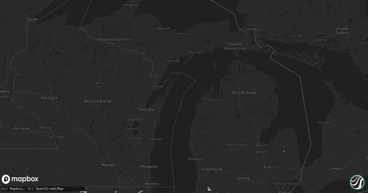
Hail Map in Michigan on September 1, 2018
Get this storm
September 1 map
$229
one time, instant access
Download today. No call, no setup
Keep the $229
Bought the map and want the full workflow? Apply the entire $229 to a subscription within 7 days. None of it is wasted.
Every map, not just this one
This buys you this map. Subscription and you get every map we run, in the markets you choose from a few cities to whole states to nationwide. Plus real-time alerts the moment a storm fires.
Contact data
Name, contact info, occupancy, even credit band for addresses in the footprint. You go from where it hit to who to call.
Become the source they trust
Unlimited branding weather history reports on demand. You already have the documented answer ready for the property owner, and you are the one who showed up with it.
Property data and RoofTrace estimates
Pull up any address you have got, its value and the exact code rules for that jurisdiction, straight from One Click Code. Then RoofTrace estimates the squares, pitch, and roof value, priced the way you price.
Storm reports in Michigan
Michigan
| Date | Description |
|---|---|
| 09/01/20186:47 PM CDT | Unoccupied trailer home destroyed near intersection of washington road and 137th avenue. Possible tornado. Time estimated from radar. |
| 09/01/20186:46 PM CDT | Ef-1 tornado with maximum winds estimated around 100 mph. Path width approximately 100 yards. Path length approximately 0.75 miles. One prefab home destroyed with numer |
| 09/01/20186:28 PM CDT | Tree down on north broadway street just north of the branch county line in union city. Time estimated from radar. |
| 09/01/20186:08 PM CDT | Ef-0 tornado with 75 mph winds was confirmed at the north end of little long lake. The path was estimated at 0.4 miles long and 100 yards wide. Several trees and limbs |
| 09/01/20185:50 PM CDT | Trees down at intersection of ab avenue and douglas avenue. Time estimated from radar. |
| 09/01/20186:54 AM CDT | At 1153 PM EDT, a severe thunderstorm was located over Colon, or 14 miles north of Sturgis, moving east at 15 mph. HAZARD...60 mph wind gusts and quarter size hail. SOURCE...Radar indicated. IMPACT...Hail damage to vehicles is expected. Expect wind damage to roofs, siding, and trees. Locations impacted include... Union City, Colon, Batavia, Leonidas, Sherwood, Matteson Lake, Hodunk and Fairfax. |
| 09/01/20183:48 AM CDT | At 847 PM EDT, a severe thunderstorm was located over Montrose, or near Birch Run, moving east at 35 mph. HAZARD...60 mph wind gusts. SOURCE...Radar indicated. IMPACT...Expect damage to roofs, siding, and trees. This severe thunderstorm will be near, Clio and Mount Morris around 900 PM EDT.Other locations impacted by this severe thunderstorm include Burt. |
| 09/01/20183:30 AM CDT | At 830 PM EDT, a severe thunderstorm was located near Vandercook Lake, moving east at 15 mph. HAZARD...60 mph wind gusts. SOURCE...Radar indicated. IMPACT...Expect damage to roofs, siding, and trees. Locations impacted include... Jackson... Vandercook Lake... Grass Lake... Leoni... Napoleon... Norvell... Oak Point... Michigan Center... |
| 09/01/20183:18 AM CDT | At 817 PM EDT, a severe thunderstorm was located near Edmore, or 12 miles north of Stanton, moving east at 25 mph. HAZARD...60 mph wind gusts. SOURCE...Radar indicated. IMPACT...Expect damage to roofs, siding, and trees. Locations impacted include... Mount Pleasant... Alma... St. Louis... Shepherd... Edmore... Elm Hall... Cedar Lake... Six Lakes... Vestaburg... Blanchard... Forest Hill... Riverdale... Wyman... Winn... |
| 09/01/20182:53 AM CDT | At 753 PM EDT, a severe thunderstorm was located 7 miles northwest of Fremont, or 10 miles south of Coldwater, moving northeast at 20 mph. HAZARD...60 mph wind gusts and quarter size hail. SOURCE...Radar indicated. IMPACT...Hail damage to vehicles is expected. Expect wind damage to roofs, siding, and trees. Locations impacted include... Coldwater, Quincy, Kinderhook, California, Gilead, East Gilead, Marble Lake, Lake Of The Woods and Coldwater Lake.This includes Interstate 69 in Michigan between mile markers 1 and14. |
| 09/01/20182:48 AM CDT | At 748 PM EDT, a severe thunderstorm was located over Spring Arbor, or 7 miles west of Jackson, moving east at 15 mph. HAZARD...60 mph wind gusts. SOURCE...Radar indicated. IMPACT...Expect damage to roofs, siding, and trees. Locations impacted include... Jackson... Vandercook Lake... Leoni... Spring Arbor... Sandstone... Michigan Center... |
| 09/01/20182:39 AM CDT | At 739 PM EDT, a severe thunderstorm was located over Leslie, or 7 miles south of Mason, moving east at 20 mph. HAZARD...60 mph wind gusts. SOURCE...Radar indicated. IMPACT...Expect damage to roofs, siding, and trees. Locations impacted include... Leslie... Stockbridge... Bunker Hill... Dansville... Eden... Fitchburg... |
| 09/01/20182:21 AM CDT | At 721 PM EDT, a severe thunderstorm was located over Union City, or 10 miles northwest of Coldwater, moving east at 25 mph. HAZARD...60 mph wind gusts and quarter size hail. SOURCE...Radar indicated. IMPACT...Hail damage to vehicles is expected. Expect wind damage to roofs, siding, and trees. Locations impacted include... Albion... Marshall... Homer... Union City... Burlington... Marengo... Tekonsha... |
| 09/01/20181:34 AM CDT | At 632 PM EDT, a severe thunderstorm was located near Otsego, or near Plainwell, moving east at 20 mph. HAZARD...60 mph wind gusts and penny size hail. SOURCE...Radar indicated. IMPACT...Expect damage to roofs, siding, and trees. Locations impacted include... Kalamazoo... Plainwell... Otsego... Richland... Comstock Northwest... Alamo... Cooper... Delton... |
| 08/31/201810:35 PM CDT | At 335 AM EDT, a severe thunderstorm was located over Alberta, or near L'anse, moving northeast at 30 mph. HAZARD...60 mph wind gusts and quarter size hail. SOURCE...Radar indicated. IMPACT...Hail damage to vehicles is expected. Expect wind damage to roofs, siding, and trees. Locations impacted include... Baraga, L'anse, Alberta, Skanee, Canyon Falls, Herman, Assinins, Mount Arvon and Prickett Dam. |
| 08/31/20189:07 PM CDT | At 207 AM EDT, a severe thunderstorm was located 8 miles southwest of Silver City, or 20 miles southwest of Ontonagon, moving east at 40 mph. HAZARD...60 mph wind gusts and quarter size hail. SOURCE...Radar indicated. IMPACT...Hail damage to vehicles is expected. Expect wind damage to roofs, siding, and trees. Locations impacted include... Ontonagon, Silver City, Norwich, White Pine and Victoria Dam. |
| 08/31/20187:38 PM CDT | Numerous trees down blocking cutler and upton roads. Time estimated from radar. |
| 08/31/20187:35 PM CDT | Ef-0 tornado with estimated maximum winds of 80 mph. Maximum width approximately 100 yards. Path estimated at 4 miles though bulk of damage occurred along the northeast |
| 08/31/20187:35 PM CDT | Location is the mid point of a 3.8 mile damage path. Trees down and some roof damage to homes. Possible tornado. Time estimated from radar. |
| 08/31/20187:12 PM CDT | Ef-0 tornado with winds estimated between 65-80 mph confirmed near jackson... Mi. Path estimated at 1.5 miles long with a maximum width of 225 yards. Many trees were sn |
All States Impacted by Hail Map on September 1, 2018
Cities Impacted by Hail Map on September 1, 2018
- Oakes, ND
- Knoxville, IA
- Monroe, IA
- Pleasantville, IA
- Dandridge, TN
- White Pine, TN
- Dunbar, NE
- Syracuse, NE
- Otoe, NE
- Sidney, NE
- Potter, NE
- Mitchellville, IA
- Colfax, IA
- Prairie City, IA
- Hobbs, NM
- Adel, IA
- Chadron, NE
- Whitney, NE
- Glen Elder, KS
- Tonalea, AZ
- Adams, NE
- Glenwood, IA
- Avoca, NE
- Pacific Junction, IA
- Panama, NE
- Plattsmouth, NE
- Sidney, IA
- Martell, NE
- Percival, IA
- Elmwood, NE
- Eagle, NE
- Tabor, IA
- Douglas, NE
- Roca, NE
- Murray, NE
- Thurman, IA
- Weeping Water, NE
- Bennet, NE
- Nehawka, NE
- Palmyra, NE
- Nebraska City, NE
- Walton, NE
- Malvern, IA
- Lincoln, NE
- Hickman, NE
- Firth, NE
- Unadilla, NE
- Union, NE
- Jetersville, VA
- Amelia Court House, VA
- Albia, IA
- Stockton, KS
- Plainville, KS
- Palco, KS
- Lucas, KS
- Luray, KS
- Trail City, SD
- McLaughlin, SD
- Glencross, SD
- Timber Lake, SD
- Edgerton, MN
- Vernon Hills, IL
- Mundelein, IL
- Lake Zurich, IL
- Clifton, KS
- Haddam, KS
- Holbrook, AZ
- Natoma, KS
- Sierra Blanca, TX
- Flagstaff, AZ
- Winslow, AZ
- Des Moines, IA
- Johnston, IA
- Hedrick, IA
- Dalton, NE
- Dix, NE
- Hays, KS
- Victoria, KS
- McIntosh, SD
- Staples, MN
- Motley, MN
- Fox Lake, IL
- Ingleside, IL
- Mchenry, IL
- Selby, SD
- Java, SD
- Eagle Butte, SD
- Apple River, IL
- Scales Mound, IL
- Show Low, AZ
- Padroni, CO
- Stoneham, CO
- Selfridge, ND
- Fort Yates, ND
- Mankato, KS
- Courtland, KS
- Webber, KS
- Ankeny, IA
- Bondurant, IA
- Berwick, IA
- Altoona, IA
- Urbandale, IA
- Rothsay, MN
- Pelican Rapids, MN
- Erhard, MN
- Elizabeth, MN
- Grosse Ile, MI
- Trenton, MI
- Wyandotte, MI
- Riverview, MI
- Keota, IA
- Harper, IA
- South English, IA
- Gila, NM
- Silver City, NM
- Lebanon, SD
- Gettysburg, SD
- Oskaloosa, IA
- Fremont, IA
- Rose Hill, IA
- Cedar, IA
- Delta, IA
- Madrid, IA
- Belleville, KS
- Cornell, WI
- Holcombe, WI
- Cumming, IA
- West Des Moines, IA
- Tatum, NM
- Dallas Center, IA
- Granger, IA
- Woodward, IA
- New Raymer, CO
- Amarillo, TX
- Marshall, MI
- North English, IA
- Alleman, IA
- Brewster, MN
- Osborne, KS
- Willcox, AZ
- Polo, IL
- Chippewa Falls, WI
- Eddyville, IA
- Ottumwa, IA
- Oregon, IL
- Leaf River, IL
- Gorham, KS
- Russell, KS
- Sylvan Grove, KS
- Bunker Hill, KS
- Walker, KS
- Pfeifer, KS
- Catharine, KS
- Hunter, KS
- Otis, KS
- Paradise, KS
- Ellis, KS
- Waldo, KS
- Lidgerwood, ND
- Wyndmere, ND
- Wakeeney, KS
- Wishek, ND
- Zeeland, ND
- Chana, IL
- Rochelle, IL
- Tallassee, TN
- Formoso, KS
- Brownell, KS
- Mount Pleasant, IA
- Wayland, IA
- Pequot Lakes, MN
- New York Mills, MN
- Sebeka, MN
- Fulton, IL
- Thomson, IL
- Agate, CO
- Gloucester, VA
- Whites Creek, TN
- Nashville, TN
- Concho, AZ
- Snowflake, AZ
- Powhatan, VA
- Crozier, VA
- Bouton, IA
- Minburn, IA
- Perry, IA
- Richland, IA
- Fairfield, IA
- Savanna, IL
- Mount Carroll, IL
- Morrowville, KS
- Burr Oak, KS
- Jamestown, KS
- Hubbell, NE
- Tipton, KS
- Downs, KS
- Cawker City, KS
- Munden, KS
- Beloit, KS
- Narka, KS
- Mahaska, KS
- Agenda, KS
- Esbon, KS
- Cuba, KS
- Republic, KS
- Scandia, KS
- Randall, KS
- Reynolds, NE
- Concordia, KS
- Jewell, KS
- Fairbury, NE
- Norway, KS
- Cary, IL
- Barrington, IL
- Crook, CO
- Iliff, CO
- Cook, NE
- Talmage, NE
- Saint Michaels, AZ
- Pearce, AZ
- Elon, NC
- Gibsonville, NC
- Forreston, IL
- Freeport, IL
- Baileyville, IL
- Lanark, IL
- Shannon, IL
- Cumberland, IA
- Artesia, NM
- Leonard, ND
- Kimball, NE
- Cornville, AZ
- Weldona, CO
- Snow Camp, NC
- Burlington, NC
- Liberty, NC
- Leupp, AZ
- Tuba City, AZ
- Davenport, ND
- Morganton, NC
- La Crosse, KS
- Waukee, IA
- Elizabeth, IL
- Hanover, IL
- Ottertail, MN
- Rockford, IL
- Winnebago, IL
- Gilman, IA
- Blaine, KY
- Ganado, AZ
- Navajo, NM
- Oxford, NC
- Sigourney, IA
- Ollie, IA
- What Cheer, IA
- Crete, NE
- Fort Stockton, TX
- Charleston, TN
- Georgetown, TN
- Marion, ND
- Pine River, MN
- Backus, MN
- Strasburg, ND
- Animas, NM
- Parkers Prairie, MN
- Farmville, NC
- Greenville, NC
- Cliff, NM
- Buckhorn, NM
- Nisswa, MN
- Earlham, IA
- Stirum, ND
- Mount Morris, IL
- Fontanelle, IA
- Julian, NE
- Peru, NE
- Brock, NE
- Cambridge, IA
- Manakin Sabot, VA
- Albany, IL
- Runnells, IA
- Woodston, KS
- Gurley, NE
- Menahga, MN
- Wadena, MN
- Kellogg, IA
- Reasnor, IA
- Newton, IA
- Ogallah, KS
- Hill City, KS
- Dodge City, KS
- Seminole, TX
- Union City, MI
- Sherwood, MI
- Utica, KS
- Collyer, KS
- Concord, NC
- Whiteriver, AZ
- Corning, IA
- Ransom, KS
- Elida, NM
- San Simon, AZ
- Hahira, GA
- Frederick, SD
- Maryville, TN
- Beardsley, MN
- Bronson, MI
- Cortez, CO
- Edgeley, ND
- Dickey, ND
- Sheldon, WI
- Gilman, WI
- Elfrida, AZ
- Marquette, MI
- Muscatine, IA
- Illinois City, IL
- Enderlin, ND
- Fingal, ND
- Nome, ND
- Cochrane, WI
- Auburn, NE
- Sterling, IL
- Dixon, IL
- Montgomery, MI
- Fremont, IN
- Coldwater, MI
- Lawrenceville, VA
- Searsboro, IA
- Montezuma, IA
- New Sharon, IA
- Chicago, IL
- Harwood Heights, IL
- Denton, NC
- Lexington, NC
- Pillager, MN
- Browerville, MN
- Brainerd, MN
- Baxter, MN
- Verndale, MN
- Quemado, NM
- Suffolk, VA
- Lake In The Hills, IL
- Algonquin, IL
- Hoffman Estates, IL
- Schaumburg, IL
- Grinnell, IA
- Genoa, WV
- Grimes, IA
- Polk City, IA
- Hewitt, MN
- Henning, MN
- Litchville, ND
- Kathryn, ND
- Fort Ransom, ND
- Horace, ND
- Darlington, WI
- Merrifield, MN
- Huntley, IL
- Hampshire, IL
- Marengo, IL
- Dundee, IL
- Union, IL
- Benson, AZ
- East Lynn, WV
- Wayne, WV
- Hanna City, IL
- Trivoli, IL
- Bethel, NC
- Oak Brook, IL
- Berkeley, IL
- Melrose Park, IL
- Elmhurst, IL
- Bellwood, IL
- Stone Park, IL
- Hillside, IL
- Villa Park, IL
- Highmore, SD
- Sheldon, ND
- Ogden, IA
- Branchland, WV
- Lamoure, ND
- Berlin, ND
- Maxwell, IA
- Huxley, IA
- Windsor Heights, IA
- De Soto, IA
- Slater, IA
- Clive, IA
- Ames, IA
- Van Meter, IA
- Kelley, IA
- Norwalk, IA
- Pleasant Hill, IA
- Elkhart, IA
- Cochise, AZ
- Tombstone, AZ
- Morrison, IL
- Thatcher, AZ
- Franklinton, NC
- Pep, NM
- Viola, IL
- Happy Jack, AZ
- Mcleod, ND
- Fenton, IL
- Erie, IL
- Williamsburg, NM
- Truth Or Consequences, NM
- Sutherland, IA
- Paullina, IA
- Cleghorn, IA
- Meriden, IA
- Odebolt, IA
- Creedmoor, NC
- Stem, NC
- Albion, MI
- Goldsboro, NC
- Tekonsha, MI
- Athens, MI
- Burlington, MI
- Marlette, MI
- Kingston, MI
- Woosung, IL
- Osceola, IA
- New Virginia, IA
- Deer Trail, CO
- Arenas Valley, NM
- Deer Creek, MN
- Arlington Heights, IL
- Palatine, IL
- Rolling Meadows, IL
- Durham, NC
- Wake Forest, NC
- Raleigh, NC
- Watauga, SD
- Milledgeville, IL
- Randolph, IA
- Kykotsmovi Village, AZ
- Lovington, NM
- Allegan, MI
- Kalamazoo, MI
- Gobles, MI
- Otsego, MI
- Chappell, NE
- Clyde, KS
- Central City, IA
- Anamosa, IA
- Douglas, AZ
- Lyndon, IL
- Merry Hill, NC
- Colerain, NC
- Wolverton, MN
- Sterling, NE
- Onida, SD
- Scottsville, VA
- Brighton, IA
- Wauconda, IL
- Montour, IA
- Bowdle, SD
- Hanover Park, IL
- Clatonia, NE
- Pickrell, NE
- De Witt, NE
- Cortland, NE
- Salt Flat, TX
- Angola, IN
- Greenbrier, TN
- Goodlettsville, TN
- Bridgeport, NE
- Beatrice, NE
- Villisca, IA
- Lisbon, ND
- Onslow, IA
- West Fargo, ND
- Park, KS
- Hoxie, KS
- Quinter, KS
- Tohatchi, NM
- Deming, NM
- Perham, MN
- Kindred, ND
- Lindenwood, IL
- Mayhill, NM
- Farmington, IL
- Libertyville, IL
- Grayslake, IL
- Kingston, IL
- Kirkland, IL
- Belvidere, IL
- Leonidas, MI
- Colon, MI
- Aldrich, MN
- Wakefield, VA
- Dearborn, MI
- Detroit, MI
- Melvindale, MI
- Concord, MI
- Chadwick, IL
- Halifax, NC
- Sisseton, SD
- Prescott, IA
- Wilber, NE
- Linn, KS
- Mooreton, ND
- Hankinson, ND
- Milnesand, NM
- Wausau, WI
- Steinhatchee, FL
- Pleasant Hill, NC
- Deep River, IA
- Isabel, SD
- Polo, MO
- Primghar, IA
- Collins, IA
- Colo, IA
- Elberon, VA
- Galena, IL
- Packwood, IA
- Webster, IA
- Cape Coral, FL
- Hague, ND
- Peetz, CO
- Barnes City, IA
- Imogene, IA
- Emerson, IA
- Hastings, IA
- Clifton, AZ
- Box Elder, SD
- Underwood, MN
- Fergus Falls, MN
- Hayesville, IA
- Martinsburg, IA
- South Hill, VA
- Wyoming, IA
- Monmouth, IA
- Monroe Center, IL
- Davis Junction, IL
- Woodstock, IL
- Virginia Beach, VA
- Mapleton, ND
- Otley, IA
- Crawford, NE
- Shullsburg, WI
- Glenham, SD
- Mound City, SD
- McCracken, KS
- East Leroy, MI
- Fulton, MI
- Winterset, IA
- San Carlos, AZ
- Elk Mound, WI
- Menomonie, WI
- Dent, MN
- Colfax, WI
- Zwingle, IA
- Elk Grove Village, IL
- Roselle, IL
- Merino, CO
- Richville, MN
- Cogswell, ND
- Rapid City, SD
- Bagley, IA
- Bellevue, IA
- Henderson, NC
- Mingo, IA
- Plymouth, NE
- Jansen, NE
- Pecatonica, IL
- Hallam, NE
- Friend, NE
- Des Plaines, IL
- Elbow Lake, MN
- Alexis, IL
- Aledo, IL
- Rippey, IA
- Lawson, MO
- Westport, SD
- Prophetstown, IL
- Rock Falls, IL
- Letts, IA
- Glasford, IL
- Canton, IL
- Elmwood, IL
- Brimfield, IL
- Yates City, IL
- Mancos, CO
- Garysburg, NC
- Skippers, VA
- Woodstock, MN
- Evanston, IL
- Swanton, NE
- Indian Rocks Beach, FL
- Jud, ND
- Liberal, KS
- Gastonia, NC
- Menlo, IA
- Sedona, AZ


