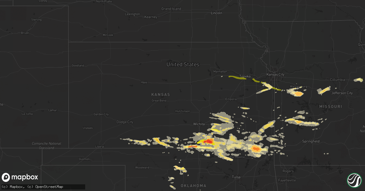
Hail Map in Kansas on September 1, 2014
Get this storm
September 1 map
$229
one time, instant access
Download today. No call, no setup
Keep the $229
Bought the map and want the full workflow? Apply the entire $229 to a subscription within 7 days. None of it is wasted.
Every map, not just this one
This buys you this map. Subscription and you get every map we run, in the markets you choose from a few cities to whole states to nationwide. Plus real-time alerts the moment a storm fires.
Contact data
Name, contact info, occupancy, even credit band for addresses in the footprint. You go from where it hit to who to call.
Become the source they trust
Unlimited branding weather history reports on demand. You already have the documented answer ready for the property owner, and you are the one who showed up with it.
Property data and RoofTrace estimates
Pull up any address you have got, its value and the exact code rules for that jurisdiction, straight from One Click Code. Then RoofTrace estimates the squares, pitch, and roof value, priced the way you price.
Storm reports in Kansas
Kansas
| Date | Description |
|---|---|
| 09/01/20146:48 PM CDT | Via eoc |
| 09/01/20146:47 PM CDT | Via spotter network |
| 09/01/20146:44 PM CDT | Hail ranged in size from three quarters of an inch to one inch. |
| 09/01/20146:42 PM CDT | A local report indicates 1.25 inch wind near 1 S EDNA |
| 09/01/20146:38 PM CDT | A local report indicates 1.25 inch wind near 9 SW WINFIELD |
| 09/01/20146:36 PM CDT | A local report indicates 1.00 inch wind near 3 N GEUDA SPRINGS |
| 09/01/20146:14 PM CDT | A local report indicates 1.00 inch wind near 15 SE WELLINGTON |
| 08/31/201410:55 PM CDT | Also reported 60 mph winds using web report. |
| 08/31/201410:27 PM CDT | A local report indicates 1.50 inch wind near SPRING HILL |
| 08/31/201410:25 PM CDT | A local report indicates 1.00 inch wind near EUREKA |
| 08/31/20149:47 PM CDT | Report of several trees... Limbs... And power lines down around the parsons... Big hill... And mound valley. |
| 08/31/20148:45 PM CDT | Estimated 70 to 80 mph. |
| 08/31/20148:45 PM CDT | Emergency manager reported possible home damage in the town of hewins... Which is around 8 miles west-northwest of elgin. |
| 08/31/20148:36 PM CDT | Tree reported down across road near intersection of southwest quaker rd and southwest 30th street. County officials removed tree. |
| 08/31/20148:35 PM CDT | Tornado was reported 7 miles southeast of cedar vale via emergency management. |
| 08/31/20148:30 PM CDT | Relayed by em. |
| 08/31/20148:25 PM CDT | Tornado reported by chief of police and deputies in cedar vale. |
| 08/31/20148:20 PM CDT | Large tornado on the ground. |
| 08/31/20148:13 PM CDT | Brief rope tornado touchdown. Via eoc. |
| 08/31/20148:10 PM CDT | A local report indicates 1.00 inch wind near 12 W BAXTER SPRINGS |
| 08/31/20148:08 PM CDT | Chaser reported cone tornado on the ground. |
| 08/31/20148:08 PM CDT | Via eoc. |
| 08/31/20147:36 PM CDT | Tree reported down across road near intersection of southwest quaker rd and southwest 30th street. County officials removed tree. Corrected time. |
| 08/31/20147:33 PM CDT | Report via twitter. |
| 08/31/20147:25 PM CDT | Via twitter. |
| 08/31/20147:17 PM CDT | Via eoc. Nickel to quarter size hail. |
| 08/31/20147:17 PM CDT | A local report indicates 60 MPH wind near 4 SW LATHAM |
| 08/31/20147:00 PM CDT | A local report indicates 3.00 inch wind near 4 S WINFIELD |
All States Impacted by Hail Map on September 1, 2014
Cities Impacted by Hail Map on September 1, 2014
- West Alton, MO
- Florissant, MO
- Independence, KS
- Rock, KS
- Gridley, KS
- Le Roy, KS
- Westphalia, KS
- Burlington, KS
- Dunnegan, MO
- Humansville, MO
- Bolivar, MO
- Nevada, MO
- Deerfield, MO
- Hawley, MN
- Leon, KS
- Latham, KS
- Ballwin, MO
- Cambridge, KS
- Grenola, KS
- Augusta, KS
- Howard, KS
- Severy, KS
- Fall River, KS
- Piedmont, KS
- Douglass, KS
- Atlanta, KS
- Tyro, KS
- Havana, KS
- Caney, KS
- Pawhuska, OK
- Copan, OK
- Niotaze, KS
- Chautauqua, KS
- Sedan, KS
- Peru, KS
- Ottawa, KS
- Oxford, KS
- Geuda Springs, KS
- Winfield, KS
- Welch, OK
- Coffeyville, KS
- S Coffeyville, OK
- Chetopa, KS
- Edna, KS
- Bartlett, KS
- Meno, OK
- Goltry, OK
- Lahoma, OK
- Roosevelt, OK
- Vinita, OK
- Bluejacket, OK
- Virgil, KS
- Alva, OK
- Ashland, KS
- Lindale, GA
- Rantoul, KS
- Osceola, MO
- Nisswa, MN
- Brainerd, MN
- Eldridge, MO
- Bushnell, FL
- Stockton, MO
- Hazelton, KS
- Okeene, OK
- Sharon, KS
- Holden, MO
- Clinton, MO
- Blairstown, MO
- Calhoun, MO
- Leeton, MO
- Chilhowee, MO
- Windsor, MO
- Bonita Springs, FL
- Eureka, MO
- Lenapah, OK
- Mound Valley, KS
- Cherryvale, KS
- Perham, MN
- Kaycee, WY
- El Dorado Springs, MO
- Milo, MO
- Elkland, MO
- Buffalo, MO
- Columbia, SC
- Oswego, KS
- Altamont, KS
- Parsons, KS
- Caldwell, KS
- Ponca City, OK
- Edwardsville, IL
- Eureka, KS
- El Dorado, KS
- Osakis, MN
- Villard, MN
- Sauk Centre, MN
- Enid, OK
- Hepler, KS
- Fort Scott, KS
- Garland, KS
- Farlington, KS
- Girard, KS
- Arcadia, KS
- Walnut, KS
- Andrews, SC
- Lamar, MO
- West Union, MN
- Garfield, MN
- Alexandria, MN
- Spring Hill, KS
- Wann, OK
- Miami, OK
- Wyandotte, OK
- Gardner, KS
- Coldwater, KS
- Englewood, KS
- Protection, KS
- Cedar Vale, KS
- Fredonia, KS
- Saint George, SC
- Cape Charles, VA
- Valentine, NE
- Harrisonville, MO
- Saint Louis, MO
- Newkirk, OK
- Braman, OK
- Attica, KS
- Anthony, KS
- Yates Center, KS
- Neosho Falls, KS
- Pine Ridge, SD
- Granby, MO
- Neosho, MO
- Bucyrus, KS
- New Century, KS
- Olathe, KS
- Half Way, MO
- Flemington, MO
- Louisburg, MO
- Polk, MO
- Belle Plaine, KS
- Hobart, OK
- Gotebo, OK
- Quapaw, OK
- Jackson, GA
- Barnesville, GA
- Forsyth, GA
- Burns, KS
- Wellsville, KS
- Paola, KS
- Gordon, NE
- Merriman, NE
- Argonia, KS
- Danville, KS
- Montgomery City, MO
- Hitchcock, OK
- Wildwood, MO
- High Ridge, MO
- Valley Park, MO
- Fenton, MO
- Fairfax, OK
- Medicine Lodge, KS
- Granite City, IL
- Saint Paul, KS
- Bluff City, KS
- Wellington, KS
- Arnold, MO
- South Haven, KS
- Lawton, OK
- Mountain View, OK
- Medford, OK
- Elk City, KS
- Longton, KS
- Elk Falls, KS
- McCune, KS
- Maple City, KS
- Dexter, KS
- Udall, KS
- Burden, KS
- Shidler, OK
- Bartlesville, OK
- Barnsdall, OK
- Arkansas City, KS
- Burbank, OK
- Manchester, OK
- Eudora, KS
- Edgerton, KS
- Gwynn, VA
- Hudgins, VA
- Quincy, MO
- Pillager, MN
- Motley, MN
- Pequot Lakes, MN
- Jasper, MO
- Oronogo, MO
- Carthage, MO
- Liberal, MO
- Whitman, NE
- Watonga, OK
- Hemingford, NE
- Hay Springs, NE
- Rushville, NE
- Pocahontas, IL
- New Douglas, IL
- Wheatland, MO
- New Florence, MO
- Kaw City, OK
- Harper, KS
- Alapaha, GA
- Baxter, MN
- Salters, SC
- Douglas, OK
- Warrensburg, MO
- Highland, IL
- Piqua, KS
- Nelson, MN
- Hardtner, KS
- Lake City, KS
- Kiowa, KS
- Towanda, KS
- Clarksburg, MO
- California, MO
- Bunceton, MO
- Prairie Home, MO
- Florence, MO
- Mora, MO
- Otterville, MO
- Tipton, MO
- Syracuse, MO
- Smithton, MO
- Stover, MO
- Versailles, MO
- Fortuna, MO
- Kilmarnock, VA
- Waukomis, OK
- Isle, MN
- Butler, MO
- Foster, MO
- Peck, KS
- Johnstown, NE
- Saint Peter, IL
- Weaubleau, MO
- Collins, MO
- Grenville, SD
- Weir, KS
- Carl Junction, MO
- Scammon, KS
- Galena, KS
- Columbus, KS
- Pittsburg, KS
- Webb City, MO
- Asbury, MO
- Ringwood, OK
- Drummond, OK
- Helena, OK
- Fairmont, OK
- Carrier, OK
- Roslyn, SD
- Currie, NC
- Defiance, MO
- Gray Summit, MO
- Labadie, MO
- Imperial, MO
- Washington, MO
- Chesterfield, MO
- Dupo, IL
- Augusta, MO
- Columbia, IL
- Pacific, MO
- Saint Albans, MO
- House Springs, MO
- East Carondelet, IL
- Villa Ridge, MO
- Dennis, KS
- Green Ridge, MO
- Burwell, NE
- Edgewood, IL
- Farina, IL
- Fairland, OK
- Freeman, MO
- Peculiar, MO
- Rhine, GA
- Milan, GA
- Nashville, GA
- Ray City, GA
- Long Lane, MO
- Fowler, KS
- Fair Play, MO
- Dearing, KS
- Moline, KS
- Delaware, OK
- Liberty, KS
- Hudson, IA
- Waterloo, IA
- Williamsburg, MO
- New Baden, IL
- Broxton, GA
- Carterville, MO
- Joplin, MO
- Opolis, KS
- Centerview, MO
- Kingfisher, OK
- Cape Coral, FL
- Ulen, MN
- Chula, GA
- Dewey, OK
- Greenville, IL
- Bartlett, NE
- Galesburg, KS
- Amelia, NE
- Humboldt, KS
- Sun City, KS
- Newnan, GA
- Fort Myers Beach, FL
- Fort Myers, FL
- Elgin, SC
- Jacksonville, GA
- Jerico Springs, MO
- Sheldon, MO
- Seneca, MO
- Reeds, MO
- Burlington, OK
- Waldron, KS
- Millstadt, IL
- Callaway, MN
- Knob Noster, MO
- Garden City, MO
- Savonburg, KS
- Clearwater, KS
- East Saint Louis, IL
- Aragon, GA
- Cedartown, GA
- Fairview, MO
- Stella, MO
- Meridian, OK
- Guthrie, OK
- Valdosta, GA
- Farwell, MN
- Neodesha, KS
- Thayer, KS
- Ava, MO
- Tunas, MO
- Hahira, GA
- East Alton, IL
- Alton, IL
- Saint Charles, MO
- Sarcoxie, MO
- Rocky Point, NC
- Conway Springs, KS
- Milan, KS
- Mulvane, KS
- Cassoday, KS
- Treece, KS
- Beaumont, KS
- Bronaugh, MO
- Picher, OK
- Commerce, OK
- North Miami, OK
- Rosalia, KS
- Arma, KS
- Mayfield, KS
- Cherokee, KS
- Amorita, OK
- Baxter Springs, KS
- Nash, OK
- Rome, GA
- Dent, MN
- Freeport, KS
- Lebanon, MO
- Richards, MO
- Southard, OK
- Fort White, FL
- Sutherland, NE
- Cave Spring, GA
- Prescott, KS
- Toronto, KS
- Douglas, WY
- Alhambra, IL
- Glyndon, MN
- Cherokee, OK
- Robinson, IL
- Junction City, KS
- Grantville, GA
- Centertown, MO
- Altoona, KS
- Creighton, MO
- Urich, MO
- Gettysburg, SD
- Jet, OK
- Wood River, IL
- Hartford, IL
- Roxana, IL
- South Roxana, IL
- Cleveland, MO
- Walker, MO
- Blackville, SC
- Barnwell, SC
- Riverton, KS
- Diamond, MO
- Jonesburg, MO
- Wilmore, KS
- Mindenmines, MO
- Buffalo, KS
- Interior, SD
- Scenic, SD
- Wanblee, SD
- Carlos, MN
- Brandon, MN
- Portage Des Sioux, MO
- Louisburg, KS
- Alma, KS
- Maple Hill, KS
- Berryton, KS
- Topeka, KS
- Paxico, KS
- McFarland, KS
- Baldwin City, KS
- Lawrence, KS


