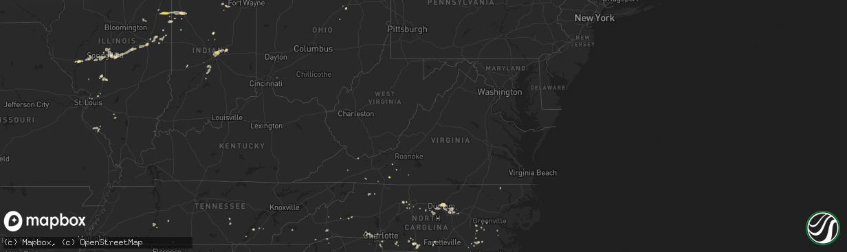
Hail Map in Virginia on August 30, 2024
The weather event in Virginia on August 30, 2024 includes Hail, Wind, and Tornado maps. 17 states and 337 cities were impacted and suffered possible damage. The total estimated number of properties impacted is 105.
Want more than just the map?
Turn this storm into a full workflow.
- Owner + property data so you know who to knock
- OnDemand branded weather history reports to win the "did we even have hail?" argument
- RoofTrace estimate so reps stop guessing numbers at the door
Bought this map? Upgrade within 7 days and we'll credit the $230. (10-15 min setup call)
Hail
Wind
Tornado
105
Estimated number of impacted properties by a 1.00" hail or larger0
Estimated number of impacted properties by a 1.75" hail or larger0
Estimated number of impacted properties by a 2.50" hail or largerStorm reports in Virginia
Virginia
| Date | Description |
|---|---|
| 08/30/20245:27 PM CDT | Tree down on witten valley road. |
| 08/30/20245:14 PM CDT | Corrects previous tstm wnd dmg report from tazewell. Trees down across the county. Reports from 6-8pm at 911 center. Time estimated from radar. |
| 08/30/20245:05 PM CDT | Tree and power lines down. |
| 08/30/20244:58 PM CDT | Tree down along u.s. 460. |
| 08/30/20243:52 PM CDT | Thunderstorm winds blew down one tree branch on forest lane near the intersection with skyline highway. |
| 08/30/20243:10 PM CDT | Tree down on rivermont heights road blocking both lanes. |
| 08/30/20242:59 PM CDT | Tree down blocking one lane on koehler road. |
| 08/30/20242:51 PM CDT | Large tree down on northbound lane of appalachian drive. |
| 08/30/20242:45 PM CDT | Tree down blocking one lane of traffic on rockwood park road. |
| 08/30/20242:20 PM CDT | Large tree limbs down. Time estimated from radar. |
| 08/30/20242:15 PM CDT | Multiple trees down near and along childress road in montgomery county. One was large enough where a crew with a chainsaw was called in. |
| 08/30/20242:00 PM CDT | Tree about two feet in diameter split and fell on residents property. Location was near community cemetery in christiansburg... Va. |
| 08/30/20242:00 PM CDT | Several trees down in alum ridge neighborhood. Trees blocked lanes and had to be removed by chainsaw. |
| 08/30/20241:36 PM CDT | A local report indicates 1.00 inch wind near 2 NW Laurel Fork |
All States Impacted by Hail Map on August 30, 2024
Cities Impacted by Hail Map on August 30, 2024
- Alpharetta, GA
- Roswell, GA
- Sainte Genevieve, MO
- Hohenwald, TN
- Lake Toxaway, NC
- Modoc, IL
- Ellis Grove, IL
- Chester, IL
- Como, NC
- Morrisville, NC
- Raleigh, NC
- Newport, NC
- Perryville, MO
- Bonne Terre, MO
- Murfreesboro, NC
- Knightdale, NC
- Mcminnville, TN
- Wake Forest, NC
- Laurel Fork, VA
- Weaverville, NC
- Walsh, IL
- Wendell, NC
- Chapel Hill, NC
- Durham, NC
- Ball Ground, GA
- Greensboro, GA
- Hendersonville, NC
- Fletcher, NC
- Almond, NC
- Horse Shoe, NC
- Mills River, NC
- Centre, AL
- Troy, SC
- Sautee Nacoochee, GA
- Pittsboro, NC
- Cleveland, GA
- Graham, NC
- Carrboro, NC
- Nashville, IL
- Old Fort, NC
- Marion, NC
- Bassett, VA
- Newbury, OH
- Chagrin Falls, OH
- Novelty, OH
- Litchfield, IL
- Morganton, NC
- Clifton, TN
- Du Bois, IL
- Winchester, IL
- Snow Camp, NC
- Burton, OH
- Vanceboro, NC
- Warrenton, MO
- Elko, GA
- Pittsfield, IL
- Bath Springs, TN
- Zebulon, NC
- New Hill, NC
- Nebo, NC
- Butler, IL
- Bloomington, IN
- Decaturville, TN
- Ernul, NC
- Rock Creek, OH
- Marietta, SC
- Orwell, OH
- Carlinville, IL
- Goshen, OH
- Liberty, NC
- Dugspur, VA
- Chardon, OH
- Nilwood, IL
- Raymond, IL
- Chatham, IL
- New Berlin, IL
- Snow Hill, NC
- Jacksonville, IL
- Buena Vista, GA
- Ellaville, GA
- Calhoun, GA
- Adairsville, GA
- Medora, IL
- Ellery, IL
- Riner, VA
- Vina, AL
- Hamilton, AL
- Edwardsville, IL
- Saint Louis, MO
- Wooster, OH
- Creston, OH
- Springfield, IL
- Odonnell, TX
- Lakeville, OH
- Alexander, IL
- Burbank, OH
- West Salem, OH
- Alhambra, IL
- La Grange, NC
- Sherman, IL
- Williamsville, IL
- Ozona, TX
- Pink Hill, NC
- Trenton, NC
- Granite City, IL
- Tahoka, TX
- Winfield, MO
- Old Monroe, MO
- Farber, MO
- Vandalia, MO
- Laddonia, MO
- La Fayette, GA
- Kalamazoo, MI
- Galesburg, MI
- Cherokee, AL
- Tremont, MS
- Commerce, GA
- Jefferson, GA
- Middletown, MO
- Saint Joseph, TN
- Marine, IL
- Summerville, GA
- Athens, TN
- Scotts, MI
- Largo, FL
- Seminole, FL
- Gillespie, IL
- Riceville, TN
- Floyd, VA
- Hillsboro, IL
- Decatur, TN
- High Point, NC
- Georgetown, TN
- Cassopolis, MI
- Seven Springs, NC
- Loami, IL
- Greensboro, NC
- Jamestown, NC
- Marcellus, MI
- Watseka, IL
- Raeford, NC
- Forrest, IL
- Strawn, IL
- Vandalia, MI
- Jones, MI
- Crescent City, IL
- Ashkum, IL
- Gilman, IL
- Atlanta, GA
- Canon, GA
- Squire, WV
- Bandy, VA
- Royston, GA
- Kernersville, NC
- Winston Salem, NC
- Cropsey, IL
- Mendon, MI
- Colon, MI
- Fairburn, GA
- Colfax, NC
- Sheldon, IL
- Hookerton, NC
- Gail, TX
- Bronson, MI
- Grifton, NC
- Kinston, NC
- Douglasville, GA
- Nappanee, IN
- Wakarusa, IN
- Goshen, IN
- New Paris, IN
- Millersburg, IN
- Palmetto, GA
- Milford, IL
- Berea, KY
- Dawson, IL
- Mechanicsburg, IL
- Edinburg, IL
- Riverton, IL
- Rochester, IL
- Elberton, GA
- Buffalo, IL
- Mount Auburn, IL
- Stockland, IL
- Fowler, IN
- Hartwell, GA
- Brook, IN
- Kentland, IN
- Goodland, IN
- Polk, PA
- Utica, PA
- Ellerbe, NC
- Rockingham, NC
- Mount Gilead, NC
- McGrady, NC
- Remington, IN
- Topeka, IN
- Ligonier, IN
- Galax, VA
- Lilesville, NC
- Hixson, TN
- Soddy Daisy, TN
- Rensselaer, IN
- McKee, KY
- Blue Mound, IL
- Richmond, KY
- Illiopolis, IL
- Hamlet, NC
- Marston, NC
- Garland, NC
- Waverly, IL
- Iroquois, IL
- Ulman, MO
- Brumley, MO
- Pleasant Garden, NC
- Wolcott, IN
- Ambia, IN
- New Baltimore, MI
- New Haven, MI
- Casco, MI
- Fayetteville, NC
- Donovan, IL
- Wolcottville, IN
- Lagrange, IN
- Tyner, KY
- Argenta, IL
- Morgantown, KY
- Decatur, IL
- Niantic, IL
- Rossville, IL
- Rankin, IL
- Saint Joseph, IL
- Charlotte, NC
- Peachland, NC
- Marshville, NC
- Monticello, IL
- Cisco, IL
- Milmine, IL
- Oreana, IL
- Cerro Gordo, IL
- Gifford, IL
- Urbana, IL
- Ogden, IL
- Penfield, IL
- Thomasboro, IL
- Ivesdale, IL
- White Heath, IL
- Marine City, MI
- Fair Haven, MI
- East China, MI
- Champaign, IL
- Savoy, IL
- Saint Clair, MI
- Matthews, NC
- Earl Park, IN
- Silver Lake, IN
- Algonac, MI
- Albertson, NC
- Bessemer City, NC
- Seymour, IL
- Collison, IL
- Danville, IL
- Potomac, IL
- Alvin, IL
- Fithian, IL
- North Manchester, IN
- Hoopeston, IL
- Gastonia, NC
- Belmont, NC
- Tolono, IL
- Kings Mountain, NC
- Armstrong, IL
- Oakwood, IL
- Martinsville, IN
- Loveland, OH
- Versailles, KY
- Lexington, KY
- Homer, IL
- Morgantown, IN
- Reelsville, IN
- Brazil, IN
- Pine Village, IN
- Kempton, IN
- Tipton, IN
- Sharpsville, IN
- Winona Lake, IN
- Pierceton, IN
- Warsaw, IN
- Roaring River, NC
- Traphill, NC
- North Wilkesboro, NC
- Columbia, KY
- Travelers Rest, SC
- Mooresville, IN
- Sheridan, IN
- Magnolia, NC
- Kenansville, NC
- Beulaville, NC
- Indianapolis, IN
- Rosedale, VA
- Lebanon, VA
- Millers Creek, NC
- Hays, NC
- Troutdale, VA
- Independence, VA
- Mccordsville, IN
- Fortville, IN
- Arcadia, IN
- Greenfield, IN
- Pendleton, IN
- Fort Mill, SC
- Lancaster, SC
- Clayton, IN
- Wabash, IN
- York, SC
- Winterville, NC
- Pikeville, NC
- Farmville, NC
- Festus, MO
- Bloomsdale, MO
- Hawk Point, MO
- Sandy Lake, PA
- Sibley, IL
- Pawnee, IL
- Frankfort, IN
- Russiaville, IN
- Kokomo, IN
- Clyde, OH
- Fremont, OH
- Green Springs, OH
- Bellevue, OH
- Vickery, OH
- Castalia, OH
- Sandusky, OH
- Noblesville, IN
- Fishers, IN
- Carlton, PA


