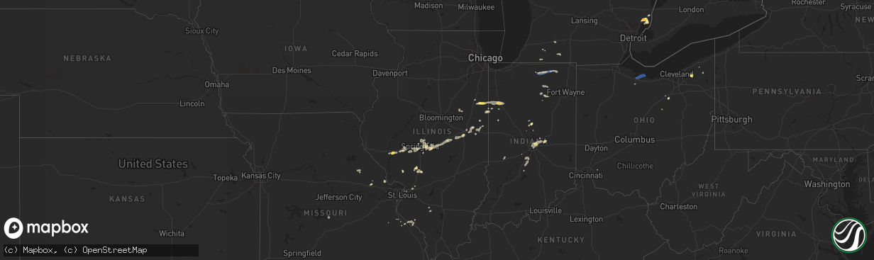
Hail Map in Illinois on August 30, 2024
The weather event in Illinois on August 30, 2024 includes Hail, Wind, and Tornado maps. 17 states and 337 cities were impacted and suffered possible damage. The total estimated number of properties impacted is 890.
Want more than just the map?
Turn this storm into a full workflow.
- Owner + property data so you know who to knock
- OnDemand branded weather history reports to win the "did we even have hail?" argument
- RoofTrace estimate so reps stop guessing numbers at the door
Bought this map? Upgrade within 7 days and we'll credit the $230. (10-15 min setup call)
Hail
Wind
Tornado
890
Estimated number of impacted properties by a 1.00" hail or larger0
Estimated number of impacted properties by a 1.75" hail or larger0
Estimated number of impacted properties by a 2.50" hail or largerStorm reports in Illinois
Illinois
| Date | Description |
|---|---|
| 08/30/20246:15 PM CDT | Large tree branch blown down at clover ln and blackthorn dr. Time estimated. |
| 08/30/20246:00 PM CDT | Power pole snapped and tree tree down on road. Time estimated from radar. |
| 08/30/20244:30 PM CDT | Approximately 6-12 diameter healthy softwood tree snapped near the base. |
| 08/30/20244:30 PM CDT | A local report indicates 1.25 inch wind near 2 NE Watseka |
| 08/30/20244:26 PM CDT | Trees down near summerville just northeast of medora. Time estimated by radar. |
| 08/30/20244:26 PM CDT | Spotter stated that a few friends in the area between medora and summerville have trees down. Time estimated by radar. |
| 08/30/20243:04 PM CDT | Trees and tree branches blown down. |
All States Impacted by Hail Map on August 30, 2024
Cities Impacted by Hail Map on August 30, 2024
- Alpharetta, GA
- Roswell, GA
- Sainte Genevieve, MO
- Hohenwald, TN
- Lake Toxaway, NC
- Modoc, IL
- Ellis Grove, IL
- Chester, IL
- Como, NC
- Morrisville, NC
- Raleigh, NC
- Newport, NC
- Perryville, MO
- Bonne Terre, MO
- Murfreesboro, NC
- Knightdale, NC
- Mcminnville, TN
- Wake Forest, NC
- Laurel Fork, VA
- Weaverville, NC
- Walsh, IL
- Wendell, NC
- Chapel Hill, NC
- Durham, NC
- Ball Ground, GA
- Greensboro, GA
- Hendersonville, NC
- Fletcher, NC
- Almond, NC
- Horse Shoe, NC
- Mills River, NC
- Centre, AL
- Troy, SC
- Sautee Nacoochee, GA
- Pittsboro, NC
- Cleveland, GA
- Graham, NC
- Carrboro, NC
- Nashville, IL
- Old Fort, NC
- Marion, NC
- Bassett, VA
- Newbury, OH
- Chagrin Falls, OH
- Novelty, OH
- Litchfield, IL
- Morganton, NC
- Clifton, TN
- Du Bois, IL
- Winchester, IL
- Snow Camp, NC
- Burton, OH
- Vanceboro, NC
- Warrenton, MO
- Elko, GA
- Pittsfield, IL
- Bath Springs, TN
- Zebulon, NC
- New Hill, NC
- Nebo, NC
- Butler, IL
- Bloomington, IN
- Decaturville, TN
- Ernul, NC
- Rock Creek, OH
- Marietta, SC
- Orwell, OH
- Carlinville, IL
- Goshen, OH
- Liberty, NC
- Dugspur, VA
- Chardon, OH
- Nilwood, IL
- Raymond, IL
- Chatham, IL
- New Berlin, IL
- Snow Hill, NC
- Jacksonville, IL
- Buena Vista, GA
- Ellaville, GA
- Calhoun, GA
- Adairsville, GA
- Medora, IL
- Ellery, IL
- Riner, VA
- Vina, AL
- Hamilton, AL
- Edwardsville, IL
- Saint Louis, MO
- Wooster, OH
- Creston, OH
- Springfield, IL
- Odonnell, TX
- Lakeville, OH
- Alexander, IL
- Burbank, OH
- West Salem, OH
- Alhambra, IL
- La Grange, NC
- Sherman, IL
- Williamsville, IL
- Ozona, TX
- Pink Hill, NC
- Trenton, NC
- Granite City, IL
- Tahoka, TX
- Winfield, MO
- Old Monroe, MO
- Farber, MO
- Vandalia, MO
- Laddonia, MO
- La Fayette, GA
- Kalamazoo, MI
- Galesburg, MI
- Cherokee, AL
- Tremont, MS
- Commerce, GA
- Jefferson, GA
- Middletown, MO
- Saint Joseph, TN
- Marine, IL
- Summerville, GA
- Athens, TN
- Scotts, MI
- Largo, FL
- Seminole, FL
- Gillespie, IL
- Riceville, TN
- Floyd, VA
- Hillsboro, IL
- Decatur, TN
- High Point, NC
- Georgetown, TN
- Cassopolis, MI
- Seven Springs, NC
- Loami, IL
- Greensboro, NC
- Jamestown, NC
- Marcellus, MI
- Watseka, IL
- Raeford, NC
- Forrest, IL
- Strawn, IL
- Vandalia, MI
- Jones, MI
- Crescent City, IL
- Ashkum, IL
- Gilman, IL
- Atlanta, GA
- Canon, GA
- Squire, WV
- Bandy, VA
- Royston, GA
- Kernersville, NC
- Winston Salem, NC
- Cropsey, IL
- Mendon, MI
- Colon, MI
- Fairburn, GA
- Colfax, NC
- Sheldon, IL
- Hookerton, NC
- Gail, TX
- Bronson, MI
- Grifton, NC
- Kinston, NC
- Douglasville, GA
- Nappanee, IN
- Wakarusa, IN
- Goshen, IN
- New Paris, IN
- Millersburg, IN
- Palmetto, GA
- Milford, IL
- Berea, KY
- Dawson, IL
- Mechanicsburg, IL
- Edinburg, IL
- Riverton, IL
- Rochester, IL
- Elberton, GA
- Buffalo, IL
- Mount Auburn, IL
- Stockland, IL
- Fowler, IN
- Hartwell, GA
- Brook, IN
- Kentland, IN
- Goodland, IN
- Polk, PA
- Utica, PA
- Ellerbe, NC
- Rockingham, NC
- Mount Gilead, NC
- McGrady, NC
- Remington, IN
- Topeka, IN
- Ligonier, IN
- Galax, VA
- Lilesville, NC
- Hixson, TN
- Soddy Daisy, TN
- Rensselaer, IN
- McKee, KY
- Blue Mound, IL
- Richmond, KY
- Illiopolis, IL
- Hamlet, NC
- Marston, NC
- Garland, NC
- Waverly, IL
- Iroquois, IL
- Ulman, MO
- Brumley, MO
- Pleasant Garden, NC
- Wolcott, IN
- Ambia, IN
- New Baltimore, MI
- New Haven, MI
- Casco, MI
- Fayetteville, NC
- Donovan, IL
- Wolcottville, IN
- Lagrange, IN
- Tyner, KY
- Argenta, IL
- Morgantown, KY
- Decatur, IL
- Niantic, IL
- Rossville, IL
- Rankin, IL
- Saint Joseph, IL
- Charlotte, NC
- Peachland, NC
- Marshville, NC
- Monticello, IL
- Cisco, IL
- Milmine, IL
- Oreana, IL
- Cerro Gordo, IL
- Gifford, IL
- Urbana, IL
- Ogden, IL
- Penfield, IL
- Thomasboro, IL
- Ivesdale, IL
- White Heath, IL
- Marine City, MI
- Fair Haven, MI
- East China, MI
- Champaign, IL
- Savoy, IL
- Saint Clair, MI
- Matthews, NC
- Earl Park, IN
- Silver Lake, IN
- Algonac, MI
- Albertson, NC
- Bessemer City, NC
- Seymour, IL
- Collison, IL
- Danville, IL
- Potomac, IL
- Alvin, IL
- Fithian, IL
- North Manchester, IN
- Hoopeston, IL
- Gastonia, NC
- Belmont, NC
- Tolono, IL
- Kings Mountain, NC
- Armstrong, IL
- Oakwood, IL
- Martinsville, IN
- Loveland, OH
- Versailles, KY
- Lexington, KY
- Homer, IL
- Morgantown, IN
- Reelsville, IN
- Brazil, IN
- Pine Village, IN
- Kempton, IN
- Tipton, IN
- Sharpsville, IN
- Winona Lake, IN
- Pierceton, IN
- Warsaw, IN
- Roaring River, NC
- Traphill, NC
- North Wilkesboro, NC
- Columbia, KY
- Travelers Rest, SC
- Mooresville, IN
- Sheridan, IN
- Magnolia, NC
- Kenansville, NC
- Beulaville, NC
- Indianapolis, IN
- Rosedale, VA
- Lebanon, VA
- Millers Creek, NC
- Hays, NC
- Troutdale, VA
- Independence, VA
- Mccordsville, IN
- Fortville, IN
- Arcadia, IN
- Greenfield, IN
- Pendleton, IN
- Fort Mill, SC
- Lancaster, SC
- Clayton, IN
- Wabash, IN
- York, SC
- Winterville, NC
- Pikeville, NC
- Farmville, NC
- Festus, MO
- Bloomsdale, MO
- Hawk Point, MO
- Sandy Lake, PA
- Sibley, IL
- Pawnee, IL
- Frankfort, IN
- Russiaville, IN
- Kokomo, IN
- Clyde, OH
- Fremont, OH
- Green Springs, OH
- Bellevue, OH
- Vickery, OH
- Castalia, OH
- Sandusky, OH
- Noblesville, IN
- Fishers, IN
- Carlton, PA


