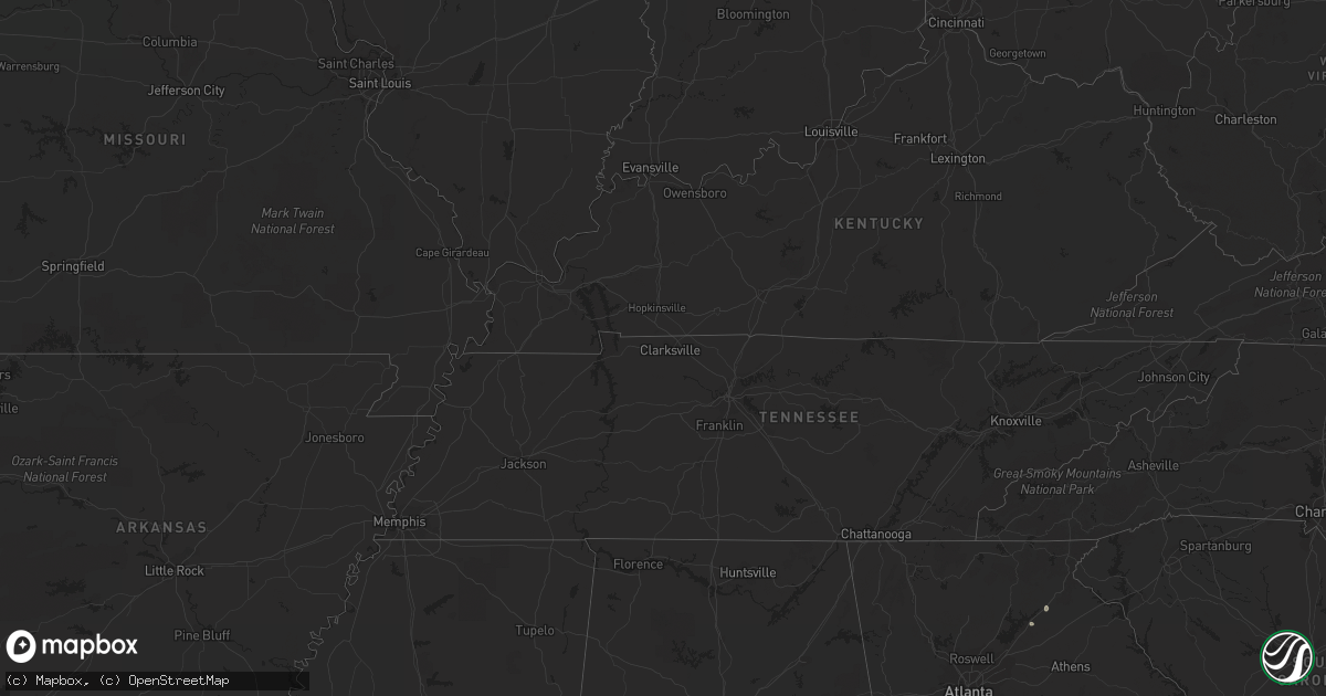
Hail Map in New York on August 30, 2022
Get this storm
August 30 map
$229
one time, instant access
Download today. No call, no setup
Keep the $229
Bought the map and want the full workflow? Apply the entire $229 to a subscription within 7 days. None of it is wasted.
Every map, not just this one
This buys you this map. Subscription and you get every map we run, in the markets you choose from a few cities to whole states to nationwide. Plus real-time alerts the moment a storm fires.
Contact data
Name, contact info, occupancy, even credit band for addresses in the footprint. You go from where it hit to who to call.
Become the source they trust
Unlimited branding weather history reports on demand. You already have the documented answer ready for the property owner, and you are the one who showed up with it.
Property data and RoofTrace estimates
Pull up any address you have got, its value and the exact code rules for that jurisdiction, straight from One Click Code. Then RoofTrace estimates the squares, pitch, and roof value, priced the way you price.
Storm reports in New York
New York
| Date | Description |
|---|---|
| 08/30/20223:25 PM CDT | Road closed due to downed tree |
| 08/30/20223:25 PM CDT | Extensive tree damage in westport with social media images showing an area on stevenson road getting hit particularly bad. Trees snapped at their bases... Trees snapped |
| 08/30/20223:12 PM CDT | Many trees down and very high winds reported |
| 08/30/20223:09 PM CDT | Downed tree blocked portion of route 28 |
| 08/30/20223:00 PM CDT | Two trees down in whitehall. Time estimated from radar. |
| 08/30/20222:35 PM CDT | About 15 to 20 trees were uprooted or snapped at hadley bend of the river golf club. Time estimated from radar. |
| 08/30/20222:25 PM CDT | Trees and wires down in the city of glens falls. Time estimated from radar. |
| 08/30/20222:20 PM CDT | I-87 northbound before exit 18 has the left lane closed due to a downed tree. Time estimated from radar. |
| 08/30/20222:10 PM CDT | Glens falls nys mesonet |
| 08/30/202212:01 AM CDT | At 500 PM EDT, a severe thunderstorm was located over Winooski, moving northeast at 40 mph. HAZARD...70 mph wind gusts and nickel size hail. SOURCE...Radar indicated. IMPACT...Expect considerable tree damage. Damage is likely to mobile homes, roofs, and outbuildings. Locations impacted include... Essex Junction, Burlington International Airport, South Burlington, Burlington, Plattsburgh, Enosburg Falls, Franklin, Jay, Cambridge, Montgomery Center, Westford, Colchester, Essex Junction Village, Sheldon, Georgia, Waterville, Grand Isle, St. Albans Town, South Alburgh and Alburgh. |
| 08/29/202211:36 PM CDT | At 436 PM EDT, a severe thunderstorm was located over Grog Harbor, moving northeast at 35 mph. HAZARD...70 mph wind gusts and ping pong ball size hail. SOURCE...Public. IMPACT...People and animals outdoors will be injured. Expect hail damage to roofs, siding, windows, and vehicles. Expect considerable tree damage. Wind damage is also likely to mobile homes, roofs, and outbuildings. Locations impacted include... Essex Junction, South Burlington, Burlington International Airport, Burlington, Vergennes, Willsboro, Winooski, Monkton Ridge, Monkton, Monkton Boro, Colchester, Essex Junction Village, Williston, Hinesburg, St. George, Shelburne, Ferrisburg, Charlotte, Waltham and South Hero. |
| 08/29/202211:06 PM CDT | At 406 PM EDT, a severe thunderstorm was located over Middleville, or 9 miles north of Herkimer, moving northeast at 30 mph. HAZARD...60 mph wind gusts and penny size hail. SOURCE...Radar indicated. IMPACT...Expect damage to roofs, siding, and trees. Locations impacted include... Ilion, Herkimer, Mohawk, Frankfort, Dolgeville, Ohio, Newport, Stratford, Middleville, Poland, Cold Brook, Russia, Fairfield, Norway, Arietta, Nobleboro, Curtis, Farrel Corner, Countryman and North Ilion. |
All States Impacted by Hail Map on August 30, 2022
Cities Impacted by Hail Map on August 30, 2022
- Estancia, NM
- Biloxi, MS
- Gulfport, MS
- Gainesville, GA
- Middletown Springs, VT
- Pennington, AL
- Boyce, VA
- Winchester, VA
- Sweet Water, AL
- Meridian, MS
- Long Beach, MS
- Butler, AL
- Rose Hill, MS
- Mineville, NY
- Moriah, NY
- Port Henry, NY
- Westport, NY
- Naples, FL
- Sandia Park, NM
- Laredo, TX
- Jachin, AL
- Bellamy, AL
- Alto, GA
- Dixons Mills, AL
- Louin, MS
- Ward, AL
- Pleasanton, TX
- Portage, ME
- Ashland, ME
- Raleigh, MS
- Pulaski, MS
- Glens Falls, NY
- Hudson Falls, NY
- Fort Ann, NY
- Queensbury, NY
- Essex, NY
- Shelburne, VT
- Moriah Center, NY
- Willsboro, NY
- Burlington, VT
- Elizabethtown, NY
- Witherbee, NY
- Culpeper, VA
- Brandy Station, VA
- Stevensburg, VA


