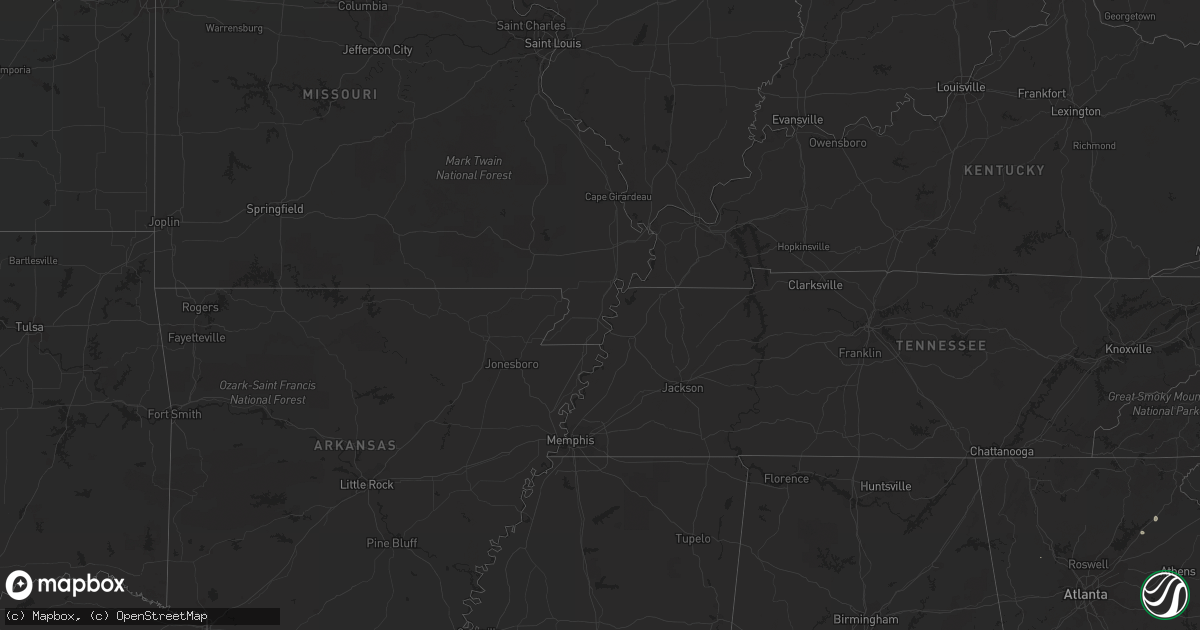
Hail Map on August 30, 2022
Get this storm
August 30 map
$229
one time, instant access
Download today. No call, no setup
Keep the $229
Bought the map and want the full workflow? Apply the entire $229 to a subscription within 7 days. None of it is wasted.
Every map, not just this one
This buys you this map. Subscription and you get every map we run, in the markets you choose from a few cities to whole states to nationwide. Plus real-time alerts the moment a storm fires.
Contact data
Name, contact info, occupancy, even credit band for addresses in the footprint. You go from where it hit to who to call.
Become the source they trust
Unlimited branding weather history reports on demand. You already have the documented answer ready for the property owner, and you are the one who showed up with it.
Property data and RoofTrace estimates
Pull up any address you have got, its value and the exact code rules for that jurisdiction, straight from One Click Code. Then RoofTrace estimates the squares, pitch, and roof value, priced the way you price.
States Impacted by Hail Map on August 30, 2022
Storm reports
New York
| Date | Description |
|---|---|
| 08/30/20223:25 PM CDT | Extensive tree damage in westport with social media images showing an area on stevenson road getting hit particularly bad. Trees snapped at their bases... Trees snapped |
| 08/30/20223:25 PM CDT | Road closed due to downed tree |
| 08/30/20223:12 PM CDT | Many trees down and very high winds reported |
| 08/30/20223:09 PM CDT | Downed tree blocked portion of route 28 |
| 08/30/20223:00 PM CDT | Two trees down in whitehall. Time estimated from radar. |
| 08/30/20222:35 PM CDT | About 15 to 20 trees were uprooted or snapped at hadley bend of the river golf club. Time estimated from radar. |
| 08/30/20222:25 PM CDT | Trees and wires down in the city of glens falls. Time estimated from radar. |
| 08/30/20222:20 PM CDT | I-87 northbound before exit 18 has the left lane closed due to a downed tree. Time estimated from radar. |
| 08/30/20222:10 PM CDT | Glens falls nys mesonet |
| 08/30/202212:01 AM CDT | At 500 PM EDT, a severe thunderstorm was located over Winooski, moving northeast at 40 mph. HAZARD...70 mph wind gusts and nickel size hail. SOURCE...Radar indicated. IMPACT...Expect considerable tree damage. Damage is likely to mobile homes, roofs, and outbuildings. Locations impacted include... Essex Junction, Burlington International Airport, South Burlington, Burlington, Plattsburgh, Enosburg Falls, Franklin, Jay, Cambridge, Montgomery Center, Westford, Colchester, Essex Junction Village, Sheldon, Georgia, Waterville, Grand Isle, St. Albans Town, South Alburgh and Alburgh. |
| 08/29/202211:36 PM CDT | At 436 PM EDT, a severe thunderstorm was located over Grog Harbor, moving northeast at 35 mph. HAZARD...70 mph wind gusts and ping pong ball size hail. SOURCE...Public. IMPACT...People and animals outdoors will be injured. Expect hail damage to roofs, siding, windows, and vehicles. Expect considerable tree damage. Wind damage is also likely to mobile homes, roofs, and outbuildings. Locations impacted include... Essex Junction, South Burlington, Burlington International Airport, Burlington, Vergennes, Willsboro, Winooski, Monkton Ridge, Monkton, Monkton Boro, Colchester, Essex Junction Village, Williston, Hinesburg, St. George, Shelburne, Ferrisburg, Charlotte, Waltham and South Hero. |
| 08/29/202211:06 PM CDT | At 406 PM EDT, a severe thunderstorm was located over Middleville, or 9 miles north of Herkimer, moving northeast at 30 mph. HAZARD...60 mph wind gusts and penny size hail. SOURCE...Radar indicated. IMPACT...Expect damage to roofs, siding, and trees. Locations impacted include... Ilion, Herkimer, Mohawk, Frankfort, Dolgeville, Ohio, Newport, Stratford, Middleville, Poland, Cold Brook, Russia, Fairfield, Norway, Arietta, Nobleboro, Curtis, Farrel Corner, Countryman and North Ilion. |
Maryland
| Date | Description |
|---|---|
| 08/30/20222:27 PM CDT | Several trees down in jefferson. |
| 08/30/20222:15 PM CDT | Tree snapped in half and lofted one hundred yards into a field. |
| 08/30/20221:56 PM CDT | Trees down on the east side of frederick. |
| 08/30/20222:55 AM CDT | At 755 PM EDT, severe thunderstorms were located along a line extending from near Salisbury to near Westover, moving east at 20 mph. HAZARD...60 mph wind gusts. SOURCE...Radar indicated. IMPACT...Expect damage to trees and powerlines. Severe thunderstorms will be near... Salisbury, Fruitland and Salisbury University around 800 PM EDT. Parsonsburg around 815 PM EDT. Snow Hill around 845 PM EDT.Other locations impacted by these severe thunderstorms include GreenHill, Catchpenny, Trinity, Salisbury-Wicomico, Cokesbury, Eden,Allen, Whitehaven, Willards and Lakewood. |
| 08/29/202211:50 PM CDT | At 450 PM EDT, a severe thunderstorm was located near Fredericksburg, moving east at 25 mph. HAZARD...60 mph wind gusts. SOURCE...Radar indicated. IMPACT...Damaging winds will cause some trees and large branches to fall. This could injure those outdoors, as well as damage homes and vehicles. Roadways may become blocked by downed trees. Localized power outages are possible. Unsecured light objects may become projectiles. Locations impacted include... King George, Dahlgren, Fairview Beach, Potomac Creek, Aquia Creek, Nanjemoy Creek, Passapatanzy, Stones Corner, Weedonville, Ninde, Brooke, Lambs Creek, White Oak, Sealston, Berthaville, Jersey, Shiloh and Dogue. |
| 08/29/202211:13 PM CDT | At 412 PM EDT, severe thunderstorms were located along a line extending from 9 miles southeast of Bealeton to near Mineral, moving east at 30 mph. HAZARD...60 mph wind gusts. SOURCE...Radar indicated. IMPACT...Damaging winds will cause some trees and large branches to fall. This could injure those outdoors, as well as damage homes and vehicles. Roadways may become blocked by downed trees. Localized power outages are possible. Unsecured light objects may become projectiles. Locations impacted include... Stafford, Fredericksburg, Quantico, Potomac Creek, Aquia Creek, Triangle, Dumfries, Massaponax, Spotsylvania, Cherry Hill, Falmouth, Passapatanzy, Stones Corner, Roseville, Garrisonville, Snell, Ramoth, Partlow, Heflin and Glenora. |
| 08/29/202211:06 PM CDT | At 406 PM EDT, a severe thunderstorm was located 7 miles east of Bealeton, or 12 miles southeast of Warrenton, moving east at 35 mph. HAZARD...60 mph wind gusts. SOURCE...Radar indicated. IMPACT...Damaging winds will cause some trees and large branches to fall. This could injure those outdoors, as well as damage homes and vehicles. Roadways may become blocked by downed trees. Localized power outages are possible. Unsecured light objects may become projectiles. Locations impacted include... Dale City, Springfield, Woodbridge, Lake Ridge, Burke, Montclair, Lorton, Newington, Dumfries, Manassas, West Springfield, Cherry Hill, Fairfax Station, Independent Hill, North Springfield, Ravensworth, Mason Neck, Nokesville, Occoquan and Catlett. |
South Carolina
| Date | Description |
|---|---|
| 08/30/202212:06 AM CDT | At 505 PM EDT, a severe thunderstorm was located 8 miles southeast of Hendersonville, or over Saluda, moving southeast at 10 mph. HAZARD...60 mph wind gusts and quarter size hail. SOURCE...Radar indicated. IMPACT...Minor hail damage to vehicles is expected. Expect wind damage to trees and power lines. Locations impacted include... Tryon, Saluda and Glassy Mountain. |
West Virginia
| Date | Description |
|---|---|
| 08/29/20229:14 PM CDT | At 214 PM EDT, severe thunderstorms were located along a line extending from near Millwood Pike to 6 miles northeast of Front Royal, moving east at 25 mph. HAZARD...60 mph wind gusts. SOURCE...Radar indicated. IMPACT...Damaging winds will cause some trees and large branches to fall. This could injure those outdoors, as well as damage homes and vehicles. Roadways may become blocked by downed trees. Localized power outages are possible. Unsecured light objects may become projectiles. Locations impacted include... Purcellville, Berryville, Round Hill, Bluemont, Boyce, Hillsboro, White Post, Gaylord, Briggs, Wickliffe, Millwood, Philomont, Bethel, Lincoln and Stringtown. |
Maine
| Date | Description |
|---|---|
| 08/30/202212:29 AM CDT | At 529 PM EDT, severe thunderstorms were located along a line extending from 6 miles southwest of Madawaska Lake to 6 miles southeast of Russel Crossing, moving east at 35 mph. HAZARD...60 mph wind gusts and nickel size hail. SOURCE...Radar indicated. IMPACT...Expect damage to trees and power lines. Locations impacted include... Presque Isle, Caribou, Fort Fairfield, Limestone, Portage, Mapleton, Washburn, Ashland, Woodland, Portage Lake, Loring, Madawaska Lake, Nashville Plantation, New Sweden, Chapman, Connor, Castle Hill, Perham, Caswell and Wade. |
| 08/30/202212:05 AM CDT | At 504 PM EDT, severe thunderstorms were located along a line extending from 8 miles south of Eagle Lake to 6 miles northeast of Big Machias Lake, moving northeast at 30 mph. HAZARD...60 mph wind gusts. SOURCE...Radar indicated. IMPACT...Expect damage to trees and power lines. Locations impacted include... Portage, Ashland, Portage Lake, Nashville Plantation, Madawaska Lake, Winterville, Westmanland and Nashville. |
Virginia
| Date | Description |
|---|---|
| 08/30/20223:39 PM CDT | Power line down near the 1700 block of richmond highway. |
| 08/30/20223:26 PM CDT | Tree down near the 100 block of choptank road. |
| 08/30/20223:21 PM CDT | Tree down near the corner of post oak road and seays road. |
| 08/30/20222:45 PM CDT | Tree down blocking roadway near the corner of north franklin street and east madison street. |
| 08/30/20222:35 PM CDT | Trees down near the corner of greens corner road and jonas road. |
| 08/30/20222:35 PM CDT | A few trees down in great falls. |
| 08/30/20222:31 PM CDT | Power lines down near the 19000 block of colonial drive. |
| 08/30/20222:21 PM CDT | Power lines down in the 7000 block of griffinsburg road. |
| 08/30/20221:15 PM CDT | Trees down blocking the roadway on the 1000 block of clay hill road. |
| 08/30/202212:57 PM CDT | Numerous wooden power poles snapped on greenwood road between senseny and dump road. |
| 08/30/202212:55 PM CDT | Large tree down blocking roadway on the 19000 block of senedo road. |
| 08/30/202212:51 PM CDT | Tree down onto power lines near the intersection of york avenue and sorrell court. |
| 08/29/202210:27 PM CDT | At 326 PM EDT, a severe thunderstorm was located over Culpeper, moving east at 35 mph. HAZARD...60 mph wind gusts. SOURCE...Radar indicated. IMPACT...Damaging winds will cause some trees and large branches to fall. This could injure those outdoors, as well as damage homes and vehicles. Roadways may become blocked by downed trees. Localized power outages are possible. Unsecured light objects may become projectiles. Locations impacted include... Culpeper, Bealeton, Nokesville, Brightwood, Opal, Remington, Catlett, Calverton, Midland, Catalpa, Elkwood, Stevensburg, Roseville, Brandy Station, Oakpark, Casanova, Jeffersonton, Winston, Heflin and Cardova. |
Alabama
| Date | Description |
|---|---|
| 08/30/20223:34 PM CDT | Emergency manager reports a couple of trees down within grove hill and the whatley community. |
| 08/30/20223:15 PM CDT | Emergency manager reports a couple sporadic trees down spread out along tallahatta springs rd. From elam rd east towards thomasville al. A couple of the trees landed on |
New Hampshire
| Date | Description |
|---|---|
| 08/30/202212:28 AM CDT | At 527 PM EDT, a severe thunderstorm was located over South Woodstock, moving northeast at 20 mph. HAZARD...60 mph wind gusts and penny size hail. SOURCE...Radar indicated. IMPACT...Expect damage to trees and powerlines. Locations impacted include... Woodstock, Hartland Four Corners, Woodstock Village, Hartland, Reading, West Windsor, Hartford, Quechee, Plymouth, Pomfret, Windsor, Cavendish, Bridgewater, Ludlow, Queechee State Park, Camp Plymouth State Park, Taftsville, South Reading, North Hartland Dam Recreation Area and West Woodstock. |
| 08/29/202211:46 PM CDT | At 446 PM EDT, a severe thunderstorm was located over South Woodstock, moving northeast at 35 mph. HAZARD...60 mph wind gusts and penny size hail. SOURCE...Radar indicated. IMPACT...Expect damage to trees and powerlines. Locations impacted include... White River Junction, Woodstock, Hartland Four Corners, Windsor, Woodstock Village, Ludlow Village, Quechee, Pomfret, Norwich, Plymouth, Hartland, Bridgewater, Reading, West Windsor, Hartford, Ludlow, Cavendish, Sharon, Mount Holly and Shrewsbury. |
Pennsylvania
| Date | Description |
|---|---|
| 08/30/20224:18 PM CDT | Trees down along interstate 81 in new milford township. Radar-estimated time. |
| 08/30/20224:10 PM CDT | Lines down on wickizer road... Brooklyn township. Radar-estimated time. |
| 08/30/20224:06 PM CDT | Multiple trees down in harford township. Also... Wires down on stephens road and state route 547. Radar-estimated time. |
| 08/30/20224:00 PM CDT | Wires down... State route 92 and feduchak lane... Lenox township. Radar-estimated time. |
| 08/30/20223:55 PM CDT | Trees and wires down over road at forest street and loomis lake road... Lenox township. Radar-estimated time. |
| 08/29/202211:43 PM CDT | At 443 PM EDT, a severe thunderstorm was located over Lake Carey, or near Tunkhannock, moving northeast at 40 mph. HAZARD...60 mph wind gusts and penny size hail. SOURCE...Radar indicated. IMPACT...Expect damage to roofs, siding, and trees. Locations impacted include... Jackson, Tunkhannock, Springville, Montrose, Dimock, Harford, New Milford, Hop Bottom, Gibson and Lake Carey. |
Vermont
| Date | Description |
|---|---|
| 08/30/20224:30 PM CDT | Tree down at park |
| 08/30/20224:17 PM CDT | Live tree snapped in half. |
| 08/30/20224:13 PM CDT | Tree down |
| 08/30/20224:04 PM CDT | Tree down |
| 08/30/20223:58 PM CDT | Large tree uprooted at appletree point |
| 08/30/20223:57 PM CDT | Downed trees |
| 08/30/20223:55 PM CDT | Several medium to large trees downed in ethan allen park. Time estimated from radar. |
| 08/30/20223:28 PM CDT | Trees and powerlines down in ira and clarendon springs. |
| 08/30/20223:40 AM CDT | Trees down |
| 08/30/202212:06 AM CDT | At 505 PM EDT, a severe thunderstorm was located over North Danville, moving north at 30 mph. HAZARD...60 mph wind gusts and penny size hail. SOURCE...Radar indicated. IMPACT...Expect damage to trees and powerlines. Locations impacted include... St. Johnsbury, Lyndon, West Burke Village, Lyndonville Village, Westmore, East Haven, Wheelock, Burke, Willoughby, Sutton, Barton, Danville, Barton Village, Sheffield, Newark, Newark Hollow, Kirby, Ferdinand, Stannard and Brownington. |
| 08/29/202211:56 PM CDT | At 455 PM EDT, a severe thunderstorm was located over Lower Granville, moving northeast at 35 mph. HAZARD...60 mph wind gusts and penny size hail. SOURCE...Radar indicated. IMPACT...Expect damage to trees and powerlines. Locations impacted include... Barre, Braintree Hill, Orange, Chelsea, Bethel, Websterville, Randolph, Waitsfield, Rochester, Berlin, Chittenden, Granville, Goshen, Barre Town, Northfield Village, Hancock, Topsham Four Corners, Washington, Northfield and Moretown. |
| 08/29/202211:17 PM CDT | At 416 PM EDT, a severe thunderstorm was located over Ira, moving northeast at 35 mph. HAZARD...60 mph wind gusts and nickel size hail. SOURCE...Radar indicated. IMPACT...Expect damage to trees and powerlines. Locations impacted include... Rutland, Killington, Tinmouth, Shrewsbury, Rutland City, Middletown Springs, Lake St. Catherine, Rutland - Southern Vermont Airport, Bridgewater, Mendon, Clarendon, West Rutland, Ira, Proctor, Chittenden, Wells, Poultney, Stockbridge, Pittsfield and Wallingford. |
| 08/29/202211:10 PM CDT | At 410 PM EDT, a severe thunderstorm was located near Crown Point Center, moving northeast at 35 mph. HAZARD...60 mph wind gusts and quarter size hail. SOURCE...Radar indicated. IMPACT...Minor hail damage to vehicles is possible. Expect wind damage to trees and powerlines. Locations impacted include... Vergennes, Moriah, Crown Point, Westport, Ferrisburg, Weybridge, Waltham, New Haven, Panton, Port Henry, Addison, Kingsland Bay State Park, D A R State Park, Crown Point Center, Bridport, Ferrisburgh, Bristol, Shoreham, Monkton and Cornwall. |
| 08/29/202211:09 PM CDT | At 407 PM EDT, a severe thunderstorm was located near Fair Haven, moving northeast at 35 mph. HAZARD...60 mph wind gusts and penny size hail. SOURCE...Radar indicated. IMPACT...Expect damage to trees and powerlines. Locations impacted include... Rutland, Middlebury, Castleton, Cornwall, Sudbury, Salisbury, Orwell, Rochester, Benson, Poultney, Chittenden, Fair Haven, West Rutland, Whiting, Goshen, West Castleton, Hancock, Hubbardton, Poultney Village and Proctor. |
| 08/29/202210:14 PM CDT | At 314 PM EDT, a severe thunderstorm was located near Hudson Falls, moving northeast at 20 mph. HAZARD...60 mph wind gusts and quarter size hail. SOURCE...Trained weather spotters. At 3:10 PM, the Glens Falls Mesonet site reported a 58 mph wind gust. IMPACT...Hail damage to vehicles is expected. Expect wind damage to roofs, siding, and trees. Locations impacted include... Glens Falls, Hudson Falls, Whitehall, Comstock, Glens Falls North, Huletts Landing, Putnam, Queensbury, Kingsbury, Mount Hope, Wright, Hampton, Fort Ann, South Bay, Chipman Point, Dunham Basin, Smiths Basin, Putnam Station, North Granville and South Bay Village. |
Cities Impacted by Hail Map on August 30, 2022
- Estancia, NM
- Biloxi, MS
- Gulfport, MS
- Gainesville, GA
- Middletown Springs, VT
- Pennington, AL
- Boyce, VA
- Winchester, VA
- Sweet Water, AL
- Meridian, MS
- Long Beach, MS
- Butler, AL
- Rose Hill, MS
- Mineville, NY
- Moriah, NY
- Port Henry, NY
- Westport, NY
- Naples, FL
- Sandia Park, NM
- Laredo, TX
- Jachin, AL
- Bellamy, AL
- Alto, GA
- Dixons Mills, AL
- Louin, MS
- Ward, AL
- Pleasanton, TX
- Portage, ME
- Ashland, ME
- Raleigh, MS
- Pulaski, MS
- Glens Falls, NY
- Hudson Falls, NY
- Fort Ann, NY
- Queensbury, NY
- Essex, NY
- Shelburne, VT
- Moriah Center, NY
- Willsboro, NY
- Burlington, VT
- Elizabethtown, NY
- Witherbee, NY
- Culpeper, VA
- Brandy Station, VA
- Stevensburg, VA