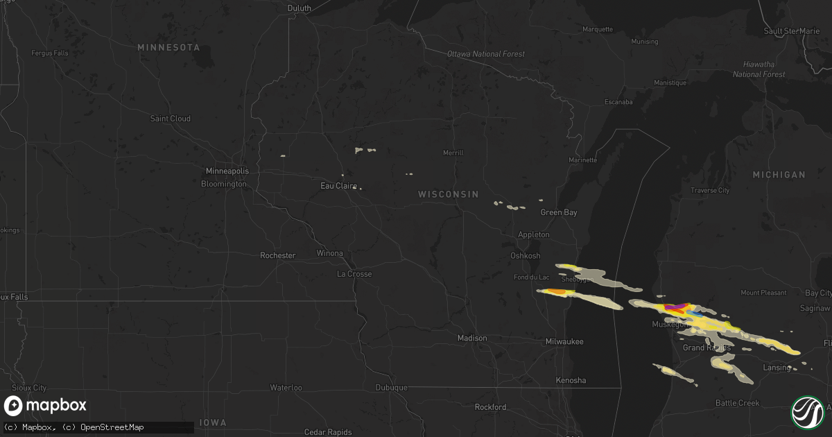
Hail Map in Wisconsin on August 29, 2019
Get this storm
August 29 map
$229
one time, instant access
Download today. No call, no setup
Keep the $229
Bought the map and want the full workflow? Apply the entire $229 to a subscription within 7 days. None of it is wasted.
Every map, not just this one
This buys you this map. Subscription and you get every map we run, in the markets you choose from a few cities to whole states to nationwide. Plus real-time alerts the moment a storm fires.
Contact data
Name, contact info, occupancy, even credit band for addresses in the footprint. You go from where it hit to who to call.
Become the source they trust
Unlimited branding weather history reports on demand. You already have the documented answer ready for the property owner, and you are the one who showed up with it.
Property data and RoofTrace estimates
Pull up any address you have got, its value and the exact code rules for that jurisdiction, straight from One Click Code. Then RoofTrace estimates the squares, pitch, and roof value, priced the way you price.
Storm reports in Wisconsin
Wisconsin
| Date | Description |
|---|---|
| 08/29/20193:00 PM CDT | Relayed by witi milwaukee from a viewer. |
| 08/29/20192:54 PM CDT | A local report indicates 1.00 inch wind near ADELL |
| 08/29/20192:23 PM CDT | Report via facebook. |
| 08/29/20191:56 AM CDT | At 656 AM CDT, a severe thunderstorm was located 10 miles south of Holyoke, or 28 miles south of Cloquet, moving east at 75 mph. HAZARD...70 mph wind gusts and quarter size hail. SOURCE...Radar indicated. IMPACT...Hail damage to vehicles is expected. Expect considerable tree damage. Wind damage is also likely to mobile homes, roofs, and outbuildings. Locations impacted include... Solon Springs, Gordon, Dairyland, Bennett, Chaffey, Harlis, Belden, Duquette, Moose Junction, Kingsdale, and Saint Croix Flowage. |
| 08/28/20199:51 PM CDT | At 251 PM CDT, a severe thunderstorm was located over Random Lake, or 10 miles south of Plymouth, moving east at 45 mph. HAZARD...60 mph wind gusts and quarter size hail. SOURCE...Radar indicated. IMPACT...Hail damage to vehicles is expected. Expect wind damage to roofs, siding, and trees. Locations impacted include... Oostburg, Belgium, Cedar Grove, Random Lake, Cascade, Adell, Waldo, Harrington Beach St Park, Gibbsville, Silver Creek, Batavia and Hingham. |
| 08/28/20199:22 PM CDT | At 222 PM CDT, a severe thunderstorm was located near Cleveland, or near Howards Grove, moving east at 50 mph. HAZARD...60 mph wind gusts and quarter size hail. SOURCE...Radar indicated. IMPACT...Hail damage to vehicles is expected. Expect wind damage to roofs, siding, and trees. Locations impacted include... Cleveland, Spring Valley and School Hill. |
| 08/28/20199:18 PM CDT | At 218 PM CDT, a severe thunderstorm was located near Camp Rokilio Scout Camp, or near Howards Grove, moving east at 30 mph. HAZARD...60 mph wind gusts and quarter size hail. SOURCE...Radar indicated. IMPACT...Hail damage to vehicles is expected. Expect wind damage to roofs, siding, and trees. Locations impacted include... Howards Grove, Elkhart Lake and Haven. |
All States Impacted by Hail Map on August 29, 2019
Cities Impacted by Hail Map on August 29, 2019
- Haslett, MI
- Williamston, MI
- Hoisington, KS
- Claflin, KS
- Stover, MO
- Gravois Mills, MO
- Edwards, MO
- Climax Springs, MO
- Preston, MO
- Macks Creek, MO
- Arkansas City, KS
- Geuda Springs, KS
- Clinton, OK
- Aspermont, TX
- Paducah, TX
- Old Glory, TX
- Weldon, IA
- Wright, KS
- Greensburg, KS
- Haviland, KS
- Wilmore, KS
- Offerle, KS
- Spearville, KS
- Bucklin, KS
- Mullinville, KS
- Hanston, KS
- Jetmore, KS
- Kinsley, KS
- Protection, KS
- Minneola, KS
- Dalhart, TX
- Nara Visa, NM
- Hayes Center, NE
- Wallace, NE
- Chillicothe, MO
- Chula, MO
- Braman, OK
- Newkirk, OK
- Perry, OK
- Billings, OK
- Jerome, AZ
- Crossroads, NM
- Tatum, NM
- Pawnee, OK
- Marysville, KS
- Blue Rapids, KS
- Jal, NM
- Cedar Springs, MI
- Rockford, MI
- Coffey, MO
- Conception, MO
- Frankfort, KS
- Maysville, MO
- Laredo, MO
- Bolckow, MO
- Seneca, KS
- Humphreys, MO
- Mound City, MO
- Graham, MO
- Wheeling, MO
- Purdin, MO
- Maitland, MO
- Browning, MO
- Weatherby, MO
- Rea, MO
- Sabetha, KS
- Jamesport, MO
- Savannah, MO
- Gallatin, MO
- White Cloud, KS
- Trenton, MO
- Vermillion, KS
- Linneus, MO
- Craig, MO
- Corning, KS
- New Hampton, MO
- Laclede, MO
- Skidmore, MO
- Maryville, MO
- Milan, MO
- Clyde, MO
- Stanberry, MO
- Oregon, MO
- Robinson, KS
- Onaga, KS
- Fairview, KS
- Westmoreland, KS
- Brookfield, MO
- Galt, MO
- Gentry, MO
- Axtell, KS
- Bethany, MO
- Oneida, KS
- Conception Junction, MO
- Pattonsburg, MO
- Highland, KS
- Darlington, MO
- Barnard, MO
- Meadville, MO
- Union Star, MO
- Guilford, MO
- Goff, KS
- Fillmore, MO
- Morrill, KS
- Beattie, KS
- Bucklin, MO
- Amazonia, MO
- Baileyville, KS
- Rulo, NE
- Forest City, MO
- Albany, MO
- Powhattan, KS
- Hiawatha, KS
- Helena, MO
- Martinsville, MO
- McFall, MO
- Centralia, KS
- Ridgeway, MO
- Rosendale, MO
- Lock Springs, MO
- Jameson, MO
- King City, MO
- Gilman City, MO
- Ensign, KS
- Copeland, KS
- Montezuma, KS
- Plains, KS
- Palisade, NE
- Selden, KS
- Minneapolis, KS
- Beloit, KS
- Barnard, KS
- Afton, IA
- Grand River, IA
- Great Bend, KS
- Rock, KS
- Burden, KS
- Chariton, IA
- Keyes, OK
- Moulton, IA
- Oberlin, KS
- Herndon, KS
- Plainville, KS
- Ellis, KS
- Sedona, AZ
- Rochester, TX
- O'Brien, TX
- Centerville, IA
- Downing, MO
- Exline, IA
- Lancaster, MO
- Udell, IA
- Drakesville, IA
- Memphis, MO
- Pulaski, IA
- Bloomfield, IA
- Albia, IA
- Coatsville, MO
- Unionville, IA
- Moravia, IA
- Oakwood, OK
- Danbury, NE
- Lenora, KS
- Clayton, KS
- Hill City, KS
- Hoxie, KS
- Penokee, KS
- Bogue, KS
- Jennings, KS
- Dickens, NE
- Dresden, KS
- Morland, KS
- Wauneta, NE
- Trenton, NE
- Norcatur, KS
- McCook, NE
- Palco, KS
- Ludell, KS
- Elsie, NE
- Norton, KS
- Culbertson, NE
- Burr Oak, KS
- Riverton, NE
- Falls City, NE
- Mooreland, OK
- Woodward, OK
- Washington, KS
- Winfield, KS
- Dexter, KS
- Guide Rock, NE
- Blue Hill, NE
- Topeka, KS
- Shelby, MI
- New Era, MI
- Middleville, MI
- Woodland, MI
- Clarksville, MI
- Hastings, MI
- Bellevue, MI
- Freeport, MI
- Vermontville, MI
- Charlotte, MI
- Alto, MI
- Lake Odessa, MI
- Caledonia, MI
- Nashville, MI
- Grand Rapids, MI
- Saranac, MI
- Lowell, MI
- Fair Grove, MO
- Springfield, MO
- Vernon, TX
- Portis, KS
- Downs, KS
- Melrose, IA
- Wynona, OK
- Lorraine, KS
- Geneseo, KS
- Kiowa, KS
- Fay, OK
- Canton, OK
- Longdale, OK
- Taloga, OK
- Seiling, OK
- Flagstaff, AZ
- Hamilton, KS
- Russell, KS
- Bunker Hill, KS
- Dorrance, KS
- Victoria, KS
- Gorham, KS
- Thomas, OK
- Payson, AZ
- Leoti, KS
- Tribune, KS
- Dodge City, KS
- Cimarron, KS
- Collyer, KS
- Wakeeney, KS
- Quinter, KS
- Kent City, MI
- Casnovia, MI
- Alma, KS
- Pond Creek, OK
- Kremlin, OK
- Mayer, AZ
- Colby, KS
- Rexford, KS
- Henderson, MI
- Elsie, MI
- Tunas, MO
- Hunter, OK
- Tonkawa, OK
- Coral, MI
- Pierson, MI
- Trufant, MI
- Randolph, KS
- Osage City, KS
- Burlingame, KS
- Scranton, KS
- Lindsborg, KS
- Roach, MO
- Camdenton, MO
- Junction City, KS
- Fort Riley, KS
- Geary, OK
- Weatherford, OK
- Seminole, OK
- Superior, NE
- Mankato, KS
- Ogallah, KS
- Hays, KS
- Sand Lake, MI
- Bailey, MI
- Sparta, MI
- Muskegon, MI
- Fremont, MI
- Holton, MI
- Grant, MI
- Ravenna, MI
- Gowen, MI
- Newaygo, MI
- Twin Lake, MI
- Fenwick, MI
- Greenville, MI
- Whitehall, MI
- Montague, MI
- Nelson, NE
- Fairfax, OK
- Burbank, OK
- Liebenthal, KS
- La Crosse, KS
- Bison, KS
- McCracken, KS
- Choctaw, OK
- Thompson, MO
- Centralia, MO
- Salisbury, MO
- Clifton Hill, MO
- Summerfield, KS
- Orleans, MI
- Kingdom City, MO
- Fulton, MO
- Corn, OK
- Waldo, KS
- Luray, KS
- Delphos, KS
- Longford, KS
- Clay Center, KS
- Chase, KS
- Partridge, KS
- Sterling, KS
- Little River, KS
- Abbyville, KS
- Lyons, KS
- Windom, KS
- Nickerson, KS
- Hutchinson, KS
- Inman, KS
- Queen City, MO
- Kewaskum, WI
- Random Lake, WI
- Oostburg, WI
- Cedar Grove, WI
- Adell, WI
- Cascade, WI
- Campbellsport, WI
- Waldo, WI
- New Richmond, WI
- Deer Park, WI
- Manhattan, KS
- Saint George, KS
- Belle Plaine, KS
- Wellington, KS
- Gotebo, OK
- Mountain View, OK
- South Haven, KS
- Boonville, MO
- Mayfield, KS
- Tecumseh, KS
- Coldwater, KS
- Salina, KS
- New Cambria, KS
- Orlando, OK
- Yale, OK
- Inavale, NE
- Red Cloud, NE
- Bartlesville, OK
- Blackwell, OK
- Lebanon, KS
- Gaylord, KS
- Esbon, KS
- New River, AZ
- Quanah, TX
- Sheboygan, WI
- Ogden, KS
- Riley, KS
- Holcombe, WI
- Cornell, WI
- Saint Johns, MI
- Princeton, MO
- Cainsville, MO
- Marion, WI
- Sawyer, KS
- Kiel, WI
- New Holstein, WI
- Cleveland, WI
- Elkhart Lake, WI
- Newton, WI
- Paxico, KS
- McFarland, KS
- Emporia, KS
- Cambridge, IA
- Goddard, KS
- Garden Plain, KS
- Kingman, KS
- Murdock, KS
- Pretty Prairie, KS
- Cheney, KS
- Ingalls, KS
- Harveyville, KS
- Eskridge, KS
- Donnellson, IA
- Grantville, KS
- El Dorado, KS
- Cambridge, KS
- Lakin, KS
- Cherokee, OK
- Loveland, OK
- Walters, OK
- Chattanooga, OK
- Custer City, OK
- Young, AZ
- Marland, OK
- Ponca City, OK
- Saugatuck, MI
- Longton, KS
- Elk City, KS
- Alva, OK
- Norwich, KS
- Belleville, KS
- Scandia, KS
- Holden, MO
- Arnett, OK
- Syracuse, KS
- Ovid, MI
- Laingsburg, MI
- Meeker, OK
- Wellston, OK
- Sun City, KS
- Alden, KS
- Cuba, KS
- Abilene, KS
- Cheyenne, OK
- Knox City, TX
- Leonardville, KS
- Olsburg, KS
- Dwight, KS
- Alta Vista, KS
- Chester, OK
- Marceline, MO
- New Cambria, MO
- Brookville, KS
- Lewis, KS
- Goodwell, OK
- Kendall, KS
- Greentop, MO
- Schoenchen, KS
- Atwood, KS
- Park, KS
- Fowler, MI
- Muir, MI
- Ionia, MI
- Conklin, MI
- Pewamo, MI
- Morrice, MI
- Owosso, MI
- Fort Supply, OK
- Clark, MO
- Moberly, MO
- Sturgeon, MO
- Cairo, MO
- Madison, MO
- Curtiss, WI
- Pulaski, WI
- Seymour, WI
- Mannford, OK
- Wilson, KS
- Coffeyville, KS
- S Coffeyville, OK
- Barnsdall, OK
- Urbandale, IA
- Courtland, KS
- Howell, MI
- Formoso, KS
- Jewell, KS
- Rule, TX
- Black Creek, WI
- Shiocton, WI
- Council Grove, KS
- Colony, OK
- Cordell, OK
- Stillwater, OK
- Cache, OK
- Macon, MO
- Excello, MO
- Bevier, MO
- Strong City, KS
- Americus, KS
- Dickens, TX
- Coats, KS
- Gilman, WI
- Ellinwood, KS
- Hudson, KS
- Atlanta, KS
- Parsons, KS
- Shidler, OK
- Dewey, AZ
- Raymond, KS
- Lincoln, MO
- Cole Camp, MO
- Warsaw, MO
- Holcomb, KS
- Garden City, KS
- Nash, OK
- Chippewa Falls, WI
- Hoyt, KS
- Mayetta, KS
- Lake City, KS
- Perry, IA
- Linden, IA
- Marshall, MO
- Hardy, NE
- South Hutchinson, KS
- Spearman, TX
- Tigerton, WI
- Osage, OK
- Sedan, KS
- Glen Elder, KS
- Tipton, KS
- Eureka, KS
- Erie, KS
- Stark, KS
- Walnut, KS
- Ralston, OK
- Odell, NE
- Bremen, KS
- Belvue, KS
- Elk Falls, KS
- Holland, MI
- Douglas, MI
- Lovilia, IA
- Russell, IA
- Williamson, IA
- Morrison, OK
- Milton, KS
- Viola, KS
- Conway Springs, KS
- Sunrise Beach, MO
- Belmont, MI
- Comstock Park, MI
- Unionville, MO
- Wakefield, KS
- Nelson, MO
- Slater, MO
- Lincoln, KS
- Glencoe, OK
- Wallace, KS
- Virgil, KS
- Madison, KS
- Niotaze, KS
- Bushton, KS
- Holyrood, KS
- Paradise, KS
- Ellsworth, KS
- Sylvan Grove, KS
- Pfeifer, KS
- Laverne, OK
- Campbell, NE
- Hurdland, MO
- Edina, MO
- Baring, MO
- Melvern, KS
- Ochelata, OK
- Allegan, MI
- Livonia, MO
- Milton, IA
- Blakesburg, IA
- Mystic, IA
- Glenwood, MO
- Cantril, IA
- Cincinnati, IA
- Otis, KS
- Armstrong, MO
- Clearwater, KS
- Hartford, KS
- Olpe, KS
- Chandler, OK
- Humeston, IA
- Woodburn, IA
- Haddam, KS
- Bristow, OK
- Kearney, NE
- Hamilton, MO
- Grenola, KS
- Red Rock, OK
- Hollenberg, KS
- Hanover, KS
- Osborne, KS
- Corydon, IA
- Pawhuska, OK
- Cleo Springs, OK
- Nunica, MI
- Coopersville, MI
- Cushing, OK
- Douglass, KS
- Webber, KS
- Nauvoo, IL
- Niota, IL
- Fort Madison, IA
- Natoma, KS
- Winona, KS
- Belgium, WI
- Sheboygan Falls, WI
- Plymouth, WI
- Cedar Vale, KS
- Kanab, UT
- Damar, KS
- Buffalo, OK
- Crowell, TX
- Wamego, KS
- Burlington, OK
- Smith Center, KS
- Nowata, OK
- Depew, OK
- Maramec, OK
- Cleveland, OK
- Pratt, KS
- Auxvasse, MO
- Hallsville, MO
- Columbia, MO
- Savonburg, KS
- Elsmore, KS
- Melcher Dallas, IA
- Lacona, IA
- Knoxville, IA
- Admire, KS
- Morrowville, KS
- Greenleaf, KS
- Barnes, KS
- Beverly, KS
- Elmer, MO
- Atlanta, MO
- Okemah, OK
- Fruitport, MI
- Belding, MI
- Ada, MI
- Howard City, MI
- Hubbardston, MI
- Udall, KS
- Mulvane, KS
- Peck, KS
- Harris, MO
- Thayer, IA
- Pep, NM
- Farmington, IA
- Effingham, KS
- Muscotah, KS
- Holton, KS
- Munday, TX
- Fall Creek, WI
- Augusta, WI
- Home, KS
- Oketo, KS
- Haven, KS
- Olmitz, KS
- Lyons, MI
- Osceola, IA
- Seymour, TX
- Derby, IA
- Santa Rosa, TX
- Sharon, OK
- Shawnee, OK
- Kensington, KS
- Eldridge, MO
- Hamilton, MI
- Fennville, MI
- Higbee, MO
- Keytesville, MO
- Freedom, OK
- Hardesty, OK
- Davidson, OK
- Vinita, OK
- West Des Moines, IA
- Mount Hope, KS
- Andale, KS
- Fayette, MO
- Sharon Springs, KS
- Peru, KS
- Fall River, KS
- Ripley, OK
- Prairie Home, MO
- Carrier, OK
- Enid, OK
- Horton, KS
- Bunceton, MO
- Allen, KS
- Canadian, TX
- Clintonville, WI
- Bear Creek, WI
- Eagleville, MO
- Tescott, KS
- Bennington, KS
- Howard, KS
- Fowlerville, MI
- Perry, MI
- Byron, MI
- Helena, OK
- Jet, OK
- Goltry, OK
- Delaware, OK
- Welch, OK
- Lenapah, OK
- White City, KS
- Milford, KS
- Chapman, KS
- Promise City, IA
- Plano, IA
- Seymour, IA
- Linn Creek, MO
- Chillicothe, TX
- Lucas, KS
- Lamont, OK
- Argonia, KS
- Milan, KS
- Oxford, KS
- Nekoma, KS
- Alexander, KS
- Rush Center, KS
- Fairview, OK
- Sapulpa, OK
- Faxon, OK
- Albert, KS
- Ashley, MI
- Bannister, MI
- Cross Timbers, MO
- Arapaho, OK
- Saint Joseph, MO
- Hardtner, KS
- Tulsa, OK
- Doniphan, NE
- Escalante, UT
- Stroud, OK
- Clive, IA
- Waukee, IA
- Lawton, OK
- Sedan, NM
- Castle, OK
- Crawford, OK
- Lovington, NM
- Bladen, NE
- Ashland, KS
- Ramona, OK
- Van Wert, IA
- Allerton, IA
- Benjamin, TX
- Electra, TX
- Ford, KS
- Fowler, KS
- Des Moines, IA
- Maud, OK
- Adel, IA
- Abbotsford, WI
- Colby, WI
- Catharine, KS
- Jamestown, KS
- Jacksonville, MO
- Callao, MO
- Stratton, NE
- Stockton, KS
- Goessel, KS
- Colwich, KS
- Derby, KS
- Andover, KS
- Walker, KS
- Assaria, KS
- Gypsum, KS
- Haysville, KS
- Marion, KS
- Towanda, KS
- Peabody, KS
- Maize, KS
- Whitewater, KS
- Hillsboro, KS
- Burrton, KS
- Halstead, KS
- Falun, KS
- Augusta, KS
- Valley Center, KS
- Burns, KS
- Kanopolis, KS
- Moundridge, KS
- North Newton, KS
- Walton, KS
- Marquette, KS
- Greenwich, KS
- Canton, KS
- Tampa, KS
- Solomon, KS
- Lost Springs, KS
- Hope, KS
- Wichita, KS
- Kechi, KS
- Potwin, KS
- Grainfield, KS
- Elbing, KS
- Ramona, KS
- Florence, KS
- Galva, KS
- Benton, KS
- Rose Hill, KS
- Mcconnell Afb, KS
- Lincolnville, KS
- Lehigh, KS
- Newton, KS
- Bentley, KS
- Buhler, KS
- Sedgwick, KS
- Roxbury, KS
- Hesston, KS
- Durham, KS
- Mcpherson, KS
- Cherryvale, KS
- Dennis, KS
- Tyro, KS
- Benedict, KS
- Westphalia, KS
- Neosho Rapids, KS
- Humboldt, KS
- Neosho Falls, KS
- Chanute, KS
- Moline, KS
- Piqua, KS
- Auburn, KS
- Yates Center, KS
- Garnett, KS
- Buffalo, KS
- Neodesha, KS
- Burlington, KS
- Galesburg, KS
- Cottonwood Falls, KS
- Saint Marys, KS
- Liberty, KS
- Maple Hill, KS
- Le Roy, KS
- Waverly, KS
- Lyndon, KS
- Lebo, KS
- Dearing, KS
- Gridley, KS
- Altoona, KS
- Iola, KS
- Caney, KS
- Reading, KS
- Fredonia, KS
- Havana, KS
- Toronto, KS
- Independence, KS
- Neal, KS
- Mound Valley, KS
- Severy, KS
- Thayer, KS
- Matfield Green, KS
- Kaw City, OK
- Maple City, KS
- Sheridan, MI


