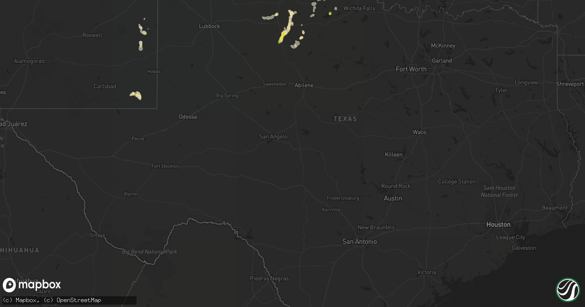
Hail Map in Texas on August 29, 2019
Get this storm
August 29 map
$229
one time, instant access
Download today. No call, no setup
Keep the $229
Bought the map and want the full workflow? Apply the entire $229 to a subscription within 7 days. None of it is wasted.
Every map, not just this one
This buys you this map. Subscription and you get every map we run, in the markets you choose from a few cities to whole states to nationwide. Plus real-time alerts the moment a storm fires.
Contact data
Name, contact info, occupancy, even credit band for addresses in the footprint. You go from where it hit to who to call.
Become the source they trust
Unlimited branding weather history reports on demand. You already have the documented answer ready for the property owner, and you are the one who showed up with it.
Property data and RoofTrace estimates
Pull up any address you have got, its value and the exact code rules for that jurisdiction, straight from One Click Code. Then RoofTrace estimates the squares, pitch, and roof value, priced the way you price.
Storm reports in Texas
Texas
| Date | Description |
|---|---|
| 08/29/20195:31 PM CDT | A local report indicates 1.00 inch wind near 8 N MABELLE |
| 08/29/20193:41 AM CDT | At 841 PM CDT, a severe thunderstorm was located near Rule, or 11 miles northwest of Haskell, moving southwest at 10 mph. HAZARD...60 mph wind gusts and quarter size hail. SOURCE...Radar indicated. IMPACT...Hail damage to vehicles is expected. Expect wind damage to roofs, siding, and trees. This severe thunderstorm will be near... Rule around 850 PM CDT. Sagerton around 930 PM CDT.Other locations impacted by this severe thunderstorm include Jud andUs-380 Near The Haskell-Stonewall County Line. |
| 08/29/20192:39 AM CDT | At 739 PM CDT, a severe thunderstorm was located 9 miles northeast of Swenson, or 13 miles north of Aspermont, moving south at 30 mph. HAZARD...70 mph wind gusts and quarter size hail. SOURCE...Radar indicated. IMPACT...Hail damage to vehicles is expected. Expect considerable tree damage. Wind damage is also likely to mobile homes, roofs, and outbuildings. Locations impacted include... Aspermont, Swenson and Peacock. |
| 08/29/201912:53 AM CDT | At 553 PM CDT, a severe thunderstorm was located near Thalia, moving east at 10 mph. HAZARD...60 mph wind gusts and quarter size hail. SOURCE...Radar indicated. IMPACT...Hail damage to vehicles is expected. Expect wind damage to roofs, siding, and trees. Locations impacted include... Thalia, Margaret and Rayland. |
| 08/29/201912:47 AM CDT | At 547 PM CDT, a severe thunderstorm was located 11 miles southeast of Thalia, and is nearly stationary. HAZARD...60 mph wind gusts and quarter size hail. SOURCE...Radar indicated. IMPACT...Hail damage to vehicles is expected. Expect wind damage to roofs, siding, and trees. This severe thunderstorm will remain over mainly rural areas of southeastern Foard, northeastern Knox, southwestern Wilbarger and northwestern Baylor Counties. |
| 08/29/201912:30 AM CDT | At 530 PM CDT, a severe thunderstorm was located near Lake Kemp, and is nearly stationary. HAZARD...60 mph wind gusts and quarter size hail. SOURCE...Radar indicated. IMPACT...Hail damage to vehicles is expected. Expect wind damage to roofs, siding, and trees. Locations impacted include... Lake Kemp and southwestern Lake Diversion. |
| 08/29/201912:11 AM CDT | At 510 PM CDT, a severe thunderstorm was located 11 miles southwest of Quanah, moving east at 5 mph. HAZARD...60 mph wind gusts and quarter size hail. SOURCE...Radar indicated. IMPACT...Hail damage to vehicles is expected. Expect wind damage to roofs, siding, and trees. Locations impacted include... Copper Breaks State Park. |
| 08/29/201912:04 AM CDT | At 503 PM CDT, a severe thunderstorm was located 11 miles southeast of Chalk, or 20 miles northeast of Guthrie, moving southeast at 5 mph. HAZARD...60 mph wind gusts and quarter size hail. SOURCE...Radar indicated. IMPACT...Hail damage to vehicles is expected. Expect wind damage to roofs, siding, and trees. This severe thunderstorm will remain over mainly rural areas of northeastern King County. |
| 08/28/201911:33 PM CDT | At 433 PM CDT, a severe thunderstorm was located 7 miles northwest of Lake Diversion, moving east at 5 mph. HAZARD...60 mph wind gusts and quarter size hail. SOURCE...Radar indicated. IMPACT...Hail damage to vehicles is expected. Expect wind damage to roofs, siding, and trees. Locations impacted include... Electra and northeastern Lake Diversion. |
| 08/28/20197:50 PM CDT | Hail up to quarter size. Strong winds too. Time estimated from radar. |
All States Impacted by Hail Map on August 29, 2019
Cities Impacted by Hail Map on August 29, 2019
- Haslett, MI
- Williamston, MI
- Hoisington, KS
- Claflin, KS
- Stover, MO
- Gravois Mills, MO
- Edwards, MO
- Climax Springs, MO
- Preston, MO
- Macks Creek, MO
- Arkansas City, KS
- Geuda Springs, KS
- Clinton, OK
- Aspermont, TX
- Paducah, TX
- Old Glory, TX
- Weldon, IA
- Wright, KS
- Greensburg, KS
- Haviland, KS
- Wilmore, KS
- Offerle, KS
- Spearville, KS
- Bucklin, KS
- Mullinville, KS
- Hanston, KS
- Jetmore, KS
- Kinsley, KS
- Protection, KS
- Minneola, KS
- Dalhart, TX
- Nara Visa, NM
- Hayes Center, NE
- Wallace, NE
- Chillicothe, MO
- Chula, MO
- Braman, OK
- Newkirk, OK
- Perry, OK
- Billings, OK
- Jerome, AZ
- Crossroads, NM
- Tatum, NM
- Pawnee, OK
- Marysville, KS
- Blue Rapids, KS
- Jal, NM
- Cedar Springs, MI
- Rockford, MI
- Coffey, MO
- Conception, MO
- Frankfort, KS
- Maysville, MO
- Laredo, MO
- Bolckow, MO
- Seneca, KS
- Humphreys, MO
- Mound City, MO
- Graham, MO
- Wheeling, MO
- Purdin, MO
- Maitland, MO
- Browning, MO
- Weatherby, MO
- Rea, MO
- Sabetha, KS
- Jamesport, MO
- Savannah, MO
- Gallatin, MO
- White Cloud, KS
- Trenton, MO
- Vermillion, KS
- Linneus, MO
- Craig, MO
- Corning, KS
- New Hampton, MO
- Laclede, MO
- Skidmore, MO
- Maryville, MO
- Milan, MO
- Clyde, MO
- Stanberry, MO
- Oregon, MO
- Robinson, KS
- Onaga, KS
- Fairview, KS
- Westmoreland, KS
- Brookfield, MO
- Galt, MO
- Gentry, MO
- Axtell, KS
- Bethany, MO
- Oneida, KS
- Conception Junction, MO
- Pattonsburg, MO
- Highland, KS
- Darlington, MO
- Barnard, MO
- Meadville, MO
- Union Star, MO
- Guilford, MO
- Goff, KS
- Fillmore, MO
- Morrill, KS
- Beattie, KS
- Bucklin, MO
- Amazonia, MO
- Baileyville, KS
- Rulo, NE
- Forest City, MO
- Albany, MO
- Powhattan, KS
- Hiawatha, KS
- Helena, MO
- Martinsville, MO
- McFall, MO
- Centralia, KS
- Ridgeway, MO
- Rosendale, MO
- Lock Springs, MO
- Jameson, MO
- King City, MO
- Gilman City, MO
- Ensign, KS
- Copeland, KS
- Montezuma, KS
- Plains, KS
- Palisade, NE
- Selden, KS
- Minneapolis, KS
- Beloit, KS
- Barnard, KS
- Afton, IA
- Grand River, IA
- Great Bend, KS
- Rock, KS
- Burden, KS
- Chariton, IA
- Keyes, OK
- Moulton, IA
- Oberlin, KS
- Herndon, KS
- Plainville, KS
- Ellis, KS
- Sedona, AZ
- Rochester, TX
- O'Brien, TX
- Centerville, IA
- Downing, MO
- Exline, IA
- Lancaster, MO
- Udell, IA
- Drakesville, IA
- Memphis, MO
- Pulaski, IA
- Bloomfield, IA
- Albia, IA
- Coatsville, MO
- Unionville, IA
- Moravia, IA
- Oakwood, OK
- Danbury, NE
- Lenora, KS
- Clayton, KS
- Hill City, KS
- Hoxie, KS
- Penokee, KS
- Bogue, KS
- Jennings, KS
- Dickens, NE
- Dresden, KS
- Morland, KS
- Wauneta, NE
- Trenton, NE
- Norcatur, KS
- McCook, NE
- Palco, KS
- Ludell, KS
- Elsie, NE
- Norton, KS
- Culbertson, NE
- Burr Oak, KS
- Riverton, NE
- Falls City, NE
- Mooreland, OK
- Woodward, OK
- Washington, KS
- Winfield, KS
- Dexter, KS
- Guide Rock, NE
- Blue Hill, NE
- Topeka, KS
- Shelby, MI
- New Era, MI
- Middleville, MI
- Woodland, MI
- Clarksville, MI
- Hastings, MI
- Bellevue, MI
- Freeport, MI
- Vermontville, MI
- Charlotte, MI
- Alto, MI
- Lake Odessa, MI
- Caledonia, MI
- Nashville, MI
- Grand Rapids, MI
- Saranac, MI
- Lowell, MI
- Fair Grove, MO
- Springfield, MO
- Vernon, TX
- Portis, KS
- Downs, KS
- Melrose, IA
- Wynona, OK
- Lorraine, KS
- Geneseo, KS
- Kiowa, KS
- Fay, OK
- Canton, OK
- Longdale, OK
- Taloga, OK
- Seiling, OK
- Flagstaff, AZ
- Hamilton, KS
- Russell, KS
- Bunker Hill, KS
- Dorrance, KS
- Victoria, KS
- Gorham, KS
- Thomas, OK
- Payson, AZ
- Leoti, KS
- Tribune, KS
- Dodge City, KS
- Cimarron, KS
- Collyer, KS
- Wakeeney, KS
- Quinter, KS
- Kent City, MI
- Casnovia, MI
- Alma, KS
- Pond Creek, OK
- Kremlin, OK
- Mayer, AZ
- Colby, KS
- Rexford, KS
- Henderson, MI
- Elsie, MI
- Tunas, MO
- Hunter, OK
- Tonkawa, OK
- Coral, MI
- Pierson, MI
- Trufant, MI
- Randolph, KS
- Osage City, KS
- Burlingame, KS
- Scranton, KS
- Lindsborg, KS
- Roach, MO
- Camdenton, MO
- Junction City, KS
- Fort Riley, KS
- Geary, OK
- Weatherford, OK
- Seminole, OK
- Superior, NE
- Mankato, KS
- Ogallah, KS
- Hays, KS
- Sand Lake, MI
- Bailey, MI
- Sparta, MI
- Muskegon, MI
- Fremont, MI
- Holton, MI
- Grant, MI
- Ravenna, MI
- Gowen, MI
- Newaygo, MI
- Twin Lake, MI
- Fenwick, MI
- Greenville, MI
- Whitehall, MI
- Montague, MI
- Nelson, NE
- Fairfax, OK
- Burbank, OK
- Liebenthal, KS
- La Crosse, KS
- Bison, KS
- McCracken, KS
- Choctaw, OK
- Thompson, MO
- Centralia, MO
- Salisbury, MO
- Clifton Hill, MO
- Summerfield, KS
- Orleans, MI
- Kingdom City, MO
- Fulton, MO
- Corn, OK
- Waldo, KS
- Luray, KS
- Delphos, KS
- Longford, KS
- Clay Center, KS
- Chase, KS
- Partridge, KS
- Sterling, KS
- Little River, KS
- Abbyville, KS
- Lyons, KS
- Windom, KS
- Nickerson, KS
- Hutchinson, KS
- Inman, KS
- Queen City, MO
- Kewaskum, WI
- Random Lake, WI
- Oostburg, WI
- Cedar Grove, WI
- Adell, WI
- Cascade, WI
- Campbellsport, WI
- Waldo, WI
- New Richmond, WI
- Deer Park, WI
- Manhattan, KS
- Saint George, KS
- Belle Plaine, KS
- Wellington, KS
- Gotebo, OK
- Mountain View, OK
- South Haven, KS
- Boonville, MO
- Mayfield, KS
- Tecumseh, KS
- Coldwater, KS
- Salina, KS
- New Cambria, KS
- Orlando, OK
- Yale, OK
- Inavale, NE
- Red Cloud, NE
- Bartlesville, OK
- Blackwell, OK
- Lebanon, KS
- Gaylord, KS
- Esbon, KS
- New River, AZ
- Quanah, TX
- Sheboygan, WI
- Ogden, KS
- Riley, KS
- Holcombe, WI
- Cornell, WI
- Saint Johns, MI
- Princeton, MO
- Cainsville, MO
- Marion, WI
- Sawyer, KS
- Kiel, WI
- New Holstein, WI
- Cleveland, WI
- Elkhart Lake, WI
- Newton, WI
- Paxico, KS
- McFarland, KS
- Emporia, KS
- Cambridge, IA
- Goddard, KS
- Garden Plain, KS
- Kingman, KS
- Murdock, KS
- Pretty Prairie, KS
- Cheney, KS
- Ingalls, KS
- Harveyville, KS
- Eskridge, KS
- Donnellson, IA
- Grantville, KS
- El Dorado, KS
- Cambridge, KS
- Lakin, KS
- Cherokee, OK
- Loveland, OK
- Walters, OK
- Chattanooga, OK
- Custer City, OK
- Young, AZ
- Marland, OK
- Ponca City, OK
- Saugatuck, MI
- Longton, KS
- Elk City, KS
- Alva, OK
- Norwich, KS
- Belleville, KS
- Scandia, KS
- Holden, MO
- Arnett, OK
- Syracuse, KS
- Ovid, MI
- Laingsburg, MI
- Meeker, OK
- Wellston, OK
- Sun City, KS
- Alden, KS
- Cuba, KS
- Abilene, KS
- Cheyenne, OK
- Knox City, TX
- Leonardville, KS
- Olsburg, KS
- Dwight, KS
- Alta Vista, KS
- Chester, OK
- Marceline, MO
- New Cambria, MO
- Brookville, KS
- Lewis, KS
- Goodwell, OK
- Kendall, KS
- Greentop, MO
- Schoenchen, KS
- Atwood, KS
- Park, KS
- Fowler, MI
- Muir, MI
- Ionia, MI
- Conklin, MI
- Pewamo, MI
- Morrice, MI
- Owosso, MI
- Fort Supply, OK
- Clark, MO
- Moberly, MO
- Sturgeon, MO
- Cairo, MO
- Madison, MO
- Curtiss, WI
- Pulaski, WI
- Seymour, WI
- Mannford, OK
- Wilson, KS
- Coffeyville, KS
- S Coffeyville, OK
- Barnsdall, OK
- Urbandale, IA
- Courtland, KS
- Howell, MI
- Formoso, KS
- Jewell, KS
- Rule, TX
- Black Creek, WI
- Shiocton, WI
- Council Grove, KS
- Colony, OK
- Cordell, OK
- Stillwater, OK
- Cache, OK
- Macon, MO
- Excello, MO
- Bevier, MO
- Strong City, KS
- Americus, KS
- Dickens, TX
- Coats, KS
- Gilman, WI
- Ellinwood, KS
- Hudson, KS
- Atlanta, KS
- Parsons, KS
- Shidler, OK
- Dewey, AZ
- Raymond, KS
- Lincoln, MO
- Cole Camp, MO
- Warsaw, MO
- Holcomb, KS
- Garden City, KS
- Nash, OK
- Chippewa Falls, WI
- Hoyt, KS
- Mayetta, KS
- Lake City, KS
- Perry, IA
- Linden, IA
- Marshall, MO
- Hardy, NE
- South Hutchinson, KS
- Spearman, TX
- Tigerton, WI
- Osage, OK
- Sedan, KS
- Glen Elder, KS
- Tipton, KS
- Eureka, KS
- Erie, KS
- Stark, KS
- Walnut, KS
- Ralston, OK
- Odell, NE
- Bremen, KS
- Belvue, KS
- Elk Falls, KS
- Holland, MI
- Douglas, MI
- Lovilia, IA
- Russell, IA
- Williamson, IA
- Morrison, OK
- Milton, KS
- Viola, KS
- Conway Springs, KS
- Sunrise Beach, MO
- Belmont, MI
- Comstock Park, MI
- Unionville, MO
- Wakefield, KS
- Nelson, MO
- Slater, MO
- Lincoln, KS
- Glencoe, OK
- Wallace, KS
- Virgil, KS
- Madison, KS
- Niotaze, KS
- Bushton, KS
- Holyrood, KS
- Paradise, KS
- Ellsworth, KS
- Sylvan Grove, KS
- Pfeifer, KS
- Laverne, OK
- Campbell, NE
- Hurdland, MO
- Edina, MO
- Baring, MO
- Melvern, KS
- Ochelata, OK
- Allegan, MI
- Livonia, MO
- Milton, IA
- Blakesburg, IA
- Mystic, IA
- Glenwood, MO
- Cantril, IA
- Cincinnati, IA
- Otis, KS
- Armstrong, MO
- Clearwater, KS
- Hartford, KS
- Olpe, KS
- Chandler, OK
- Humeston, IA
- Woodburn, IA
- Haddam, KS
- Bristow, OK
- Kearney, NE
- Hamilton, MO
- Grenola, KS
- Red Rock, OK
- Hollenberg, KS
- Hanover, KS
- Osborne, KS
- Corydon, IA
- Pawhuska, OK
- Cleo Springs, OK
- Nunica, MI
- Coopersville, MI
- Cushing, OK
- Douglass, KS
- Webber, KS
- Nauvoo, IL
- Niota, IL
- Fort Madison, IA
- Natoma, KS
- Winona, KS
- Belgium, WI
- Sheboygan Falls, WI
- Plymouth, WI
- Cedar Vale, KS
- Kanab, UT
- Damar, KS
- Buffalo, OK
- Crowell, TX
- Wamego, KS
- Burlington, OK
- Smith Center, KS
- Nowata, OK
- Depew, OK
- Maramec, OK
- Cleveland, OK
- Pratt, KS
- Auxvasse, MO
- Hallsville, MO
- Columbia, MO
- Savonburg, KS
- Elsmore, KS
- Melcher Dallas, IA
- Lacona, IA
- Knoxville, IA
- Admire, KS
- Morrowville, KS
- Greenleaf, KS
- Barnes, KS
- Beverly, KS
- Elmer, MO
- Atlanta, MO
- Okemah, OK
- Fruitport, MI
- Belding, MI
- Ada, MI
- Howard City, MI
- Hubbardston, MI
- Udall, KS
- Mulvane, KS
- Peck, KS
- Harris, MO
- Thayer, IA
- Pep, NM
- Farmington, IA
- Effingham, KS
- Muscotah, KS
- Holton, KS
- Munday, TX
- Fall Creek, WI
- Augusta, WI
- Home, KS
- Oketo, KS
- Haven, KS
- Olmitz, KS
- Lyons, MI
- Osceola, IA
- Seymour, TX
- Derby, IA
- Santa Rosa, TX
- Sharon, OK
- Shawnee, OK
- Kensington, KS
- Eldridge, MO
- Hamilton, MI
- Fennville, MI
- Higbee, MO
- Keytesville, MO
- Freedom, OK
- Hardesty, OK
- Davidson, OK
- Vinita, OK
- West Des Moines, IA
- Mount Hope, KS
- Andale, KS
- Fayette, MO
- Sharon Springs, KS
- Peru, KS
- Fall River, KS
- Ripley, OK
- Prairie Home, MO
- Carrier, OK
- Enid, OK
- Horton, KS
- Bunceton, MO
- Allen, KS
- Canadian, TX
- Clintonville, WI
- Bear Creek, WI
- Eagleville, MO
- Tescott, KS
- Bennington, KS
- Howard, KS
- Fowlerville, MI
- Perry, MI
- Byron, MI
- Helena, OK
- Jet, OK
- Goltry, OK
- Delaware, OK
- Welch, OK
- Lenapah, OK
- White City, KS
- Milford, KS
- Chapman, KS
- Promise City, IA
- Plano, IA
- Seymour, IA
- Linn Creek, MO
- Chillicothe, TX
- Lucas, KS
- Lamont, OK
- Argonia, KS
- Milan, KS
- Oxford, KS
- Nekoma, KS
- Alexander, KS
- Rush Center, KS
- Fairview, OK
- Sapulpa, OK
- Faxon, OK
- Albert, KS
- Ashley, MI
- Bannister, MI
- Cross Timbers, MO
- Arapaho, OK
- Saint Joseph, MO
- Hardtner, KS
- Tulsa, OK
- Doniphan, NE
- Escalante, UT
- Stroud, OK
- Clive, IA
- Waukee, IA
- Lawton, OK
- Sedan, NM
- Castle, OK
- Crawford, OK
- Lovington, NM
- Bladen, NE
- Ashland, KS
- Ramona, OK
- Van Wert, IA
- Allerton, IA
- Benjamin, TX
- Electra, TX
- Ford, KS
- Fowler, KS
- Des Moines, IA
- Maud, OK
- Adel, IA
- Abbotsford, WI
- Colby, WI
- Catharine, KS
- Jamestown, KS
- Jacksonville, MO
- Callao, MO
- Stratton, NE
- Stockton, KS
- Goessel, KS
- Colwich, KS
- Derby, KS
- Andover, KS
- Walker, KS
- Assaria, KS
- Gypsum, KS
- Haysville, KS
- Marion, KS
- Towanda, KS
- Peabody, KS
- Maize, KS
- Whitewater, KS
- Hillsboro, KS
- Burrton, KS
- Halstead, KS
- Falun, KS
- Augusta, KS
- Valley Center, KS
- Burns, KS
- Kanopolis, KS
- Moundridge, KS
- North Newton, KS
- Walton, KS
- Marquette, KS
- Greenwich, KS
- Canton, KS
- Tampa, KS
- Solomon, KS
- Lost Springs, KS
- Hope, KS
- Wichita, KS
- Kechi, KS
- Potwin, KS
- Grainfield, KS
- Elbing, KS
- Ramona, KS
- Florence, KS
- Galva, KS
- Benton, KS
- Rose Hill, KS
- Mcconnell Afb, KS
- Lincolnville, KS
- Lehigh, KS
- Newton, KS
- Bentley, KS
- Buhler, KS
- Sedgwick, KS
- Roxbury, KS
- Hesston, KS
- Durham, KS
- Mcpherson, KS
- Cherryvale, KS
- Dennis, KS
- Tyro, KS
- Benedict, KS
- Westphalia, KS
- Neosho Rapids, KS
- Humboldt, KS
- Neosho Falls, KS
- Chanute, KS
- Moline, KS
- Piqua, KS
- Auburn, KS
- Yates Center, KS
- Garnett, KS
- Buffalo, KS
- Neodesha, KS
- Burlington, KS
- Galesburg, KS
- Cottonwood Falls, KS
- Saint Marys, KS
- Liberty, KS
- Maple Hill, KS
- Le Roy, KS
- Waverly, KS
- Lyndon, KS
- Lebo, KS
- Dearing, KS
- Gridley, KS
- Altoona, KS
- Iola, KS
- Caney, KS
- Reading, KS
- Fredonia, KS
- Havana, KS
- Toronto, KS
- Independence, KS
- Neal, KS
- Mound Valley, KS
- Severy, KS
- Thayer, KS
- Matfield Green, KS
- Kaw City, OK
- Maple City, KS
- Sheridan, MI


