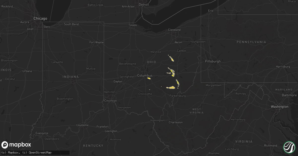
Hail Map on August 26, 2020
Get this storm
August 26 map
$229
one time, instant access
Download today. No call, no setup
Keep the $229
Bought the map and want the full workflow? Apply the entire $229 to a subscription within 7 days. None of it is wasted.
Every map, not just this one
This buys you this map. Subscription and you get every map we run, in the markets you choose from a few cities to whole states to nationwide. Plus real-time alerts the moment a storm fires.
Contact data
Name, contact info, occupancy, even credit band for addresses in the footprint. You go from where it hit to who to call.
Become the source they trust
Unlimited branding weather history reports on demand. You already have the documented answer ready for the property owner, and you are the one who showed up with it.
Property data and RoofTrace estimates
Pull up any address you have got, its value and the exact code rules for that jurisdiction, straight from One Click Code. Then RoofTrace estimates the squares, pitch, and roof value, priced the way you price.
States Impacted by Hail Map on August 26, 2020
Storm reports
Georgia
| Date | Description |
|---|---|
| 08/26/20202:57 PM CDT | Trees and powerlines down of drowning creek rd near tanner rd se of dacula |
| 08/26/20202:54 PM CDT | Trees and powerlines down off dogwood lane in nw lawrenceville. |
| 08/25/202010:49 PM CDT | At 349 PM EDT, a severe thunderstorm was located near Lawrenceville, moving southeast at 10 mph. HAZARD...60 mph wind gusts and quarter size hail. SOURCE...Radar indicated. IMPACT...Hail damage to vehicles is expected. Expect wind damage to roofs, siding, and trees. Locations impacted include... Lawrenceville, Snellville, Lilburn, Grayson and Mountain Park. |
Nebraska
| Date | Description |
|---|---|
| 08/26/20206:25 AM CDT | At 1125 PM CDT/1025 PM MDT/, a severe thunderstorm was located near Whitman, or 29 miles west of Mullen, moving southeast at 25 mph. HAZARD...60 mph wind gusts and quarter size hail. SOURCE...Radar indicated. IMPACT...Hail damage to vehicles is expected. Expect wind damage to roofs, siding, and trees. Locations impacted include... Hyannis, Whitman, Carr Lake, Green Lake, Duluth, Lena, Sand Puddin Lake, Pratt Lake, Spring Valley Lake, Cogill Lake and East Cody Lake.This includes the following highways... Highway 2 between mile markers 147 and 163. Highway 61 between mile markers 129 and 132, between mile markers134 and 137, and between mile markers 151 and 156. |
| 08/26/20204:37 AM CDT | At 937 PM CDT/837 PM MDT/, a severe thunderstorm was located near Merritt Reservoir, or 23 miles southwest of Valentine, moving southeast at 35 mph. HAZARD...Two inch hail and 60 mph wind gusts. SOURCE...Radar indicated. IMPACT...People and animals outdoors will be injured. Expect hail damage to roofs, siding, windows, and vehicles. Expect wind damage to roofs, siding, and trees. Locations impacted include... Valentine National Wildlife Refuge, Merritt Reservoir, Anderson Bridge State Wildlife Management Area and Big Alkali Lake State Wildlife Management Area.This includes the following highways... Highway 97 between mile markers 95 and 126. Highway 83 between mile markers 187 and 192. |
| 08/25/20209:06 PM CDT | Golf ball sized hail. A little breezy but no significant winds. |
Michigan
| Date | Description |
|---|---|
| 08/26/20204:27 AM CDT | At 927 AM EDT, a severe thunderstorm was located over Manistique, moving east at 45 mph. HAZARD...Quarter size hail. SOURCE...Radar indicated. IMPACT...Damage to vehicles is expected. Locations impacted include... Manistique, Thompson and Gulliver. |
| 08/25/202011:09 PM CDT | At 408 AM EDT, a severe thunderstorm was located 7 miles southwest of Ludington State Park, moving southeast at 25 mph. HAZARD...60 mph wind gusts and quarter size hail. SOURCE...Radar indicated. IMPACT...Hail damage to vehicles is expected. Expect wind damage to roofs, siding, and trees. Locations impacted include... Ludington... Hart... Ludington SP... Shelby... Scottville... Pentwater... Mears SP... Silver Lake SP... Weare... Elbridge... Colfax... Walkerville... Crystal Valley... |
| 08/25/202010:24 PM CDT | At 323 AM EDT, a severe thunderstorm was located 8 miles west of Pierport, or 12 miles north of Manistee, moving east at 40 mph. HAZARD...60 mph wind gusts and quarter size hail. SOURCE...Radar indicated. IMPACT...Hail damage to vehicles is expected. Expect wind damage to roofs, siding, and trees. Locations impacted include... Arcadia, Kaleva, Onekama, Wellston, Brethren, Norwalk, Pierport, Dublin, Pere Marquette State Forest and Star Crossing. |
| 08/25/20209:44 PM CDT | At 244 AM EDT, a severe thunderstorm was located near L'anse, moving east at 35 mph. HAZARD...Quarter size hail. SOURCE...Radar indicated. IMPACT...Damage to vehicles is expected. Locations impacted include... Herman and Craig Lake State Park. |
| 08/25/20209:27 PM CDT | At 226 AM EDT, a severe thunderstorm was located 7 miles east of Nisula, or 8 miles southwest of Baraga, moving east at 30 mph. HAZARD...Ping pong ball size hail. SOURCE...Radar indicated. IMPACT...People and animals outdoors will be injured. Expect damage to roofs, siding, windows, and vehicles. Locations impacted include... Baraga, L'anse, Alberta, Canyon Falls, Herman, Pelkie, Pequaming, Assinins and Prickett Dam. |
| 08/25/20209:11 PM CDT | At 211 AM EDT, a severe thunderstorm was located near Nisula, or 18 miles west of Baraga, moving east at 30 mph. HAZARD...Ping pong ball size hail and 60 mph wind gusts. SOURCE...Radar indicated. IMPACT...People and animals outdoors will be injured. Expect hail damage to roofs, siding, windows, and vehicles. Expect wind damage to roofs, siding, and trees. Locations impacted include... Baraga, Nisula, Alston, Bob Lake, Pelkie and Prickett Dam. |
Idaho
| Date | Description |
|---|---|
| 08/26/20204:26 AM CDT | At 925 PM MDT, a severe thunderstorm was located 14 miles northwest of Shelley, or 17 miles west of Idaho Falls, moving east at 35 mph. HAZARD...60 mph wind gusts and quarter size hail. SOURCE...Radar indicated and confirmed by surface observations. A 64 mph wind gust was recorded at Telegraph Hill ITD site at 915 PM MDT. IMPACT...Hail damage to vehicles is expected. Expect wind damage to roofs, siding, and trees. Locations impacted include... Idaho Falls, Ammon, Shelley, Iona, Ucon, Menan, Roberts, Lewisville, Osgood and Kettle Butte. |
| 08/26/20203:43 AM CDT | At 842 PM MDT, a severe thunderstorm was located near Atomic City, or 25 miles northwest of Blackfoot, moving east at 45 mph. HAZARD...60 mph wind gusts and quarter size hail. SOURCE...Radar indicated. IMPACT...Hail damage to vehicles is expected. Expect wind damage to roofs, siding, and trees. Locations impacted include... Firth, Atomic City, Rose, Central Inl, Taber, Southeast Inl, Basalt, Kettle Butte and East Butte. |
| 08/26/20202:21 AM CDT | At 721 PM MDT, a severe thunderstorm was located near Twentymile Butte, or 17 miles southeast of Glenns Ferry, moving northeast at 35 mph. HAZARD...Two inch hail and 60 mph wind gusts. SOURCE...Radar indicated. IMPACT...People and animals outdoors will be injured. Expect hail damage to roofs, siding, windows, and vehicles. Expect wind damage to roofs, siding, and trees. This severe thunderstorm will be near... Hagerman and Bliss around 740 PM MDT. Wendell around 750 PM MDT. Gooding around 800 PM MDT. |
| 08/26/20201:49 AM CDT | At 649 PM MDT, a severe thunderstorm was located near Crows Nest Butte, or 19 miles south of Glenns Ferry, moving east at 40 mph. HAZARD...Golf ball size hail and 60 mph wind gusts. SOURCE...Radar indicated. IMPACT...People and animals outdoors will be injured. Expect hail damage to roofs, siding, windows, and vehicles. Expect wind damage to roofs, siding, and trees. This severe thunderstorm will be near... Crows Nest Butte around 650 PM MDT. Deadman Flat around 700 PM MDT. Twentymile Butte around 710 PM MDT. Hagerman, Wendell and Bliss around 730 PM MDT. |
| 08/26/20201:37 AM CDT | At 637 PM MDT, a severe thunderstorm was located near Richfield, or 11 miles south of Picabo, moving northeast at 30 mph. HAZARD...60 mph wind gusts and quarter size hail. SOURCE...Radar indicated. IMPACT...Hail damage to vehicles is expected. Expect wind damage to roofs, siding, and trees. Locations impacted include... Carey, Picabo, Richfield and Craters Of The Moon. |
| 08/26/20201:19 AM CDT | At 619 PM MDT, a severe thunderstorm was located over Twin Butte, or 35 miles southwest of Glenns Ferry, moving northeast at 30 mph. HAZARD...Golf ball size hail and 60 mph wind gusts. SOURCE...Radar indicated. IMPACT...People and animals outdoors will be injured. Expect hail damage to roofs, siding, windows, and vehicles. Expect wind damage to roofs, siding, and trees. This severe thunderstorm will be near... Twin Butte around 620 PM MDT. Bruneau Canyon Viewpoint around 630 PM MDT. Winter Camp Butte and Lookout Butte around 640 PM MDT. Pot Hole Butte around 650 PM MDT. Crows Nest Butte around 700 PM MDT. |
| 08/26/202012:48 AM CDT | At 548 PM MDT, a severe thunderstorm was located near Turner Butte, or 31 miles north of Owyhee, moving east at 25 mph. HAZARD...Golf ball size hail and 60 mph wind gusts. SOURCE...Radar indicated. IMPACT...People and animals outdoors will be injured. Expect hail damage to roofs, siding, windows, and vehicles. Expect wind damage to roofs, siding, and trees. This severe thunderstorm will be near... Gedney Butte and Grasmere around 610 PM MDT. Blackstone Reservoir around 620 PM MDT. Twin Butte and Monument Butte around 630 PM MDT. |
| 08/26/202012:27 AM CDT | At 527 PM MDT, a severe thunderstorm was located near Big Horse Basin Gap, or 39 miles southwest of Mountain Home, moving northeast at 20 mph. HAZARD...Quarter size hail. SOURCE...Radar indicated. IMPACT...Damage to vehicles is expected. This severe thunderstorm will be near... Big Horse Basin Gap around 540 PM MDT. Chalk Hills around 600 PM MDT. Bruneau, Hot Spring and C J Strike Reservoir around 610 PM MDT. |
| 08/26/202012:23 AM CDT | Mesonet station gasi1 - gas caves. |
| 08/26/202012:16 AM CDT | At 516 PM MDT, a severe thunderstorm was located over Dollar Butte, or 30 miles north of Owyhee, moving east at 25 mph. HAZARD...Golf ball size hail. SOURCE...Radar indicated. IMPACT...People and animals outdoors will be injured. Expect damage to roofs, siding, windows, and vehicles. This severe thunderstorm will be near... Blue Creek Reservoir around 530 PM MDT. Turner Butte around 540 PM MDT. Grasmere, Gedney Butte and Tindall Ranch around 600 PM MDT. |
| 08/25/202011:55 PM CDT | At 455 PM MDT, a severe thunderstorm was located near Frying Pan Spring, or 34 miles northwest of Owyhee, moving northeast at 30 mph. HAZARD...Quarter size hail. SOURCE...Radar indicated. IMPACT...Damage to vehicles is expected. This severe thunderstorm will be near... Frying Pan Spring and Dollar Butte around 510 PM MDT. Battle Creek Ranch around 520 PM MDT. Crab Spring Butte around 530 PM MDT. The Hat around 540 PM MDT. |
| 08/25/202010:15 PM CDT | Itd - telegraph hill |
| 08/25/20209:45 PM CDT | Itd - inl puzzle |
| 08/25/20209:40 PM CDT | Inl arl frd - critical infrastructure complex |
| 08/25/20209:35 PM CDT | Mesonet station 690 - inl central facilities. |
| 08/25/20209:35 PM CDT | Inl arl frd - reactor technologies complex |
| 08/25/20209:35 PM CDT | Inl ard frd - central facilities |
| 08/25/20209:30 PM CDT | Inl arl frd - inl puzzle observation site |
| 08/25/20209:30 PM CDT | Inl arl frd - lost river rest area |
| 08/25/20209:25 PM CDT | Inl arl frd - big southern butte |
Minnesota
| Date | Description |
|---|---|
| 08/26/20202:20 AM CDT | At 720 AM CDT, a severe thunderstorm was located 14 miles northeast of Gunflint Lake, moving east-southeast at 40 mph. HAZARD...Two inch hail and 70 mph wind gusts. SOURCE...Radar indicated. IMPACT...People and animals outdoors will be injured. Expect hail damage to roofs, siding, windows, and vehicles. Expect considerable tree damage. Wind damage is also likely to mobile homes, roofs, and outbuildings. Locations impacted include... Grand Portage, Pine Lake, Tom Lake, Clearwater Lake, Swamp Lake, Grand Portage Reservation, Grand Portage State Park, North Fowl Lake, Watab Lake, and Bearskin Lake. |
South Carolina
| Date | Description |
|---|---|
| 08/26/20205:50 PM CDT | The south carolina highway patrol reports a tree down on us-17. Time estimated based on radar. |
| 08/26/20204:44 PM CDT | Law enforcement relayed report of a tree down on storyteller rd. Likely caused by thunderstorm outflow. Time estimated from radar. |
| 08/26/20203:41 PM CDT | Tree down near the intersection of bodison memorial drive and round o road. |
| 08/25/202011:40 PM CDT | At 440 PM EDT, a severe thunderstorm was located near Cottageville, moving southeast at 25 mph. HAZARD...60 mph wind gusts and quarter size hail. SOURCE...Radar indicated. IMPACT...Minor hail damage to vehicles is possible. Expect wind damage to trees and powerlines. Locations impacted include... Walterboro, Cottageville and Round O. |
Arkansas
| Date | Description |
|---|---|
| 08/25/202011:33 PM CDT | At 432 PM CDT, a severe thunderstorm was located near Lonsdale, or 8 miles west of Benton, moving northeast at 20 mph. HAZARD...60 mph wind gusts. SOURCE...Radar indicated. IMPACT...Expect damage to roofs, siding, and trees. Locations impacted include... Benton... Bryant... Haskell... Traskwood... Lonsdale... Salem in Saline County... Avilla... Nance... Congo... Paron... Grape... Crows... Bland... This includes Interstate 30 between mile markers 106 and 121. |
West Virginia
| Date | Description |
|---|---|
| 08/25/202010:58 PM CDT | At 357 PM EDT, a severe thunderstorm was located over Beverly, moving east at 30 mph. HAZARD...60 mph wind gusts and half dollar size hail. SOURCE...Radar indicated. IMPACT...Hail damage to vehicles is expected. Expect wind damage to roofs, siding, and trees. Locations impacted include... Marietta, Beverly, Lowell, Lower Salem and Devola. This includes Interstate 77 in Ohio between mile markers 1 and 13. |
| 08/25/202010:31 PM CDT | At 331 PM EDT, a severe thunderstorm was located over Chesterhill, moving east at 35 mph. HAZARD...60 mph wind gusts and quarter size hail. SOURCE...Radar indicated. IMPACT...Hail damage to vehicles is expected. Expect wind damage to roofs, siding, and trees. Locations impacted include... Marietta, Beverly, Chesterhill, Vienna, Williamstown, Boaz, Lowell, Stockport, Lower Salem, Fleming, Bartlett and Devola.This includes the following highways... Interstate 77 in West Virginia between mile markers 181 and 182. Interstate 77 in Ohio between mile markers 3 and 13. |
Arizona
| Date | Description |
|---|---|
| 08/25/202010:33 PM CDT | At 333 PM MST, a severe thunderstorm was located near Pisinemo, or 26 miles west of Sells, moving west at 5 mph. HAZARD...60 mph wind gusts. SOURCE...Radar indicated. IMPACT...Expect damage to roofs, siding, and trees. Locations impacted include... Pisinemo, San Simon, Santa Cruz, Papago Farms and San Simon West. This includes Route 86 between mile markers 70 and 87. |
South Dakota
| Date | Description |
|---|---|
| 08/26/20206:30 PM CDT | Mesonet station grrs2 bullhead 10 s. Estimated time. |
| 08/26/20206:20 PM CDT | A local report indicates 58 MPH wind near 1 NE MIDLAND |
| 08/26/20206:20 PM CDT | Report of golfball and larger. |
| 08/26/20206:17 PM CDT | Update to previous report. |
| 08/26/20206:13 PM CDT | Relayed through spotter. |
| 08/26/20206:13 PM CDT | Relayed through spotter. |
| 08/26/20206:00 PM CDT | A local report indicates 1.00 inch wind near 12 ESE FAIRBURN |
| 08/26/20205:58 PM CDT | Time estimated. |
| 08/26/20205:48 PM CDT | Time estimated. Broke 6 windows on north and west side of residence. |
| 08/26/20205:31 PM CDT | A local report indicates 1.00 inch wind near 5 NNW FAIRBURN |
| 08/26/20205:25 PM CDT | A local report indicates 1.00 inch wind near 3 NW KIRLEY |
| 08/26/20204:45 PM CDT | Time estimated. |
| 08/26/20204:45 PM CDT | A local report indicates 60 MPH wind near 15 ENE CHERRY CREEK |
| 08/26/20204:30 PM CDT | Time estimated. Multiple sizes but largest was golf ball. Covered ground. |
| 08/26/20204:20 PM CDT | Roof torn off one outbuilding... A second outbuilding had north door blown in. Time estimated. |
| 08/26/20204:20 PM CDT | Time estimated. |
| 08/26/20204:17 PM CDT | Mesonet station 168 foster bay |
| 08/26/20204:06 PM CDT | Update to previous report. |
| 08/26/20204:02 PM CDT | Slightly larger then quarters. |
| 08/26/20204:00 PM CDT | Most hail was nickel size |
| 08/26/20206:00 AM CDT | A local report indicates 1.25 inch wind near 4 SE DEERFIELD |
| 08/26/20204:15 AM CDT | At 915 PM CDT, a severe thunderstorm was located near Littleburg, or 13 miles north of Valentine, moving southeast at 30 mph. HAZARD...Golf ball size hail and 60 mph wind gusts. SOURCE...Radar indicated. IMPACT...People and animals outdoors will be injured. Expect hail damage to roofs, siding, windows, and vehicles. Expect wind damage to roofs, siding, and trees. Locations impacted include... Valentine, Sparks and Smith Falls State Park. This includes the following highways... Highway 20 between mile markers 195 and 207. Highway 97 between mile markers 140 and 141. Highway 83 between mile markers 203 and 222. Highway 12 between mile markers 1 and 27. |
| 08/26/20204:01 AM CDT | At 900 PM CDT, a severe thunderstorm was located 6 miles east of Lakeview, or 14 miles south of Mission, moving southeast at 30 mph. HAZARD...Golf ball size hail and 60 mph wind gusts. SOURCE...Radar indicated. IMPACT...People and animals outdoors will be injured. Expect hail damage to roofs, siding, windows, and vehicles. Expect wind damage to roofs, siding, and trees. This severe thunderstorm will be near... Littleburg around 920 PM CDT. |
| 08/26/20203:56 AM CDT | At 856 PM CDT/756 PM MDT/, a severe thunderstorm was located 8 miles northeast of Cody, or 30 miles east of Martin, moving southeast at 30 mph. HAZARD...Ping pong ball size hail and 60 mph wind gusts. SOURCE...Radar indicated. IMPACT...People and animals outdoors will be injured. Expect hail damage to roofs, siding, windows, and vehicles. Expect wind damage to roofs, siding, and trees. Locations impacted include... Cody, Kilgore, Nenzel, Crookston, Steer Creek Campground and Anderson Bridge State Wildlife Management Area.This includes Highway 20 between mile markers 155 and 189. |
| 08/26/20203:09 AM CDT | At 809 PM CDT, a severe thunderstorm was located 3 miles east of Wood, or 17 miles east of White River, moving southeast at 35 mph. HAZARD...Golf ball size hail and 60 mph wind gusts. SOURCE...Radar indicated. IMPACT...People and animals outdoors will be injured. Expect hail damage to roofs, siding, windows, and vehicles. Expect wind damage to roofs, siding, and trees. This severe thunderstorm will be near... Mosher around 820 PM CDT. Okreek around 825 PM CDT. Carter around 830 PM CDT. Witten around 835 PM CDT. Clearfield around 900 PM CDT. Dog Ear Lake around 910 PM CDT. |
| 08/26/20202:18 AM CDT | At 718 PM CDT, a severe thunderstorm was located near Westover, or near Murdo, moving southeast at 30 mph. HAZARD...60 mph wind gusts and quarter size hail. SOURCE...Radar indicated. IMPACT...Hail damage to vehicles is expected. Expect wind damage to roofs, siding, and trees. Locations impacted include... Murdo and Westover. |
| 08/26/20202:13 AM CDT | At 713 PM MDT/813 PM CDT/, a severe thunderstorm was located 5 miles northeast of Parmelee, or 14 miles west of Mission, moving southeast at 30 mph. HAZARD...Tennis ball size hail and 60 mph wind gusts. SOURCE...Radar indicated. IMPACT...People and animals outdoors will be injured. Expect hail damage to roofs, siding, windows, and vehicles. Expect wind damage to roofs, siding, and trees. This severe thunderstorm will be near... Rosebud around 835 PM CDT. Mission around 840 PM CDT. Lakeview around 850 PM CDT. |
| 08/26/20202:11 AM CDT | At 711 PM MDT/811 PM CDT/, a severe thunderstorm was located 5 miles northwest of Vetal, or 14 miles northeast of Martin, moving southeast at 35 mph. HAZARD...Two inch hail and 60 mph wind gusts. SOURCE...Radar indicated. IMPACT...People and animals outdoors will be injured. Expect hail damage to roofs, siding, windows, and vehicles. Expect wind damage to roofs, siding, and trees. This severe thunderstorm will be near... Tuthill and Vetal around 720 PM MDT. Harrington around 735 PM MDT. |
| 08/26/20201:32 AM CDT | At 631 PM CDT/531 PM MDT/, a severe thunderstorm was located over Van Metre, or 17 miles north of Murdo, moving southeast at 35 mph. HAZARD...60 mph wind gusts and quarter size hail. SOURCE...Radar indicated. IMPACT...Hail damage to vehicles is expected. Expect wind damage to roofs, siding, and trees. Locations impacted include... Murdo, Draper, Okaton, Capa, Wendte and Van Metre. |
| 08/26/20201:20 AM CDT | At 620 PM MDT/720 PM CDT/, severe thunderstorms were located along a line extending from 6 miles southeast of Okaton to 10 miles south of Belvidere to 6 miles northeast of Snake Butte, moving southeast at 30 mph. HAZARD...60 mph wind gusts and quarter size hail. SOURCE...Radar indicated. IMPACT...Hail damage to vehicles is expected. Expect wind damage to roofs, siding, and trees. Severe thunderstorms will be near... Cedar Butte around 745 PM CDT. Long Valley around 750 PM CDT. White River around 810 PM CDT. Vetal around 815 PM CDT. |
| 08/26/202012:35 AM CDT | At 535 PM MDT, a severe thunderstorm was located 8 miles east of Intersection of Red Shirt and Cuny Table Roads, or 32 miles north of Pine Ridge, moving southeast at 30 mph. HAZARD...Ping pong ball size hail and 60 mph wind gusts. SOURCE...Radar indicated. IMPACT...People and animals outdoors will be injured. Expect hail damage to roofs, siding, windows, and vehicles. Expect wind damage to roofs, siding, and trees. This severe thunderstorm will be near... Sharps Corner around 605 PM MDT. Manderson around 610 PM MDT. Porcupine around 620 PM MDT. |
| 08/26/202012:11 AM CDT | At 510 PM MDT, a severe thunderstorm was located over Timber Lake, or 27 miles southwest of Mclaughlin, moving northeast at 30 mph. HAZARD...Golf ball size hail and 60 mph wind gusts. SOURCE...Radar indicated. IMPACT...People and animals outdoors will be injured. Expect hail damage to roofs, siding, windows, and vehicles. Expect wind damage to roofs, siding, and trees. Locations impacted include... Timber Lake, Little Moreau Rec Area, Spring Lake, Glencross and Little Eagle. |
| 08/25/202011:45 PM CDT | At 444 PM CDT/344 PM MDT/, a severe thunderstorm was located 9 miles south of Mission Ridge, or 23 miles northwest of Fort Pierre, moving southeast at 30 mph. HAZARD...Ping pong ball size hail and 60 mph wind gusts. SOURCE...Radar indicated. IMPACT...People and animals outdoors will be injured. Expect hail damage to roofs, siding, windows, and vehicles. Expect wind damage to roofs, siding, and trees. Locations impacted include... Grey Goose, Okobojo Point Rec Area, Overlook Rec Area, Spring Creek Rec Area, Cow Creek Rec Area, West Shore Rec Area, Oahe Mission Rec Area and Chantier Creek Recreation Area. |
| 08/25/202011:34 PM CDT | At 434 PM MDT, a severe thunderstorm was located near Kirley, or 33 miles south of Eagle Butte, moving southeast at 30 mph. HAZARD...Ping pong ball size hail and 60 mph wind gusts. SOURCE...Radar indicated. IMPACT...People and animals outdoors will be injured. Expect hail damage to roofs, siding, windows, and vehicles. Expect wind damage to roofs, siding, and trees. Locations impacted include... Sansarc, Brown Church and Hayes. |
| 08/25/202011:29 PM CDT | At 428 PM MDT, a severe thunderstorm was located 3 miles northwest of Fairburn, or 18 miles east of Custer, moving southeast at 20 mph. HAZARD...60 mph wind gusts and quarter size hail. SOURCE...Radar indicated. IMPACT...Hail damage to vehicles is expected. Expect wind damage to roofs, siding, and trees. This severe thunderstorm will be near... Fairburn around 435 PM MDT. Red Shirt around 515 PM MDT. Red Shirt Table Overlook around 525 PM MDT. |
| 08/25/202011:22 PM CDT | At 421 PM MDT, a severe thunderstorm was located 4 miles north of Kirley, or 28 miles south of Eagle Butte, moving southeast at 20 mph. HAZARD...Ping pong ball size hail and 60 mph wind gusts. SOURCE...Radar indicated. IMPACT...People and animals outdoors will be injured. Expect hail damage to roofs, siding, windows, and vehicles. Expect wind damage to roofs, siding, and trees. This severe thunderstorm will be near... Kirley around 430 PM MDT. |
| 08/25/202011:18 PM CDT | At 417 PM MDT, a severe thunderstorm was located 7 miles south of Isabel, or 18 miles north of Lantry, moving east at 20 mph. HAZARD...60 mph wind gusts and half dollar size hail. SOURCE...Radar indicated. IMPACT...Hail damage to vehicles is expected. Expect wind damage to roofs, siding, and trees. Locations impacted include... Timber Lake and Little Moreau Rec Area. |
| 08/25/202011:13 PM CDT | At 413 PM MDT, a severe thunderstorm was located near White Horse, or 22 miles northeast of Eagle Butte, moving northeast at 20 mph. HAZARD...Ping pong ball size hail and 60 mph wind gusts. SOURCE...Radar indicated. IMPACT...People and animals outdoors will be injured. Expect hail damage to roofs, siding, windows, and vehicles. Expect wind damage to roofs, siding, and trees. Locations impacted include... Promise and White Horse. |
| 08/25/202010:27 PM CDT | At 326 PM MDT, a severe thunderstorm was located 5 miles southwest of Intersection of Cherry Creek and Sunnybrook Roads, or 16 miles south of Dupree, moving southeast at 25 mph. HAZARD...60 mph wind gusts and half dollar size hail. SOURCE...Radar indicated. IMPACT...Hail damage to vehicles is expected. Expect wind damage to roofs, siding, and trees. This severe thunderstorm will be near... Intersection of Cherry Creek and Sunnybrook Roads around 335 PM MDT. |
| 08/25/202010:27 PM CDT | At 326 PM MDT, a severe thunderstorm was located near Parade, or 7 miles northeast of Eagle Butte, moving northeast at 25 mph. HAZARD...60 mph wind gusts and half dollar size hail. SOURCE...Radar indicated. IMPACT...Hail damage to vehicles is expected. Expect wind damage to roofs, siding, and trees. Locations impacted include... Parade and Ridgeview. |
| 08/25/202010:01 PM CDT | At 300 PM MDT, a severe thunderstorm was located over southwestern Lake Oahe, or 20 miles southeast of Eagle Butte, moving east at 30 mph. HAZARD...Ping pong ball size hail and 60 mph wind gusts. SOURCE...Radar indicated. IMPACT...People and animals outdoors will be injured. Expect hail damage to roofs, siding, windows, and vehicles. Expect wind damage to roofs, siding, and trees. Locations impacted include... Mission Ridge. |
| 08/25/20209:48 PM CDT | At 247 PM MDT, a severe thunderstorm was located near Lantry, moving northeast at 20 mph. HAZARD...60 mph wind gusts and quarter size hail. SOURCE...Radar indicated. IMPACT...Hail damage to vehicles is expected. Expect wind damage to roofs, siding, and trees. Locations impacted include... Eagle Butte, Lantry, Parade and Green Grass. |
| 08/25/20209:28 PM CDT | At 228 PM MDT, a severe thunderstorm was located 6 miles south of Lantry, moving east at 15 mph. HAZARD...Ping pong ball size hail and 60 mph wind gusts. SOURCE...Radar indicated. IMPACT...People and animals outdoors will be injured. Expect hail damage to roofs, siding, windows, and vehicles. Expect wind damage to roofs, siding, and trees. Locations impacted include... South Eagle Butte and Intersection of Highway 63 and BIA Road 8. |
| 08/25/20209:04 PM CDT | A local report indicates 76 MPH wind near 15 SSE MISSION |
| 08/25/20208:59 PM CDT | A local report indicates 71 MPH wind near 15 SSE MISSION |
| 08/25/20208:45 PM CDT | A local report indicates 66 MPH wind near 7 ESE ROSEBUD |
| 08/25/20208:25 PM CDT | A local report indicates 60 MPH wind near 1 NW VETAL |
| 08/25/20208:25 PM CDT | A local report indicates 1.00 inch wind near 1 NW VETAL |
| 08/25/20208:10 PM CDT | A local report indicates 1.50 inch wind near 4 NE WOOD |
| 08/25/20208:00 PM CDT | A local report indicates 2.50 inch wind near 5 ESE NORRIS |
| 08/25/20208:00 PM CDT | Broken windshield to law enforcement vehicle |
| 08/25/20207:40 PM CDT | A local report indicates 1.00 inch wind near 7 W CEDAR BUTTE |
| 08/25/20207:37 PM CDT | A local report indicates 1.00 inch wind near 14 ESE POTATO CREEK |
| 08/25/20207:25 PM CDT | Time estimated. |
Ohio
| Date | Description |
|---|---|
| 08/26/20202:58 PM CDT | Several trees down in town. Also pea to half inch size hail in the beverly-waterford area. |
| 08/26/20202:40 PM CDT | Numerous trees reported down in vicinity of piedmont lake dam. |
| 08/26/20202:35 PM CDT | Two trees down... One on state route 266... The other on roy gins road.. Time estimated from radar. |
| 08/26/20202:15 PM CDT | A local report indicates 1.00 inch wind near 7 WSW CAMBRIDGE |
| 08/26/20201:17 PM CDT | Small tree down in charm. |
| 08/26/202012:50 PM CDT | Power pole and wires down. |
| 08/25/202011:22 PM CDT | At 421 PM EDT, a severe thunderstorm was located near Caldwell, moving southeast at 15 mph. HAZARD...60 mph wind gusts and quarter size hail. SOURCE...Radar indicated. IMPACT...Hail damage to vehicles is expected. Expect wind damage to roofs, siding, and trees. Locations impacted include... Marietta, Lowell, Macksburg, Lower Salem and Devola. This includes Interstate 77 in Ohio between mile markers 4 and 17. |
| 08/25/202011:06 PM CDT | At 406 PM EDT, a severe thunderstorm was located over Caldwell, moving southeast at 20 mph. HAZARD...Wind gusts to 60 mph and quarter-size hail. SOURCE...Radar. IMPACT...Minor hail damage to vehicles is possible. Expect wind damage to trees and power lines, resulting in some power outages. Locations impacted include... Caldwell... Dudley... Dexter City... Stafford... Graysville... Harriettsville... Rinard Mills... This includes Interstate 77 in Ohio between mile markers 18 and 26. |
| 08/25/202010:29 PM CDT | At 329 PM EDT, a severe thunderstorm was located near New Concord, or 10 miles southwest of Cambridge, moving southeast at 20 mph. HAZARD...Wind gusts to 60 mph. SOURCE...Radar. IMPACT...Expect damage to trees and power lines, resulting in some power outages. Locations impacted include... Caldwell... Dudley... Pleasant City... Cumberland... Belle Valley... Sarahsville... Wolf Run State Park... This includes the following highways... Interstate 70 in Ohio near mile marker 173. Interstate 77 in Ohio between mile markers 22 and 40. |
| 08/25/20209:45 PM CDT | At 245 PM EDT, a severe thunderstorm was located 9 miles northwest of New Concord, or 10 miles south of Coshocton, moving southeast at 20 mph. HAZARD...Wind gusts to 60 mph and quarter-size hail. SOURCE...Radar. IMPACT...Minor hail damage to vehicles is possible. Expect wind damage to trees and power lines, resulting in some power outages. Locations impacted include... Cambridge... New Concord... Byesville... Norwich... Otsego... Boden...This includes the following highways... Interstate 70 in Ohio between mile markers 163 and 181. Interstate 77 in Ohio between mile markers 40 and 46. |
| 08/25/20209:17 PM CDT | At 217 PM EDT, a severe thunderstorm was located over Farmerstown, or 10 miles southeast of Millersburg, moving southeast at 15 mph. HAZARD...Wind gusts to 60 mph and half dollar-size hail. SOURCE...Radar. IMPACT...Minor hail damage to vehicles is possible. Expect wind damage to trees and power lines, resulting in some power outages. Locations impacted include... Newcomerstown... Sugarcreek... Baltic... Port Washington... Stone Creek... Chili... Bakersville... This includes Interstate 77 in Ohio between mile markers 66 and 77. |
| 08/25/20209:09 PM CDT | At 209 PM EDT, a severe thunderstorm was located over Walnut Creek, or 7 miles east of Millersburg, moving southeast at 25 mph. HAZARD...60 mph wind gusts and quarter size hail. SOURCE...Radar indicated. IMPACT...Minor damage to vehicles is possible. Expect damage to trees and power lines. Locations impacted include... Berlin, Walnut Creek, Farmerstown, Baltic and Charm. |
| 08/25/20208:36 PM CDT | At 136 PM EDT, a severe thunderstorm was located over Canal Winchester, moving east at 15 mph. HAZARD...60 mph wind gusts and quarter size hail. SOURCE...Radar indicated. IMPACT...Minor hail damage to vehicles is possible. Expect wind damage to trees and power lines. Locations impacted include... Columbus, Pickerington, Canal Winchester, Baltimore, Carroll, State Route 158 at State Route 204 and Dumontville. |
Montana
| Date | Description |
|---|---|
| 08/26/20206:40 PM CDT | Corrects previous non-tstm wnd gst report from 2 ese twin bridges. Awos station k7s1 twin bridges. |
| 08/26/202012:53 AM CDT | At 552 PM MDT, a severe thunderstorm was located near Conner, or 25 miles south of Hamilton, moving northeast at 35 mph. HAZARD...60 mph wind gusts and quarter size hail. SOURCE...Radar indicated. IMPACT...Hail damage to vehicles is expected. Expect wind damage to roofs, siding, and trees. Locations impacted include... Conner and Sula. |
| 08/26/202012:51 AM CDT | At 551 PM MDT, a severe thunderstorm was located 7 miles southeast of Silver Star, or 11 miles north of Sheridan, moving east at 35 mph. HAZARD...70 mph wind gusts and quarter size hail. SOURCE...Radar indicated. IMPACT...Hail damage to vehicles is expected. Expect considerable tree damage. Wind damage is also likely to mobile homes, roofs, and outbuildings. Locations impacted include... Silver Star, Harrison, Pony, Norris and Waterloo. |
Louisiana
| Date | Description |
|---|---|
| 08/26/20201:55 PM CDT | Public called in report of a tornado touchdown near paincourtville. No damage reported. |
| 08/26/20207:14 AM CDT | At 1213 PM CDT, severe thunderstorms were located along a line extending from 20 miles south of Bayou Vista to 12 miles south of Amelia to 13 miles southwest of Bayou Cane to 7 miles southwest of Houma to 11 miles west of Leeville, moving north at 45 mph. HAZARD...60 mph wind gusts. SOURCE...Radar indicated. IMPACT...Expect damage to roofs, siding, and trees. Locations impacted include... Houma, Thibodaux, Lockport, Schriever, Supreme, Gray, Chauvin, Dulac, Labadieville, Montegut, Bayou Cane and Raceland. |
| 08/25/202010:48 PM CDT | At 348 PM CDT, a severe thunderstorm was located near French Settlement, or 14 miles northeast of Gonzales, moving northwest at 35 mph. HAZARD...60 mph wind gusts. SOURCE...Radar indicated. IMPACT...Expect damage to roofs, siding, and trees. Locations impacted include... Denham Springs, Walker, Livingston, French Settlement, Port Vincent and Watson. |
| 08/25/202010:00 PM CDT | Spotter report of a rain wrapped tornado near bell city. |
Wyoming
| Date | Description |
|---|---|
| 08/26/20205:10 AM CDT | Lots of golf ball hail. Damage to houses and vehicles. Hail lasted 20 to 25 minutes. |
Cities Impacted by Hail Map on August 26, 2020
- Macksburg, OH
- Cumberland, OH
- Caldwell, OH
- Dexter City, OH
- Belle Valley, OH
- Wood, SD
- Norris, SD
- Hill City, SD
- Draper, SD
- Blackfoot, ID
- Eagle Butte, SD
- Glouster, OH
- Chesterhill, OH
- Malta, OH
- Cody, NE
- Kilgore, NE
- Saint Francis, SD
- Nenzel, NE
- Merriman, NE
- Hyannis, NE
- Whitman, NE
- Osage, WY
- Valentine, NE
- Idaho Falls, ID
- Allen, SD
- Newcastle, WY
- Custer, SD
- Richfield, ID
- Kadoka, SD
- Martin, SD
- Round O, SC
- Sula, MT
- Conner, MT
- Dupree, SD
- Sells, AZ
- Owanka, SD
- Wanblee, SD
- Hayes, SD
- Stockport, OH
- Waterford, OH
- Belvidere, SD
- Adamsville, OH
- Thedford, NE
- Tuthill, SD
- Groveport, OH
- Canal Winchester, OH
- Pickerington, OH
- Baltic, OH
- Millersburg, OH
- Sugarcreek, OH
- Mission, SD
- White River, SD
- Garryowen, MT
- Saint Xavier, MT
- Lodge Grass, MT
- Riverside, OR
- Adrian, OR
- Murdo, SD
- Okaton, SD
- Long Valley, SD
- Midland, SD
- Lowell, OH
- Wasta, SD
- Harrison, MT
- Cardwell, MT
- Norris, MT
- Manistique, MI
- Fort Pierre, SD
- Upton, WY
- Cottageville, SC
- Lawrenceville, GA
- Mullen, NE
- Darby, MT
- Brinkley, AR
- Des Arc, AR
- Fresno, OH
- Holmesville, OH
- Rosebud, SD
- Parmelee, SD
- Carroll, OH
- Mcconnelsville, OH
- Washington, GA
- Burns, OR
- Rapid City, SD
- Charleston, SC
- Cooks, MI
- Hermosa, SD
- New Concord, OH
- Norwich, OH
- Cambridge, OH
- Keystone, SD
- Crystal Falls, MI
- Busby, MT
- Yale, OK
- Philip, SD
- Ironside, OR
- Unity, OR
- Crenshaw, MS
- Rigby, ID
- Pawnee, OK
- Kingston, OH
- Laurelville, OH
- Sherwood, AR
- Jacksonville, AR
- North Little Rock, AR
- Ashton, ID
- Lonsdale, AR
- Benton, AR
- Wall, SD
- Hereford, OR
- Kimbolton, OH
- Conesville, OH
- Coshocton, OH
- Senatobia, MS
- King Hill, ID
- Bruneau, ID
- Hagerman, ID
- Munising, MI
- Shawnee, OK
- Wetmore, MI
- McLaughlin, SD
- Deerton, MI
- Kewadin, MI
- Walterboro, SC
- Beverly, OH
- Como, MS
- Gibbonsville, ID
- Birney, MT
- New Straitsville, OH
- Hines, OR
- Princeton, OR
- Zanesville, OH
- Nashport, OH
- Lula, GA
- Gillsville, GA
- Grand Rapids, MN
- Theriot, LA
- Chauvin, LA
- Dulac, LA
- Vinton, LA
- Iowa, LA
- Cameron, LA
- Grand Chenier, LA
- Bell City, LA
- Lake Charles, LA
- Orange, TX
- Westlake, LA
- Creole, LA
- Sulphur, LA
- Hackberry, LA
- Addis, LA
- Lakeland, LA
- Port Allen, LA
- Brusly, LA
- Fordoche, LA
- Morganza, LA
- Erwinville, LA
- Oscar, LA
- Baton Rouge, LA
- Livonia, LA
- Donaldsonville, LA
- Belle Rose, LA
- White Castle, LA
- Darrow, LA
- Saint James, LA
- Rougon, LA
- Jarreau, LA
- Ventress, LA
- New Roads, LA
- Glynn, LA
- Gonzales, LA
- Prairieville, LA
- Saint Amant, LA
- Spurger, TX
- Woodville, TX
- Silsbee, TX
- Warren, TX
- Hillister, TX
- Fred, TX
- Basile, LA
- Crowley, LA
- Rayne, LA
- Iota, LA
- Grosse Tete, LA
- Lottie, LA
- Maringouin, LA
- Sunshine, LA
- Plaquemine, LA
- Saint Gabriel, LA
- Carville, LA
- Geismar, LA
- Ville Platte, LA
- Saint Landry, LA
- Bunkie, LA
- Merryville, LA
- Burkeville, TX
- Newton, TX
- Lockport, LA
- Des Allemands, LA
- Cut Off, LA
- Pitkin, LA
- La Place, LA
- Ponchatoula, LA
- Walker, LA
- Livingston, LA
- Greenwell Springs, LA
- Denham Springs, LA
- Pride, LA
- Springfield, LA
- Holden, LA
- Jackson, LA
- Saint Francisville, LA
- Amite, LA
- Pine Grove, LA
- Albany, LA
- Tickfaw, LA
- Hammond, LA
- Greensburg, LA
- Clinton, LA
- Centreville, MS
- Norwood, LA
- Wilson, LA
- Independence, LA
- Zachary, LA
- Pierre Part, LA
- Monroe, LA
- Napoleonville, LA
- Port Barre, LA
- Sieper, LA
- Plattenville, LA
- Trout, LA
- Mittie, LA
- Lisbon, LA
- Grant, LA
- Magnolia, AR
- Downsville, LA
- Emerson, AR
- Jasper, TX
- Branch, LA
- Gilbert, LA
- Broaddus, TX
- Egan, LA
- Starks, LA
- Sterlington, LA
- Pleasant Hill, LA
- Cottonport, LA
- Choudrant, LA
- Minden, LA
- Shongaloo, LA
- Clayton, LA
- Buna, TX
- Morse, LA
- Bossier City, LA
- Elmer, LA
- Waldo, AR
- Barksdale Afb, LA
- Evergreen, LA
- Coushatta, LA
- El Dorado, AR
- Roanoke, LA
- Dodson, LA
- Pelican, LA
- Colfax, LA
- Hessmer, LA
- Benton, LA
- Vidalia, LA
- Cheneyville, LA
- Mora, LA
- Gilliam, LA
- Wisner, LA
- Hornbeck, LA
- Fouke, AR
- Rodessa, LA
- Longville, LA
- Brookeland, TX
- Lafayette, LA
- Marion, LA
- Ashland, LA
- Delcambre, LA
- Bethany, LA
- Rosedale, LA
- Winnfield, LA
- Bronson, TX
- Baldwin, LA
- Princeton, LA
- Mangham, LA
- Ball, LA
- Natchez, MS
- Fisher, LA
- Plain Dealing, LA
- Eunice, LA
- Olla, LA
- Batchelor, LA
- Farmerville, LA
- Lewisville, AR
- Gibsland, LA
- Vidor, TX
- Jena, LA
- Natchitoches, LA
- Keatchie, LA
- Sunset, LA
- Slagle, LA
- Collinston, LA
- Atlanta, LA
- Gueydan, LA
- Mamou, LA
- Mansura, LA
- Gloster, MS
- Provencal, LA
- Jamestown, LA
- Center Point, LA
- Columbia, LA
- Pineland, TX
- Glenmora, LA
- Many, LA
- Lorman, MS
- New Iberia, LA
- Evangeline, LA
- Sikes, LA
- Breaux Bridge, LA
- Georgetown, LA
- Anacoco, LA
- Angola, LA
- Waterproof, LA
- Robeline, LA
- Slaughter, LA
- Arnaudville, LA
- Oberlin, LA
- Elton, LA
- Pineville, LA
- Shreveport, LA
- Lena, LA
- Morrow, LA
- Sibley, LA
- Duson, LA
- Winnsboro, LA
- Oakdale, LA
- Call, TX
- Pollock, LA
- Elm Grove, LA
- Haughton, LA
- Lecompte, LA
- Grayson, LA
- Rayville, LA
- Flatwoods, LA
- Homer, LA
- Bon Wier, TX
- Ethel, LA
- Summerfield, LA
- Junction City, AR
- Youngsville, LA
- Melville, LA
- Gloster, LA
- Bentley, LA
- Dequincy, LA
- Forest Hill, LA
- Lacassine, LA
- Leesville, LA
- Simmesport, LA
- Keithville, LA
- Joaquin, TX
- Tallulah, LA
- Deweyville, TX
- Otis, LA
- Jonesboro, LA
- Saline, LA
- Hineston, LA
- Morgan City, LA
- Deville, LA
- Sicily Island, LA
- Stephens, AR
- Shelbyville, TX
- Bastrop, LA
- Fort Necessity, LA
- Roxie, MS
- Dubach, LA
- Boyce, LA
- Lake Arthur, LA
- Harrisonburg, LA
- Oil City, LA
- Quitman, LA
- Hall Summit, LA
- Erath, LA
- Reeves, LA
- Montgomery, LA
- Loreauville, LA
- Lillie, LA
- Kirbyville, TX
- Baker, LA
- Krotz Springs, LA
- Dry Prong, LA
- Bridge City, TX
- De Berry, TX
- Doyline, LA
- Aimwell, LA
- Elizabeth, LA
- San Augustine, TX
- Natchez, LA
- Lettsworth, LA
- Dry Creek, LA
- Milam, TX
- Castor, LA
- Mansfield, LA
- Alexandria, LA
- Franklin, LA
- Jonesville, LA
- Grambling, LA
- Ruston, LA
- West Monroe, LA
- Doddridge, AR
- Center, TX
- Greenwood, LA
- Monterey, LA
- Plaucheville, LA
- Saint Joseph, LA
- Kinder, LA
- Delhi, LA
- Ringgold, LA
- Welsh, LA
- Sugartown, LA
- Crosby, MS
- Acme, LA
- Enterprise, LA
- Campti, LA
- Groves, TX
- Cloutierville, LA
- Simsboro, LA
- Marthaville, LA
- Sarepta, LA
- Deridder, LA
- Dubberly, LA
- Scott, LA
- Port Arthur, TX
- Patterson, LA
- Opelousas, LA
- Bradley, AR
- New Llano, LA
- Rosepine, LA
- Broussard, LA
- Frierson, LA
- Ragley, LA
- Belmont, LA
- Effie, LA
- Belcher, LA
- Mooringsport, LA
- Moreauville, LA
- Kelly, LA
- Berwick, LA
- McNeil, AR
- Carthage, TX
- Carencro, LA
- Jennings, LA
- Wiergate, TX
- Woodworth, LA
- Calhoun, LA
- Jeanerette, LA
- Baskin, LA
- Fayette, MS
- Oak Ridge, LA
- Chatham, LA
- Mount Holly, AR
- Hemphill, TX
- Church Point, LA
- Simpson, LA
- Bienville, LA
- Goldonna, LA
- Converse, LA
- Saint Martinville, LA
- Blanchard, LA
- Arcadia, LA
- Bernice, LA
- Stamps, AR
- Vivian, LA
- Haynesville, LA
- Buckner, AR
- Tullos, LA
- Stonewall, LA
- Spearsville, LA
- Taylor, AR
- Fort Polk, LA
- Noble, LA
- Evans, LA
- Ida, LA
- Washington, LA
- Hosston, LA
- Waskom, TX
- Melrose, LA
- Estherwood, LA
- Athens, LA
- Cotton Valley, LA
- Garland City, AR
- Palmetto, LA
- Grand Cane, LA
- Woodville, MS
- Heflin, LA
- Logansport, LA
- Singer, LA
- Kaplan, LA
- Newellton, LA
- Florien, LA
- Maurice, LA
- Eros, LA
- Ferriday, LA
- Sabine Pass, TX
- Abbeville, LA
- Gibson, LA
- Marksville, LA
- Zwolle, LA
- Mermentau, LA
- Springhill, LA
- Kentwood, LA
- Roseland, LA
- Loranger, LA
- Bono, AR
- Weiner, AR
- Jonesboro, AR
- Trumann, AR
- Bay, AR
- Paragould, AR
- Harrisburg, AR
- Walnut Ridge, AR
- State University, AR
- Marked Tree, AR
- Beech Grove, AR
- Maynard, AR
- Biggers, AR
- Pocahontas, AR
- Monette, AR
- Knobel, AR
- Lafe, AR
- Lepanto, AR
- Black Oak, AR
- Marmaduke, AR
- Gatewood, MO
- Leachville, AR
- Brookland, AR
- Tyronza, AR
- Peach Orchard, AR
- Caraway, AR
- Warm Springs, AR
- Datto, AR
- Doniphan, MO
- Corning, AR
- Delaplaine, AR
- Cardwell, MO
- Lake City, AR
- Couch, MO
- Malden, MO
- Gideon, MO
- Kennett, MO
- Holcomb, MO
- Gobler, MO
- Clarkton, MO
- Ripley, TN
- Bragg City, MO
- Steele, MO
- Blytheville, AR
- Campbell, MO
- Cotton Plant, AR
- Hunter, AR
- Thida, AR
- Newport, AR
- Augusta, AR
- Beedeville, AR
- McCrory, AR
- Oil Trough, AR
- Pleasant Plains, AR
- Wynne, AR
- Bradford, AR
- Hickory Ridge, AR
- Tuckerman, AR
- Charlotte, AR
- Amagon, AR
- Batesville, AR
- Newark, AR
- Sulphur Rock, AR
- Smithville, AR
- Strawberry, AR
- Powhatan, AR
- Cash, AR
- Black Rock, AR
- Swifton, AR
- Evening Shade, AR
- Alicia, AR
- Lynn, AR
- Poughkeepsie, AR
- Fisher, AR
- Grand View, ID
- Arco, ID
- Shelley, ID
- Moore, ID
- Atomic City, ID
- Carey, ID
- Grand Marais, MN
- Timber Lake, SD
- Trail City, SD
- Isabel, SD
- Pine Ridge, SD
- Fairburn, SD