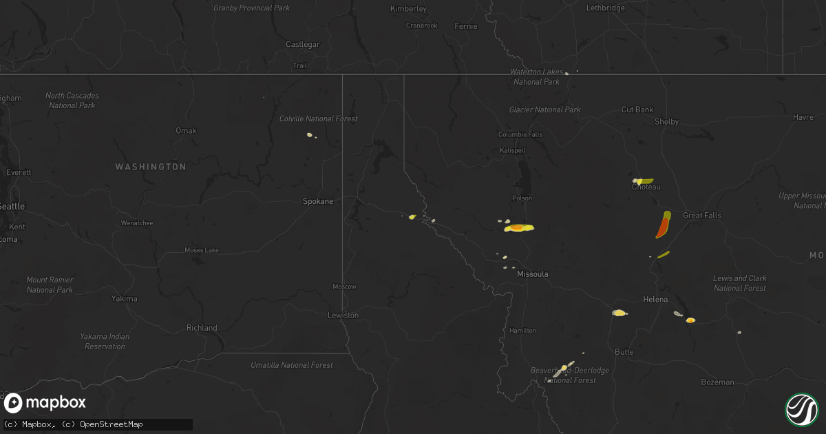
Hail Map on August 25, 2022
Get this storm
August 25 map
$229
one time, instant access
Download today. No call, no setup
Keep the $229
Bought the map and want the full workflow? Apply the entire $229 to a subscription within 7 days. None of it is wasted.
Every map, not just this one
This buys you this map. Subscription and you get every map we run, in the markets you choose from a few cities to whole states to nationwide. Plus real-time alerts the moment a storm fires.
Contact data
Name, contact info, occupancy, even credit band for addresses in the footprint. You go from where it hit to who to call.
Become the source they trust
Unlimited branding weather history reports on demand. You already have the documented answer ready for the property owner, and you are the one who showed up with it.
Property data and RoofTrace estimates
Pull up any address you have got, its value and the exact code rules for that jurisdiction, straight from One Click Code. Then RoofTrace estimates the squares, pitch, and roof value, priced the way you price.
States Impacted by Hail Map on August 25, 2022
Storm reports
Missouri
| Date | Description |
|---|---|
| 08/25/20222:18 AM CDT | At 717 PM CDT, a severe thunderstorm was located over Bridgeton, moving southeast at 15 mph. HAZARD...60 mph wind gusts and penny size hail. SOURCE...Radar indicated. IMPACT...Expect damage to roofs, siding, and trees. This severe thunderstorm will be near... Florissant around 725 PM CDT. Hazelwood and Lambert-St. Louis International Airport around 730 PM CDT.Other locations in the path of this severe thunderstorm include St.Ann, Berkeley, Breckenridge Hills, Edmundson, Ferguson, Creve Coeur,Overland, St. John, Woodson Terrace, Kinloch and Calverton Park.This includes Interstate 70 in Missouri between exits 227 and 231. This also includes First Missouri State Capitol Historic Site. |
| 08/24/20227:29 PM CDT | Large tree limb down onto hwy 141. |
| 08/24/20227:14 PM CDT | Several 10 inch-diameter tree branches downed. Pea size hail also falling. |
South Dakota
| Date | Description |
|---|---|
| 08/25/20221:58 AM CDT | At 658 PM MDT, a severe thunderstorm was located 14 miles southeast of Redbird, or 22 miles southwest of Edgemont, moving northeast at 30 mph. HAZARD...60 mph wind gusts and quarter size hail. SOURCE...Radar indicated. IMPACT...Hail damage to vehicles is expected. Expect wind damage to roofs, siding, and trees. This severe thunderstorm will remain over mainly rural areas of east central Niobrara County. |
Washington
| Date | Description |
|---|---|
| 08/24/20228:07 PM CDT | Downed trees and wires near deer lake and east of loon lake. Time estimated from radar. |
| 08/24/20227:52 PM CDT | Outflow winds from thunderstorms knocked down a tree and power lines northwest of nine mile falls. Time estimated from radar. |
| 08/24/20227:35 PM CDT | Outflow winds from thunderstorms downed trees and power lines west of springdale. Nearly 1200 customers were without power for several hours. Time estimated from radar. |
Montana
| Date | Description |
|---|---|
| 08/25/20226:15 PM CDT | Public report via social media of quarter-sized hail. |
| 08/25/20226:07 PM CDT | Social media post from near townsend... Mt. |
| 08/25/20225:46 PM CDT | Ping pong size hail... Heavy rain and strong winds. |
| 08/25/20225:30 PM CDT | Public report through social media of ping pong sized hail quickly reducing to marble sized hail. |
| 08/25/20222:31 AM CDT | At 730 PM MDT, severe thunderstorms were located along a line extending from near Fort Shaw to near Sun River, moving north at 20 mph. HAZARD...Half dollar size hail. SOURCE...Radar indicated. IMPACT...Damage to vehicles is expected. Locations impacted include... Fort Shaw, Fort Shaw and Sun River. |
| 08/25/20222:22 AM CDT | At 721 PM MDT, a severe thunderstorm was located 10 miles south of Fairfield, or 22 miles northwest of Cascade. Movement is east at 10 mph. HAZARD...Half dollar size hail. SOURCE...Radar indicated. IMPACT...Damage to vehicles is expected. This severe thunderstorm will remain over mainly rural areas of central Lewis and Clark, southeastern Teton and northwestern Cascade Counties. |
| 08/25/20221:37 AM CDT | At 636 PM MDT, a severe thunderstorm was located 11 miles west of Cascade, moving northeast at 25 mph. HAZARD...Ping pong ball size hail. SOURCE...Radar indicated. IMPACT...People and animals outdoors will be injured. Expect damage to roofs, siding, windows, and vehicles. Locations impacted include... Simms. |
| 08/25/20221:24 AM CDT | At 622 PM MDT, a severe thunderstorm was located near Choteau, moving east at 15 mph. HAZARD...Two inch hail and 70 mph wind gusts. SOURCE...Radar indicated. IMPACT...People and animals outdoors will be injured. Expect hail damage to roofs, siding, windows, and vehicles. Expect considerable tree damage. Wind damage is also likely to mobile homes, roofs, and outbuildings. Locations impacted include... Choteau, Dutton, Power, Collins and Farmington. |
| 08/25/202212:51 AM CDT | At 551 PM MDT, a severe thunderstorm was located 24 miles southeast of White Sulphur Springs, moving east at 10 mph. HAZARD...Quarter size hail. SOURCE...Radar indicated. IMPACT...Damage to vehicles is expected. This severe thunderstorm will remain over mainly rural areas of southeastern Meagher County. |
| 08/25/202212:37 AM CDT | At 537 PM MDT, a severe thunderstorm was located 8 miles northwest of Choteau, moving east at 20 mph. HAZARD...60 mph wind gusts and quarter size hail. SOURCE...Radar indicated. IMPACT...Hail damage to vehicles is expected. Expect wind damage to roofs, siding, and trees. Locations impacted include... Choteau and Farmington. |
| 08/25/202212:06 AM CDT | At 506 PM MDT, a severe thunderstorm was located near Townsend, moving southeast at 20 mph. HAZARD...Half dollar size hail. SOURCE...Radar indicated. IMPACT...Damage to vehicles is expected. Locations impacted include... Townsend. |
| 08/24/202211:39 PM CDT | At 439 PM MDT, a severe thunderstorm was located 11 miles northwest of Wisdom, or 37 miles southwest of Anaconda, moving northeast at 15 mph. HAZARD...Quarter size hail. SOURCE...Radar indicated. IMPACT...Damage to vehicles is expected. This severe thunderstorm will remain over mainly rural areas of northwestern Beaverhead County. |
| 08/24/202211:35 PM CDT | At 435 PM MDT, a severe thunderstorm was located near Old Agency, or 23 miles south of Polson, moving east at 15 mph. HAZARD...60 mph wind gusts and half dollar size hail. SOURCE...Radar indicated. IMPACT...Hail damage to vehicles is expected. Expect wind damage to roofs, siding, and trees. Locations impacted include... Ravalli, St. Ignatius, Old Agency, Dixon, Allentown, Moiese, Kicking Horse, Charlo and Fort Connah. |
| 08/24/20229:52 PM CDT | At 252 PM MDT, a severe thunderstorm was located near Alberton, or 20 miles northwest of Missoula, moving east at 10 mph. HAZARD...60 mph wind gusts and quarter size hail and very heavy rain. SOURCE...Radar indicated. IMPACT...Hail damage to vehicles is expected. Expect wind damage to roofs, siding, and trees. Locations impacted include... Frenchtown, Huson and Ninemile. |
| 08/24/20228:29 PM CDT | At 129 PM PDT, a severe thunderstorm was located over Wallace, moving east at 15 mph. HAZARD...Quarter size hail. SOURCE...Radar indicated. IMPACT...Damage to vehicles is expected. Locations impacted include... Wallace and Mullan. This includes Interstate 90 in Idaho between mile markers 61 and 73. |
| 08/24/20227:16 PM CDT | Large amounts of hail up to 1 inch in diameter on highway 220 4 miles outside of choteau. |
Illinois
| Date | Description |
|---|---|
| 08/25/20223:06 AM CDT | At 806 PM CDT, a severe thunderstorm was located over Kirkwood, moving southeast at 15 mph. HAZARD...60 mph wind gusts and penny size hail. SOURCE...Radar indicated. IMPACT...Expect damage to roofs, siding, and trees. This severe thunderstorm will be near... Webster Groves, Crestwood, Richmond Heights, Sunset Hills, Brentwood, Maplewood and Oakland around 810 PM CDT. Shrewsbury around 815 PM CDT. Affton, Marlborough, Grantwood Village, Mackenzie and Sappington around 820 PM CDT. Lakeshire, Green Park and Concord around 825 PM CDT.Other locations in the path of this severe thunderstorm includeMehlville, St. George, Wilbur Park, Arnold, Lemay, Bella Villa andOakville.This includes the following highways... Interstate 44 in Missouri between exits 272 and 277. Interstate 55 in Missouri between exits 190 and 191. |
Virginia
| Date | Description |
|---|---|
| 08/24/202211:54 PM CDT | At 454 PM EDT, a severe thunderstorm was located 7 miles east of Upper Tract, or 8 miles south of Rough Run, moving southeast at 15 mph. HAZARD...60 mph wind gusts and quarter size hail. SOURCE...Radar indicated. IMPACT...Damaging winds will cause some trees and large branches to fall. This could injure those outdoors, as well as damage homes and vehicles. Roadways may become blocked by downed trees. Localized power outages are possible. Unsecured light objects may become projectiles. Locations impacted include... Criders. |
Georgia
| Date | Description |
|---|---|
| 08/24/202211:25 PM CDT | At 424 PM EDT, a severe thunderstorm was located near Homeland, or near Folkston, moving northwest at 5 mph. HAZARD...60 mph wind gusts and nickel size hail. SOURCE...Radar indicated. IMPACT...Expect damage to roofs, siding, and trees. Locations impacted include... Homeland, Race Pond and Winokur. |
Texas
| Date | Description |
|---|---|
| 08/25/202211:18 AM CDT | Video of brief weak tornado in open field provided by the public. |
Arizona
| Date | Description |
|---|---|
| 08/25/20226:00 PM CDT | Landspout reported near los reales landfill on social media. |
| 08/25/20221:02 AM CDT | At 602 PM MST, a severe thunderstorm was located over Tucson International Airport, or near Tucson, moving east at 5 mph. HAZARD...60 mph wind gusts and penny size hail. SOURCE...Radar indicated. IMPACT...Expect damage to roofs, siding, and trees. Locations impacted include... Tucson, Davis-Monthan Air Force Base, Drexel Heights, Pascua Pueblo Yaqui Reservation, Tucson International Airport, Summit and San Xavier Mission. |
| 08/25/20221:00 AM CDT | At 600 PM MST, a severe thunderstorm was located over Tucson International Airport, or near Tucson, moving east at 5 mph. HAZARD...60 mph wind gusts and penny size hail. SOURCE...Radar indicated. IMPACT...Expect damage to roofs, siding, and trees. Locations impacted include... Tucson, Davis-Monthan Air Force Base, Drexel Heights, Pascua Pueblo Yaqui Reservation, Tucson International Airport, Summit and San Xavier Mission. |
Wyoming
| Date | Description |
|---|---|
| 08/25/20226:50 PM CDT | Social media post shows video of ping pong to golf ball size hail with accumulation along state highway 39. Traffic was at a stand still. |
| 08/25/20222:09 AM CDT | At 708 PM MDT, a severe thunderstorm was located 11 miles southeast of Redbird, or 17 miles southwest of Edgemont, moving northeast at 35 mph. HAZARD...60 mph wind gusts and quarter size hail. SOURCE...Radar indicated. IMPACT...Hail damage to vehicles is expected. Expect wind damage to roofs, siding, and trees. Locations impacted include... Provo and Edgemont. |
| 08/25/20221:54 AM CDT | At 654 PM MDT, a severe thunderstorm was located near Manning Ranch, or 23 miles northwest of Lusk, moving east at 25 mph. HAZARD...Two inch hail. SOURCE...Radar indicated. IMPACT...People and animals outdoors will be injured. Expect damage to roofs, siding, windows, and vehicles. Locations impacted include... Manville, Manning Ranch and Lance Creek. |
| 08/25/20221:35 AM CDT | At 635 PM MDT, a severe thunderstorm was located 11 miles east of Wright, moving east at 15 mph. HAZARD...Ping pong ball size hail. SOURCE...Radar indicated. IMPACT...People and animals outdoors will be injured. Expect damage to roofs, siding, windows, and vehicles. This severe thunderstorm will remain over mainly rural areas of southeastern Campbell and southwestern Weston Counties, moving along Highway 450. |
| 08/25/20221:13 AM CDT | At 613 PM MDT, a severe thunderstorm was located near Manning Ranch, or 30 miles northeast of Douglas, moving east at 30 mph. HAZARD...Two inch hail. SOURCE...Radar indicated. IMPACT...People and animals outdoors will be injured. Expect damage to roofs, siding, windows, and vehicles. Locations impacted include... Manning Ranch and Lance Creek. |
| 08/25/20221:10 AM CDT | At 610 PM MDT, a severe thunderstorm was located near Rawhide Buttes, or 8 miles south of Lusk, moving east at 30 mph. HAZARD...Quarter size hail. SOURCE...Radar indicated. IMPACT...Damage to vehicles is expected. Locations impacted include... Lusk. |
| 08/25/202212:46 AM CDT | At 546 PM MDT, a severe thunderstorm was located 10 miles northeast of Two Moon Campground, or 21 miles southwest of Lusk, moving east at 30 mph. HAZARD...Ping pong ball size hail and 60 mph wind gusts. SOURCE...Radar indicated. IMPACT...People and animals outdoors will be injured. Expect hail damage to roofs, siding, windows, and vehicles. Expect wind damage to roofs, siding, and trees. This severe thunderstorm will remain over mainly rural areas of southwestern Niobrara, northwestern Goshen, northeastern Platte and southeastern Converse Counties. |
| 08/25/202212:39 AM CDT | At 539 PM MDT, a severe thunderstorm was located 8 miles north of Bill, or 32 miles southeast of Wright, moving east at 30 mph. HAZARD...Ping pong ball size hail and 60 mph wind gusts. SOURCE...Radar indicated. IMPACT...People and animals outdoors will be injured. Expect hail damage to roofs, siding, windows, and vehicles. Expect wind damage to roofs, siding, and trees. This severe thunderstorm will remain over mainly rural areas of west central Niobrara and northeastern Converse Counties. |
| 08/25/202212:31 AM CDT | At 531 PM MDT, a severe thunderstorm was located 5 miles north of Wright, moving east at 20 mph. HAZARD...Ping pong ball size hail and 60 mph wind gusts. SOURCE...Radar indicated. IMPACT...People and animals outdoors will be injured. Expect hail damage to roofs, siding, windows, and vehicles. Expect wind damage to roofs, siding, and trees. This severe thunderstorm will remain over mainly rural areas of southeastern Campbell County. |
| 08/25/202212:28 AM CDT | At 528 PM MDT, a severe thunderstorm was located 12 miles southwest of Bill, or 22 miles north of Douglas, moving east at 30 mph. HAZARD...Golf ball size hail and 60 mph wind gusts. SOURCE...Radar indicated. IMPACT...People and animals outdoors will be injured. Expect hail damage to roofs, siding, windows, and vehicles. Expect wind damage to roofs, siding, and trees. This severe thunderstorm will remain over mainly rural areas of east central Converse County. |
| 08/24/20227:35 PM CDT | Strong winds reported from the public... Which caused a camper to move. |
Idaho
| Date | Description |
|---|---|
| 08/25/20223:32 PM CDT | Hail covered interstate 90 east of wallace during the storm. Time estimated from radar. |
| 08/25/20223:30 PM CDT | A local report indicates 1.00 inch wind near WALLACE |
| 08/25/20223:04 PM CDT | Downed tree and wires near big creek road. Time estimated from radar. |
| 08/24/202211:47 PM CDT | At 447 PM MDT, a severe thunderstorm was located near Monida, or 30 miles northwest of Idmon, moving east at 15 mph. HAZARD...Half dollar size hail. SOURCE...Radar indicated. IMPACT...Damage to vehicles is expected. Locations impacted include... Monida and Snowline. |
West Virginia
| Date | Description |
|---|---|
| 08/25/20223:09 PM CDT | Trees blew down near the 20000 block of south fork rd. |
| 08/24/202211:08 PM CDT | At 407 PM EDT, a severe thunderstorm was located near Rough Run, moving east at 10 mph. HAZARD...60 mph wind gusts and quarter size hail. SOURCE...Radar indicated. IMPACT...Damaging winds will cause some trees and large branches to fall. This could injure those outdoors, as well as damage homes and vehicles. Roadways may become blocked by downed trees. Localized power outages are possible. Unsecured light objects may become projectiles. Locations impacted include... Criders, Bergton and Milam. |
Cities Impacted by Hail Map on August 25, 2022
- Townsend, MT
- Alberton, MT
- Silverton, ID
- Wallace, ID
- Douglas, WY
- Lead, SD
- Saint Regis, MT
- Deer Lodge, MT
- Glendo, WY
- Lima, MT
- Gillette, WY
- Saint Ignatius, MT
- Dixon, MT
- Charlo, MT
- Winston, MT
- Huson, MT
- White Sulphur Springs, MT
- Plains, MT
- Choteau, MT
- Lusk, WY
- Garrison, MT
- Avon, MT
- Sun River, MT
- Fort Shaw, MT
- Cascade, MT
- Wolf Creek, MT
- Lost Springs, WY
- Shawnee, WY