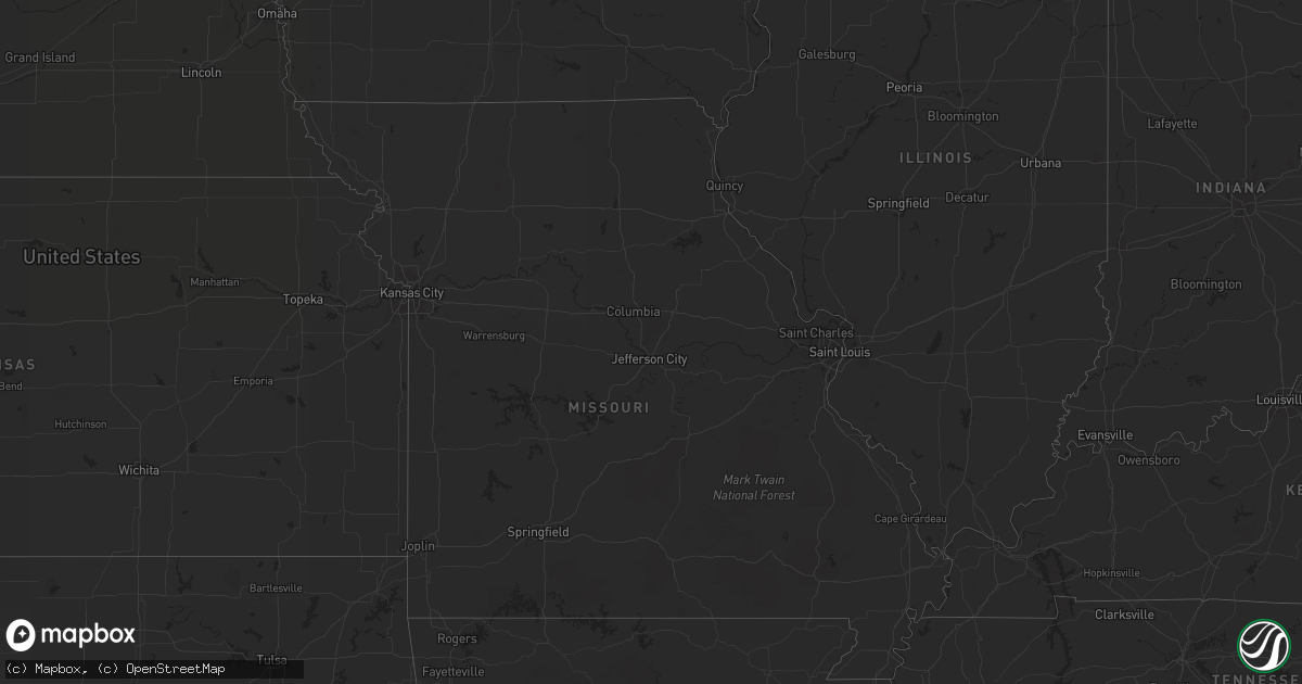
Hail Map in South Dakota on August 24, 2012
Get this storm
August 24 map
$229
one time, instant access
Download today. No call, no setup
Keep the $229
Bought the map and want the full workflow? Apply the entire $229 to a subscription within 7 days. None of it is wasted.
Every map, not just this one
This buys you this map. Subscription and you get every map we run, in the markets you choose from a few cities to whole states to nationwide. Plus real-time alerts the moment a storm fires.
Contact data
Name, contact info, occupancy, even credit band for addresses in the footprint. You go from where it hit to who to call.
Become the source they trust
Unlimited branding weather history reports on demand. You already have the documented answer ready for the property owner, and you are the one who showed up with it.
Property data and RoofTrace estimates
Pull up any address you have got, its value and the exact code rules for that jurisdiction, straight from One Click Code. Then RoofTrace estimates the squares, pitch, and roof value, priced the way you price.
Storm reports in South Dakota
South Dakota
| Date | Description |
|---|---|
| 08/24/20126:30 PM CDT | Large tree blown over |
| 08/23/201211:10 PM CDT | Automated pinnacles raws site. |
| 08/23/20128:29 PM CDT | Public reported quarter sized hail along hwy 12 west of mobridge...location estimated based off of radar |
| 08/23/20128:05 PM CDT | Public reported 60 plus mph winds at residence with damage to crops and nickel sized hail |
| 08/23/20127:30 PM CDT | Time estimated |
| 08/23/20127:05 PM CDT | Public reported 60 plus mph winds at residence with damage to crops and nickel sized hail |
| 08/23/20127:00 PM CDT | Quarter size hail and 70 to 80 mph winds lasted 10 minutes |
All States Impacted by Hail Map on August 24, 2012
Cities Impacted by Hail Map on August 24, 2012
- McIntosh, SD
- Steele, ND
- Hazelton, ND
- Moffit, ND
- Bismarck, ND
- Sterling, ND
- Pettibone, ND
- Tappen, ND
- Dawson, ND
- Menoken, ND
- Woodworth, ND
- Driscoll, ND
- Coleharbor, ND
- Beulah, ND
- Turtle Lake, ND
- Underwood, ND
- Stanton, ND
- Hazen, ND
- Thompson, UT
- Monticello, UT
- Winter Garden, FL
- Montverde, FL
- Clermont, FL
- Oakland, FL
- Windermere, FL
- Minot, ND
- Surrey, ND
- Rifle, CO
- Newfolden, MN
- Strandquist, MN
- Jennings, KS
- Nucla, CO
- Redvale, CO
- Rush, CO
- Wall, SD
- Sugar City, CO
- Lakin, KS
- Kanab, UT
- Fessenden, ND
- Harvey, ND
- Roseau, MN
- Ulysses, KS
- Wakpala, SD
- Stephen, MN
- Gordon, NE
- Langdon, ND
- Johnson, KS
- Glen Ullin, ND
- Hensel, ND
- Saint Thomas, ND
- Hamilton, ND
- Cavalier, ND
- Scott City, KS
- Mandan, ND
- Saint Anthony, ND
- Raleigh, ND
- Carson, ND
- Cedar Island, NC
- New Underwood, SD
- Wasta, SD
- Scenic, SD
- Grinnell, KS
- Oakley, KS
- Selfridge, ND
- Solen, ND
- Fort Yates, ND
- Post, TX
- Regan, ND
- Wilton, ND
- Mcclusky, ND
- Caputa, SD
- Hermosa, SD
- Center, ND
- Karval, CO
- Haswell, CO
- Wing, ND
- Tuttle, ND
- Newburg, ND
- Minto, ND
- Cannon Ball, ND
- Linton, ND
- Walsh, CO
- Hannaford, ND
- Antler, ND
- Mohall, ND
- Higgins, TX
- Sykeston, ND
- Boone, CO
- Yoder, CO
- Olney Springs, CO
- Towner, ND
- Granville, ND
- Garden City, KS
- Upham, ND
- Flasher, ND
- Brownfield, TX
- McLaughlin, SD
- Watauga, SD
- Panhandle, TX
- Green River, UT
- Trail City, SD
- De Beque, CO
- Kennedy, MN
- Borger, TX
- Fritch, TX
- Newport News, VA
- Hampton, VA
- Hardesty, OK
- Timber Lake, SD
- Mercer, ND
- Riverdale, ND
- Beaver, WV
- Harkers Island, NC
- Warroad, MN
- Kismet, KS
- Liberal, KS
- Turpin, OK
- Hugoton, KS
- Plains, KS
- Pampa, TX
- Wannaska, MN
- Ocracoke, NC
- Burlington, ND
- Kadoka, SD
- Parachute, CO
- Sawyer, ND
- Denhoff, ND
- Washburn, ND
- Martin, SD
- Bisbee, ND
- Donaldson, MN
- Gloucester, NC
- Smyrna, NC
- Marshallberg, NC
- Beaufort, NC
- Forgan, OK
- Goodrich, ND
- Avondale, CO
- White Deer, TX
- Groom, TX
- Colorado Springs, CO
- Copeland, KS
- Quinn, SD
- Bowdon, ND
- Chaseley, ND
- Hurdsfield, ND
- Ordway, CO
- Two Buttes, CO
- Springfield, CO
- Carrington, ND
- Hoxie, KS
- Max, ND
- Grygla, MN
- Sublette, KS
- Merkel, TX
- Las Animas, CO
- Montpelier, ND
- Salol, MN
- Benedict, ND
- Stinnett, TX
- Crosbyton, TX
- Maxbass, ND
- Garrison, ND
- Wolford, ND
- Souris, ND
- Westhope, ND
- Climax, MN
- Zap, ND
- Beryl, UT
- Pekin, ND
- Robinson, ND
- Asbury, WV
- Lewisburg, WV
- Ypsilanti, ND
- Douglas, ND
- Norwich, ND
- Velva, ND
- Deering, ND
- Bantry, ND
- Grand Forks, ND
- Middle River, MN
- New Salem, ND
- Rudyard, MT
- Orlando, FL
- Red Lake Falls, MN
- Satanta, KS
- Mountain, ND
- Penrose, CO
- Mylo, ND
- Lancaster, MN
- Batesland, SD
- Manter, KS
- East Carbon, UT
- Meade, KS
- Ralls, TX
- Floydada, TX
- Karlsruhe, ND
- Perryton, TX
- Cando, ND
- Kim, CO
- Butte, ND
- New Rockford, ND
- Karlstad, MN
- Pollock, SD
- Ingalls, KS
- Glenfield, ND
- Grace City, ND
- Nielsville, MN
- Davenport, FL
- Northwood, ND
- La Junta, CO
- Strathcona, MN
- Justiceburg, TX
- Cathay, ND
- Aneta, ND
- Spearman, TX
- Meadow, TX
- Lansford, ND
- Ashley, ND
- Gate, OK
- Valley City, ND
- Bristol, TN
- Milton, ND
- Gilby, ND
- Mcville, ND
- Selden, KS
- Philip, SD
- Deerfield, KS
- Norton, KS
- Clayton, KS
- Hugo, CO
- Wimbledon, ND
- Eads, CO
- Pierceville, KS
- Abilene, TX
- Glenburn, ND
- Walhalla, ND
- Rugby, ND
- Moscow, KS
- Agate, ND
- Mound City, SD


