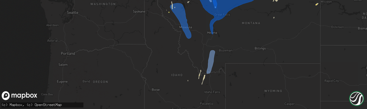
Hail Map in Idaho on August 23, 2024
The weather event in Idaho on August 23, 2024 includes Hail and Wind maps. 12 states and 304 cities were impacted and suffered possible damage. The total estimated number of properties impacted is 0.
Want more than just the map?
Turn this storm into a full workflow.
- Owner + property data so you know who to knock
- OnDemand branded weather history reports to win the "did we even have hail?" argument
- RoofTrace estimate so reps stop guessing numbers at the door
Bought this map? Upgrade within 7 days and we'll credit the $230. (10-15 min setup call)
Hail
Wind
0
Estimated number of impacted properties by a 1.00" hail or larger0
Estimated number of impacted properties by a 1.75" hail or larger0
Estimated number of impacted properties by a 2.50" hail or largerStorm reports in Idaho
Idaho
| Date | Description |
|---|---|
| 08/23/20245:53 PM CDT | Idaho power reports over 100 customers without power just west of rockford. |
| 08/23/20245:50 PM CDT | Tree down in warm river. Time estimated based on radar and observed wind gusts. |
| 08/23/20245:50 PM CDT | Fall river rural electric cooperative reports a power outage across the area. |
| 08/23/20245:42 PM CDT | Large tree limbs down in the area of n 3600 e and e 1475 n. Time estimated based on radar. |
| 08/23/20245:40 PM CDT | Several reports of large tree limbs down in ashton. Time estimated based on radar. |
| 08/23/20245:40 PM CDT | Large tree limbs down at ashton elementary school. Also portions of a wood and sheet metal roof blown off a building in the area. Photos received via nws pocatello face |
| 08/23/20245:40 PM CDT | Trees down at ashton city park. Report and photos provided via social media. Time estimated based on radar and nearby reports and wind gusts. |
| 08/23/20245:39 PM CDT | Tree down blocking a road in the area of id-32 and e 1200 n/reclamation rd. Report and photo received via social media. Time estimated based on radar...observed wind gu |
| 08/23/20245:38 PM CDT | Fremont county 911 dispatch reports a tree down on wires along n 3400 e south of e 1000 n. Time estimated based on radar and observed wind gusts. |
| 08/23/20245:35 PM CDT | Rocky mountain power reports over 200 customers without power due to thunderstorm winds. |
| 08/23/20245:30 PM CDT | Two trees snapped off along n 2600 e... Reported via social media. Time estimated based on radar and nearby wind gusts. |
| 08/23/20245:30 PM CDT | Multiple trees uprooted in the area of e 500 n and n 2500 e. Report and photo received via social media. Time estimated based on radar and surrounding reports and wind |
| 08/23/20245:30 PM CDT | Fall river rural electric cooperative reports power outages due to thunderstorm winds in the wilford and twin groves areas. |
| 08/23/20245:30 PM CDT | Mesonet station pc141 canyon creek. |
| 08/23/20245:30 PM CDT | Rwis itdd3 fall river us-20. |
| 08/23/20245:26 PM CDT | 8 trees down across a canal in the wilford area. Report and photo received via social media. Time estimated based on radar...observed wind gusts...and surrounding repor |
| 08/23/20245:26 PM CDT | Fremont county 911 dispatch reports a tree down blocking e 200 n near n 2300 e. Time estimated based on radar and observed wind gusts. |
| 08/23/20245:25 PM CDT | Rocky mountain power reports over 160 customers without power southwest of teton due to thunderstorm winds. |
| 08/23/20245:25 PM CDT | Fremont county 911 dispatch reports multiple trees and wires down across south central fremont county. No injuries or fatalities are known. Time estimated based on rada |
| 08/23/20245:22 PM CDT | Fremont county emergency management reports multiple power poles down in the area of id-33 milepost 108 near newdale. Rocky mountain power reports several thousand cust |
| 08/23/20245:22 PM CDT | Multiple large trees snapped off at a residence including two pines estimated at over 2 feet in diameter. Power poles snapped off near the base. Debris strewn across th |
| 08/23/20245:22 PM CDT | Madison county emergency management reports significant damage to electrical infrastructure in eastern parts of the county. Multiple power poles snapped off and wires d |
| 08/23/20245:22 PM CDT | Fremont county emergency management reports approximately 80 power poles are down along id-33 from newdale eastward. Idaho transportation department reports id-33 close |
| 08/23/20245:22 PM CDT | Fremont county 911 dispatch reports windows smashed out on one vehicle traveling on id-33 due to falling power lines and power poles. Occupants were evaluated by ems bu |
| 08/23/20245:21 PM CDT | 3 power poles snapped off along e 2000 n. Photos and video received via social media. Time estimated based on radar. |
| 08/23/20245:20 PM CDT | Large aspen tree down near horseshoe canyon. Photo of damage provided via social media. Time estimated based on radar. |
| 08/23/20245:20 PM CDT | Madison county sheriffs office reports wires down across the county. Numerous power outages reported. |
| 08/23/20245:15 PM CDT | Rwis itd95 inl puzzle us-20. |
| 08/23/20245:15 PM CDT | Rwis itd18 ririe us-26. |
| 08/23/20245:10 PM CDT | Mesonet station pc130 cub river. |
| 08/23/20245:08 PM CDT | Madison county sheriffs office reports e 8000 s is closed at approximately s 6200 e due to downed wires. Time estimated based on radar. |
| 08/23/20245:08 PM CDT | Rocky mountain power reports outages northeast of herbert due to thunderstorm winds. |
| 08/23/20245:05 PM CDT | Several trees reported down in the area of kelly mountain...kelly canyon trail...and kelly canyon resort. One trail blocked. Time estimated based on radar and nearby re |
| 08/23/20245:05 PM CDT | Jefferson county 911 dispatch reports multiple trees down across far eastern jefferson county. No injuries or fatalities are known and no major structural damage was re |
| 08/23/20245:05 PM CDT | Large tree limbs down blocking 160 e near e ririe highway. Photo and report received via social media. Time estimated based on report... Radar... And surrounding report |
| 08/23/20245:05 PM CDT | Video and photos received via social media of winds estimated at 60 mph and significant blowing dust with large tree limbs breaking off and falling on road. Tree also d |
| 08/23/20245:05 PM CDT | Jefferson county emergency management reports tree down on a vehicle on kelly canyon rd. Vehicle on fire. Unknown if any injuries occurred. Time estimated based on rada |
| 08/23/20245:00 PM CDT | Mesonet station pc134 moss avery. |
| 08/23/20245:00 PM CDT | Several trees and large tree limbs snapped and down in franklin. Report and photos received via social media. Time estimated based on report...radar...and observed wind |
| 08/23/20245:00 PM CDT | Private weather station just east of birch creek rd. |
| 08/23/20244:46 PM CDT | Mesonet station pcni1 pole canyon. |
| 08/23/20244:45 PM CDT | Rwis itd99 kettle butte us-20. |
| 08/23/20244:30 PM CDT | Mesonet station bas base of howe peak. |
| 08/23/20244:30 PM CDT | Mesonet station pc371 medicine lodge. |
| 08/23/20244:20 PM CDT | Measured wind gust to 74 mph in chesterfield snapping off a large pine tree several feet above the ground. Report and photos received via social media. Time estimated b |
| 08/23/20244:20 PM CDT | Measured wind gust to 74 mph in chesterfield snapping off a large pine tree several feet above the ground. Report and photos received via social media. Time estimated b |
| 08/23/20244:20 PM CDT | Mesonet station pc364 chesterfield reservoir. |
| 08/23/20244:15 PM CDT | Mesonet station tra reactor technologies complex. |
| 08/23/20244:10 PM CDT | Mesonet station pc133 pebble. |
| 08/23/20244:07 PM CDT | Tree limb down on wires. |
| 08/23/20244:05 PM CDT | Mesonet station rwm radioactive waste management. |
| 08/23/20244:02 PM CDT | Mesonet station crii1 cotton ridge. |
| 08/23/20243:45 PM CDT | Mesonet station big coxs well. |
| 08/23/20243:30 PM CDT | Large tree limb down damaging a fence. |
| 08/23/20243:30 PM CDT | Rwis itd55 henrys lake us-20. |
| 08/23/20243:05 PM CDT | Mesonet station sum big southern butte. |
| 08/23/20242:51 PM CDT | Mesonet station krci1 kriley creek raws. |
| 08/23/20242:35 PM CDT | Jefferson county emergency management reports multiple trees down in the area of e menan lorenzo highway and n 3950 e. Time estimated based on radar. |
| 08/23/20242:34 PM CDT | Trees down along e 600 n. Reported via social media. Time estimated based on radar and surrounding reports. |
| 08/23/20242:24 PM CDT | About 6 trees blown down in skinner canyon. Fire department and power company on scene. Time estimated. |
| 08/23/20242:18 PM CDT | Idaho power reports over 700 customers without power. |
| 08/23/202412:57 PM CDT | Tree limbs down approximately 3 inches in diameter and 15 feet long in the area of 13th ave and 14th ave. Pea size hail also reported. Report received via social media. |
All States Impacted by Hail Map on August 23, 2024
Cities Impacted by Hail Map on August 23, 2024
- Augusta, KS
- Andover, KS
- Rose Hill, KS
- Douglass, KS
- Culbertson, MT
- Fairview, MT
- Leon, KS
- Bainville, MT
- Saint David, AZ
- Mackay, ID
- Leadore, ID
- Lima, MT
- Menan, ID
- Palestine, TX
- Dubois, ID
- Oakwood, TX
- Ganado, AZ
- Keams Canyon, AZ
- Florahome, FL
- Fairfield, TX
- Kanab, UT
- Buffalo, TX
- Blanding, UT
- Teague, TX
- Vail, AZ
- Chinle, AZ
- Escalante, UT
- Granada, CO
- Waelder, TX
- Jewett, TX
- Holly, CO
- Mexia, TX
- Groesbeck, TX
- Wortham, TX
- Richland, TX
- Streetman, TX
- Benson, AZ
- Marquez, TX
- Boulder, UT
- Thompson Falls, MT
- Plains, MT
- Animas, NM
- Coolidge, TX
- Spencer, ID
- Philipsburg, MT
- Stevensville, MT
- Clinton, MT
- Drummond, MT
- Florence, MT
- Missoula, MT
- Lolo, MT
- Huson, MT
- Alberton, MT
- Milltown, MT
- Frenchtown, MT
- Bonner, MT
- Dillon, MT
- Virginia City, MT
- Dawson, TX
- Giddings, TX
- Prairie Hill, TX
- Mart, TX
- Purdon, TX
- Abilene, TX
- Willard, UT
- Brigham City, UT
- Mantua, UT
- Hyrum, UT
- Logan, UT
- Wellsville, UT
- Arlee, MT
- Alder, MT
- Sheridan, MT
- McAllister, MT
- Harrisburg, NE
- Grover, CO
- Syracuse, KS
- Paige, TX
- Dixon, MT
- Clancy, MT
- Helena, MT
- Fort Harrison, MT
- Canyon Creek, MT
- Wolf Creek, MT
- Saint Ignatius, MT
- Ravalli, MT
- Charlo, MT
- Hubbard, TX
- Breckenridge, TX
- Hanksville, UT
- Marion, MT
- Libby, MT
- Smithville, TX
- Temple, TX
- Mount Calm, TX
- Axtell, TX
- Thompson, UT
- Oracle, AZ
- New Raymer, CO
- Cascade, MT
- Wiggins, CO
- Roggen, CO
- Tucson, AZ
- Troy, TX
- Moulton, TX
- Peridot, AZ
- Eloy, AZ
- Sun River, MT
- Fort Shaw, MT
- Simms, MT
- Fairfield, MT
- Clyde, TX
- Gering, NE
- Casa Grande, AZ
- Coolidge, AZ
- Lorena, TX
- Rosanky, TX
- Fort Morgan, CO
- Gonzales, TX
- Ronan, MT
- Hot Springs, MT
- Polson, MT
- Pablo, MT
- Pony, MT
- Silver Star, MT
- Cardwell, MT
- Norris, MT
- Bayard, NE
- Bushnell, NE
- Newcastle, TX
- Crawford, TX
- McGregor, TX
- Belton, TX
- Kimball, NE
- Lonepine, MT
- Big Arm, MT
- Rollins, MT
- Dayton, MT
- Lakeside, MT
- Kila, MT
- Proctor, MT
- Elmo, MT
- Great Falls, MT
- Ulm, MT
- Sand Coulee, MT
- Augusta, MT
- Power, MT
- Choteau, MT
- Vaughn, MT
- Black Eagle, MT
- Floweree, MT
- Stockett, MT
- Dutton, MT
- Carter, MT
- Highwood, MT
- Fort Benton, MT
- Shiner, TX
- Flatonia, TX
- Rexford, MT
- Mcgrew, NE
- Marana, AZ
- Jarrell, TX
- Ledger, MT
- Loma, MT
- Brady, MT
- Valier, MT
- Chester, MT
- Conrad, MT
- Pendroy, MT
- Bynum, MT
- Stoneham, CO
- Young, AZ
- Salado, TX
- Georgetown, TX
- Merino, CO
- Snyder, CO
- Baird, TX
- Stockdale, TX
- Mooreland, OK
- Monticello, UT
- Nashua, MT
- Kalispell, MT
- Killeen, TX
- Browning, MT
- Dupuyer, MT
- Heart Butte, MT
- Cut Bank, MT
- Babb, MT
- Ethridge, MT
- Shelby, MT
- Galata, MT
- Oilmont, MT
- Sunburst, MT
- Lothair, MT
- Kevin, MT
- Sweet Grass, MT
- Joplin, MT
- Big Sandy, MT
- Rudyard, MT
- Whitlash, MT
- Inverness, MT
- Johnson City, TX
- Round Mountain, TX
- Roosevelt, AZ
- Albany, TX
- Florence, AZ
- Florence, TX
- Winslow, AZ
- Cisco, TX
- Geraldine, MT
- Chinook, MT
- Box Elder, MT
- Havre, MT
- Lloyd, MT
- Kremlin, MT
- Gildford, MT
- Hingham, MT
- Hays, MT
- Harlem, MT
- Turner, MT
- Zurich, MT
- Loring, MT
- Dodson, MT
- Hogeland, MT
- Moab, UT
- Green Valley, AZ
- Chambers, AZ
- Ovalo, TX
- Whitefish, MT
- Strawn, TX
- Larslan, MT
- Columbia Falls, MT
- San Simon, AZ
- Padroni, CO
- Sterling, CO
- Burnet, TX
- Moran, TX
- Peetz, CO
- Bertram, TX
- Lometa, TX
- Spring Branch, TX
- Kendalia, TX
- Richland, MT
- Opheim, MT
- Mason, TX
- Lampasas, TX
- Bend, TX
- San Saba, TX
- Hinsdale, MT
- Tow, TX
- Bluffton, TX
- Chappell, NE
- Buchanan Dam, TX
- Eastland, TX
- Rising Star, TX
- Cherokee, TX
- Valley Spring, TX
- Caddo, TX
- Carbon, TX
- Graford, TX
- Glentana, MT
- Peerless, MT
- Pontotoc, TX
- Frazer, MT
- Art, TX
- Cross Plains, TX
- Coleman, TX
- Whitewater, MT
- Venango, NE
- Fort Peck, MT
- Saco, MT
- Grant, NE
- Brusett, MT
- Glasgow, MT
- Corsicana, TX
- Malta, MT
- Scobey, MT
- Peyton, CO
- Redstone, MT
- Orleans, NE
- Alma, NE
- Elgin, AZ
- Republican City, NE
- Naponee, NE
- Jamestown, KS
- Beloit, KS
- Concordia, KS
- Bloomington, NE
- Mankato, KS
- Esbon, KS
- Aurora, KS
- Formoso, KS
- Courtland, KS
- Clyde, KS
- Belleville, KS
- Scandia, KS
- Westmoreland, KS
- Amazonia, MO
- Leesville, TX
- Oregon, MO
- Savannah, MO
- Maysville, MO
- Kansas City, MO
- Albany, MO


