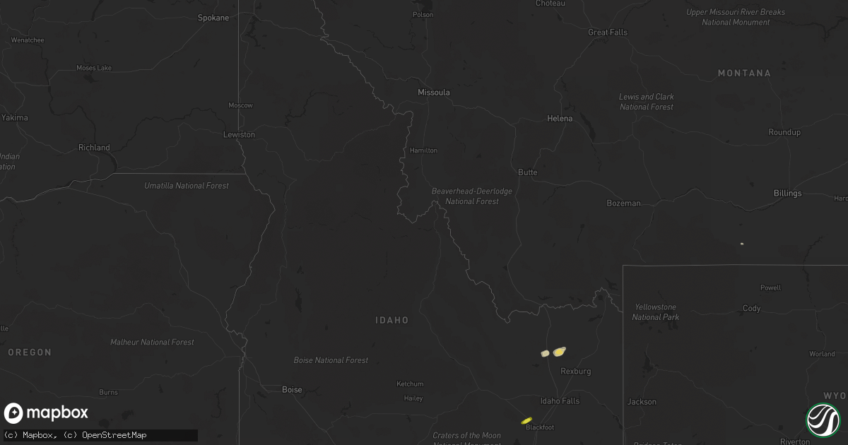
Hail Map in Idaho on August 22, 2018
Get this storm
August 22 map
$229
one time, instant access
Download today. No call, no setup
Keep the $229
Bought the map and want the full workflow? Apply the entire $229 to a subscription within 7 days. None of it is wasted.
Every map, not just this one
This buys you this map. Subscription and you get every map we run, in the markets you choose from a few cities to whole states to nationwide. Plus real-time alerts the moment a storm fires.
Contact data
Name, contact info, occupancy, even credit band for addresses in the footprint. You go from where it hit to who to call.
Become the source they trust
Unlimited branding weather history reports on demand. You already have the documented answer ready for the property owner, and you are the one who showed up with it.
Property data and RoofTrace estimates
Pull up any address you have got, its value and the exact code rules for that jurisdiction, straight from One Click Code. Then RoofTrace estimates the squares, pitch, and roof value, priced the way you price.
Storm reports in Idaho
Idaho
| Date | Description |
|---|---|
| 08/22/20186:21 PM CDT | Measured with a ruler. Report and photo posted to kifi local news 8 facebook page. Time estimated based on report and radar data. |
| 08/22/20186:20 PM CDT | Second report and photo of quarter to half dollar size hail in downtown soda springs... Posted to the kpvi facebook page. Time of hail provided by public. |
| 08/22/20184:43 PM CDT | Time estimated from radar. |
| 08/22/201810:50 AM CDT | Viewer submitted picture of hail up to quarter size to ksl 5 in salt lake city. From wednesday morning. |
| 08/22/20189:51 AM CDT | Corrects time on previous hail report from franklin. Viewer submitted picture of hail up to quarter size to ksl 5 in salt lake city. Photos also submitted to the presto |
| 08/22/20189:40 AM CDT | Hail lightly covered the ground. Reported by the public on the preston citizen facebook page. Time estimated based on radar. |
| 08/22/20184:28 AM CDT | At 925 AM MDT, a severe thunderstorm was located near Howell, or 15 miles northwest of Tremonton near I-84, moving northeast at 50 mph. HAZARD...60 mph wind gusts and half dollar size hail. SOURCE...Radar indicated. IMPACT...Hail damage to vehicles is expected. Expect wind damage to roofs, siding, and trees. Locations impacted include... Cache, Clarkston, Trenton, Plymouth, Howell, Riverside, Peter, Benson, Newton, Fielding, Cornish, Portage and Washakie. |
| 08/22/20183:52 AM CDT | At 852 AM MDT, a severe thunderstorm was located 15 miles south of Snowville, moving northeast at 40 mph. HAZARD...60 mph wind gusts and quarter size hail. SOURCE...Radar indicated. IMPACT...Hail damage to vehicles is expected. Expect wind damage to roofs, siding, and trees. Locations impacted include... Snowville, Howell, Riverside and Locomotive Springs. |
| 08/22/20183:16 AM CDT | At 815 AM MDT, a severe thunderstorm was located 8 miles south of Cherry Creek Rest Area, or 14 miles south of Malad, moving northeast at 40 mph. HAZARD...60 mph wind gusts and quarter size hail. SOURCE...Radar indicated. IMPACT...Hail damage to vehicles is expected. Expect wind damage to roofs, siding, and trees. Locations impacted include... Cornish, Portage and Washakie. |
| 08/21/201811:41 PM CDT | At 440 PM MDT, a severe thunderstorm was located near Rose, moving east-northeast at 20 mph. HAZARD...60 mph wind gusts and quarter size hail. SOURCE...Radar indicated. IMPACT...Hail damage to vehicles is expected. Expect wind damage to roofs, siding, and trees. Locations impacted include... Shelley, Firth, Rose, Basalt and Wapello. |
| 08/21/201811:28 PM CDT | At 424 PM MDT, severe thunderstorms were located along a line extending from near Dubois to 12 miles northwest of Plano to 6 miles south of Hamer, moving east at 35 mph. A wind gust to 56 MPH was recorded around 4:20 PM MDT in Camas with these storms. A trained spotter also reported power outages in Camas. HAZARD...60 mph wind gusts and quarter size hail. SOURCE...Radar indicated. IMPACT...Hail damage to vehicles is expected. Expect wind damage to roofs, siding, and trees. Locations impacted include... Dubois, Sugar City, Teton, Parker, Hamer, Egin, St Anthony, Plano, Saint Anthony Sand Dunes and Sage Junction. |
| 08/21/201811:07 PM CDT | At 407 PM MDT, a severe thunderstorm was located near Moreland or 10 miles northwest of Blackfoot, moving east-northeast at 25 mph. HAZARD...60 mph wind gusts and quarter size hail. SOURCE...Radar indicated. IMPACT...Hail damage to vehicles is expected. Expect wind damage to roofs, siding, and trees. Locations impacted include... Goshen, Shelley, Firth, Rose, Moreland, Groveland, Basalt and Wapello. |
| 08/21/201810:46 PM CDT | At 345 PM MDT, severe thunderstorms were located along a line extending from 14 miles northwest of Monteview to near Mud Lake, moving northeast at 35 mph. HAZARD...60 mph wind gusts and quarter size hail. SOURCE...Radar indicated. IMPACT...Hail damage to vehicles is expected. Expect wind damage to roofs, siding, and trees. Locations impacted include... Dubois, Terreton, Mud Lake, Hamer, Spencer, Monteview, southern Saint Anthony Sand Dunes and Small. |
| 08/21/201810:12 PM CDT | At 312 PM MDT, a severe thunderstorm was located 14 miles southwest of Rockland or 20 miles east of Malta, moving northeast at 35 mph. HAZARD...60 mph wind gusts and quarter size hail. SOURCE...Radar indicated. IMPACT...Hail damage to vehicles is expected. Expect wind damage to roofs, siding, and trees. Locations impacted include... Rockland, Fort Hall Bannock Peak, Pauline, Arbon, Sublett Reservoir, Roy, Mink Creek Pass and Daniels Reservoir. |
| 08/21/20187:46 PM CDT | Hail up to quarter size lightly covered the ground at treasureton reservoir. Report and video shared by the public on the preston citizen facebook page. Time estimated |
| 08/21/20187:35 PM CDT | Estimated pea to quarter size hail in oxford. Time of event adjusted based on radar. |
| 08/21/20187:34 PM CDT | Preston citizen reports damage to siding on homes in clifton. Additional photo of ping pong size hail provided. |
| 08/21/20187:33 PM CDT | Ping pong ball size hail confirmed via photos posted to the preston citizen facebook page. Damage to tree foliage. Reported at the church of jesus christ of latter-day |
All States Impacted by Hail Map on August 22, 2018
Cities Impacted by Hail Map on August 22, 2018
- Centerville, UT
- Bountiful, UT
- Layton, UT
- Kaysville, UT
- Farmington, UT
- Morgan, UT
- Mona, UT
- Santaquin, UT
- Payson, UT
- Perryton, TX
- Altamont, UT
- Georgetown, TX
- Florence, TX
- American Fork, UT
- Cedar Valley, UT
- Vineyard, UT
- Saratoga Springs, UT
- Eagle Mountain, UT
- Richmond, UT
- Hamer, ID
- Preston, ID
- Franklin, ID
- Weston, ID
- Garland, UT
- Snowville, UT
- Holloman Air Force Base, NM
- Tucson, AZ
- Rochester, TX
- Saint Anthony, ID
- Malad City, ID
- Portage, UT
- Salt Lake City, UT
- Miami, TX
- Nephi, UT
- Arbon, ID
- Roosevelt, UT
- Croydon, UT
- Mountain Home, UT
- Duchesne, UT
- Grantsville, UT
- Volborg, MT
- Rockland, ID
- Malta, ID
- Grace, ID
- Bancroft, ID
- Magna, UT
- Syracuse, UT
- Baird, TX
- Clifton, ID
- Lava Hot Springs, ID
- Otter, MT
- Vernal, UT
- Saint Charles, ID
- Montpelier, ID
- Fish Haven, ID
- Heber City, UT
- Clearfield, UT
- Albany, TX
- North Salt Lake, UT
- Woods Cross, UT
- Lampasas, TX
- Blackfoot, ID
- Spanish Fork, UT
- Monteview, ID
- Soda Springs, ID
- Canadian, TX
- Logan, UT
- Smithfield, UT
- Holbrook, ID
- Clyde, TX
- Collinston, UT
- Grouse Creek, UT
- Downey, ID
- Red Lodge, MT
- Roberts, MT
- Pocatello, ID
- Park Valley, UT
- Whiterocks, UT
- Tridell, UT
- Eureka, UT
- Dayton, ID
- Lewiston, UT
- Green River, WY
- Howell, UT
- Superior, AZ
- Ashland, MT
- Cokeville, WY
- Fort Lauderdale, FL
- Arimo, ID
- Abilene, TX
- Tabiona, UT
- Fallon, MT
- Dugway, UT
- Neola, UT
- Bluebell, UT


