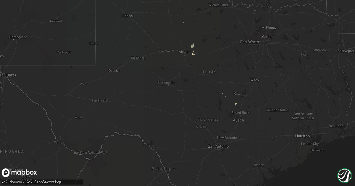
Hail Map in Texas on August 22, 2018
Get this storm
August 22 map
$229
one time, instant access
Download today. No call, no setup
Keep the $229
Bought the map and want the full workflow? Apply the entire $229 to a subscription within 7 days. None of it is wasted.
Every map, not just this one
This buys you this map. Subscription and you get every map we run, in the markets you choose from a few cities to whole states to nationwide. Plus real-time alerts the moment a storm fires.
Contact data
Name, contact info, occupancy, even credit band for addresses in the footprint. You go from where it hit to who to call.
Become the source they trust
Unlimited branding weather history reports on demand. You already have the documented answer ready for the property owner, and you are the one who showed up with it.
Property data and RoofTrace estimates
Pull up any address you have got, its value and the exact code rules for that jurisdiction, straight from One Click Code. Then RoofTrace estimates the squares, pitch, and roof value, priced the way you price.
Storm reports in Texas
Texas
| Date | Description |
|---|---|
| 08/22/20185:45 PM CDT | Possible brief tornado near lampasas. Minor tree damage. Picutre of funnel/tree damage from social media. Fire officials investigating if any other damage. |
| 08/22/20184:30 PM CDT | Abilene emergency manager reports 2 downed trees in the canterberry subdivision... Multiple tree limbs down in cal young park... Power pole down north of cal young park |
| 08/22/201812:05 AM CDT | At 505 PM CDT, a severe thunderstorm was located 14 miles northwest of Codman, or 16 miles northwest of Miami, moving east at 5 mph. HAZARD...60 mph wind gusts and quarter size hail. SOURCE...Radar indicated. IMPACT...Minor damage to roofs, siding, and trees is possible. Hail damage to vehicles is expected. This severe thunderstorm will remain over mainly rural areas of central Roberts County. |
| 08/21/201811:20 PM CDT | At 420 PM CDT, a severe thunderstorm was located 11 miles southwest of Albany, moving east at 5 mph. HAZARD...60 mph wind gusts and penny size hail. SOURCE...Radar indicated. IMPACT...Expect damage to roofs, siding, and trees. This severe thunderstorm will remain over mainly rural areas of southern Shackelford County, including the following locations... Mccarty Lake. |
All States Impacted by Hail Map on August 22, 2018
Cities Impacted by Hail Map on August 22, 2018
- Centerville, UT
- Bountiful, UT
- Layton, UT
- Kaysville, UT
- Farmington, UT
- Morgan, UT
- Mona, UT
- Santaquin, UT
- Payson, UT
- Perryton, TX
- Altamont, UT
- Georgetown, TX
- Florence, TX
- American Fork, UT
- Cedar Valley, UT
- Vineyard, UT
- Saratoga Springs, UT
- Eagle Mountain, UT
- Richmond, UT
- Hamer, ID
- Preston, ID
- Franklin, ID
- Weston, ID
- Garland, UT
- Snowville, UT
- Holloman Air Force Base, NM
- Tucson, AZ
- Rochester, TX
- Saint Anthony, ID
- Malad City, ID
- Portage, UT
- Salt Lake City, UT
- Miami, TX
- Nephi, UT
- Arbon, ID
- Roosevelt, UT
- Croydon, UT
- Mountain Home, UT
- Duchesne, UT
- Grantsville, UT
- Volborg, MT
- Rockland, ID
- Malta, ID
- Grace, ID
- Bancroft, ID
- Magna, UT
- Syracuse, UT
- Baird, TX
- Clifton, ID
- Lava Hot Springs, ID
- Otter, MT
- Vernal, UT
- Saint Charles, ID
- Montpelier, ID
- Fish Haven, ID
- Heber City, UT
- Clearfield, UT
- Albany, TX
- North Salt Lake, UT
- Woods Cross, UT
- Lampasas, TX
- Blackfoot, ID
- Spanish Fork, UT
- Monteview, ID
- Soda Springs, ID
- Canadian, TX
- Logan, UT
- Smithfield, UT
- Holbrook, ID
- Clyde, TX
- Collinston, UT
- Grouse Creek, UT
- Downey, ID
- Red Lodge, MT
- Roberts, MT
- Pocatello, ID
- Park Valley, UT
- Whiterocks, UT
- Tridell, UT
- Eureka, UT
- Dayton, ID
- Lewiston, UT
- Green River, WY
- Howell, UT
- Superior, AZ
- Ashland, MT
- Cokeville, WY
- Fort Lauderdale, FL
- Arimo, ID
- Abilene, TX
- Tabiona, UT
- Fallon, MT
- Dugway, UT
- Neola, UT
- Bluebell, UT


