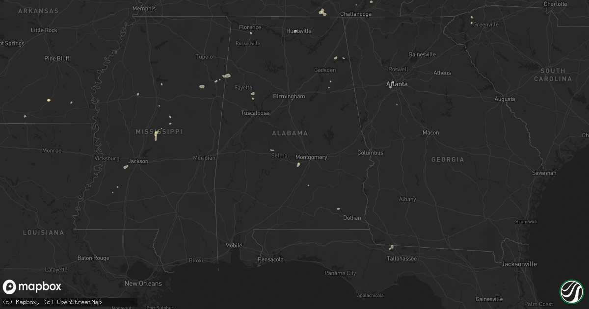
Hail Map in Alabama on August 20, 2025
Get this storm
August 20 map
$229
one time, instant access
Download today. No call, no setup
Keep the $229
Bought the map and want the full workflow? Apply the entire $229 to a subscription within 7 days. None of it is wasted.
Every map, not just this one
This buys you this map. Subscription and you get every map we run, in the markets you choose from a few cities to whole states to nationwide. Plus real-time alerts the moment a storm fires.
Contact data
Name, contact info, occupancy, even credit band for addresses in the footprint. You go from where it hit to who to call.
Become the source they trust
Unlimited branding weather history reports on demand. You already have the documented answer ready for the property owner, and you are the one who showed up with it.
Property data and RoofTrace estimates
Pull up any address you have got, its value and the exact code rules for that jurisdiction, straight from One Click Code. Then RoofTrace estimates the squares, pitch, and roof value, priced the way you price.
Storm reports in Alabama
Alabama
| Date | Description |
|---|---|
| 08/20/20255:50 PM CDT | Two large bamboo trees were knocked down into the roadway blocking one lane at the intersection of cr 25 and cr 144. Time estimated by radar. |
| 08/20/20255:50 PM CDT | A large tree limb was knocked down blocking all lanes of the roadway at 2251 cr 22. Time estimated by radar. |
| 08/20/20255:50 PM CDT | Tree down blocking almost the whole road on county rd 23. |
| 08/20/20255:48 PM CDT | A tree was knocked down and blocking both lanes at the intersection of cr 14 and cr 19. Time estimated by radar. |
| 08/20/20255:32 PM CDT | A tree was knocked down blocking both lanes of the road at the intersection of cr 7 and cr 6 at shadowbrook drive. Time estimated by radar. |
| 08/20/20255:25 PM CDT | Power line down along county rd 382 south of centre. |
| 08/20/20255:20 PM CDT | A tree and power lines were knocked down onto the roadway at the intersection of cr 7 and cr 639. Time estimated by radar. |
| 08/20/20255:15 PM CDT | A tree fell on a house located along valley acres rd in leesburg. |
| 08/20/20255:12 PM CDT | Tree down across county rd 36 three miles west of state highway 68. |
| 08/20/20255:10 PM CDT | Tree down blocking county rd 50 near sand rock. |
| 08/20/20255:03 PM CDT | Tree down blocking state highway 273. |
| 08/20/20255:03 PM CDT | Tree down blocking county rd 91. |
| 08/20/20255:02 PM CDT | Tree down blocking the roadway at railroad ave and cornwall dr in cedar bluff. |
| 08/20/20255:00 PM CDT | Tree down blocking county rd 133 between blanche and broomtown. |
| 08/20/20254:56 PM CDT | A tree was knocked down at the intersection of alabama highway 68 and cr 57. Time estimated by radar. |
| 08/20/20254:55 PM CDT | Tree down blocking county rd 15 at hen |
| 08/20/20254:55 PM CDT | Tree down blocking county rd 15 at henderson hill cemetery. |
| 08/20/20254:43 PM CDT | Power lines were knocked down at 3400 cr 97 in pine ridge. Time estimated by radar. |
| 08/20/20254:40 PM CDT | A tree was knocked down blocking one lane of traffic at 3500 cr 156 which is 1 mile west of cr 155. Time estimated by radar. |
| 08/20/20254:38 PM CDT | A tree was knocked down blocking both lanes of the road at 572 cr 531. Time estimated by radar. |
| 08/20/20254:35 PM CDT | A tree was knocked down at 2700 cr 494. Time estimated by radar. |
| 08/20/20254:31 PM CDT | A tree was knocked down at 6600 cr 121. Time estimated by radar. |
| 08/20/20254:31 PM CDT | A tree was knocked down blocking one lane of i-59 at mm 226. Time estimated by radar. |
| 08/20/20254:29 PM CDT | A tree and power line were knocked down at 300 george wallace drive. Time estimated by radar. |
| 08/20/20254:23 PM CDT | A tree and power lines were knocked down at 464 lowery road. Time estimated by radar. |
| 08/20/20254:21 PM CDT | Multiple trees were knocked down on i-59 close to the hammondville exit. Time estimated by radar. |
| 08/20/20254:20 PM CDT | Trees and power lines were knocked down at 464 lowery road. Time estimated by radar. |
| 08/20/20254:08 PM CDT | A tree was knocked down blocking the roaday on highway 117 in bass. Time estimated by radar. |
| 08/20/20252:20 PM CDT | A tree was knocked down at 990 discovery drive. Time estimated by nearby mesonet site. |
| 08/20/20252:10 PM CDT | A tree was knocked down at oakwood road and bethany lane. |
| 08/20/20251:24 PM CDT | A tree was knocked down at 2502 rochell drive nw. Time estimated by radar. |
| 08/19/20257:12 PM CDT | A tree was knocked down blocking both lanes of the roadway at the intersection of cr 54 and cr 14. Time estimated by radar. |
All States Impacted by Hail Map on August 20, 2025
Cities Impacted by Hail Map on August 20, 2025
- Camden, MS
- Kosciusko, MS
- Canton, MS
- Dayton, TN
- Carthage, TX
- Crossville, TN
- Altha, FL
- Marianna, FL
- Grandview, TN
- Ethel, MS
- Huntsville, AL
- Mertzon, TX
- Harriman, TN
- Garrison, TX
- Nacogdoches, TX
- Morrison, TN
- Mcminnville, TN
- Georgetown, TN
- Birchwood, TN
- Harrison, TN
- Old Fort, NC
- Ringgold, LA
- West Point, MS
- Cleveland, TN
- Signal Mountain, TN
- Hamilton, MS
- Prairie, MS
- Utica, MS
- Raymond, MS
- Fort Rucker, AL
- Ozark, AL
- Duck Hill, MS
- Grenada, MS
- Berry, AL
- Northport, AL
- Aberdeen, MS
- Belvidere, TN
- Winchester, TN
- Pickens, SC
- Conrad, MT
- Detroit, AL
- Sulligent, AL
- Greenwood Springs, MS
- Ledger, MT
- Quincy, FL
- Attapulgus, GA
- Greenwood, MS
- Havana, FL
- Elm Grove, LA
- Sherwood, TN
- Choteau, MT
- El Dorado, AR
- Gattman, MS
- Caledonia, MS
- Galata, MT
- Chester, MT
- Vaiden, MS
- Hazlehurst, MS
- Grand Cane, LA
- Frierson, LA
- Imperial, TX
- Gloster, LA
- Union Church, MS
- Eldorado, TX
- Livingston, TX
- Cleveland, TX
- Hermitage, AR
- Highland Home, AL
- Luverne, AL
- Honoraville, AL
- Leesburg, AL
- Warren, AR
- Joplin, MT
- Jamestown, TN
- Allardt, TN
- Spring Hill, TN
- Columbia, TN
- Inverness, MT
- Cedar Bluff, AL
- Rudyard, MT
- Hingham, MT
- Paoli, OK
- Muscle Shoals, AL
- Gildford, MT
- Rayville, LA
- Tuscumbia, AL
- Maysville, OK
- Belt, MT
- Pauls Valley, OK
- Geyser, MT
- Hayneville, AL
- Lowndesboro, AL
- Kremlin, MT
- Box Elder, MT
- Baskin, LA
- Highwood, MT
- Raynesford, MT
- Rattan, OK
- Havre, MT
- Geraldine, MT
- Coffee Creek, MT
- Georgetown, LA
- Hugo, OK
- Jacksonville, AL
- Wellington, AL
- Alexandria, AL
- Denton, MT
- Winnsboro, LA
- Monticello, AR
- Anniston, AL
- Lineville, AL
- Chinook, MT
- Soper, OK
- Jones, LA
- Lewistown, MT
- Hilger, MT
- Marion, AL
- Bonita, LA
- Atlanta, GA
- Mer Rouge, LA
- Harlem, MT
- Zurich, MT
- Hogeland, MT
- Roy, MT
- Winifred, MT
- Turner, MT
- Hampton, GA
- Fayetteville, GA
- Malta, MT
- Winnett, MT
- Marana, AZ
- Tucson, AZ
- Loring, MT
- Terry, MT
- Lindsay, MT
- Circle, MT
- Brockway, MT
- Angela, MT
- Glendive, MT
- Whitetail, MT


