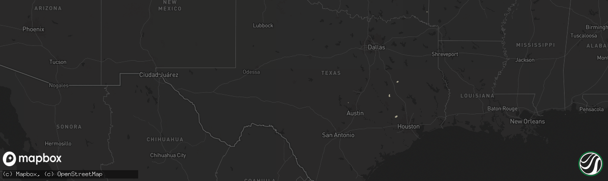
Hail Map in Texas on August 19, 2025
The weather event in Texas on August 19, 2025 includes Wind and Hail maps. 16 states and 603 cities were impacted and suffered possible damage. The total estimated number of properties impacted is 0.
Want more than just the map?
Turn this storm into a full workflow.
- Owner + property data so you know who to knock
- OnDemand branded weather history reports to win the "did we even have hail?" argument
- RoofTrace estimate so reps stop guessing numbers at the door
Bought this map? Upgrade within 7 days and we'll credit the $230. (10-15 min setup call)
Wind
Hail
0
Estimated number of impacted properties by a 1.00" hail or larger0
Estimated number of impacted properties by a 1.75" hail or larger0
Estimated number of impacted properties by a 2.50" hail or largerStorm reports in Texas
Texas
| Date | Description |
|---|---|
| 08/19/20255:15 PM CDT | A few small trees down and metal traffic signs bent near st. Marys university. |
| 08/19/20254:30 PM CDT | A multi-trunk tree was split and knocked over a street light. |
| 08/19/20254:25 PM CDT | Power lines downed across multiple houses and trees downed. |
| 08/19/20254:25 PM CDT | Corrects previous tstm wnd dmg report from 1 wnw natalia. There was damage on 5th and 6th streets in natalia. Several trees were knocked down and took down power lines. |
| 08/19/20254:20 PM CDT | The sutton county sheriffs office reported numerous roofs blown off... Power poles are down... And numerous large trees are down just south of sonora off of u.s. Hwy 27 |
| 08/19/20254:20 PM CDT | Corrects previous thunderstorm wind damage report from 1 ssw sonora. The sutton county sheriffs office reported numerous roofs blown off... Power poles are down... And |
| 08/19/20253:20 PM CDT | Video confirmed a landspout formed under a developing shower close to the east end of amistad reservoir... North of loop 79. The landspout appears to have remained over |
| 08/19/20252:55 PM CDT | Trained spotter reported damaging winds 1 mile to the north of clyde... Tx. He received some damage to his house. |
| 08/19/20252:40 PM CDT | Pictures of a multi-trunked tree split at inks lake state park. Estimating winds of 55 mph. Time estimated from radar. |
| 08/19/20252:40 PM CDT | Corrects previous tstm wnd dmg report from inks lake state park. Pictures of a multi-trunked tree split at inks lake state park. The park has an anemometer that measure |
| 08/19/202512:54 PM CDT | A 58 mph gust was measured by station anpt2. |
| 08/19/20258:18 AM CDT | Photo sent by harris county pct 4 employee showing trees down on waller spring creek rd. Time estimated from radar. |
| 08/18/202510:52 PM CDT | A local report indicates 63 MPH wind near 9 NNE Sunray |
| 08/18/20258:48 PM CDT | Multiple social media reports of several trees down along western center from i-35 to beach st. |
All States Impacted by Hail Map on August 19, 2025
Cities Impacted by Hail Map on August 19, 2025
- Mapleton, KS
- Hockley, TX
- Waller, TX
- Oakwood, TX
- Hempstead, TX
- Prescott, KS
- Abilene, KS
- Solomon, KS
- White City, KS
- Concord, AR
- Drasco, AR
- Junction City, KS
- Herington, KS
- Minneapolis, KS
- Woodbine, KS
- Hope, KS
- Milford, KS
- Riley, KS
- Chapman, KS
- Enterprise, KS
- Wakefield, KS
- Fort Riley, KS
- Patton, MO
- Marquand, MO
- Marshall, AR
- Sedgewickville, MO
- Arcadia, MO
- Perryville, MO
- Strong City, KS
- Jackson, MO
- Longford, KS
- Burdick, KS
- Gypsum, KS
- Friedheim, MO
- Mountain View, AR
- Hot Springs Village, AR
- Lonsdale, AR
- Annapolis, MO
- Fredericktown, MO
- Oak Ridge, MO
- Bradford, AR
- Dwight, KS
- Manhattan, KS
- Alta Vista, KS
- Cottonwood Falls, KS
- Quitman, AR
- Shelbyville, IN
- Fairland, IN
- Judsonia, AR
- Lincolnville, KS
- Clinton, AR
- Altenburg, MO
- Harriet, AR
- Eagletown, OK
- Bee Branch, AR
- Normangee, TX
- Clarksville, AR
- Hartman, AR
- North Zulch, TX
- Valley Springs, AR
- Elmdale, KS
- Daisy, MO
- Greenville, MO
- Winona, MO
- Shirley, AR
- Liberty Hill, TX
- Kingsville, TX
- Burbank, OK
- Burns, KS
- Dennard, AR
- Solgohachia, AR
- Hearne, TX
- Center Ridge, AR
- Cape Girardeau, MO
- Cedar Point, KS
- McClure, IL
- Poteet, TX
- Fay, OK
- Springfield, AR
- Franklin, TX
- Fox, AR
- Oakland, AR
- Whitewater, MO
- Benton, KS
- Newton, KS
- Burfordville, MO
- Fairfax, OK
- Fifty Six, AR
- Damascus, AR
- Van Buren, MO
- Ellington, MO
- Bryan, TX
- Gainesville, MO
- Perryville, AR
- Everton, AR
- Rover, AR
- Hattieville, AR
- Dierks, AR
- Advance, MO
- Kerrville, TX
- Center Point, TX
- Alton, MO
- Smyrna, GA
- Plumerville, AR
- Pocahontas, AR
- Myrtle, MO
- Mulberry, AR
- Gatewood, MO
- Lesterville, MO
- Rocksprings, TX
- Marietta, GA
- Mount Judea, AR
- Lawton, OK
- Faxon, OK
- El Dorado, KS
- Doniphan, MO
- Zalma, MO
- Casa, AR
- Oran, MO
- Bell City, MO
- Helotes, TX
- Thomas, OK
- Towanda, KS
- Junction, IL
- Cave In Rock, IL
- Elizabethtown, IL
- Poplar Bluff, MO
- Ola, AR
- Plainview, AR
- Cabot, AR
- Mayflower, AR
- Wappapello, MO
- Williamsville, MO
- Ellsinore, MO
- Alma, AR
- Bandera, TX
- Bloomfield, MO
- Glen Elder, KS
- Beebe, AR
- Sainte Genevieve, MO
- Burnet, TX
- Couch, MO
- Delphos, KS
- Tescott, KS
- Franklin, AR
- Melbourne, AR
- Charleston, MO
- Danville, AR
- Buncombe, IL
- Sterling, KS
- Rosiclare, IL
- Herod, IL
- Warm Springs, AR
- Ravenden Springs, AR
- Morrilton, AR
- Medina, TX
- Ozark, AR
- Vilonia, AR
- Bunch, OK
- Buchanan Dam, TX
- Iola, TX
- Dardanelle, AR
- Puxico, MO
- Houston, AR
- Lockesburg, AR
- Merom, IN
- Sullivan, IN
- Bluffton, TX
- Mico, TX
- San Antonio, TX
- Welling, OK
- Beloit, KS
- Jacksonville, AR
- Ozona, TX
- Grandin, MO
- Mammoth Spring, AR
- Thayer, MO
- Goreville, IL
- Watonga, OK
- Sherwood, AR
- Lyons, KS
- Camp, AR
- Nickerson, KS
- Tow, TX
- Black Rock, AR
- Uniontown, AR
- Muldrow, OK
- Perry, AR
- North Little Rock, AR
- Wichita, KS
- Llano, TX
- Cecil, AR
- Boling, TX
- Van Vleck, TX
- Pledger, TX
- Dongola, IL
- Maumelle, AR
- Conway, AR
- Bigelow, AR
- Cape Coral, FL
- Dudley, MO
- Utopia, TX
- Sabinal, TX
- Moores Hill, IN
- Port Charlotte, FL
- Dallas, GA
- Barksdale, TX
- Ravenden, AR
- Poughkeepsie, AR
- Williford, AR
- Hardy, AR
- Ironton, MO
- Marion, KY
- Imboden, AR
- Golconda, IL
- Natural Dam, AR
- Birch Tree, MO
- Partridge, KS
- Abbyville, KS
- Bremond, TX
- Mcconnell Afb, KS
- Maynard, AR
- Cypress, IL
- North Fort Myers, FL
- Andover, KS
- Derby, KS
- Little Rock, AR
- Concan, TX
- Leon, KS
- Atlanta, KS
- Uvalde, TX
- Knippa, TX
- Whitewater, KS
- Rio Frio, TX
- Cedarville, AR
- D Hanis, TX
- Salem, KY
- Rudy, AR
- Hutchinson, KS
- Geneseo, KS
- Lorraine, KS
- Dugger, IN
- Rose Hill, KS
- Leakey, TX
- Ellsworth, KS
- Evening Shade, AR
- Belknap, IL
- Burlington, TX
- Vanderpool, TX
- Hampton, KY
- Glencoe, AR
- Doe Run, MO
- Fort Myers, FL
- Douglass, KS
- Benton, AR
- Paron, AR
- Alexander, AR
- Carlisle, IN
- Fort Myers Beach, FL
- Haysville, KS
- Cawker City, KS
- Downs, KS
- Esbon, KS
- Eureka, KS
- Equality, IL
- Fisk, MO
- Pawnee, OK
- Glencoe, OK
- Calvert, TX
- Barnard, KS
- Campbell, MO
- Bloomsdale, MO
- French Village, MO
- Ballinger, TX
- Marquez, TX
- Rosebud, TX
- Jewett, TX
- Piggott, AR
- Peck, KS
- South Hutchinson, KS
- Heavener, OK
- Clearwater, KS
- Bonne Terre, MO
- Thornton, TX
- Devine, TX
- Natalia, TX
- Lytle, TX
- Rector, AR
- Metropolis, IL
- Karnak, IL
- Walnut Ridge, AR
- Oxford, KS
- Geuda Springs, KS
- Traskwood, AR
- Brackettville, TX
- La Coste, TX
- Portis, KS
- O'Kean, AR
- Salem, AR
- Springville, IN
- Wilsonville, NE
- Bloomfield, IN
- Newberry, IN
- Paducah, KY
- Salem, MO
- Groesbeck, TX
- Geary, OK
- Waldron, AR
- Greenway, AR
- Pollard, AR
- Brookport, IL
- Hitchcock, OK
- Okeene, OK
- Kingfisher, OK
- Irondale, MO
- Potosi, MO
- Mineral Point, MO
- Witter, AR
- Wellington, KS
- Paragould, AR
- Bono, AR
- Beech Grove, AR
- Lafe, AR
- Marmaduke, AR
- Princeton, KY
- Bismarck, MO
- Belle Plaine, KS
- Severy, KS
- Mansfield, AR
- Huntington, AR
- Vincennes, IN
- Boaz, KY
- Mayfield, KY
- Hickory, KY
- Norcatur, KS
- Farmington, MO
- Park Hills, MO
- Malvern, AR
- Booneville, AR
- Mccurtain, OK
- Leadwood, MO
- Rogers, TX
- Englewood, FL
- Heltonville, IN
- Udall, KS
- Jonesboro, AR
- Belgrade, MO
- Caledonia, MO
- Cherryville, MO
- Rolla, MO
- Murfreesboro, AR
- Bedford, IN
- Huntsville, AR
- Edcouch, TX
- Buckholts, TX
- Senath, MO
- Hornersville, MO
- Arbyrd, MO
- Leachville, AR
- Manila, AR
- Lenox, MO
- Edgar Springs, MO
- Blytheville, AR
- Delight, AR
- Aline, OK
- Grantsburg, IL
- Brookland, AR
- Hartford, AR
- Symsonia, KY
- Ledbetter, KY
- Bulverde, TX
- Marshall, OK
- Douglas, OK
- Carmen, OK
- Temple, TX
- Sonora, TX
- Dell, AR
- Etowah, AR
- Elberfeld, IN
- Norman, IN
- Decker, IN
- Prescott, AR
- Blevins, AR
- Dupont, IN
- Amity, AR
- Weslaco, TX
- Donna, TX
- Saint Amant, LA
- Gonzales, LA
- Mcalester, OK
- Stuart, OK
- Jadwin, MO
- Crystal City, TX
- Belton, TX
- Elsa, TX
- Menard, TX
- Keiser, AR
- Osceola, AR
- Wilson, AR
- Agra, KS
- Kensington, KS
- De Soto, MO
- Festus, MO
- Harper, KS
- S Coffeyville, OK
- Belleview, MO
- Madison, IN
- Kendalia, TX
- Kempner, TX
- French Lick, IN
- Jbsa Lackland, TX
- Phillipsburg, KS
- Oakland City, IN
- Lake City, AR
- Medford, OK
- Steelville, MO
- Macedonia, IL
- Cherry Valley, AR
- Wynne, AR
- Lamont, OK
- Paris, TN
- La Pryor, TX
- Kiowa, KS
- Alva, OK
- Hardtner, KS
- Cabool, MO
- Elk Creek, MO
- Willow Springs, MO
- Henry, TN
- Clarksville, TN
- Seligman, MO
- Crothersville, IN
- Meadville, MS
- Seymour, IN
- Brownstown, IN
- Raymondville, MO
- Summersville, MO
- Coldwater, MS
- Hartshorn, MO
- McKenzie, TN
- Cherokee, OK
- Bertram, TX
- Woodlawn, TN
- Ochopee, FL
- Austin, IN
- Kremlin, OK
- Quemado, TX
- Enid, OK
- Lutz, FL
- Land O'Lakes, FL
- Birdseye, IN
- Copperas Cove, TX
- Cook Sta, MO
- Bison, OK
- Olive Branch, MS
- Memphis, TN
- Stendal, IN
- Waynoka, OK
- Carmi, IL
- Crossville, IL
- Clifton, AZ
- Billings, MO
- Crane, MO
- Jasper, IN
- Roxie, MS
- Gentry, AR
- Colcord, OK
- Watts, OK
- Siloam Springs, AR
- Inola, OK
- Huntingdon, TN
- Wilson, KS
- Bristow, IN
- Branchville, IN
- Tell City, IN
- Saint Croix, IN
- Hollister, MO
- Newburg, MO
- Irvington, KY
- Nardin, OK
- Jerome, MO
- Dixon, MO
- Bentonville, AR
- Hiwasse, AR
- Stamford, NE
- Decatur, AR
- Bunker, MO
- Cedar Grove, TN
- Oakwood, OK
- Orlando, OK
- Eddyville, NE
- Salado, TX
- Crocker, MO
- Vine Grove, KY
- Crescent, OK
- Guthrie, OK
- Waynesville, MO
- Fort Leonard Wood, MO
- Coffeyville, KS
- Louisville, KY
- Little River Academy, TX
- Oconto, NE
- Eunice, MO
- Hennessey, OK
- Burlington, OK
- Sumner, NE
- Saint Robert, MO
- Mulhall, OK
- Briggs, TX
- Oklahoma City, OK
- Southaven, MS
- Waukomis, OK
- Wewoka, OK
- Hartshorne, OK
- Alma, NE
- Orleans, NE
- Long Island, KS
- Holyrood, KS
- Gaylord, KS
- Overton, NE
- Muskogee, OK
- Checotah, OK
- Holdenville, OK
- Greenville, MS
- Smith Center, KS
- Chickasha, OK
- Ninnekah, OK
- Bradley, OK
- Alex, OK
- Eufaula, OK
- Athol, KS
- Marlow, OK
- Oktaha, OK
- Lindsay, OK
- Decatur, TX
- Hanna, OK
- Fort Worth, TX
- Spearsville, LA
- Frohna, MO
- Springdale, AR
- Wolf Lake, IL
- Grand Tower, IL
- Dustin, OK
- Perryton, TX
- Leland, MS
- Chester, MT
- Whitlash, MT
- Galata, MT
- Oak Grove, LA
- Pioneer, LA
- Rayville, LA
- Joplin, MT
- Mer Rouge, LA
- Baldwyn, MS
- Oak Ridge, LA
- Bowie, TX
- Bellevue, TX
- Inverness, MT
- Augusta, MT
- Fairfield, MT
- Choteau, MT
- Cascade, MT
- Simms, MT
- Fort Shaw, MT
- Ledger, MT
- Conrad, MT
- Brady, MT
- Dutton, MT
- Sun River, MT
- Rudyard, MT
- Wilburton, OK
- Smithland, KY
- Ulm, MT
- Great Falls, MT
- Vaughn, MT
- Power, MT
- Havre, MT
- Honobia, OK
- Sand Coulee, MT
- Stratford, TX
- Gruver, TX
- Sunray, TX
- Floweree, MT
- Black Eagle, MT
- Carter, MT
- Stringtown, OK
- Shelby, MT
- Fort Benton, MT
- Lothair, MT
- Hingham, MT
- Gildford, MT
- Kremlin, MT
- Leopold, IN
- Foster, OK
- Wichita Falls, TX
- Chinook, MT
- Harlem, MT
- Hogeland, MT
- Henryetta, OK
- Blanchard, OK
- Quinton, OK
- Nocona, TX
- Montague, TX


