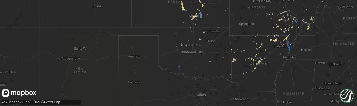
Hail Map in Oklahoma on August 19, 2025
The weather event in Oklahoma on August 19, 2025 includes Wind and Hail maps. 16 states and 603 cities were impacted and suffered possible damage. The total estimated number of properties impacted is 0.
Want more than just the map?
Turn this storm into a full workflow.
- Owner + property data so you know who to knock
- OnDemand branded weather history reports to win the "did we even have hail?" argument
- RoofTrace estimate so reps stop guessing numbers at the door
Bought this map? Upgrade within 7 days and we'll credit the $230. (10-15 min setup call)
Wind
Hail
0
Estimated number of impacted properties by a 1.00" hail or larger0
Estimated number of impacted properties by a 1.75" hail or larger0
Estimated number of impacted properties by a 2.50" hail or largerStorm reports in Oklahoma
Oklahoma
| Date | Description |
|---|---|
| 08/19/20256:21 PM CDT | Large tree downed. |
| 08/19/20256:21 PM CDT | Large tre |
| 08/19/20256:10 PM CDT | Power lines downed. Time estimated. |
| 08/19/20255:30 PM CDT | 59 mph gust measured by the oklahoma mesonet site 3 miles southeast of stuart. |
| 08/19/20254:40 PM CDT | Rolled over rvs... Peeled roofs on houses... And roofs removed from barns. |
| 08/19/20254:33 PM CDT | Personal weather station measured 67 mph wind gust. |
| 08/19/20254:28 PM CDT | Damage to a large outbuilding |
| 08/19/20253:20 PM CDT | Power poles snapped and some leaning along stretch of 1st street/jennings road east to sw 177th street. Time estimated from radar. |
| 08/19/20252:39 PM CDT | Lawton municipal airport. |
| 08/18/20258:00 PM CDT | One pole barn roof ripped off and multiple trees and power poles down. Time estimated from radar. |
All States Impacted by Hail Map on August 19, 2025
Cities Impacted by Hail Map on August 19, 2025
- Mapleton, KS
- Hockley, TX
- Waller, TX
- Oakwood, TX
- Hempstead, TX
- Prescott, KS
- Abilene, KS
- Solomon, KS
- White City, KS
- Concord, AR
- Drasco, AR
- Junction City, KS
- Herington, KS
- Minneapolis, KS
- Woodbine, KS
- Hope, KS
- Milford, KS
- Riley, KS
- Chapman, KS
- Enterprise, KS
- Wakefield, KS
- Fort Riley, KS
- Patton, MO
- Marquand, MO
- Marshall, AR
- Sedgewickville, MO
- Arcadia, MO
- Perryville, MO
- Strong City, KS
- Jackson, MO
- Longford, KS
- Burdick, KS
- Gypsum, KS
- Friedheim, MO
- Mountain View, AR
- Hot Springs Village, AR
- Lonsdale, AR
- Annapolis, MO
- Fredericktown, MO
- Oak Ridge, MO
- Bradford, AR
- Dwight, KS
- Manhattan, KS
- Alta Vista, KS
- Cottonwood Falls, KS
- Quitman, AR
- Shelbyville, IN
- Fairland, IN
- Judsonia, AR
- Lincolnville, KS
- Clinton, AR
- Altenburg, MO
- Harriet, AR
- Eagletown, OK
- Bee Branch, AR
- Normangee, TX
- Clarksville, AR
- Hartman, AR
- North Zulch, TX
- Valley Springs, AR
- Elmdale, KS
- Daisy, MO
- Greenville, MO
- Winona, MO
- Shirley, AR
- Liberty Hill, TX
- Kingsville, TX
- Burbank, OK
- Burns, KS
- Dennard, AR
- Solgohachia, AR
- Hearne, TX
- Center Ridge, AR
- Cape Girardeau, MO
- Cedar Point, KS
- McClure, IL
- Poteet, TX
- Fay, OK
- Springfield, AR
- Franklin, TX
- Fox, AR
- Oakland, AR
- Whitewater, MO
- Benton, KS
- Newton, KS
- Burfordville, MO
- Fairfax, OK
- Fifty Six, AR
- Damascus, AR
- Van Buren, MO
- Ellington, MO
- Bryan, TX
- Gainesville, MO
- Perryville, AR
- Everton, AR
- Rover, AR
- Hattieville, AR
- Dierks, AR
- Advance, MO
- Kerrville, TX
- Center Point, TX
- Alton, MO
- Smyrna, GA
- Plumerville, AR
- Pocahontas, AR
- Myrtle, MO
- Mulberry, AR
- Gatewood, MO
- Lesterville, MO
- Rocksprings, TX
- Marietta, GA
- Mount Judea, AR
- Lawton, OK
- Faxon, OK
- El Dorado, KS
- Doniphan, MO
- Zalma, MO
- Casa, AR
- Oran, MO
- Bell City, MO
- Helotes, TX
- Thomas, OK
- Towanda, KS
- Junction, IL
- Cave In Rock, IL
- Elizabethtown, IL
- Poplar Bluff, MO
- Ola, AR
- Plainview, AR
- Cabot, AR
- Mayflower, AR
- Wappapello, MO
- Williamsville, MO
- Ellsinore, MO
- Alma, AR
- Bandera, TX
- Bloomfield, MO
- Glen Elder, KS
- Beebe, AR
- Sainte Genevieve, MO
- Burnet, TX
- Couch, MO
- Delphos, KS
- Tescott, KS
- Franklin, AR
- Melbourne, AR
- Charleston, MO
- Danville, AR
- Buncombe, IL
- Sterling, KS
- Rosiclare, IL
- Herod, IL
- Warm Springs, AR
- Ravenden Springs, AR
- Morrilton, AR
- Medina, TX
- Ozark, AR
- Vilonia, AR
- Bunch, OK
- Buchanan Dam, TX
- Iola, TX
- Dardanelle, AR
- Puxico, MO
- Houston, AR
- Lockesburg, AR
- Merom, IN
- Sullivan, IN
- Bluffton, TX
- Mico, TX
- San Antonio, TX
- Welling, OK
- Beloit, KS
- Jacksonville, AR
- Ozona, TX
- Grandin, MO
- Mammoth Spring, AR
- Thayer, MO
- Goreville, IL
- Watonga, OK
- Sherwood, AR
- Lyons, KS
- Camp, AR
- Nickerson, KS
- Tow, TX
- Black Rock, AR
- Uniontown, AR
- Muldrow, OK
- Perry, AR
- North Little Rock, AR
- Wichita, KS
- Llano, TX
- Cecil, AR
- Boling, TX
- Van Vleck, TX
- Pledger, TX
- Dongola, IL
- Maumelle, AR
- Conway, AR
- Bigelow, AR
- Cape Coral, FL
- Dudley, MO
- Utopia, TX
- Sabinal, TX
- Moores Hill, IN
- Port Charlotte, FL
- Dallas, GA
- Barksdale, TX
- Ravenden, AR
- Poughkeepsie, AR
- Williford, AR
- Hardy, AR
- Ironton, MO
- Marion, KY
- Imboden, AR
- Golconda, IL
- Natural Dam, AR
- Birch Tree, MO
- Partridge, KS
- Abbyville, KS
- Bremond, TX
- Mcconnell Afb, KS
- Maynard, AR
- Cypress, IL
- North Fort Myers, FL
- Andover, KS
- Derby, KS
- Little Rock, AR
- Concan, TX
- Leon, KS
- Atlanta, KS
- Uvalde, TX
- Knippa, TX
- Whitewater, KS
- Rio Frio, TX
- Cedarville, AR
- D Hanis, TX
- Salem, KY
- Rudy, AR
- Hutchinson, KS
- Geneseo, KS
- Lorraine, KS
- Dugger, IN
- Rose Hill, KS
- Leakey, TX
- Ellsworth, KS
- Evening Shade, AR
- Belknap, IL
- Burlington, TX
- Vanderpool, TX
- Hampton, KY
- Glencoe, AR
- Doe Run, MO
- Fort Myers, FL
- Douglass, KS
- Benton, AR
- Paron, AR
- Alexander, AR
- Carlisle, IN
- Fort Myers Beach, FL
- Haysville, KS
- Cawker City, KS
- Downs, KS
- Esbon, KS
- Eureka, KS
- Equality, IL
- Fisk, MO
- Pawnee, OK
- Glencoe, OK
- Calvert, TX
- Barnard, KS
- Campbell, MO
- Bloomsdale, MO
- French Village, MO
- Ballinger, TX
- Marquez, TX
- Rosebud, TX
- Jewett, TX
- Piggott, AR
- Peck, KS
- South Hutchinson, KS
- Heavener, OK
- Clearwater, KS
- Bonne Terre, MO
- Thornton, TX
- Devine, TX
- Natalia, TX
- Lytle, TX
- Rector, AR
- Metropolis, IL
- Karnak, IL
- Walnut Ridge, AR
- Oxford, KS
- Geuda Springs, KS
- Traskwood, AR
- Brackettville, TX
- La Coste, TX
- Portis, KS
- O'Kean, AR
- Salem, AR
- Springville, IN
- Wilsonville, NE
- Bloomfield, IN
- Newberry, IN
- Paducah, KY
- Salem, MO
- Groesbeck, TX
- Geary, OK
- Waldron, AR
- Greenway, AR
- Pollard, AR
- Brookport, IL
- Hitchcock, OK
- Okeene, OK
- Kingfisher, OK
- Irondale, MO
- Potosi, MO
- Mineral Point, MO
- Witter, AR
- Wellington, KS
- Paragould, AR
- Bono, AR
- Beech Grove, AR
- Lafe, AR
- Marmaduke, AR
- Princeton, KY
- Bismarck, MO
- Belle Plaine, KS
- Severy, KS
- Mansfield, AR
- Huntington, AR
- Vincennes, IN
- Boaz, KY
- Mayfield, KY
- Hickory, KY
- Norcatur, KS
- Farmington, MO
- Park Hills, MO
- Malvern, AR
- Booneville, AR
- Mccurtain, OK
- Leadwood, MO
- Rogers, TX
- Englewood, FL
- Heltonville, IN
- Udall, KS
- Jonesboro, AR
- Belgrade, MO
- Caledonia, MO
- Cherryville, MO
- Rolla, MO
- Murfreesboro, AR
- Bedford, IN
- Huntsville, AR
- Edcouch, TX
- Buckholts, TX
- Senath, MO
- Hornersville, MO
- Arbyrd, MO
- Leachville, AR
- Manila, AR
- Lenox, MO
- Edgar Springs, MO
- Blytheville, AR
- Delight, AR
- Aline, OK
- Grantsburg, IL
- Brookland, AR
- Hartford, AR
- Symsonia, KY
- Ledbetter, KY
- Bulverde, TX
- Marshall, OK
- Douglas, OK
- Carmen, OK
- Temple, TX
- Sonora, TX
- Dell, AR
- Etowah, AR
- Elberfeld, IN
- Norman, IN
- Decker, IN
- Prescott, AR
- Blevins, AR
- Dupont, IN
- Amity, AR
- Weslaco, TX
- Donna, TX
- Saint Amant, LA
- Gonzales, LA
- Mcalester, OK
- Stuart, OK
- Jadwin, MO
- Crystal City, TX
- Belton, TX
- Elsa, TX
- Menard, TX
- Keiser, AR
- Osceola, AR
- Wilson, AR
- Agra, KS
- Kensington, KS
- De Soto, MO
- Festus, MO
- Harper, KS
- S Coffeyville, OK
- Belleview, MO
- Madison, IN
- Kendalia, TX
- Kempner, TX
- French Lick, IN
- Jbsa Lackland, TX
- Phillipsburg, KS
- Oakland City, IN
- Lake City, AR
- Medford, OK
- Steelville, MO
- Macedonia, IL
- Cherry Valley, AR
- Wynne, AR
- Lamont, OK
- Paris, TN
- La Pryor, TX
- Kiowa, KS
- Alva, OK
- Hardtner, KS
- Cabool, MO
- Elk Creek, MO
- Willow Springs, MO
- Henry, TN
- Clarksville, TN
- Seligman, MO
- Crothersville, IN
- Meadville, MS
- Seymour, IN
- Brownstown, IN
- Raymondville, MO
- Summersville, MO
- Coldwater, MS
- Hartshorn, MO
- McKenzie, TN
- Cherokee, OK
- Bertram, TX
- Woodlawn, TN
- Ochopee, FL
- Austin, IN
- Kremlin, OK
- Quemado, TX
- Enid, OK
- Lutz, FL
- Land O'Lakes, FL
- Birdseye, IN
- Copperas Cove, TX
- Cook Sta, MO
- Bison, OK
- Olive Branch, MS
- Memphis, TN
- Stendal, IN
- Waynoka, OK
- Carmi, IL
- Crossville, IL
- Clifton, AZ
- Billings, MO
- Crane, MO
- Jasper, IN
- Roxie, MS
- Gentry, AR
- Colcord, OK
- Watts, OK
- Siloam Springs, AR
- Inola, OK
- Huntingdon, TN
- Wilson, KS
- Bristow, IN
- Branchville, IN
- Tell City, IN
- Saint Croix, IN
- Hollister, MO
- Newburg, MO
- Irvington, KY
- Nardin, OK
- Jerome, MO
- Dixon, MO
- Bentonville, AR
- Hiwasse, AR
- Stamford, NE
- Decatur, AR
- Bunker, MO
- Cedar Grove, TN
- Oakwood, OK
- Orlando, OK
- Eddyville, NE
- Salado, TX
- Crocker, MO
- Vine Grove, KY
- Crescent, OK
- Guthrie, OK
- Waynesville, MO
- Fort Leonard Wood, MO
- Coffeyville, KS
- Louisville, KY
- Little River Academy, TX
- Oconto, NE
- Eunice, MO
- Hennessey, OK
- Burlington, OK
- Sumner, NE
- Saint Robert, MO
- Mulhall, OK
- Briggs, TX
- Oklahoma City, OK
- Southaven, MS
- Waukomis, OK
- Wewoka, OK
- Hartshorne, OK
- Alma, NE
- Orleans, NE
- Long Island, KS
- Holyrood, KS
- Gaylord, KS
- Overton, NE
- Muskogee, OK
- Checotah, OK
- Holdenville, OK
- Greenville, MS
- Smith Center, KS
- Chickasha, OK
- Ninnekah, OK
- Bradley, OK
- Alex, OK
- Eufaula, OK
- Athol, KS
- Marlow, OK
- Oktaha, OK
- Lindsay, OK
- Decatur, TX
- Hanna, OK
- Fort Worth, TX
- Spearsville, LA
- Frohna, MO
- Springdale, AR
- Wolf Lake, IL
- Grand Tower, IL
- Dustin, OK
- Perryton, TX
- Leland, MS
- Chester, MT
- Whitlash, MT
- Galata, MT
- Oak Grove, LA
- Pioneer, LA
- Rayville, LA
- Joplin, MT
- Mer Rouge, LA
- Baldwyn, MS
- Oak Ridge, LA
- Bowie, TX
- Bellevue, TX
- Inverness, MT
- Augusta, MT
- Fairfield, MT
- Choteau, MT
- Cascade, MT
- Simms, MT
- Fort Shaw, MT
- Ledger, MT
- Conrad, MT
- Brady, MT
- Dutton, MT
- Sun River, MT
- Rudyard, MT
- Wilburton, OK
- Smithland, KY
- Ulm, MT
- Great Falls, MT
- Vaughn, MT
- Power, MT
- Havre, MT
- Honobia, OK
- Sand Coulee, MT
- Stratford, TX
- Gruver, TX
- Sunray, TX
- Floweree, MT
- Black Eagle, MT
- Carter, MT
- Stringtown, OK
- Shelby, MT
- Fort Benton, MT
- Lothair, MT
- Hingham, MT
- Gildford, MT
- Kremlin, MT
- Leopold, IN
- Foster, OK
- Wichita Falls, TX
- Chinook, MT
- Harlem, MT
- Hogeland, MT
- Henryetta, OK
- Blanchard, OK
- Quinton, OK
- Nocona, TX
- Montague, TX


