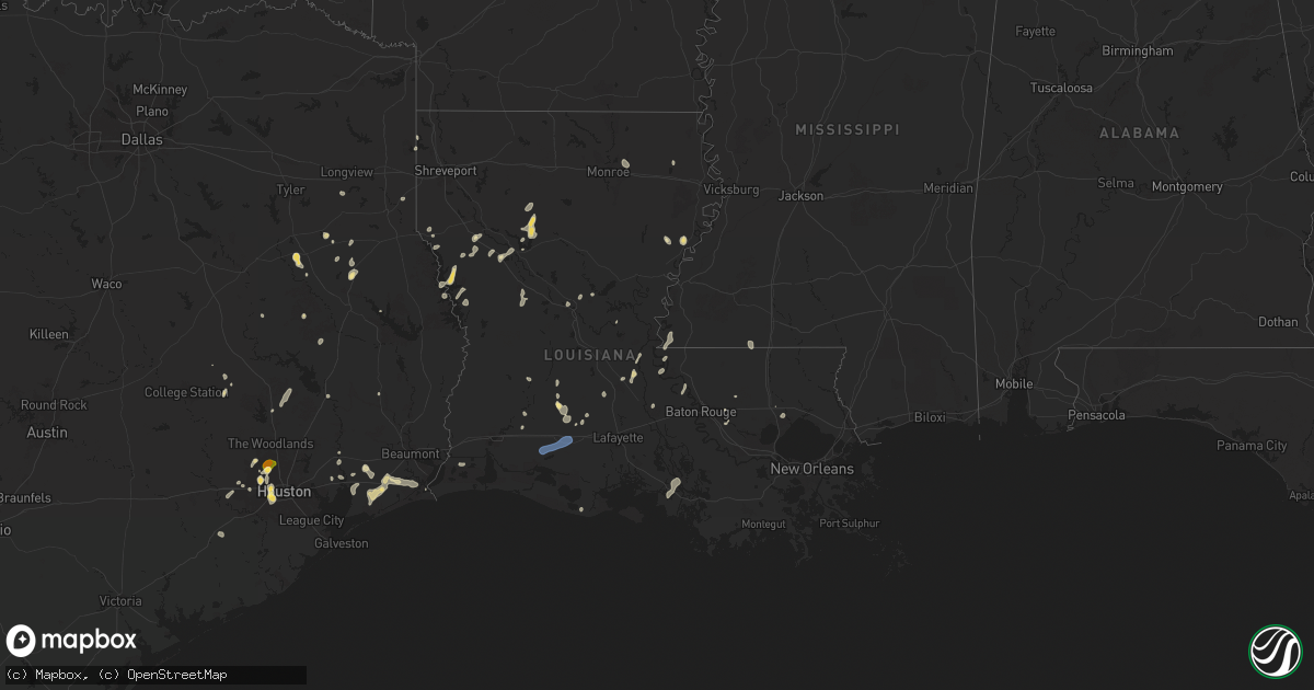
Hail Map in Louisiana on August 18, 2025
Get this storm
August 18 map
$229
one time, instant access
Download today. No call, no setup
Keep the $229
Bought the map and want the full workflow? Apply the entire $229 to a subscription within 7 days. None of it is wasted.
Every map, not just this one
This buys you this map. Subscription and you get every map we run, in the markets you choose from a few cities to whole states to nationwide. Plus real-time alerts the moment a storm fires.
Contact data
Name, contact info, occupancy, even credit band for addresses in the footprint. You go from where it hit to who to call.
Become the source they trust
Unlimited branding weather history reports on demand. You already have the documented answer ready for the property owner, and you are the one who showed up with it.
Property data and RoofTrace estimates
Pull up any address you have got, its value and the exact code rules for that jurisdiction, straight from One Click Code. Then RoofTrace estimates the squares, pitch, and roof value, priced the way you price.
Storm reports in Louisiana
Louisiana
| Date | Description |
|---|---|
| 08/18/20256:58 PM CDT | Very large tree uprooted on desoto road. Also... Reports of trees and branches down on nearby roadways. |
| 08/18/20256:45 PM CDT | Trees and power lines down along highway 6 east near highway 486 near grand ecore. Trees and power lines were also downed on tauzin island road near grand ecore. |
| 08/18/20255:53 PM CDT | A tree fell onto a house on ed edelen road. A tree was also downed on stubbs vinson road. |
| 08/18/20254:30 PM CDT | 2 powerpoles broken... Shed moved... And partial roof damage in the estherwood area. |
| 08/18/20254:25 PM CDT | 3 power poles broken near crowley. 1...976 customers with out power in slemco's area. |
| 08/18/20252:35 PM CDT | A few trees and powerlines reported down along chenal road. |
| 08/17/202510:00 PM CDT | As of 10 pm over 3000 customers were without power across natchitoches parish from thunderstorms causing down trees and power lines in several locations across the pari |
| 08/17/20257:25 PM CDT | Trees and power lines down on robeline provencal road near provencal. |
All States Impacted by Hail Map on August 18, 2025
Cities Impacted by Hail Map on August 18, 2025
- Lemmon, SD
- Auburn, NE
- Centralia, KS
- Sedgwick, CO
- Dalton, NE
- Seneca, KS
- Goff, KS
- Corning, KS
- Riley, KS
- Woodville, MS
- Stamford, TX
- Roscoe, IL
- Centreville, MS
- Caledonia, IL
- Poplar Grove, IL
- Kaplan, LA
- Sylvester, TX
- Anson, TX
- Gloster, MS
- Capron, IL
- Saint Francisville, LA
- Hamlin, TX
- Harvard, IL
- Bell City, LA
- Maringouin, LA
- Batchelor, LA
- Liberty, MS
- Colorado Springs, CO
- Grand Chenier, LA
- Satartia, MS
- Deadwood, SD
- Lindenwood, IL
- Florissant, CO
- Lettsworth, LA
- Conifer, CO
- Etoile, TX
- Polk City, FL
- Sedalia, CO
- Ponchatoula, LA
- Palmetto, LA
- Plaucheville, LA
- Lincoln, NM
- Capitan, NM
- Simmesport, LA
- Nemo, SD
- Piedmont, SD
- Deville, LA
- Glynn, LA
- Rougon, LA
- Jarreau, LA
- Childress, TX
- Limon, CO
- Groveland, FL
- Troy, MO
- Wright City, MO
- Montreal, MO
- Linn Creek, MO
- Saint Elizabeth, MO
- Tuscumbia, MO
- Esmond, IL
- Roscoe, TX
- Blackwell, TX
- Maryneal, TX
- Nacogdoches, TX
- Sturgis, SD
- Rapid City, SD
- Ramah, CO
- Washington, LA
- Western Grove, AR
- Harrison, AR
- Vendor, AR
- Hill City, SD
- Owensville, MO
- Hermann, MO
- Dry Creek, LA
- Kirkland, IL
- Rochelle, IL
- New Haven, MO
- Meadow, SD
- Carrington, ND
- Iowa, LA
- Burns, WY
- Lebanon, MO
- Genoa, CO
- Oakdale, LA
- Arriba, CO
- Deer Trail, CO
- Leslie, MO
- Gerald, MO
- Wentzville, MO
- Mittie, LA
- West Brooklyn, IL
- Calhan, CO
- Crocker, MO
- Rush, CO
- Hermanville, MS
- Byers, CO
- Sycamore, IL
- Kingston, IL
- Clare, IL
- Woodrow, CO
- Picayune, MS
- Bison, SD
- Opelousas, LA
- Dupree, SD
- Hampshire, IL
- Ocala, FL
- Pine Bluffs, WY
- Dixon, MO
- Pingree, ND
- Raymond, MS
- Burlington, IL
- Rosston, OK
- Maple Park, IL
- Pattison, MS
- Malta, IL
- Kensal, ND
- Utica, MS
- Strasburg, CO
- Kinder, LA
- Mount Enterprise, TX
- Compton, IL
- Dunnellon, FL
- Elgin, IL
- Shabbona, IL
- Dekalb, IL
- Lee, IL
- Waterman, IL
- Hinckley, IL
- Cedar Key, FL
- Inglis, FL
- Spokane, MO
- Oberlin, LA
- Hugo, CO
- Waynesville, MO
- Berryville, AR
- Hammond, LA
- Canadian, TX
- Lake Saint Louis, MO
- Basile, LA
- O'Fallon, MO
- Port Gibson, MS
- Genoa, IL
- Gilberts, IL
- Dundee, IL
- Elburn, IL
- Big Rock, IL
- Flagler, CO
- Laneville, TX
- Henderson, TX
- Reklaw, TX
- Rosebud, MO
- Cushing, TX
- Wiggins, CO
- Saint Joseph, LA
- Kilgore, TX
- Fordland, MO
- Marshfield, MO
- Glenfield, ND
- Epps, LA
- Sullivan, MO
- Bourbon, MO
- Saint Robert, MO
- Alto, TX
- Eunice, LA
- Bushnell, NE
- Branch, LA
- Crowley, LA
- Highlandville, MO
- Cuba, MO
- Buffalo, OK
- Church Point, LA
- Walker, LA
- Iota, LA
- Hermosa, SD
- Seibert, CO
- Sublette, IL
- Mendota, IL
- Gilbert, LA
- Laverne, OK
- Rayne, LA
- Buchanan, ND
- Fort Leonard Wood, MO
- Fort Morgan, CO
- Rogersville, MO
- Rusk, TX
- Sugar Grove, IL
- Atwood, KS
- Caputa, SD
- Ellis, KS
- Lubbock, TX
- New Waverly, TX
- Baton Rouge, LA
- Natoma, KS
- Plainville, KS
- Licking, MO
- Salem, MO
- Fargo, OK
- Provencal, LA
- Robertsville, MO
- Lonedell, MO
- Denham Springs, LA
- Branson, MO
- Collyer, KS
- Prairieville, LA
- Webster, FL
- Warren, TX
- Vona, CO
- Aurora, IL
- Batavia, IL
- Paradise, KS
- Catharine, KS
- Victoria, KS
- Eagle Butte, SD
- Lantry, SD
- Eunice, NM
- Winona, KS
- Seymour, MO
- Quinter, KS
- Bryant, IA
- Clinton, IA
- Goose Lake, IA
- Wharton, TX
- East Bernard, TX
- Bedias, TX
- Clayton, LA
- Medford, OK
- Franklin, LA
- Jeanerette, LA
- Richards, TX
- Bushnell, FL
- Morriston, FL
- Wildwood, FL
- Grovespring, MO
- Stratton, CO
- Edson, KS
- Goodland, KS
- Gorham, KS
- Kennard, TX
- De Berry, TX
- Beloit, WI
- Oakley, KS
- Liberty, TX
- Willis, TX
- Anderson, TX
- Cope, CO
- Houston, TX
- Bethune, CO
- Shattuck, OK
- Dacoma, OK
- Alva, OK
- May, OK
- Logansport, LA
- Grand Cane, LA
- Kanorado, KS
- Tonkawa, OK
- Dayton, TX
- Clinton, WI
- Wakeeney, KS
- Goldonna, LA
- Williston, FL
- Earlville, IL
- Paw Paw, IL
- Sykeston, ND
- Burlington, CO
- Gage, OK
- Hunter, OK
- Pond Creek, OK
- Lamont, OK
- New Raymer, CO
- Crockett, TX
- Nardin, OK
- Morgan City, LA
- Devers, TX
- Mansfield, LA
- Mount Carroll, IL
- Lanark, IL
- Milledgeville, IL
- Shannon, IL
- Forreston, IL
- Baileyville, IL
- Freeport, IL
- Weskan, KS
- Mount Morris, IL
- Leaf River, IL
- German Valley, IL
- Ridott, IL
- Palco, KS
- Ypsilanti, ND
- Ogallah, KS
- Gate, OK
- Hackberry, LA
- Jamestown, ND
- Spiritwood, ND
- Colby, KS
- Morland, KS
- Monroe, LA
- Grace City, ND
- Anahuac, TX
- Anton, CO
- Grubville, MO
- Baytown, TX
- Beaumont, TX
- Port Arthur, TX
- Katy, TX
- Vivian, LA
- Mooringsport, LA
- Sterling, CO
- Hayes, SD
- Fort Pierre, SD
- Akron, CO
- Alliance, NE
- Steward, IL
- Cypress, TX
- Stoneham, CO
- Hays, KS
- Hamshire, TX
- Venus, FL
- Bienville, LA
- Saline, LA
- Tomball, TX
- Wimbledon, ND
- Osyka, MS
- Winnie, TX
- Woodworth, ND
- Levant, KS
- Amboy, IL
- Mooreland, OK
- Chester, OK
- Winnfield, LA
- Carrier, OK
- Grainfield, KS
- Hoxie, KS
- Robeline, LA
- Courtenay, ND
- Magnolia, MS
- Groom, TX
- Pampa, TX
- Franklin Grove, IL
- Gove, KS
- Fulshear, TX
- Brookshire, TX
- Park, KS
- Natchitoches, LA
- Campti, LA
- Pelican, LA
- Enid, OK
- Lahoma, OK
- Sanborn, ND
- Hill City, KS
- Bogue, KS
- Sharon Springs, KS
- Marion, ND
- Hartford, AR
- Pleasant Hill, LA
- Brewster, KS
- Punta Gorda, FL
- Isabella, OK
- Dickey, ND
- Litchville, ND
- Lamoure, ND
- Montpelier, ND
- Walnut, IL
- Ohio, IL
- La Moille, IL
- Van Orin, IL
- Arlington, IL
- Triumph, IL
- Berlin, ND
- Verona, ND
- North Zulch, TX
- Clarendon, TX
- Taloga, OK
- Goodrich, TX
- Waukomis, OK
- Dazey, ND
- Mokena, IL
- Orland Park, IL
- Hemphill, TX
- Gettysburg, SD
- Converse, LA
- Fort Ransom, ND
- Spring, TX
- Cherry Creek, SD
- De Witt, IA
- Wanblee, SD
- Hartville, MO
- Ball, LA
- Pineville, LA
- Milam, TX
- Utica, IL
- Ottawa, IL
- Marseilles, IL
- Serena, IL
- Leland, IL
- Sheridan, IL
- Plano, IL
- Yorkville, IL
- Millington, IL
- Millbrook, IL
- Wedron, IL
- Sandwich, IL
- Somonauk, IL
- Newark, IL
- Troy Grove, IL
- La Salle, IL
- Grand Ridge, IL
- Lisbon, ND
- Bellaire, TX
- Seiling, OK
- Okeene, OK
- Noble, LA
- Zwolle, LA
- Oakwood, OK
- Cloutierville, LA
- Grinnell, KS
- Streator, IL
- Seneca, IL
- Morris, IL
- Ransom, IL
- Verona, IL
- Minooka, IL
- Plainfield, IL
- Joliet, IL
- Shorewood, IL
- Channahon, IL
- Crest Hill, IL
- Roseville, IL
- Berwick, IL
- Avon, IL
- Saint Augustine, IL
- London Mills, IL
- Fairview, IL
- Farmington, IL
- Oakes, ND
- Lostant, IL
- Wenona, IL
- Oshkosh, NE
- Tylertown, MS
- Fairview, OK
- Mora, LA
- Toluca, IL
- Wellington, TX
- Happy, TX
- Many, LA
- Canton, IL
- Norris, IL
- Elmwood, IL
- Kinsman, IL
- Lockport, IL
- Rutland, IL
- Kentwood, LA
- Longdale, OK
- Canton, OK
- Lomax, IL
- Stronghurst, IL
- Tinley Park, IL
- Florien, LA
- Healy, KS
- Glasford, IL
- Trivoli, IL
- New Lenox, IL
- Manhattan, IL
- Wilmington, IL
- Elwood, IL
- Homer Glen, IL
- Monee, IL
- Frankfort, IL
- Chesterton, IN
- Gary, IN
- Hobart, IN
- Portage, IN
- Lake Station, IN
- Valparaiso, IN
- East Chicago, IN
- Hanna City, IL
- Mapleton, IL
- Raritan, IL
- Media, IL
- Dana, IL
- Smithshire, IL
- Akron, AL
- Lebanon, SD
- Long Point, IL
- La Harpe, IL
- Michigan City, IN
- Pekin, IL
- Kingston Mines, IL
- Manito, IL
- South Pekin, IL
- Green Valley, IL
- Peotone, IL
- Manteno, IL
- Grant Park, IL
- Momence, IL
- Matteson, IL
- University Park, IL
- Beecher, IL
- Crete, IL
- Arcadia, FL
- Hennessey, OK
- Fairmont, OK
- Dixon, IL
- Bison, OK
- Schneider, IN
- Lake Village, IN
- Lowell, IN
- Cedar Lake, IN
- Dyer, IN
- Steger, IL
- Park Forest, IL
- Saint John, IN
- Chicago Heights, IL
- Richton Park, IL
- Schererville, IN
- Crown Point, IN
- Griffith, IN
- Munster, IN
- Highland, IN
- Olympia Fields, IL
- Glenwood, IL
- Lansing, IL
- Flossmoor, IL
- Thornton, IL
- Hammond, IN
- Homewood, IL
- Merrillville, IN
- Hebron, IN
- Demotte, IN
- Shelby, IN
- Peoria, IL
- Pecatonica, IL
- Fingal, ND
- Enderlin, ND
- Britton, SD
- Hoven, SD
- Marksville, LA
- Peru, IL
- Butler, OK
- Kingfisher, OK
- Oglesby, IL
- Holcomb, KS
- Blandinsville, IL
- Perkinston, MS
- Tonica, IL
- Lake City, SD
- Varna, IL
- Putnam, OK
- Milnor, ND
- Rio, IL
- Thomas, OK
- Custer City, OK
- Boone Grove, IN
- Wheatfield, IN
- Kouts, IN
- Thayer, IN
- Walkerton, IN
- Westville, IN
- Wanatah, IN
- Knox, IN
- North Judson, IN
- La Porte, IN
- San Pierre, IN
- Hamlet, IN
- Union Mills, IN
- Kingsford Heights, IN
- La Crosse, IN
- Hanna, IN
- Mishawaka, IN
- South Bend, IN
- Lakeville, IN
- North Liberty, IN
- Bremen, IN
- Mill Creek, IN
- Rolling Prairie, IN
- Grovertown, IN
- New Carlisle, IN
- Penokee, KS
- Rensselaer, IN
- Fair Oaks, IN
- Ransom, KS
- Culbertson, NE
- Levelland, TX
- Egan, LA
- Estherwood, LA
- Morse, LA
- Mermentau, LA
- Jennings, LA
- Lake Arthur, LA
- Romeoville, IL
- Oswego, IL
- Maquon, IL
- Lucas, KS
- Luray, KS
- Dorrance, KS
- Watkins, CO
- Aurora, CO
- Bennett, CO
- Mchenry, ND
- Sutton, ND
- Binford, ND
- Dolton, IL
- South Holland, IL
- Beverly Shores, IN
- Calumet City, IL
- Elkhart, IL
- Lincoln, IL
- Maroa, IL
- Argenta, IL
- Monticello, IL
- Cisco, IL
- Weldon, IL
- Clinton, IL
- De Land, IL
- Mansfield, IL
- White Heath, IL
- Decatur, IL
- Oreana, IL
- Forsyth, IL
- Cerro Gordo, IL
- Delia, KS
- Mayetta, KS
- Milmine, IL
- Hammond, IL
- La Place, IL
- Bement, IL
- Ivesdale, IL
- Sadorus, IL
- Tolono, IL
- Hoyt, KS
- Champaign, IL
- Topeka, KS
- Meriden, KS
- Emporia, KS
- Bartlesville, OK
- Waverly, KS
- Grantville, KS
- Wann, OK
- Groveton, TX
- Ochelata, OK
- Ramona, OK
- Barnsdall, OK
- Dewey, OK
- Kansas City, MO
- Kansas City, KS


