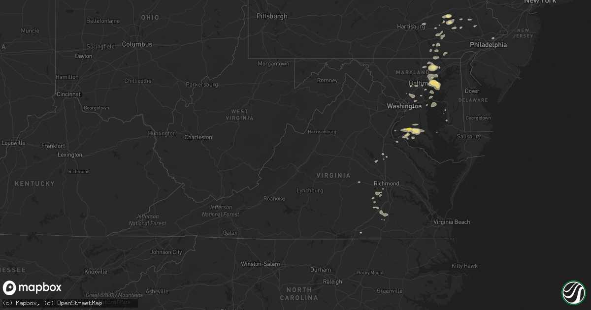
Hail Map in Virginia on August 18, 2017
Get this storm
August 18 map
$229
one time, instant access
Download today. No call, no setup
Keep the $229
Bought the map and want the full workflow? Apply the entire $229 to a subscription within 7 days. None of it is wasted.
Every map, not just this one
This buys you this map. Subscription and you get every map we run, in the markets you choose from a few cities to whole states to nationwide. Plus real-time alerts the moment a storm fires.
Contact data
Name, contact info, occupancy, even credit band for addresses in the footprint. You go from where it hit to who to call.
Become the source they trust
Unlimited branding weather history reports on demand. You already have the documented answer ready for the property owner, and you are the one who showed up with it.
Property data and RoofTrace estimates
Pull up any address you have got, its value and the exact code rules for that jurisdiction, straight from One Click Code. Then RoofTrace estimates the squares, pitch, and roof value, priced the way you price.
Storm reports in Virginia
Virginia
| Date | Description |
|---|---|
| 08/18/20176:49 PM CDT | Asos station ofp... Hanover county municipal. |
| 08/18/20176:42 PM CDT | Trees down across northern essex county. Reports of wind debris in the road as far south as tappahannock. |
| 08/18/20176:21 PM CDT | Numerous trees down in sparta with damage to a home. |
| 08/18/20176:20 PM CDT | Numerous trees down across caroline county primarily in the central and eastern portions of the county. Numerous roads blocked by fallen trees. |
| 08/18/20176:05 PM CDT | Multiple trees knocked down across the roadway at the intersection of bath road and south river road. Time estimated from radar. |
| 08/17/20177:30 PM CDT | Few trees down across the county. |
| 08/17/20177:23 PM CDT | Trees down in southern king william county along highway 30. |
| 08/17/20177:12 PM CDT | A local report indicates 1.00 inch wind near WARSAW |
| 08/17/20177:10 PM CDT | Trees down along highway 360 and mill pond rd. |
All States Impacted by Hail Map on August 18, 2017
Cities Impacted by Hail Map on August 18, 2017
- Effie, MN
- Walnut Hill, IL
- Dix, IL
- Centralia, IL
- Barnett, MO
- Stover, MO
- Versailles, MO
- Johnsonville, IL
- Iuka, IL
- Coatsville, MO
- Camdenton, MO
- Lynd, MN
- Wadena, MN
- Wayne City, IL
- Keenes, IL
- Bluford, IL
- Sanborn, MN
- Lamberton, MN
- Revillo, SD
- Chandler, MN
- Lake Wilson, MN
- Sanborn, IA
- Altus, AR
- Casa, AR
- Ola, AR
- Dardanelle, AR
- Danville, AR
- Milbank, SD
- Twin Brooks, SD
- Elkins, AR
- Fayetteville, AR
- Burlington, IA
- Marietta, MN
- Aurelia, IA
- Alta, IA
- Peterson, IA
- Ocheyedan, IA
- Hartley, IA
- Sibley, IA
- Reading, MN
- Iona, MN
- Primghar, IA
- Slayton, MN
- Galva, IA
- Wilmont, MN
- Cherokee, IA
- Melvin, IA
- Worthington, MN
- Schaller, IA
- Rushmore, MN
- Sutherland, IA
- Bigelow, MN
- Larrabee, IA
- Brandt, SD
- Gary, SD
- Strandburg, SD
- Clear Lake, SD
- Canby, MN
- Warrensburg, MO
- Centerview, MO
- Odessa, MO
- Sulphur Springs, AR
- South West City, MO
- Washburn, MO
- Carmi, IL
- Springerton, IL
- Enfield, IL
- Sunrise Beach, MO
- Kaiser, MO
- Linn Creek, MO
- Osage Beach, MO
- Monticello, AR
- Gorin, MO
- Winslow, AR
- Holland, MN
- Ruthton, MN
- Mora, MO
- Cole Camp, MO
- Gravois Mills, MO
- Rocky Mount, MO
- Richards, MO
- Mechanicsville, MD
- Charlotte Hall, MD
- Hopedale, IL
- Stanford, IL
- Armington, IL
- Fifty Lakes, MN
- Crosslake, MN
- Emily, MN
- Jasper, AR
- Green Forest, AR
- Berryville, AR
- Harrison, AR
- Marble Falls, AR
- Alpena, AR
- Maysville, AR
- Jay, OK
- McLean, IL
- Minier, IL
- La Monte, MO
- Higginsville, MO
- Mayview, MO
- Bates City, MO
- Whiteman Air Force Base, MO
- Concordia, MO
- Knob Noster, MO
- Green Ridge, MO
- Oak Grove, MO
- Napoleon, MO
- Richmond, MO
- Lexington, MO
- Schwenksville, PA
- Garfield, AR
- Rogers, AR
- Laurel, MD
- Burtonsville, MD
- Beltsville, MD
- Newmanstown, PA
- Pinckneyville, IL
- Tamaroa, IL
- Fortuna, MO
- Bumpass, VA
- Beaverdam, VA
- Welcome, MD
- La Plata, MD
- Port Tobacco, MD
- Port Republic, MD
- Newburg, MD
- Prince Frederick, MD
- Faulkner, MD
- Bel Alton, MD
- Hughesville, MD
- Chaptico, MD
- Iberia, MO
- Gary, MN
- Twin Valley, MN
- Fort Meade, FL
- Bowling Green, FL
- Montreal, MO
- Alexandria, MO
- Saint Patrick, MO
- Atchison, KS
- Cummings, KS
- Joppa, MD
- Kingsville, MD
- Middle River, MD
- Rosedale, MD
- Edgewood, MD
- Nottingham, MD
- Parkville, MD
- Sparrows Point, MD
- Baltimore, MD
- Upper Falls, MD
- Perry Hall, MD
- White Marsh, MD
- Rock Hall, MD
- Gunpowder, MD
- Glen Arm, MD
- Essex, MD
- Dundalk, MD
- Jacksonville, NC
- Little Rock, AR
- Windom, MN
- Fulda, MN
- Reading, PA
- Bryantown, MD
- Brandywine, MD
- Waldorf, MD
- Aquasco, MD
- Havana, AR
- Kansas City, MO
- Dryden, TX
- Lomax, IL
- Bonnie, IL
- Belle Rive, IL
- Independence, MO
- Corder, MO
- Alma, MO
- Dover, MO
- Waverly, MO
- Norborne, MO
- Gentry, MO
- Galesburg, IL
- Knoxville, IL
- Lake Benton, MN
- Orrick, MO
- Roach, MO
- Macks Creek, MO
- Brumley, MO
- Georgetown, DE
- Forest Hill, MD
- Bel Air, MD
- Fallston, MD
- Punta Gorda, FL
- Carrollton, MO
- Saint Robert, MO
- Crocker, MO
- Waynesville, MO
- Fort Leonard Wood, MO
- Platte City, MO
- Grain Valley, MO
- Buckner, MO
- Liberty, MO
- Florence, MO
- Otterville, MO
- Monmouth, IL
- Cameron, IL
- Chesterfield, VA
- Lawson, MO
- Opdyke, IL
- Fort Scott, KS
- Glenn Dale, MD
- Lanham, MD
- Bowie, MD
- Norris City, IL
- Broughton, IL
- McLeansboro, IL
- Merrifield, MN
- Brainerd, MN
- Round Lake, MN
- Madison, MN
- Powell, MO
- Eureka Springs, AR
- Pineville, MO
- Seligman, MO
- Richmond, VA
- Mohrsville, PA
- Bernville, PA
- Leesport, PA
- Amelia Court House, VA
- Church Road, VA
- Mount Vernon, IL
- Crossville, IL
- Richview, IL
- Texico, IL
- Hoyleton, IL
- Woodlawn, IL
- Dahlgren, IL
- Gentry, AR
- New Bloomfield, MO
- Media, IL
- Smithshire, IL
- Makinen, MN
- Aurora, MN
- Paton, IA
- Farnhamville, IA
- Somers, IA
- Rockwell City, IA
- Gowrie, IA
- Siloam Springs, AR
- Terril, IA
- Noel, MO
- Gravette, AR
- Hardin, MO
- Adrian, MN
- Redwood Falls, MN
- Belview, MN
- Deerfield, MO
- Niota, IL
- Fort Madison, IA
- West Point, IA
- Donnellson, IA
- Wever, IA
- Menahga, MN
- Goodman, MO
- Anderson, MO
- Smithville, MO
- Ogema, MN
- Callaway, MN
- Tremont, IL
- Pekin, IL
- Green Valley, IL
- Weston, MO
- Ozark, AR
- Carlisle, AR
- England, AR
- Belleville, AR
- Perryville, AR
- Colcord, OK
- Millersville, PA
- Conestoga, PA
- Currie, MN
- Avoca, MN
- Carson, VA
- Dewitt, VA
- Stony Creek, VA
- Dinwiddie, VA
- Polo, MO
- Pasadena, MD
- Bluffton, MN
- Oley, PA
- Hightstown, NJ
- Cranbury, NJ
- Princeton Junction, NJ
- Richland, MO
- Reinholds, PA
- Wernersville, PA
- Minneota, MN
- Dale, IL
- Subiaco, AR
- New Blaine, AR
- Scranton, AR
- Delavan, IL
- Wesley, AR
- Huntsville, AR
- Hindsville, AR
- Cherry Hill, NJ
- Quarryville, PA
- Peach Bottom, PA
- Kirkwood, PA
- Nottingham, PA
- Roland, AR
- Plymouth, IL
- Littleton, IL
- Rayville, MO
- Balaton, MN
- Pequot Lakes, MN
- Brodnax, VA
- Hendricks, MN
- Dallas City, IL
- Carthage, IL
- Philadelphia, PA
- Jarrettsville, MD
- Lathrop, MO
- Tyler, MN
- Princeton, NJ
- Floriston, CA
- Holtwood, PA
- Upper Marlboro, MD
- Witter, AR
- Comstock, TX
- Ulman, MO
- Taunton, MN
- Porter, MN
- Jeffers, MN
- Lake Ozark, MO
- Newburg, MO
- Dixon, MO
- Smithton, MO
- Devils Elbow, MO
- Duke, MO
- Dana, IA
- Pomeroy, IA
- Manson, IA
- Woodstock, MN
- Dearborn, MO
- Stewartsville, MO
- Gower, MO
- Robesonia, PA
- Womelsdorf, PA
- Street, MD
- Baldwin, MD
- Hughesville, MO
- Hydes, MD
- White Hall, MD
- Silver Spring, MD
- Paullina, IA
- Ashton, IA
- White, SD
- Calumet, IA
- Elkton, SD
- Garvin, MN
- Big Falls, MN
- Coal Hill, AR
- Pettigrew, AR
- Oark, AR
- Deer, AR
- Hewitt, MN
- Henning, MN
- Deer Creek, MN
- Felton, MN
- Annville, PA
- Palmyra, PA
- Hershey, PA
- Taylors Island, MD
- Bellingham, MN
- Western Grove, AR
- Hasty, AR
- Compton, AR
- Mohnton, PA
- Birdsboro, PA
- Dahlgren, VA
- King George, VA
- Arcadia, FL
- Ruther Glen, VA
- Salem, IA
- Turney, MO
- Braymer, MO
- Henrietta, MO
- Cowgill, MO
- Plattsburg, MO
- Douglassville, PA
- Granby, MO
- Rolfe, IA
- Bradgate, IA
- Ottosen, IA
- Glen Burnie, MD
- Curtis Bay, MD
- Canton, IL
- Topeka, IL
- South Pekin, IL
- Manito, IL
- Springdale, AR
- Gibson Island, MD
- Annapolis, MD
- Arnold, MD
- Westbrook, MN
- Kell, IL
- Sherwood, AR
- Jacksonville, AR
- Scott, AR
- North Little Rock, AR
- Edgewater, MD
- Immokalee, FL
- Naples, FL
- Powhatan, VA
- Arco, MN
- Ivanhoe, MN
- Edgerton, MO
- Trimble, MO
- Magazine, AR
- Paris, AR
- Kahoka, MO
- Clarksville, AR
- Ozone, AR
- Lowell, AR
- Dickens, IA
- Ayrshire, IA
- Mallard, IA
- Emmetsburg, IA
- Ruthven, IA
- Mulberry, AR
- Brogue, PA
- Airville, PA
- Barto, PA
- Pennsburg, PA
- Bechtelsville, PA
- Churchville, MD
- Livonia, MO
- Lancaster, MO
- Wellington, MO
- Robertsdale, AL
- Capitol Heights, MD
- Hartman, AR
- Labolt, SD
- Goodwin, SD
- Astoria, SD
- Heron Lake, MN
- Ona, FL
- Midlothian, VA
- Stevensville, MD
- Hollandale, MS
- Trappe, MD
- Echo, MN
- Park Rapids, MN
- Exeter, MO
- Neosho, MO
- Aledo, IL
- Alexis, IL
- Brooklyn, MD
- Halethorpe, MD
- Half Way, MO
- Ratcliff, AR
- Columbia, MD
- Ellicott City, MD
- Marshall, MN
- Ghent, MN
- Russell, MN
- Wyaconda, MO
- Borup, MN
- Easton, MD
- West Bend, IA
- Nisswa, MN
- Almyra, AR
- Stuttgart, AR
- Humphrey, AR
- Laurel, DE
- Nanjemoy, MD
- Gambrills, MD
- Odenton, MD
- Millersville, MD
- Callahan, FL
- Catonsville, MD
- Elkridge, MD
- Bella Vista, AR
- Zolfo Springs, FL
- Wauchula, FL
- Bowen, IL
- Augusta, IL
- Chestertown, MD
- Sedalia, MO
- Woodford, VA
- Manheim, PA
- Lititz, PA
- Pylesville, MD
- Delta, PA
- Whiteford, MD
- Lismore, MN
- Ford, VA
- Crane, MO
- Monkton, MD
- Sparks Glencoe, MD
- Willow Street, PA
- New Providence, PA
- Pequea, PA
- Lancaster, PA
- Tunas, MO
- Easton, KS
- Pinecrest, CA
- Quitman, AR
- Bee Branch, AR
- Excelsior Springs, MO
- Akron, PA
- Leola, PA
- Ephrata, PA
- New Holland, PA
- Bird In Hand, PA
- Combs, AR
- Decatur, AR
- Bentonville, AR
- Sweet Springs, MO
- Houstonia, MO
- Bertha, MN
- Eagle Bend, MN
- Parkers Prairie, MN
- Carman, IL


