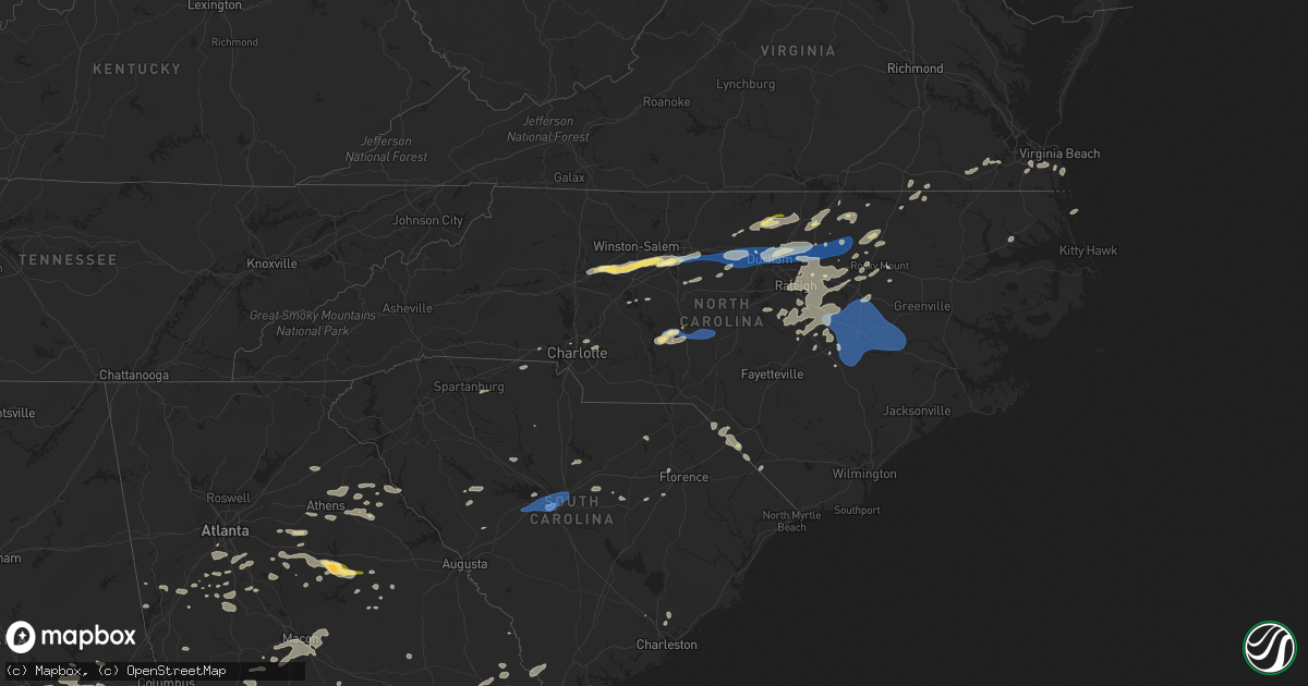
Hail Map in North Carolina on August 15, 2023
Get this storm
August 15 map
$229
one time, instant access
Download today. No call, no setup
Keep the $229
Bought the map and want the full workflow? Apply the entire $229 to a subscription within 7 days. None of it is wasted.
Every map, not just this one
This buys you this map. Subscription and you get every map we run, in the markets you choose from a few cities to whole states to nationwide. Plus real-time alerts the moment a storm fires.
Contact data
Name, contact info, occupancy, even credit band for addresses in the footprint. You go from where it hit to who to call.
Become the source they trust
Unlimited branding weather history reports on demand. You already have the documented answer ready for the property owner, and you are the one who showed up with it.
Property data and RoofTrace estimates
Pull up any address you have got, its value and the exact code rules for that jurisdiction, straight from One Click Code. Then RoofTrace estimates the squares, pitch, and roof value, priced the way you price.
Storm reports in North Carolina
North Carolina
| Date | Description |
|---|---|
| 08/15/20236:15 PM CDT | Tree down on powerline on ivy road. |
| 08/15/20236:10 PM CDT | Multiple trees down on pauls path road in la grange. Time estimated by radar. |
| 08/15/20235:55 PM CDT | Corrects previous tstm wnd dmg report from faison. Roof blown off mobile home on cousin fannie road. Time estimated by radar. |
| 08/15/20235:55 PM CDT | Roof blown on mobile home on cousin fannie road. Time estimated by radar. |
| 08/15/20235:50 PM CDT | Minor damage to several structures... Powerlines and trees down. No injuries. Time estimated by radar. |
| 08/15/20235:35 PM CDT | Tree down on powerline on reedy branch road. Time estimated by radar. |
| 08/15/20235:25 PM CDT | Tree down near the intersection willett rd and hickory house road. Time estimated by radar. |
| 08/15/20235:11 PM CDT | Small shed blown into roadway near galilee road and packing plant road. |
| 08/15/20235:05 PM CDT | Trees down blocking roadway on j dowdy rd. |
| 08/15/20235:02 PM CDT | Power outages due to storm on sandy hook road in southeast camden county. Time estimated from radar data. |
| 08/15/20235:01 PM CDT | Tree down blocking roadway near intersection of nc highway 904 and fairbluff road between fair bluff... Nc and marietta... Nc. Time estimated based on radar. |
| 08/15/20235:00 PM CDT | Power outages due to storm near weeksville. Time estimated from radar data. |
| 08/15/20234:58 PM CDT | Corrects previous tstm wnd dmg report from 4 sw robbins. Trees down on power lines. |
| 08/15/20234:57 PM CDT | Tree down blocking tobacco road west of barnesville... Nc. Time estimated based on radar. |
| 08/15/20234:55 PM CDT | Tree debris and power lines down at bensalem church rd and nc highway 705. |
| 08/15/20234:55 PM CDT | Trees down blocking roadway on eta bell rd. |
| 08/15/20234:51 PM CDT | Multiple reports of trees down from tarboro to macclesfield. Time estimated by radar. |
| 08/15/20234:48 PM CDT | Tree down in biscoe. |
| 08/15/20234:42 PM CDT | Tree down near the intersection of yank rd and akron rd. Time estimated by radar. |
| 08/15/20234:42 PM CDT | Tree down near the intersection of woodbridge rd and howard loop rd. Time estimated by radar. |
| 08/15/20234:33 PM CDT | Tree down blocking roadway near intersection of east white pond road and east raynham road east of five forks... Nc. Time estimated based on radar. |
| 08/15/20234:33 PM CDT | Transformer blown down and landed on building in sharpsburg... Nc. Time estimated by radar. No injuries reported. |
| 08/15/20234:28 PM CDT | Tree fell on the library in whitaker... Nc. Time estimated by radar. No injuries were reported. |
| 08/15/20234:25 PM CDT | Several downed trees across johnston county. Worst damage was seen from jackson king road road to four oak and locations south. Reports still coming in. |
| 08/15/20234:19 PM CDT | Downed tree along peachland polkton road near bill curlee road. Time estimated by radar. |
| 08/15/20234:19 PM CDT | Numerous trees down across nash county. Time estimated when storms were in central nash county. |
| 08/15/20234:16 PM CDT | Tree down on holland at judd parkway in fuquay varina. |
| 08/15/20234:15 PM CDT | 911 call center reported tree blocking roadway on thomas helms rd. |
| 08/15/20234:11 PM CDT | Tree down blocking dew road northeast of rowland... Nc. Time estimated based on radar. |
| 08/15/20234:02 PM CDT | Tree down near the intersection of old beulah road and woodruff road. Time estimated by radar. |
| 08/15/20234:00 PM CDT | Large tree down. |
| 08/15/20233:59 PM CDT | Numerous trees down across a widespread area in franklin county. Time is when storms were in central franklin. |
| 08/15/20233:57 PM CDT | Two pine trees down in parking lot. |
| 08/15/20233:55 PM CDT | Tree down on old weaver trail creedmoor. |
| 08/15/20233:53 PM CDT | Tree down at wayman church rd and johnny johnson rd. |
| 08/15/20233:50 PM CDT | A local report indicates 1.00 inch wind near 3 SSE Raleigh |
| 08/15/20233:48 PM CDT | Tree down blocking roadway near intersection of mcleod road and midway road east of raemon... Nc. Time estimated based on radar. |
| 08/15/20233:46 PM CDT | Tree down at ita rd near nc highway 43. |
| 08/15/20233:46 PM CDT | Severe trees down blocking the road at park avenue and hampton lane in youngsville... Nc. |
| 08/15/20233:45 PM CDT | Tree knocked down. Time estimated from radar. |
| 08/15/20233:43 PM CDT | Tree down at purnell rd and holly forest dr. |
| 08/15/20233:43 PM CDT | Tree down at nc highway 96 and pocomoke rd. |
| 08/15/20233:38 PM CDT | Duke energy reports trees blown down on powerlines near the intersection of henslowe ln and faringford ct. |
| 08/15/20233:36 PM CDT | Multiple trees down at creedmoor rd and old weaver trail. |
| 08/15/20233:34 PM CDT | Trees and tree limbs down blocking the road. |
| 08/15/20233:33 PM CDT | Duke energy reports trees blown down on powerlines near the intersection of durham ln and statesville rd. |
| 08/15/20233:28 PM CDT | Wind damage resulting in broken crossing arm at railroad crossing. |
| 08/15/20233:28 PM CDT | Two trees down on hwy 98 in vicinity of woodcrest st. |
| 08/15/20233:25 PM CDT | 911 call center reported powerlines down on providence rd. |
| 08/15/20233:24 PM CDT | Trees down on power lines. |
| 08/15/20233:23 PM CDT | Tree knocked down on franklin drive. Time estimated from radar. |
| 08/15/20233:20 PM CDT | Duke energy reported fallen trees leading to power outage in the steele creek area. |
| 08/15/20233:17 PM CDT | *** 1 fatal *** fatality from a tree falling onto a vehicle on anderson st. And morehead ave. 78 year old female. |
| 08/15/20233:15 PM CDT | Tree knocked down. Time estimated from radar. |
| 08/15/20233:15 PM CDT | Tree downed along mary circle. |
| 08/15/20233:15 PM CDT | Measured on roof duke hospital helipad. Awos station id was ktqv. |
| 08/15/20233:15 PM CDT | Numerous trees down in the maplewood cemetery area. |
| 08/15/20233:07 PM CDT | Trees downed near roberta road and physicians blvd. |
| 08/15/20233:00 PM CDT | Trees down south of whitakers near the intersection of morning star church rd and benson farm rd. |
| 08/15/20233:00 PM CDT | Corrects previous flash flood report from 4 ene teer to thunderstorm wind damage. Spotter reported large tree blown down. |
| 08/15/20233:00 PM CDT | Tree down on an apartment building. No injuries. |
| 08/15/20232:55 PM CDT | Multiple trees down north of denton. |
| 08/15/20232:54 PM CDT | Tree knocked down. Time estimated from radar. |
| 08/15/20232:52 PM CDT | Numerous trees down. |
| 08/15/20232:44 PM CDT | Corrects previous tstm wnd dmg report from 4 nne glenview. Tree down at wayman church rd and johnny johnson rd. |
| 08/15/20232:44 PM CDT | Tree down at melton bridge rd and fishing creek rd. |
| 08/15/20232:40 PM CDT | Trees down in the area. |
| 08/15/20232:39 PM CDT | Report from mping: golf ball |
| 08/15/20232:33 PM CDT | Duke energy reports trees down on powerlines near recreation dr. |
| 08/15/20232:32 PM CDT | Corrects previous tstm wnd dmg report from 3 ne aventon. Tree down at ita rd near nc highway 43. |
| 08/15/20232:29 PM CDT | Large tree blocking one lane of hwy 64 going west bound. |
| 08/15/20232:28 PM CDT | Trees down on power lines resulting in power outages around highway 64 and pleasant grove church rd. |
| 08/15/20232:25 PM CDT | Tree blown down on to a home. |
| 08/15/20232:24 PM CDT | Tree down on roper springs rd. |
| 08/15/20232:23 PM CDT | Tree down on a home. |
| 08/15/20232:23 PM CDT | Several trees and power lines down calls in the areas of high point... Pleasant garden... And jamestown in guilford county. |
| 08/15/20232:22 PM CDT | Duke energy reports trees blown down on powerlines near the intersection of noles rd and goodson st. |
| 08/15/20232:18 PM CDT | Corrects previous tstm wnd dmg report from 4 ssw greensboro. Report of bread truck blown over on holden rd. |
| 08/15/20232:06 PM CDT | Report from wghp studio of 1 inch hail falling. |
| 08/15/20232:05 PM CDT | A local report indicates 1.25 inch wind near 7 SSE Sedge Garden |
| 08/15/20231:48 PM CDT | A local report indicates 1.00 inch wind near 2 NNE Welcome |
| 08/15/20231:46 PM CDT | Tree down on weldon rd. |
| 08/15/20231:45 PM CDT | A local report indicates 1.00 inch wind near 1 SSE South Henderson |
| 08/15/20231:25 PM CDT | Duke energy reports trees down on powerlines near the intersection of milling rd and sain rd. |
| 08/15/20231:20 PM CDT | Trees and power lines down in davie county. |
| 08/15/20231:20 PM CDT | Social media report. |
| 08/15/20231:18 PM CDT | Tree down on burwell ave. |
| 08/15/20231:18 PM CDT | Report of bread truck blown over on holden rd. |
All States Impacted by Hail Map on August 15, 2023
Cities Impacted by Hail Map on August 15, 2023
- Timberlake, NC
- Commerce, GA
- Maysville, GA
- Nicholson, GA
- Athens, GA
- Hull, GA
- Loganville, GA
- Covington, GA
- Oxford, GA
- Crawfordville, FL
- Sopchoppy, FL
- Lawtey, FL
- Danielsville, GA
- Comer, GA
- Colbert, GA
- Rougemont, NC
- Mocksville, NC
- Advance, NC
- Oxford, NC
- Lexington, NC
- Winston Salem, NC
- High Point, NC
- Henderson, NC
- Thomasville, NC
- Greensboro, NC
- Jamestown, NC
- Pleasant Garden, NC
- Julian, NC
- Whitsett, NC
- Burlington, NC
- Liberty, NC
- Snow Camp, NC
- Graham, NC
- Haw River, NC
- Mebane, NC
- Chapel Hill, NC
- Efland, NC
- Hillsborough, NC
- Durham, NC
- Creedmoor, NC
- Wake Forest, NC
- Raleigh, NC
- Franklinton, NC
- Youngsville, NC
- Madison, GA
- Buckhead, GA
- Eatonton, GA
- Greensboro, GA
- White Plains, GA
- Sparta, GA
- Louisburg, NC
- Spring Hope, NC
- Gilbert, SC
- Lexington, SC
- West Columbia, SC
- Cayce, SC
- Columbia, SC
- Castalia, NC
- Troy, NC
- Biscoe, NC
- Star, NC
- Eagle Springs, NC
- Carthage, NC
- Robbins, NC
- Clio, SC
- McColl, SC
- Maxton, NC
- Little Rock, SC
- Laurinburg, NC
- Chesapeake, VA
- Benson, NC
- Four Oaks, NC
- Bush, LA
- Middlesex, NC
- Bailey, NC
- Cerro Gordo, NC
- Fair Bluff, NC
- Nichols, SC
- Pansey, AL
- Gordon, AL
- Shorter, AL
- Warthen, GA
- Ponchatoula, LA
- Mansfield, GA
- Rutledge, GA
- Seaboard, NC
- Pleasant Hill, NC
- Margarettsville, NC
- Monticello, GA
- Hampton, GA
- Du Pont, GA
- Pearl River, LA
- Hebron, MD
- Quantico, MD
- Tyaskin, MD
- Perkinston, MS
- Saucier, MS
- McHenry, MS
- Picayune, MS
- Carriere, MS
- Gulfport, MS
- Miami, FL
- Social Circle, GA
- Monroe, GA
- Griffin, GA
- Jackson, GA
- Samson, AL
- Suffolk, VA
- Carrsville, VA
- Windsor, VA
- Dunn, NC
- Goose Creek, SC
- Littleton, NC
- Kittrell, NC
- Branchville, VA
- Williamson, GA
- Concord, GA
- Zebulon, GA
- Bishop, GA
- Bogart, GA
- Watkinsville, GA
- Newborn, GA
- Salisbury, MD
- Jeanerette, LA
- Franklin, LA
- Clio, AL
- Ariton, AL
- Jacksonville, FL
- Orange Park, FL
- Wiggins, MS
- Lexington, GA
- Opp, AL
- Elba, AL
- Brantley, AL
- Roberta, GA
- Baconton, GA
- Camilla, GA
- Ozark, AL
- Fort Rucker, AL
- Hogansville, GA
- Franklin, GA
- Elberton, GA
- Georgetown, GA
- Bluffton, SC
- Cochran, GA
- Chester, GA
- Covington, LA
- Abita Springs, LA
- Reynolds, GA
- Rupert, GA
- Ellaville, GA
- Ideal, GA
- Hastings, FL
- Chester, SC
- Emporia, VA
- Charlotte, NC
- Atlanta, GA
- Jonesboro, GA
- Riverdale, GA
- Fairburn, GA
- Fayetteville, GA
- Union City, GA
- Denton, NC
- Defuniak Springs, FL
- Florala, AL
- Franklin, VA
- Graceville, FL
- Carlton, GA
- Zebulon, NC
- Madison, FL
- Mcdonough, GA
- Ocala, FL
- Marianna, FL
- Leary, GA
- Troy, AL
- Hamer, SC
- Newberry, SC
- Pomaria, SC
- Whitakers, NC
- Enfield, NC
- Nashville, NC
- Hollister, NC
- Mandeville, LA
- La Place, LA
- Bowman, GA
- Dewy Rose, GA
- Gastonia, NC
- Gay, GA
- Senoia, GA
- Elm City, NC
- Rocky Mount, NC
- Rowland, NC
- Newnan, GA
- Moreland, GA
- Macon, NC
- Brooklyn, MS
- Ridgeway, SC
- Good Hope, GA
- Rembert, SC
- Lugoff, SC
- Eastover, SC
- Hartford, AL
- Black, AL
- Dillon, SC
- Sandersville, GA
- Warrenton, NC
- Madisonville, LA
- Macon, GA
- Dry Branch, GA
- Bonifay, FL
- Dozier, AL
- Butner, NC
- Stockbridge, GA
- Chappells, SC
- Saluda, SC
- Ninety Six, SC
- Pike Road, AL
- Montgomery, AL
- Wilson, NC
- Banks, AL
- Brooks, GA
- Dawson, GA
- Lake View, SC
- Fairmont, NC
- Jacksonville Beach, FL
- Neptune Beach, FL
- Atlantic Beach, FL
- Auburn, AL
- Notasulga, AL
- Biloxi, MS
- Arlington, GA
- Morgan, GA
- Shellman, GA
- Folsom, LA
- Delmar, MD
- Laurel Hill, FL
- Mount Gilead, NC
- Slocomb, AL
- Saint Augustine, FL
- Wendell, NC
- Arnoldsville, GA
- Winterville, GA
- Fort Valley, GA
- Fernandina Beach, FL
- Yulee, FL
- Greenville, GA
- Coats, NC
- Candor, NC
- Harrisburg, NC
- Stennis Space Center, MS
- Buena Vista, GA
- Tallassee, AL
- Summerville, SC
- Shorterville, AL
- Abbeville, AL
- Staley, NC
- Darlington, SC
- Fargo, GA
- Pittsview, AL
- Sharpsburg, GA
- Newton, GA
- Reddick, FL
- Andalusia, AL
- Red Level, AL
- Angier, NC
- Clayton, NC
- Selma, NC
- Willow Spring, NC
- Smithfield, NC
- Garner, NC
- Hamilton, GA
- Bogalusa, LA
- Lacombe, LA
- Pacolet, SC
- Spartanburg, SC
- Randleman, NC
- Franklinville, NC
- Grand Ridge, FL
- Virginia Beach, VA
- Fort Gaines, GA
- Salisbury, NC
- Mobile, AL
- Clemmons, NC
- McLeansville, NC
- Vancleave, MS
- Fuquay Varina, NC
- Lagrange, GA
- Holly Springs, NC
- New Hill, NC
- Okatie, SC
- Hilton Head Island, SC
- Cedar Grove, NC
- Rayle, GA
- Crawford, GA
- Tuskegee, AL
- Nanticoke, MD
- Bivalve, MD
- Delmar, DE
- Hardaway, AL
- Tuskegee Institute, AL
- Eclectic, AL
- Butler, GA
- Poplarville, MS
- Hawkinsville, GA
- Edgefield, SC
- Blacksburg, SC
- Johnston, SC
- Trenton, SC
- Newton Grove, NC
- Corolla, NC
- Eight Mile, AL
- McLain, MS
- Byron, GA
- Jeffersonville, GA
- Gordon, GA
- Warner Robins, GA
- Lizella, GA
- Hurdle Mills, NC
- Mitchell, GA
- Fort Benning, GA
- Cusseta, GA
- Campbellton, FL
- Cottonwood, AL
- Peachtree City, GA
- Grantville, GA
- Weldon, NC
- Lumberton, MS
- Damascus, GA
- Hartsville, SC
- Roxboro, NC
- Calhoun Falls, SC
- Lucedale, MS
- Statesville, NC
- Harmony, NC
- Rolesville, NC
- Knightdale, NC
- Cary, NC
- Bunn, NC
- Cottondale, FL
- Albany, GA
- Princeton, NC
- Pine Level, NC
- Goldsboro, NC
- Mount Olive, NC
- Dudley, NC
- Faison, NC
- Calypso, NC
- Seven Springs, NC
- La Grange, NC
- Kinston, NC
- Snow Hill, NC
- Hookerton, NC
- Pikeville, NC
- Stantonsburg, NC
- Grifton, NC
- Fremont, NC
- Black Creek, NC
- Lucama, NC
- Kenly, NC
- Lockhart, AL
- Sumter, SC
- Dalzell, SC
- Semmes, AL
- Cut Off, LA
- Galliano, LA
- Atmore, AL
- Century, FL
- Flomaton, AL
- Erath, LA
- Holt, FL
- Vienna, GA
- Cordele, GA
- Hardeeville, SC
- Collins, GA
- Sylvania, GA
- Milton, FL
- Pinetops, NC
- Wing, AL
- Springfield, LA
- Maurepas, LA
- Jay, FL
- Mardela Springs, MD
- Mims, FL
- Brooklet, GA
- Oglethorpe, GA
- Larose, LA
- Lockport, LA
- Christmas, FL
- Crapo, MD
- Church Creek, MD
- Livingston, LA
- Brewton, AL
- Enterprise, AL
- Bay Minette, AL
- Statesboro, GA
- Moss Point, MS
- Ellabell, GA
- Timmonsville, SC
- McDavid, FL
- Lynchburg, SC
- Port Wentworth, GA
- Savannah, GA
- Daphne, AL
- Pineview, GA
- Kenner, LA
- Norlina, NC
- Kite, GA
- Geneva, FL
- Oviedo, FL
- Rochelle, GA
- Baker, FL
- Castleberry, AL
- Evergreen, AL
- Unadilla, GA
- Pinehurst, GA
- Raceland, LA
- Gheens, LA
- Gantt, AL
- Marshallville, GA
- Edison, GA
- Guyton, GA
- Bloomingdale, GA
- Clyo, GA
- Estill, SC
- Garnett, SC
- Pineland, SC
- Skipperville, AL
- Hertford, NC
- Osteen, FL
- Newington, GA
- Lamont, FL
- Pembroke, GA
- Register, GA
- Metter, GA
- Lamar, SC
- Monticello, FL
- Springfield, GA
- Rincon, GA
- Warrenton, GA
- New Smyrna Beach, FL
- Claxton, GA
- Cobbtown, GA
- Valdosta, GA
- Westville, FL


