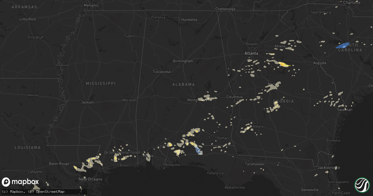
Hail Map in Alabama on August 15, 2023
Get this storm
August 15 map
$229
one time, instant access
Download today. No call, no setup
Keep the $229
Bought the map and want the full workflow? Apply the entire $229 to a subscription within 7 days. None of it is wasted.
Every map, not just this one
This buys you this map. Subscription and you get every map we run, in the markets you choose from a few cities to whole states to nationwide. Plus real-time alerts the moment a storm fires.
Contact data
Name, contact info, occupancy, even credit band for addresses in the footprint. You go from where it hit to who to call.
Become the source they trust
Unlimited branding weather history reports on demand. You already have the documented answer ready for the property owner, and you are the one who showed up with it.
Property data and RoofTrace estimates
Pull up any address you have got, its value and the exact code rules for that jurisdiction, straight from One Click Code. Then RoofTrace estimates the squares, pitch, and roof value, priced the way you price.
Storm reports in Alabama
Alabama
| Date | Description |
|---|---|
| 08/15/20235:33 PM CDT | Coffee county em reported multiple trees down on roadways on cr-248 near us 84. |
| 08/15/20235:18 PM CDT | Coffee county em reported multiple downed trees across roadways on cr-608/cr-611. |
| 08/15/20234:34 PM CDT | Geneva county dispatch reported a downed tree on state highway 153. |
| 08/15/20234:28 PM CDT | 911 call center reported 9 trees down across houston county alabama. |
| 08/15/20234:15 PM CDT | Tree down off dothan road south of abbeville in houston county alabama. |
| 08/15/20233:57 PM CDT | Multiple reports of trees down in pike county near troy. Location and time estimated. |
| 08/15/20233:48 PM CDT | Multiple trees reported down in the eastern portion of coffee county... Including highways 167 n and 189 s. |
| 08/15/20233:28 PM CDT | Tree down along highway 80 near the dixie community. |
| 08/15/20233:20 PM CDT | Tree down on road at lee road 165 and lee road 121. |
| 08/15/20233:08 PM CDT | Tree down near sandhill road and lee road 159. |
| 08/15/20232:54 PM CDT | Casey avenue between armstrong street and gay street blocked by downed power lines. |
| 08/15/20232:54 PM CDT | Multiple trees down in the tuskegee area... Including county road 45. |
| 08/15/20232:35 PM CDT | Public report of estimated 50-60 mph wind gust in pike road... Off of vaughn road. Accompanied by pea sized hail. Via social media. |
| 08/15/20232:30 PM CDT | Multiple trees down across the western portions of the county... Including the shorter area. |
All States Impacted by Hail Map on August 15, 2023
Cities Impacted by Hail Map on August 15, 2023
- Timberlake, NC
- Commerce, GA
- Maysville, GA
- Nicholson, GA
- Athens, GA
- Hull, GA
- Loganville, GA
- Covington, GA
- Oxford, GA
- Crawfordville, FL
- Sopchoppy, FL
- Lawtey, FL
- Danielsville, GA
- Comer, GA
- Colbert, GA
- Rougemont, NC
- Mocksville, NC
- Advance, NC
- Oxford, NC
- Lexington, NC
- Winston Salem, NC
- High Point, NC
- Henderson, NC
- Thomasville, NC
- Greensboro, NC
- Jamestown, NC
- Pleasant Garden, NC
- Julian, NC
- Whitsett, NC
- Burlington, NC
- Liberty, NC
- Snow Camp, NC
- Graham, NC
- Haw River, NC
- Mebane, NC
- Chapel Hill, NC
- Efland, NC
- Hillsborough, NC
- Durham, NC
- Creedmoor, NC
- Wake Forest, NC
- Raleigh, NC
- Franklinton, NC
- Youngsville, NC
- Madison, GA
- Buckhead, GA
- Eatonton, GA
- Greensboro, GA
- White Plains, GA
- Sparta, GA
- Louisburg, NC
- Spring Hope, NC
- Gilbert, SC
- Lexington, SC
- West Columbia, SC
- Cayce, SC
- Columbia, SC
- Castalia, NC
- Troy, NC
- Biscoe, NC
- Star, NC
- Eagle Springs, NC
- Carthage, NC
- Robbins, NC
- Clio, SC
- McColl, SC
- Maxton, NC
- Little Rock, SC
- Laurinburg, NC
- Chesapeake, VA
- Benson, NC
- Four Oaks, NC
- Bush, LA
- Middlesex, NC
- Bailey, NC
- Cerro Gordo, NC
- Fair Bluff, NC
- Nichols, SC
- Pansey, AL
- Gordon, AL
- Shorter, AL
- Warthen, GA
- Ponchatoula, LA
- Mansfield, GA
- Rutledge, GA
- Seaboard, NC
- Pleasant Hill, NC
- Margarettsville, NC
- Monticello, GA
- Hampton, GA
- Du Pont, GA
- Pearl River, LA
- Hebron, MD
- Quantico, MD
- Tyaskin, MD
- Perkinston, MS
- Saucier, MS
- McHenry, MS
- Picayune, MS
- Carriere, MS
- Gulfport, MS
- Miami, FL
- Social Circle, GA
- Monroe, GA
- Griffin, GA
- Jackson, GA
- Samson, AL
- Suffolk, VA
- Carrsville, VA
- Windsor, VA
- Dunn, NC
- Goose Creek, SC
- Littleton, NC
- Kittrell, NC
- Branchville, VA
- Williamson, GA
- Concord, GA
- Zebulon, GA
- Bishop, GA
- Bogart, GA
- Watkinsville, GA
- Newborn, GA
- Salisbury, MD
- Jeanerette, LA
- Franklin, LA
- Clio, AL
- Ariton, AL
- Jacksonville, FL
- Orange Park, FL
- Wiggins, MS
- Lexington, GA
- Opp, AL
- Elba, AL
- Brantley, AL
- Roberta, GA
- Baconton, GA
- Camilla, GA
- Ozark, AL
- Fort Rucker, AL
- Hogansville, GA
- Franklin, GA
- Elberton, GA
- Georgetown, GA
- Bluffton, SC
- Cochran, GA
- Chester, GA
- Covington, LA
- Abita Springs, LA
- Reynolds, GA
- Rupert, GA
- Ellaville, GA
- Ideal, GA
- Hastings, FL
- Chester, SC
- Emporia, VA
- Charlotte, NC
- Atlanta, GA
- Jonesboro, GA
- Riverdale, GA
- Fairburn, GA
- Fayetteville, GA
- Union City, GA
- Denton, NC
- Defuniak Springs, FL
- Florala, AL
- Franklin, VA
- Graceville, FL
- Carlton, GA
- Zebulon, NC
- Madison, FL
- Mcdonough, GA
- Ocala, FL
- Marianna, FL
- Leary, GA
- Troy, AL
- Hamer, SC
- Newberry, SC
- Pomaria, SC
- Whitakers, NC
- Enfield, NC
- Nashville, NC
- Hollister, NC
- Mandeville, LA
- La Place, LA
- Bowman, GA
- Dewy Rose, GA
- Gastonia, NC
- Gay, GA
- Senoia, GA
- Elm City, NC
- Rocky Mount, NC
- Rowland, NC
- Newnan, GA
- Moreland, GA
- Macon, NC
- Brooklyn, MS
- Ridgeway, SC
- Good Hope, GA
- Rembert, SC
- Lugoff, SC
- Eastover, SC
- Hartford, AL
- Black, AL
- Dillon, SC
- Sandersville, GA
- Warrenton, NC
- Madisonville, LA
- Macon, GA
- Dry Branch, GA
- Bonifay, FL
- Dozier, AL
- Butner, NC
- Stockbridge, GA
- Chappells, SC
- Saluda, SC
- Ninety Six, SC
- Pike Road, AL
- Montgomery, AL
- Wilson, NC
- Banks, AL
- Brooks, GA
- Dawson, GA
- Lake View, SC
- Fairmont, NC
- Jacksonville Beach, FL
- Neptune Beach, FL
- Atlantic Beach, FL
- Auburn, AL
- Notasulga, AL
- Biloxi, MS
- Arlington, GA
- Morgan, GA
- Shellman, GA
- Folsom, LA
- Delmar, MD
- Laurel Hill, FL
- Mount Gilead, NC
- Slocomb, AL
- Saint Augustine, FL
- Wendell, NC
- Arnoldsville, GA
- Winterville, GA
- Fort Valley, GA
- Fernandina Beach, FL
- Yulee, FL
- Greenville, GA
- Coats, NC
- Candor, NC
- Harrisburg, NC
- Stennis Space Center, MS
- Buena Vista, GA
- Tallassee, AL
- Summerville, SC
- Shorterville, AL
- Abbeville, AL
- Staley, NC
- Darlington, SC
- Fargo, GA
- Pittsview, AL
- Sharpsburg, GA
- Newton, GA
- Reddick, FL
- Andalusia, AL
- Red Level, AL
- Angier, NC
- Clayton, NC
- Selma, NC
- Willow Spring, NC
- Smithfield, NC
- Garner, NC
- Hamilton, GA
- Bogalusa, LA
- Lacombe, LA
- Pacolet, SC
- Spartanburg, SC
- Randleman, NC
- Franklinville, NC
- Grand Ridge, FL
- Virginia Beach, VA
- Fort Gaines, GA
- Salisbury, NC
- Mobile, AL
- Clemmons, NC
- McLeansville, NC
- Vancleave, MS
- Fuquay Varina, NC
- Lagrange, GA
- Holly Springs, NC
- New Hill, NC
- Okatie, SC
- Hilton Head Island, SC
- Cedar Grove, NC
- Rayle, GA
- Crawford, GA
- Tuskegee, AL
- Nanticoke, MD
- Bivalve, MD
- Delmar, DE
- Hardaway, AL
- Tuskegee Institute, AL
- Eclectic, AL
- Butler, GA
- Poplarville, MS
- Hawkinsville, GA
- Edgefield, SC
- Blacksburg, SC
- Johnston, SC
- Trenton, SC
- Newton Grove, NC
- Corolla, NC
- Eight Mile, AL
- McLain, MS
- Byron, GA
- Jeffersonville, GA
- Gordon, GA
- Warner Robins, GA
- Lizella, GA
- Hurdle Mills, NC
- Mitchell, GA
- Fort Benning, GA
- Cusseta, GA
- Campbellton, FL
- Cottonwood, AL
- Peachtree City, GA
- Grantville, GA
- Weldon, NC
- Lumberton, MS
- Damascus, GA
- Hartsville, SC
- Roxboro, NC
- Calhoun Falls, SC
- Lucedale, MS
- Statesville, NC
- Harmony, NC
- Rolesville, NC
- Knightdale, NC
- Cary, NC
- Bunn, NC
- Cottondale, FL
- Albany, GA
- Princeton, NC
- Pine Level, NC
- Goldsboro, NC
- Mount Olive, NC
- Dudley, NC
- Faison, NC
- Calypso, NC
- Seven Springs, NC
- La Grange, NC
- Kinston, NC
- Snow Hill, NC
- Hookerton, NC
- Pikeville, NC
- Stantonsburg, NC
- Grifton, NC
- Fremont, NC
- Black Creek, NC
- Lucama, NC
- Kenly, NC
- Lockhart, AL
- Sumter, SC
- Dalzell, SC
- Semmes, AL
- Cut Off, LA
- Galliano, LA
- Atmore, AL
- Century, FL
- Flomaton, AL
- Erath, LA
- Holt, FL
- Vienna, GA
- Cordele, GA
- Hardeeville, SC
- Collins, GA
- Sylvania, GA
- Milton, FL
- Pinetops, NC
- Wing, AL
- Springfield, LA
- Maurepas, LA
- Jay, FL
- Mardela Springs, MD
- Mims, FL
- Brooklet, GA
- Oglethorpe, GA
- Larose, LA
- Lockport, LA
- Christmas, FL
- Crapo, MD
- Church Creek, MD
- Livingston, LA
- Brewton, AL
- Enterprise, AL
- Bay Minette, AL
- Statesboro, GA
- Moss Point, MS
- Ellabell, GA
- Timmonsville, SC
- McDavid, FL
- Lynchburg, SC
- Port Wentworth, GA
- Savannah, GA
- Daphne, AL
- Pineview, GA
- Kenner, LA
- Norlina, NC
- Kite, GA
- Geneva, FL
- Oviedo, FL
- Rochelle, GA
- Baker, FL
- Castleberry, AL
- Evergreen, AL
- Unadilla, GA
- Pinehurst, GA
- Raceland, LA
- Gheens, LA
- Gantt, AL
- Marshallville, GA
- Edison, GA
- Guyton, GA
- Bloomingdale, GA
- Clyo, GA
- Estill, SC
- Garnett, SC
- Pineland, SC
- Skipperville, AL
- Hertford, NC
- Osteen, FL
- Newington, GA
- Lamont, FL
- Pembroke, GA
- Register, GA
- Metter, GA
- Lamar, SC
- Monticello, FL
- Springfield, GA
- Rincon, GA
- Warrenton, GA
- New Smyrna Beach, FL
- Claxton, GA
- Cobbtown, GA
- Valdosta, GA
- Westville, FL


