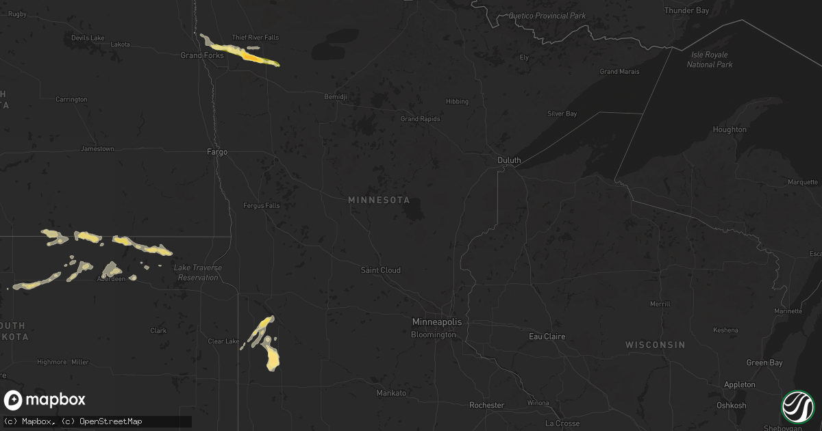
Hail Map in Minnesota on August 14, 2025
Get this storm
August 14 map
$229
one time, instant access
Download today. No call, no setup
Keep the $229
Bought the map and want the full workflow? Apply the entire $229 to a subscription within 7 days. None of it is wasted.
Every map, not just this one
This buys you this map. Subscription and you get every map we run, in the markets you choose from a few cities to whole states to nationwide. Plus real-time alerts the moment a storm fires.
Contact data
Name, contact info, occupancy, even credit band for addresses in the footprint. You go from where it hit to who to call.
Become the source they trust
Unlimited branding weather history reports on demand. You already have the documented answer ready for the property owner, and you are the one who showed up with it.
Property data and RoofTrace estimates
Pull up any address you have got, its value and the exact code rules for that jurisdiction, straight from One Click Code. Then RoofTrace estimates the squares, pitch, and roof value, priced the way you price.
Storm reports in Minnesota
Minnesota
| Date | Description |
|---|---|
| 08/14/20256:48 PM CDT | Quarter to half dollar sized hail... Along with moderate to heavy rain. |
| 08/14/20256:48 PM CDT | Quarter to half dollar s |
| 08/14/20256:04 PM CDT | Report and photo via social media. Time estimated by radar. |
| 08/14/20253:46 PM CDT | Spotter also estimated wind gusts of 60 mph. |
| 08/13/202511:45 PM CDT | A local report indicates 1.00 inch wind near Oklee |
| 08/13/202511:18 PM CDT | Photo of hail measuring 2.75 inches next to ruler south of plummer |
| 08/13/202511:18 PM CDT | Photo of hail measuring 2.75 inches next to ruler south of plummer collected 45 minutes after storm. Via social media. Time estimated from radar. |
| 08/13/202511:00 PM CDT | Hail intermittent for 15 mins with stones ranging in size up to 2 inches. |
| 08/13/202510:34 PM CDT | Public report of about 20 minutes of light hail up to quarter-size. Via social media. Time estimated from radar. |
| 08/13/202510:21 PM CDT | Hailing at time of the report. Estimated size. |
| 08/13/20259:45 PM CDT | A few stones up to an inch in size... Mostly soft hail. |
All States Impacted by Hail Map on August 14, 2025
Cities Impacted by Hail Map on August 14, 2025
- Eros, LA
- Choudrant, LA
- Calhoun, LA
- Saint Joseph, LA
- Ayden, NC
- Hollis Center, ME
- Harrisonburg, LA
- Jonesville, LA
- Tallulah, LA
- Clayton, LA
- Waterproof, LA
- Buxton, ME
- Ferriday, LA
- Canby, MN
- Natchez, MS
- Ruston, LA
- Quitman, LA
- Port Gibson, MS
- Monroe, LA
- Baltimore, MD
- Towson, MD
- Pikesville, MD
- Parkville, MD
- Nottingham, MD
- Columbia, LA
- Louin, MS
- Madison, MN
- Lutherville Timonium, MD
- Hermanville, MS
- Prescott, AZ
- Springfield, ME
- Raleigh, MS
- Jena, LA
- Dawson, MN
- Boyd, MN
- Gibsland, LA
- Jamestown, LA
- Cherryfield, ME
- Danforth, ME
- Bay Springs, MS
- Rayville, LA
- Grayson, LA
- Hopkinsville, KY
- Utica, MS
- Chatham, LA
- Delhi, LA
- Sikes, LA
- Wesson, MS
- Quitman, GA
- Pelahatchie, MS
- Brandon, MS
- Crystal Springs, MS
- Bienville, LA
- Epps, LA
- Pioneer, LA
- Benton, MS
- Dewey, AZ
- Hazlehurst, MS
- Jonesboro, LA
- Cottonwood, AZ
- Bentonia, MS
- Vaughan, MS
- Dixie, GA
- Montevideo, MN
- Lena, MS
- Porter, MN
- Tullos, LA
- Dodson, LA
- Port Orange, FL
- Daytona Beach, FL
- Ringgold, LA
- Heflin, LA
- Greenville, FL
- Portsmouth, NH
- Kittery, ME
- Eliot, ME
- Rye, NH
- New Castle, NH
- Kittery Point, ME
- Tichnor, AR
- Leakesville, MS
- Minneota, MN
- Elm Grove, LA
- Ash Fork, AZ
- Olla, LA
- New Smyrna Beach, FL
- Winnfield, LA
- Sallis, MS
- Goodman, MS
- De Witt, AR
- Shreveport, LA
- Frierson, LA
- Hamburg, AR
- Clarkfield, MN
- Watson, MN
- Athens, LA
- Richton, MS
- Boyce, LA
- Crossett, AR
- Olive Branch, MS
- Durant, MS
- Taunton, MN
- Haughton, LA
- Noxapater, MS
- Philadelphia, MS
- Camp Verde, AZ
- Memphis, TN
- Dry Prong, LA
- Hermitage, AR
- El Dorado, AR
- Forest Hill, LA
- Carrollton, MS
- McCarley, MS
- Hanley Falls, MN
- Pineville, LA
- Alexandria, LA
- West, MS
- Orlando, FL
- Cascilla, MS
- Oviedo, FL
- Geneva, FL
- Cleveland, MS
- Hornsby, TN
- Grenada, MS
- French Camp, MS
- Charleston, MS
- Weir, MS
- Ethel, MS
- McCool, MS
- Cottonport, LA
- Bunkie, LA
- Holcomb, MS
- Pocahontas, TN
- Wellborn, FL
- Lake City, FL
- Elmer, LA
- Middleton, TN
- Starkville, MS
- Columbus, MS
- Tutwiler, MS
- Marshall, MN
- Cottonwood, MN
- Otis, LA
- Mattapan, MA
- Hyde Park, MA
- Dorchester Center, MA
- Roslindale, MA
- Jamaica Plain, MA
- Dorchester, MA
- Milton, MA
- Roxbury, MA
- Chestnut Hill, MA
- Briggsdale, CO
- Matheson, CO
- Limon, CO
- Ghent, MN
- Quincy, MA
- Kilmichael, MS
- Randolph, MA
- Braintree, MA
- Eupora, MS
- Weymouth, MA
- North Weymouth, MA
- Ackerman, MS
- Lucedale, MS
- Canton, MA
- Brookline, MA
- East Weymouth, MA
- Vance, MS
- Lambert, MS
- Mathiston, MS
- Drew, MS
- Kissimmee, FL
- Orchard, CO
- Dundee, FL
- West Point, MS
- Holbrook, MA
- South Weymouth, MA
- Saulsbury, TN
- Avon, MA
- Brockton, MA
- Abington, MA
- Stoughton, MA
- Hamilton, MS
- Philipp, MS
- Whitman, MA
- Walnut, MS
- Leesville, LA
- Rockland, MA
- East Bridgewater, MA
- Hanson, MA
- Hingham, MA
- Jasper, TX
- Colmesneil, TX
- Fort Morgan, CO
- Lynd, MN
- Haines City, FL
- Sugar City, CO
- Snyder, CO
- Rush, CO
- Caledonia, MS
- Aberdeen, MS
- Doddsville, MS
- Ruleville, MS
- Ashland, MS
- Minter City, MS
- Wiggins, CO
- Hugo, CO
- Wiergate, TX
- Karval, CO
- Greenwood, MS
- Shannon, MS
- Schlater, MS
- Sells, AZ
- Forest River, ND
- Minto, ND
- Ramah, CO
- Brookeland, TX
- West Bridgewater, MA
- Bridgewater, MA
- Hanover, MA
- Alliance, NE
- West Roxbury, MA
- East Grand Forks, MN
- Oslo, MN
- Warren, MN
- Euclid, MN
- Hay Springs, NE
- Cope, CO
- Rushville, NE
- Akron, CO
- Red Lake Falls, MN
- Badger, MN
- Pine Ridge, SD
- Thief River Falls, MN
- Otis, CO
- Yuma, CO
- Gordon, NE
- Morristown, AZ
- Plummer, MN
- Peoria, AZ
- Brooks, MN
- Oklee, MN
- Trail, MN
- Congress, AZ
- Ashley, ND
- Dupree, SD
- Isabel, SD
- Timber Lake, SD
- Eagle Butte, SD
- Strasburg, ND
- Agar, SD
- Selby, SD
- Bowdle, SD
- Java, SD
- Hoven, SD
- Fredonia, ND
- Leola, SD
- Eureka, SD
- Hosmer, SD
- Roscoe, SD
- Forbes, ND
- Gackle, ND
- Kulm, ND
- Long Lake, SD
- Hague, ND
- Ipswich, SD
- Frederick, SD
- Ellendale, ND
- Oakland, IA
- Hancock, IA
- Aberdeen, SD
- Hecla, SD
- Oakes, ND
- Westport, SD
- Kintyre, ND
- Columbia, SD
- Bath, SD
- Groton, SD
- Britton, SD
- Amherst, SD
- Langford, SD
- Claremont, SD
- Lake City, SD
- Saint Hilaire, MN


