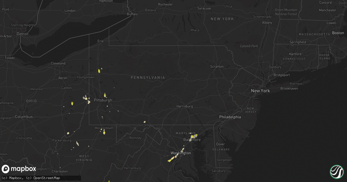
Hail Map in Pennsylvania on August 13, 2018
Get this storm
August 13 map
$229
one time, instant access
Download today. No call, no setup
Keep the $229
Bought the map and want the full workflow? Apply the entire $229 to a subscription within 7 days. None of it is wasted.
Every map, not just this one
This buys you this map. Subscription and you get every map we run, in the markets you choose from a few cities to whole states to nationwide. Plus real-time alerts the moment a storm fires.
Contact data
Name, contact info, occupancy, even credit band for addresses in the footprint. You go from where it hit to who to call.
Become the source they trust
Unlimited branding weather history reports on demand. You already have the documented answer ready for the property owner, and you are the one who showed up with it.
Property data and RoofTrace estimates
Pull up any address you have got, its value and the exact code rules for that jurisdiction, straight from One Click Code. Then RoofTrace estimates the squares, pitch, and roof value, priced the way you price.
Storm reports in Pennsylvania
Pennsylvania
| Date | Description |
|---|---|
| 08/13/20186:45 PM CDT | A few trees down between oxford and mount vernon. Time estimated from radar. |
| 08/13/20182:30 PM CDT | A local report indicates 1.00 inch wind near JACKSON CENTER |
| 08/13/20181:30 PM CDT | Several trees uprooted |
| 08/13/201812:58 PM CDT | Tree down on markle road. |
| 08/13/201812:30 PM CDT | A local report indicates 1.00 inch wind near INDIANOLA |
| 08/13/201812:29 PM CDT | Trees down on keyser road |
| 08/13/201812:24 PM CDT | A local report indicates 1.00 inch wind near 1 S FAWN HAVEN NUMBER T |
| 08/13/201811:23 AM CDT | Trees down around manor township... Some wires brought down by trees falling. |
| 08/13/201810:54 AM CDT | Tree down on ross mountain park rd. |
| 08/13/20184:16 AM CDT | At 916 PM EDT, a severe thunderstorm was located over Dublin, or 22 miles southeast of Allentown, moving northeast at 20 mph. It will not take as much wind to down some trees due to the saturated ground. HAZARD...60 mph wind gusts. SOURCE...Radar indicated. IMPACT...Damage to roofs, siding, trees, and power lines is possible. Locations impacted include... Perkasie, Doylestown, Byram, Bedminster, Tinicum, Dublin, Ferndale, Frenchtown, Milford, Riegelsville, Stockton, Revere, Ottsville, Sergeantsville, Pipersville, Erwinna, Gardenville, Lumberville and Sand Brook. |
| 08/13/20184:00 AM CDT | At 859 PM EDT, a severe thunderstorm was located over Germantown, or near Philadelphia, moving northeast at 20 mph. It will not take as much wind to down some trees due to the saturated ground. HAZARD...60 mph wind gusts. SOURCE...Radar indicated. IMPACT...Damage to roofs, siding, trees, and power lines is possible. Locations impacted include... Philadelphia, Bensalem, Yeadon, Burlington, Bristol, Conshohocken, Palmyra, Hatboro, Ambler, Jenkintown, Narberth, Rockledge, Tullytown, Abington, Langhorne, Bryn Athyn, Ivyland, Wissinoming, Feasterville-Trevose and Morris Park. |
| 08/13/20183:51 AM CDT | At 850 PM EDT, a severe thunderstorm was located over East Norriton, or 15 miles northwest of Philadelphia, moving northeast at 10 mph. There are some other storms within this warning. It will not take as much wind to down some trees due to the saturated ground. HAZARD...60 mph wind gusts. SOURCE...Radar indicated. IMPACT...Damage to roofs, siding, trees, and power lines is possible. Locations impacted include... Norristown, Lansdale, West Norriton, East Norriton, Perkasie, Doylestown, Conshohocken, Souderton, Ambler, Collegeville, Chalfont, Trappe, Hatfield, Fricks, Plymouth Meeting, King Of Prussia, Skippack, Telford, Bridgeport and Sellersville. |
| 08/12/201810:37 PM CDT | At 337 PM EDT, severe thunderstorms were located along a line extending from near Weirton to near Avella, moving south at 10 mph. HAZARD...Wind gusts to 60 mph and quarter-size hail. SOURCE...Radar. IMPACT...Hail damage to vehicles. Damage to trees and power lines. Locations impacted include... Weirton... Steubenville... Avella... Mingo Junction... Follansbee... Hooverson Heights... Franklin... Colliers... Langeloth... Rockdale... East Steubenville... |
| 08/12/201810:15 PM CDT | At 315 PM EDT, a severe thunderstorm was located 7 miles north of Grove City, moving south at 25 mph. HAZARD...Wind gusts to 60 mph. SOURCE...Radar. IMPACT...Damage to trees and power lines. Locations impacted include... Grove City... Stoneboro... Sandy Lake... Jackson Center... Barkeyville... This includes the following highways... Interstate 79 in Pennsylvania between mile markers 118 and 126. Interstate 80 in Pennsylvania between mile markers 19 and 29. |
| 08/12/20189:19 PM CDT | At 219 PM EDT, a severe thunderstorm was located over Jefferson Boro, or 8 miles east of Waynesburg, moving south at 20 mph. HAZARD...Wind gusts to 60 mph and quarter-size hail. SOURCE...Radar. IMPACT...Hail damage to vehicles. Damage to trees and power lines. Locations impacted include... Fredericktown-Millsboro... Jefferson Boro... Fairdale... Carmichaels... Rices Landing... Clarksville...This includes Interstate 79 in Pennsylvania between mile markers 5and 12. |
| 08/12/20188:48 PM CDT | At 148 PM EDT, a severe thunderstorm was located near West Newton, or 7 miles southeast of McKeesport, moving southeast at 15 mph. HAZARD...Wind gusts to 60 mph. SOURCE...Radar. IMPACT...Damage to trees and power lines. Locations impacted include... West Newton... Elizabeth... Lincoln... Sutersville... Smithton... Madison... Herminie... This includes Interstate 70 in Pennsylvania between mile markers 45and 54. |
| 08/12/20188:40 PM CDT | At 140 PM EDT, severe thunderstorms were located along a line extending from Ross Township to Sharpsburg, moving south at 25 mph. HAZARD...Wind gusts to 60 mph. SOURCE...Radar. IMPACT...Damage to trees and power lines. Locations impacted include... Pittsburgh... Mount Lebanon... Ross Township... McCandless Township... Franklin Park... Shaler Township... West Mifflin... North Side Pittsburgh... Baldwin... Hampton Township... Scott Township... Whitehall...This includes the following highways... Interstate 79 in Pennsylvania between mile markers 57 and 63. Interstate 279 in Pennsylvania between mile markers 1 and 11. Interstate 376 in Pennsylvania between mile markers 63 and 76. |
| 08/12/20188:30 PM CDT | At 129 PM EDT, a severe thunderstorm was located near Hampton Township, or near Penn Hills, and is nearly stationary. HAZARD...Wind gusts to 60 mph. SOURCE...Radar. IMPACT...Expect damage to trees and power lines, resulting in some power outages. Locations impacted include... Pittsburgh... Penn Hills... Monroeville... Shaler Township... Plum... Hampton Township... New Kensington... O'hara Township... Oakmont... Fox Chapel... Arnold... Sharpsburg...This includes Pennsylvania Turnpike between mile markers 36 and 55. |
| 08/12/20188:23 PM CDT | At 122 PM EDT, a severe thunderstorm was located 8 miles east of Mount Pleasant, or 12 miles northeast of Connellsville, moving southwest at 5 mph. HAZARD...Wind gusts to 60 mph. SOURCE...Radar. IMPACT...Expect damage to trees and power lines, resulting in some power outages. Locations impacted include... Mount Pleasant... Donegal... Champion... Indian Head... Acme... Jones Mills...This includes Pennsylvania Turnpike between mile markers 83 and 95. |
| 08/12/20188:08 PM CDT | At 107 PM EDT, a severe thunderstorm was located near Fox Chapel, or near Penn Hills, and is nearly stationary. HAZARD...Wind gusts to 60 mph and quarter-size hail. SOURCE...Radar. IMPACT...Minor hail damage to vehicles is possible. Expect wind damage to trees and power lines, resulting in some power outages. Locations impacted include... Pittsburgh... Penn Hills... Ross Township... McCandless Township... Monroeville... Shaler Township... Plum... Hampton Township... Wilkinsburg... New Kensington... Lower Burrell... Harrison Township...This includes Pennsylvania Turnpike between mile markers 35 and 56. |
| 08/12/20187:33 PM CDT | Report of large trees and limbs down in a wooded area near paoli hospital as well. |
All States Impacted by Hail Map on August 13, 2018
Cities Impacted by Hail Map on August 13, 2018
- Nottingham, MD
- Parkville, MD
- Towson, MD
- Baltimore, MD
- College Park, MD
- Tucumcari, NM
- Conchas Dam, NM
- Burke, VA
- Fairfax Station, VA
- Patterson, GA
- Shattuck, OK
- Solano, NM
- Mosquero, NM
- New Cumberland, WV
- Georgetown, PA
- Burgettstown, PA
- Colliers, WV
- Weirton, WV
- Valdosta, GA
- Ludowici, GA
- Manassas, VA
- Clifton, VA
- Woodbridge, VA
- Concord, VA
- Lynchburg, VA
- Amelia Court House, VA
- Coxs Mills, WV
- Auburn, WV
- Camp Verde, AZ
- Alden, MN
- Albert Lea, MN
- Hartland, MN
- Gate, OK
- Tallahassee, FL
- New Smyrna Beach, FL
- Snowflake, AZ
- Kittanning, PA
- San Jose, NM
- Las Vegas, NM
- Plains, KS
- Marietta, OH
- Vinton, VA
- Roanoke, VA
- Hardy, VA
- Goodview, VA
- Doerun, GA
- Moultrie, GA
- Albany, GA
- Roy, NM
- Pittsburgh, PA
- Gibsonia, PA
- Cheswick, PA
- Glenshaw, PA
- Allison Park, PA
- Sanborn, ND
- Cumberland, VA
- Meade, KS
- Fowler, KS
- Sedona, AZ
- Rimrock, AZ
- Show Low, AZ
- Mercer, PA
- Jackson Center, PA
- Grove City, PA
- Painter, VA
- Belle Haven, VA
- Hacksneck, VA
- Clearville, PA
- Flagstaff, AZ
- Harkers Island, NC
- Baconton, GA
- Newton, GA
- Morgantown, WV
- Independence, WV
- Wolverton, MN
- Brentwood, MD
- Hyattsville, MD
- Mount Rainier, MD
- Washington, DC
- Rocky Mount, VA
- Saluda, VA
- Shacklefords, VA
- Gloucester, VA
- Adel, GA
- Springfield, VA
- Milnor, ND
- Ronceverte, WV
- Nokesville, VA
- Copeland, KS
- Montezuma, KS
- Toronto, OH
- Appomattox, VA
- Gladstone, VA
- Madison Heights, VA
- Follansbee, WV
- Reno, OH
- Whipple, OH
- Mcalister, NM
- House, NM
- Martinsville, VA
- Penhook, VA
- Harrisville, WV
- Pullman, WV
- Pennsboro, WV
- Berea, WV
- Acme, PA
- Stahlstown, PA
- Detroit Lakes, MN
- White Stone, VA
- Saint Johns, AZ
- Sanford, FL
- Sandy Lake, PA
- Polk, PA
- Breckenridge, MN
- Cushing, MN
- Hinesville, GA
- Blackshear, GA
- Nahunta, GA
- Greenbelt, MD
- Beltsville, MD
- Grafton, WV
- Fairmont, WV
- Kingsville, MD
- Catonsville, MD
- Upper Falls, MD
- Glen Arm, MD
- Middle River, MD
- Rosedale, MD
- White Marsh, MD
- Lutherville Timonium, MD
- Perry Hall, MD
- Halethorpe, MD
- Newcomerstown, OH
- Port Washington, OH
- Springerville, AZ
- Waycross, GA
- Randall, MN
- Rices Landing, PA
- Carmichaels, PA
- Cockeysville, MD
- Falls Church, VA
- Arlington, VA
- Alexandria, VA
- Midway, GA
- Amherst, VA
- Quaker City, OH
- Richmond Hill, GA
- Sylvester, GA
- Marshallberg, NC
- Verona, PA
- Oakmont, PA
- Lake Park, GA
- Celeste, TX
- Douglas, GA
- Seligman, AZ
- Laverne, OK
- Irondale, OH
- Artemas, PA
- Hartfield, VA
- Barhamsville, VA
- Mattaponi, VA
- Locust Hill, VA
- Wake, VA
- West Point, VA
- Topping, VA
- Mayer, AZ
- Fingal, ND
- Enderlin, ND
- Nome, ND
- Bristol, GA
- Mershon, GA
- Glade Hill, VA
- Rozet, WY
- Providence Forge, VA
- Rivesville, WV
- Cadiz, OH
- Scio, OH
- Audubon, MN
- East Millsboro, PA
- Clarksville, PA
- Hortense, GA
- Annandale, VA
- Cimarron, KS
- Burtonsville, MD
- Laurel, MD
- New Matamoras, OH
- Forgan, OK
- Ripley, WV
- Sandyville, WV
- Wallace, NC
- Allenhurst, GA
- Empire, OH
- Stratton, OH
- Sunray, TX
- Dumas, TX
- Sumner, GA
- Valley City, ND
- Bedford, VA
- Perryopolis, PA
- Dawson, PA
- Charleston, WV
- Henrico, VA
- Chester, VA
- Colonial Heights, VA
- Richmond, VA
- Fort Towson, OK
- Big Bend, WV
- Oriska, ND
- Gallup, NM
- Sutersville, PA
- Elizabeth, PA
- Concho, AZ
- Weston, WV
- Camden, WV
- Thomasville, GA
- Lenox, GA
- Sparks, GA
- Wheatland, ND
- Norman Park, GA
- Osage, MN
- Park Rapids, MN
- Lexington, VA
- Valliant, OK
- Lanexa, VA
- Beaver, OK
- Fleming, GA
- Sinks Grove, WV
- Union, WV
- Big Springs, WV
- Smithville, WV
- Ashdown, AR
- Indianola, PA
- Stoneboro, PA
- Bowerston, OH
- Millboro, VA
- Quantico, VA


