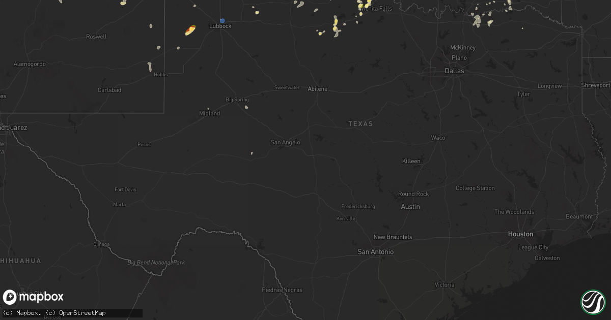
Hail Map in Texas on August 11, 2025
Get this storm
August 11 map
$229
one time, instant access
Download today. No call, no setup
Keep the $229
Bought the map and want the full workflow? Apply the entire $229 to a subscription within 7 days. None of it is wasted.
Every map, not just this one
This buys you this map. Subscription and you get every map we run, in the markets you choose from a few cities to whole states to nationwide. Plus real-time alerts the moment a storm fires.
Contact data
Name, contact info, occupancy, even credit band for addresses in the footprint. You go from where it hit to who to call.
Become the source they trust
Unlimited branding weather history reports on demand. You already have the documented answer ready for the property owner, and you are the one who showed up with it.
Property data and RoofTrace estimates
Pull up any address you have got, its value and the exact code rules for that jurisdiction, straight from One Click Code. Then RoofTrace estimates the squares, pitch, and roof value, priced the way you price.
Storm reports in Texas
Texas
| Date | Description |
|---|---|
| 08/11/20256:26 PM CDT | A local report indicates 59 MPH wind near 1 NNW Lubbock Int. Airp |
| 08/11/20256:23 PM CDT | Motorist driving north stopped due to large hail estimated to be ping pong ball size. Relayed by boys ranch em. |
| 08/11/20256:20 PM CDT | A local report indicates 1.50 inch wind near 4 ENE Panhandle |
| 08/11/20256:08 PM CDT | Hail up to tennis ball size along highway 287 south of masterson. |
| 08/11/20256:05 PM CDT | Photo of tree uprooted on rogers road about 3 miles east-northeast of iowa park sent by a viewer to kfdx. Time estimated. |
| 08/11/20256:04 PM CDT | Media viewer report. |
| 08/11/20255:59 PM CDT | Multiple hail reports were submitted with pictures. Hail sizes ranged between golf ball to 2 inches on the east side of panhandle. Timeframe for hail started at 559 and |
| 08/11/20255:58 PM CDT | A local report indicates 1.00 inch wind near Iowa Park |
| 08/11/20255:50 PM CDT | A local report indicates 2.00 inch wind near 1 N Panhandle |
| 08/11/20255:02 PM CDT | A local report indicates 1.25 inch wind near 1 W Burkburnett |
| 08/10/202511:45 PM CDT | A local report indicates 61 MPH wind near 3 N Hart |
| 08/10/202510:16 PM CDT | A local report indicates 67 MPH wind near 6 SE Wellington |
| 08/10/202510:12 PM CDT | A local report indicates 72 MPH wind near 2 S Lesley |
| 08/10/202510:10 PM CDT | A local report indicates 71 MPH wind near 2 S Lesley |
| 08/10/202510:00 PM CDT | A local report indicates 66 MPH wind near 2 S Lesley |
| 08/10/20258:40 PM CDT | Delayed report. Large tree limbs blown down. Time estimated from radar. |
| 08/10/20258:22 PM CDT | A lot of dime size with a few stones as large as qu |
| 08/10/20258:22 PM CDT | A lot of dime size with a few stones as large as quarters. Trees and vegetation da |
| 08/10/20258:00 PM CDT | A local report indicates 66 MPH wind near Goodnight |
| 08/10/20257:51 PM CDT | A local report indicates 62 MPH wind near Goodnight |
| 08/10/20257:30 PM CDT | Report from mping: ping pong ball |
| 08/10/20257:23 PM CDT | A local report indicates 60 MPH wind near 4 NNW Lake Tanglewood |
| 08/10/20257:23 PM CDT | Picture from social media. |
| 08/10/20257:23 PM CDT | Report from mping: half dollar |
| 08/10/20257:14 PM CDT | A local report indicates 1.00 inch wind near 7 NW Canyon |
| 08/10/20257:12 PM CDT | Report from mping: golf ball |
| 08/10/20257:03 PM CDT | Report from mping: half dollar |
| 08/10/20257:03 PM CDT | A local report indicates 1.75 inch wind near 5 WNW Amarillo |
| 08/10/20257:03 PM CDT | Report from mping: golf ball |
| 08/10/20257:03 PM CDT | *** 1 inj *** golfball size hail fell and result in one known injury. |
All States Impacted by Hail Map on August 11, 2025
Cities Impacted by Hail Map on August 11, 2025
- Thayer, KS
- Cherryvale, KS
- Dennis, KS
- Mound Valley, KS
- Big Spring, TX
- Sterling City, TX
- Midland, TX
- Coffeyville, KS
- Edna, KS
- Delaware, OK
- Minco, OK
- Tuttle, OK
- Mustang, OK
- Lenapah, OK
- Guthrie, OK
- Vinita, OK
- Talala, OK
- Pocasset, OK
- Union City, OK
- Nowata, OK
- Oswego, KS
- McCune, KS
- Lakeside, AZ
- Saline, MI
- Welch, OK
- S Coffeyville, OK
- Chickasha, OK
- Amber, OK
- Yukon, OK
- Edmond, OK
- Arcadia, OK
- Piedmont, OK
- Bartlett, KS
- Cleveland, OK
- Mannford, OK
- Sand Springs, OK
- Lawton, OK
- Milan, MI
- Meridian, OK
- Oktaha, OK
- Liberal, MO
- Kim, CO
- Jennings, OK
- Blanchard, OK
- Bethany, MO
- McFall, MO
- Chetopa, KS
- Columbus, KS
- Devol, OK
- Butler, MO
- Rich Hill, MO
- Marlow, OK
- Montezuma, NM
- Bluejacket, OK
- Walters, OK
- Muskogee, OK
- Bronaugh, MO
- Oklahoma City, OK
- Deport, TX
- Stroud, OK
- Drumright, OK
- Bristow, OK
- Cushing, OK
- Jones, OK
- Miami, OK
- Skiatook, OK
- Galena, KS
- Afton, OK
- Randlett, OK
- Iowa Park, TX
- Claremore, OK
- Wellston, OK
- Norman, OK
- Owasso, OK
- Collinsville, OK
- Barnhart, TX
- Carl Junction, MO
- Joplin, MO
- Oronogo, MO
- Yale, OK
- Tulsa, OK
- Catoosa, OK
- Arma, KS
- Barnsdall, OK
- Wichita Falls, TX
- Burkburnett, TX
- Carney, OK
- Tryon, OK
- Chandler, OK
- Asbury, MO
- Plains, TX
- Fairland, OK
- Choctaw, OK
- Spencer, OK
- Webb City, MO
- Mindenmines, MO
- Arcadia, KS
- Meeker, OK
- Eucha, OK
- Oologah, OK
- Newalla, OK
- Buffalo, ND
- Wheatland, ND
- Lovington, NM
- Agra, OK
- Apache, OK
- Seneca, MO
- Harrah, OK
- Mcloud, OK
- Pryor, OK
- Anadarko, OK
- Roseau, MN
- Panhandle, TX
- Elgin, OK
- Jerico Springs, MO
- Stockton, MO
- Badger, MN
- Mora, NM
- Ochelata, OK
- Bartlesville, OK
- Castle, OK
- Paden, OK
- Big Cabin, OK
- Sheldon, ND
- Cogswell, ND
- Vaughn, NM
- Chelsea, OK
- Stirum, ND
- Depew, OK
- Corona, NM
- Hurdsfield, ND
- Masterson, TX
- Adair, OK
- Grandfield, OK
- Ocate, NM
- Guadalupita, NM
- Lisbon, ND
- Littlefield, TX
- Levelland, TX
- Happy, TX
- Stella, MO
- Neosho, MO
- Fort Scott, KS
- Salina, OK
- Electra, TX
- Palermo, ND
- Stanley, ND
- Greenbush, MN
- Gwinner, ND
- Fort Cobb, OK
- Rose, OK
- Sundown, TX
- Boley, OK
- Jenks, OK
- Douglas, AZ
- Gracemont, OK
- Broken Arrow, OK
- Bixby, OK
- Osceola, MO
- Tatum, NM
- Inola, OK
- Lowry City, MO
- El Dorado Springs, MO
- Locust Grove, OK
- Spavinaw, OK
- Amarillo, TX
- Mounds, OK
- Beggs, OK
- Groom, TX
- Okmulgee, OK
- Amherst, TX
- Deepwater, MO
- Forman, ND
- Quinton, OK
- Hughesville, MO
- Elida, NM
- Chouteau, OK
- Twin Valley, MN
- Miami, TX
- Clinton, MO
- Gary, MN
- Mahnomen, MN
- Houstonia, MO
- Morris, OK
- Quincy, MO
- Fessenden, ND
- Harvey, ND
- Rutland, ND
- Indiahoma, OK
- Milnesand, NM
- Checotah, OK
- Collins, MO
- Seymour, TX
- Holliday, TX
- Canyon, TX
- Boynton, OK
- Pritchett, CO
- Weaubleau, MO
- Mcadoo, TX
- Crosbyton, TX
- Stigler, OK
- Seminole, OK
- Hawley, MN
- Mobeetie, TX
- Cayuga, ND
- Haskell, OK
- Council Hill, OK
- Calhoun, MO
- Wildorado, TX
- Lake Park, MN
- Wagoner, OK
- Milnor, ND
- Hobbs, NM
- Dimmitt, TX
- Hart, TX
- Henryetta, OK
- Butte, ND
- Barnesville, MN
- Weleetka, OK
- Hankinson, ND
- Nazareth, TX
- Fort Gibson, OK
- Wahpeton, ND
- Carnegie, OK
- Waubun, MN
- Naytahwaush, MN
- Pelican Rapids, MN
- Toluca, IL
- Coweta, OK
- Warsaw, MO
- Eufaula, OK
- Portales, NM
- Tulia, TX
- Breckenridge, MN
- Telephone, TX
- Windsor, MO
- Lubbock, TX
- Muldrow, OK
- Claude, TX
- Fairmount, ND
- Underwood, ND
- Turtle Lake, ND
- Hulbert, OK
- Sedalia, MO
- Green Ridge, MO
- Rutland, IL
- Floydada, TX
- Campbell, MN
- Knob Noster, MO
- Strang, OK
- Texico, NM
- Washburn, ND
- Wenona, IL
- Muleshoe, TX
- Vega, TX
- Hereford, TX
- Alton, KS
- Clarendon, TX
- Tintah, MN
- Nashua, MN
- Clovis, NM
- Vergas, MN
- Warner, OK
- Roland, OK
- Cannon Afb, NM
- Roswell, NM
- Sisseton, SD
- Paducah, TX
- Cee Vee, TX
- Floyd, NM
- Matador, TX
- Norcross, MN
- Elbow Lake, MN
- Bovina, TX
- Farwell, TX
- Wendell, MN
- Wheaton, MN
- Munday, TX
- Van Buren, AR
- Regan, ND
- Memphis, TX
- Childress, TX
- Lostant, IL
- Melrose, NM
- Fitzhugh, OK
- Mcalester, OK
- Savanna, OK
- Donnelly, MN
- Herman, MN
- Dumont, MN
- Wister, OK
- Talihina, OK
- Red Oak, OK
- Barrett, MN
- Friona, TX
- Wayside, TX
- Kiowa, OK
- Knox City, TX
- Broadview, NM
- Tell, TX
- Goree, TX
- Alma, AR
- Hoffman, MN
- Morris, MN
- Downing, MO
- Clayton, OK
- Olton, TX
- Lelia Lake, TX
- Hedley, TX
- Ravenna, TX
- Calera, OK
- Durant, OK
- Chokio, MN
- Nashoba, OK
- Wellington, TX
- Quail, TX
- Ector, TX
- Bonham, TX
- Lakeview, TX
- Bloomfield, IA
- Drakesville, IA
- Moulton, IA
- Tucumcari, NM
- Pulaski, IA
- Quanah, TX
- Farwell, MN
- Cyrus, MN
- Kensington, MN
- Bard, NM
- Crowell, TX
- Atoka, OK
- Chillicothe, TX
- Milton, IA
- Windom, TX
- Dodd City, TX
- Honey Grove, TX
- San Jon, NM
- Starbuck, MN
- Douds, IA
- Cantril, IA
- Keosauqua, IA
- Dodson, TX
- Lamar, AR
- Hagarville, AR
- Vernon, TX
- Hollis, OK
- Hendrix, OK
- Birmingham, IA
- Gould, OK
- Lowry, MN
- Ivanhoe, TX
- Bennington, OK
- Soper, OK
- Hugo, OK
- Glenwood, MN
- Stockport, IA
- Norman, AR
- Boswell, OK
- Hillsboro, IA
- Bonaparte, IA
- Albany, MN
- Arthur City, TX
- Mount Pleasant, IA
- Salem, IA
- Memphis, MO
- Powderly, TX
- Savoy, TX
- Colbert, OK
- Temple, OK
- Afton, TX
- Hominy, OK
- Ramona, OK
- Booker, TX
- Fletcher, OK
- Pampa, TX
- Bells, TX
- Wewoka, OK
- Idalou, TX
- Bokchito, OK
- Celina, TX
- Okemah, OK
- Canadian, TX
- Fort Sill, OK
- Throckmorton, TX
- Wheatland, OK
- Pewaukee, WI
- Delafield, WI
- Hartland, WI
- Menomonee Falls, WI
- Sussex, WI
- Waukesha, WI
- Lannon, WI
- Milwaukee, WI
- Germantown, WI
- Mequon, WI
- Colgate, WI
- Butler, WI
- Brookfield, WI
- Grafton, WI
- Cedarburg, WI
- New Berlin, WI
- Dousman, WI
- Oconomowoc, WI
- Fort Atkinson, WI
- Jefferson, WI
- Helenville, WI
- Sullivan, WI
- Wales, WI
- Whitewater, WI
- Nashotah, WI
- Okauchee, WI
- Hartford, WI
- Hubertus, WI
- Springlake, TX
- Kress, TX
- Bethany, OK
- Newcastle, OK


