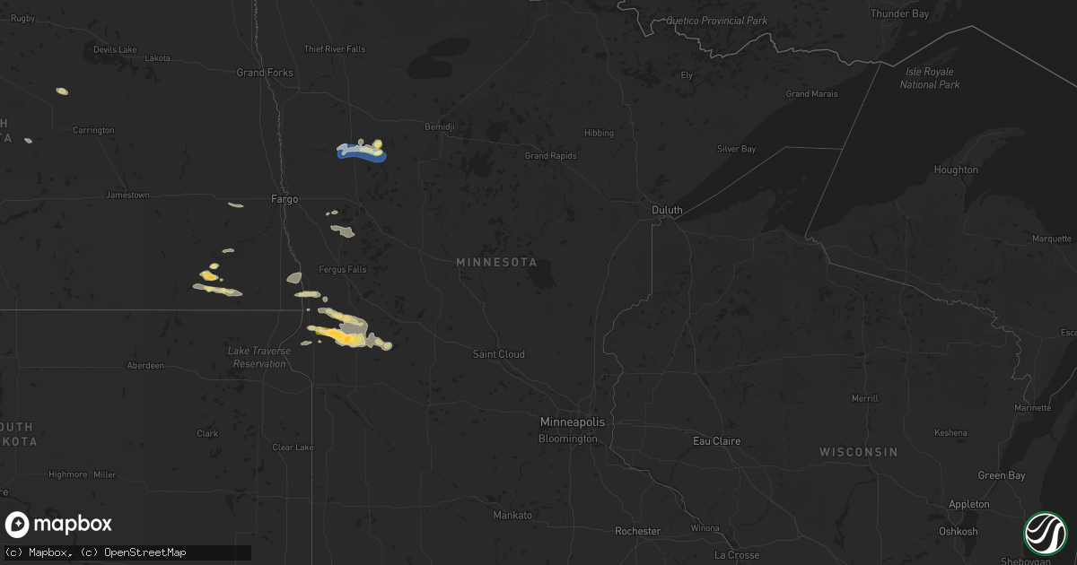
Hail Map in Minnesota on August 11, 2025
Get this storm
August 11 map
$229
one time, instant access
Download today. No call, no setup
Keep the $229
Bought the map and want the full workflow? Apply the entire $229 to a subscription within 7 days. None of it is wasted.
Every map, not just this one
This buys you this map. Subscription and you get every map we run, in the markets you choose from a few cities to whole states to nationwide. Plus real-time alerts the moment a storm fires.
Contact data
Name, contact info, occupancy, even credit band for addresses in the footprint. You go from where it hit to who to call.
Become the source they trust
Unlimited branding weather history reports on demand. You already have the documented answer ready for the property owner, and you are the one who showed up with it.
Property data and RoofTrace estimates
Pull up any address you have got, its value and the exact code rules for that jurisdiction, straight from One Click Code. Then RoofTrace estimates the squares, pitch, and roof value, priced the way you price.
Storm reports in Minnesota
Minnesota
| Date | Description |
|---|---|
| 08/11/20256:55 PM CDT | Corrects previous non-tstm wnd gst report from 3 sse mahnomen. Mesonet station mn044 mahnomen mn dot. |
| 08/10/20259:10 PM CDT | A local report indicates 1.50 inch wind near 2 NNW Donnelly |
| 08/10/20258:58 PM CDT | A local report indicates 1.50 inch wind near 9 WNW Donnelly |
| 08/10/20258:00 PM CDT | Delayed report: hail sizes ranged from mostly pea sized to a few stones up to quarter sized. |
| 08/10/20257:40 PM CDT | Report relayed on social media. |
| 08/10/20257:40 PM CDT | Report relayed on social media. ( |
All States Impacted by Hail Map on August 11, 2025
Cities Impacted by Hail Map on August 11, 2025
- Thayer, KS
- Cherryvale, KS
- Dennis, KS
- Mound Valley, KS
- Big Spring, TX
- Sterling City, TX
- Midland, TX
- Coffeyville, KS
- Edna, KS
- Delaware, OK
- Minco, OK
- Tuttle, OK
- Mustang, OK
- Lenapah, OK
- Guthrie, OK
- Vinita, OK
- Talala, OK
- Pocasset, OK
- Union City, OK
- Nowata, OK
- Oswego, KS
- McCune, KS
- Lakeside, AZ
- Saline, MI
- Welch, OK
- S Coffeyville, OK
- Chickasha, OK
- Amber, OK
- Yukon, OK
- Edmond, OK
- Arcadia, OK
- Piedmont, OK
- Bartlett, KS
- Cleveland, OK
- Mannford, OK
- Sand Springs, OK
- Lawton, OK
- Milan, MI
- Meridian, OK
- Oktaha, OK
- Liberal, MO
- Kim, CO
- Jennings, OK
- Blanchard, OK
- Bethany, MO
- McFall, MO
- Chetopa, KS
- Columbus, KS
- Devol, OK
- Butler, MO
- Rich Hill, MO
- Marlow, OK
- Montezuma, NM
- Bluejacket, OK
- Walters, OK
- Muskogee, OK
- Bronaugh, MO
- Oklahoma City, OK
- Deport, TX
- Stroud, OK
- Drumright, OK
- Bristow, OK
- Cushing, OK
- Jones, OK
- Miami, OK
- Skiatook, OK
- Galena, KS
- Afton, OK
- Randlett, OK
- Iowa Park, TX
- Claremore, OK
- Wellston, OK
- Norman, OK
- Owasso, OK
- Collinsville, OK
- Barnhart, TX
- Carl Junction, MO
- Joplin, MO
- Oronogo, MO
- Yale, OK
- Tulsa, OK
- Catoosa, OK
- Arma, KS
- Barnsdall, OK
- Wichita Falls, TX
- Burkburnett, TX
- Carney, OK
- Tryon, OK
- Chandler, OK
- Asbury, MO
- Plains, TX
- Fairland, OK
- Choctaw, OK
- Spencer, OK
- Webb City, MO
- Mindenmines, MO
- Arcadia, KS
- Meeker, OK
- Eucha, OK
- Oologah, OK
- Newalla, OK
- Buffalo, ND
- Wheatland, ND
- Lovington, NM
- Agra, OK
- Apache, OK
- Seneca, MO
- Harrah, OK
- Mcloud, OK
- Pryor, OK
- Anadarko, OK
- Roseau, MN
- Panhandle, TX
- Elgin, OK
- Jerico Springs, MO
- Stockton, MO
- Badger, MN
- Mora, NM
- Ochelata, OK
- Bartlesville, OK
- Castle, OK
- Paden, OK
- Big Cabin, OK
- Sheldon, ND
- Cogswell, ND
- Vaughn, NM
- Chelsea, OK
- Stirum, ND
- Depew, OK
- Corona, NM
- Hurdsfield, ND
- Masterson, TX
- Adair, OK
- Grandfield, OK
- Ocate, NM
- Guadalupita, NM
- Lisbon, ND
- Littlefield, TX
- Levelland, TX
- Happy, TX
- Stella, MO
- Neosho, MO
- Fort Scott, KS
- Salina, OK
- Electra, TX
- Palermo, ND
- Stanley, ND
- Greenbush, MN
- Gwinner, ND
- Fort Cobb, OK
- Rose, OK
- Sundown, TX
- Boley, OK
- Jenks, OK
- Douglas, AZ
- Gracemont, OK
- Broken Arrow, OK
- Bixby, OK
- Osceola, MO
- Tatum, NM
- Inola, OK
- Lowry City, MO
- El Dorado Springs, MO
- Locust Grove, OK
- Spavinaw, OK
- Amarillo, TX
- Mounds, OK
- Beggs, OK
- Groom, TX
- Okmulgee, OK
- Amherst, TX
- Deepwater, MO
- Forman, ND
- Quinton, OK
- Hughesville, MO
- Elida, NM
- Chouteau, OK
- Twin Valley, MN
- Miami, TX
- Clinton, MO
- Gary, MN
- Mahnomen, MN
- Houstonia, MO
- Morris, OK
- Quincy, MO
- Fessenden, ND
- Harvey, ND
- Rutland, ND
- Indiahoma, OK
- Milnesand, NM
- Checotah, OK
- Collins, MO
- Seymour, TX
- Holliday, TX
- Canyon, TX
- Boynton, OK
- Pritchett, CO
- Weaubleau, MO
- Mcadoo, TX
- Crosbyton, TX
- Stigler, OK
- Seminole, OK
- Hawley, MN
- Mobeetie, TX
- Cayuga, ND
- Haskell, OK
- Council Hill, OK
- Calhoun, MO
- Wildorado, TX
- Lake Park, MN
- Wagoner, OK
- Milnor, ND
- Hobbs, NM
- Dimmitt, TX
- Hart, TX
- Henryetta, OK
- Butte, ND
- Barnesville, MN
- Weleetka, OK
- Hankinson, ND
- Nazareth, TX
- Fort Gibson, OK
- Wahpeton, ND
- Carnegie, OK
- Waubun, MN
- Naytahwaush, MN
- Pelican Rapids, MN
- Toluca, IL
- Coweta, OK
- Warsaw, MO
- Eufaula, OK
- Portales, NM
- Tulia, TX
- Breckenridge, MN
- Telephone, TX
- Windsor, MO
- Lubbock, TX
- Muldrow, OK
- Claude, TX
- Fairmount, ND
- Underwood, ND
- Turtle Lake, ND
- Hulbert, OK
- Sedalia, MO
- Green Ridge, MO
- Rutland, IL
- Floydada, TX
- Campbell, MN
- Knob Noster, MO
- Strang, OK
- Texico, NM
- Washburn, ND
- Wenona, IL
- Muleshoe, TX
- Vega, TX
- Hereford, TX
- Alton, KS
- Clarendon, TX
- Tintah, MN
- Nashua, MN
- Clovis, NM
- Vergas, MN
- Warner, OK
- Roland, OK
- Cannon Afb, NM
- Roswell, NM
- Sisseton, SD
- Paducah, TX
- Cee Vee, TX
- Floyd, NM
- Matador, TX
- Norcross, MN
- Elbow Lake, MN
- Bovina, TX
- Farwell, TX
- Wendell, MN
- Wheaton, MN
- Munday, TX
- Van Buren, AR
- Regan, ND
- Memphis, TX
- Childress, TX
- Lostant, IL
- Melrose, NM
- Fitzhugh, OK
- Mcalester, OK
- Savanna, OK
- Donnelly, MN
- Herman, MN
- Dumont, MN
- Wister, OK
- Talihina, OK
- Red Oak, OK
- Barrett, MN
- Friona, TX
- Wayside, TX
- Kiowa, OK
- Knox City, TX
- Broadview, NM
- Tell, TX
- Goree, TX
- Alma, AR
- Hoffman, MN
- Morris, MN
- Downing, MO
- Clayton, OK
- Olton, TX
- Lelia Lake, TX
- Hedley, TX
- Ravenna, TX
- Calera, OK
- Durant, OK
- Chokio, MN
- Nashoba, OK
- Wellington, TX
- Quail, TX
- Ector, TX
- Bonham, TX
- Lakeview, TX
- Bloomfield, IA
- Drakesville, IA
- Moulton, IA
- Tucumcari, NM
- Pulaski, IA
- Quanah, TX
- Farwell, MN
- Cyrus, MN
- Kensington, MN
- Bard, NM
- Crowell, TX
- Atoka, OK
- Chillicothe, TX
- Milton, IA
- Windom, TX
- Dodd City, TX
- Honey Grove, TX
- San Jon, NM
- Starbuck, MN
- Douds, IA
- Cantril, IA
- Keosauqua, IA
- Dodson, TX
- Lamar, AR
- Hagarville, AR
- Vernon, TX
- Hollis, OK
- Hendrix, OK
- Birmingham, IA
- Gould, OK
- Lowry, MN
- Ivanhoe, TX
- Bennington, OK
- Soper, OK
- Hugo, OK
- Glenwood, MN
- Stockport, IA
- Norman, AR
- Boswell, OK
- Hillsboro, IA
- Bonaparte, IA
- Albany, MN
- Arthur City, TX
- Mount Pleasant, IA
- Salem, IA
- Memphis, MO
- Powderly, TX
- Savoy, TX
- Colbert, OK
- Temple, OK
- Afton, TX
- Hominy, OK
- Ramona, OK
- Booker, TX
- Fletcher, OK
- Pampa, TX
- Bells, TX
- Wewoka, OK
- Idalou, TX
- Bokchito, OK
- Celina, TX
- Okemah, OK
- Canadian, TX
- Fort Sill, OK
- Throckmorton, TX
- Wheatland, OK
- Pewaukee, WI
- Delafield, WI
- Hartland, WI
- Menomonee Falls, WI
- Sussex, WI
- Waukesha, WI
- Lannon, WI
- Milwaukee, WI
- Germantown, WI
- Mequon, WI
- Colgate, WI
- Butler, WI
- Brookfield, WI
- Grafton, WI
- Cedarburg, WI
- New Berlin, WI
- Dousman, WI
- Oconomowoc, WI
- Fort Atkinson, WI
- Jefferson, WI
- Helenville, WI
- Sullivan, WI
- Wales, WI
- Whitewater, WI
- Nashotah, WI
- Okauchee, WI
- Hartford, WI
- Hubertus, WI
- Springlake, TX
- Kress, TX
- Bethany, OK
- Newcastle, OK


