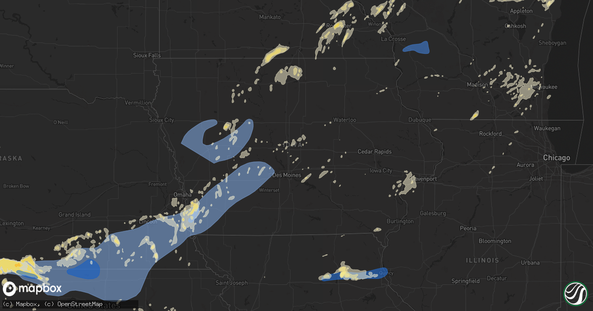
Hail Map in Iowa on August 9, 2025
Get this storm
August 9 map
$229
one time, instant access
Download today. No call, no setup
Keep the $229
Bought the map and want the full workflow? Apply the entire $229 to a subscription within 7 days. None of it is wasted.
Every map, not just this one
This buys you this map. Subscription and you get every map we run, in the markets you choose from a few cities to whole states to nationwide. Plus real-time alerts the moment a storm fires.
Contact data
Name, contact info, occupancy, even credit band for addresses in the footprint. You go from where it hit to who to call.
Become the source they trust
Unlimited branding weather history reports on demand. You already have the documented answer ready for the property owner, and you are the one who showed up with it.
Property data and RoofTrace estimates
Pull up any address you have got, its value and the exact code rules for that jurisdiction, straight from One Click Code. Then RoofTrace estimates the squares, pitch, and roof value, priced the way you price.
Storm reports in Iowa
Iowa
| Date | Description |
|---|---|
| 08/09/20258:27 AM CDT | Report of trees and branches down across town... Via social media. Time estimated by radar. |
| 08/09/20257:55 AM CDT | Large tree snapped in schaller city park. Delayed report... Time estimated by radar. |
| 08/09/20257:50 AM CDT | Delayed report: a personal weather station just southeast of galva recorded a 59 mph wind gust. |
| 08/09/20257:38 AM CDT | Fire department reported estimated winds between 65 and 70 mph over the last 15 minutes. |
| 08/09/20257:29 AM CDT | Measured gust from awos. Time of peak gust estimated from radar. |
| 08/09/20257:28 AM CDT | Measured from personal weather station. |
| 08/09/20257:26 AM CDT | Emergency manager reported large trees down in swan lake state park. Time estimated from radar. |
| 08/09/20257:22 AM CDT | Emergency manager reported damage to sheds and outbuildings. Time estimated from radar. |
| 08/09/20257:22 AM CDT | Emergency manager reported significant damage to a barn south of westside. Time estimated by radar. |
| 08/09/20257:20 AM CDT | Emergency manager reported trees down in halbur. Time estimated from radar. |
| 08/09/20257:19 AM CDT | Large tree down at this location... Few others reported in town. Time estimated by radar. |
| 08/09/20257:18 AM CDT | Measured from personal weather station. |
| 08/09/20257:15 AM CDT | Large pine uprooted and garage doors pushed in. Delayed report via social media... Time given in social media post and confirmed by radar. |
| 08/09/20257:10 AM CDT | Large tree... Unclear is rotted or healthy... Snapped at base. Few other small branches in town snapped. Delayed report... Time estimated by radar. |
| 08/09/20257:07 AM CDT | Emergency manager reported a snapped light pole and a tree down in manilla. Time estimated from radar. |
| 08/09/20257:05 AM CDT | Tree blown down. |
| 08/09/20257:05 AM CDT | Barn blown down and damage to trees. |
| 08/09/20255:39 AM CDT | A line of power |
| 08/09/20255:39 AM CDT | A line |
| 08/09/20255:39 AM CDT | A line of power poles snapped off from 230th street to blackhawk |
| 08/09/20255:39 AM CDT | A line of power poles snapped off |
| 08/09/20255:39 AM CDT | A line of power poles snapped off |
| 08/09/20255:39 AM CDT | A line of power poles snapped |
| 08/09/20255:39 AM CDT | A line of power poles snapped off from 230th street to blackhawk trail. No other damage in the vicinity. Time estimated from radar data. |
| 08/09/20255:07 AM CDT | Measured by personal weather station. |
| 08/09/20253:46 AM CDT | Measured via public mesonet station. |
| 08/09/20253:37 AM CDT | Emergency manager report of an overturned semi in retail lot. Time based on radar. |
| 08/09/20253:32 AM CDT | Significant tree damage across the town. Numerous large trees snapped. Some minor structural damage. |
| 08/09/20253:28 AM CDT | Measured via public mesonet station. |
| 08/09/20253:24 AM CDT | Shed destroyed. |
| 08/09/20253:24 AM CDT | Extensive tree damage in farragut. |
| 08/09/20253:23 AM CDT | Significant roof and wall damage to large barn. |
| 08/09/20253:20 AM CDT | Extensive tree damage in riverton. |
All States Impacted by Hail Map on August 9, 2025
Cities Impacted by Hail Map on August 9, 2025
- Charter Oak, IA
- Manilla, IA
- Defiance, IA
- Mapleton, IA
- Deloit, IA
- Arion, IA
- Onawa, IA
- Schleswig, IA
- Denison, IA
- Dunlap, IA
- Soldier, IA
- Irwin, IA
- Dow City, IA
- Ute, IA
- Kirkman, IA
- Vail, IA
- Earling, IA
- Castana, IA
- Rodney, IA
- Ricketts, IA
- Smithland, IA
- Battle Creek, IA
- Kiron, IA
- Manning, IA
- Audubon, IA
- Altamont, MO
- Independence, WI
- Bancroft, IA
- Arcadia, WI
- Zumbrota, MN
- Pine Island, MN
- Dorchester, WI
- Medford, WI
- Withee, WI
- Lake View, IA
- Sac City, IA
- Swea City, IA
- Ledyard, IA
- Lakota, IA
- Greenwood, WI
- Elmore, MN
- Buffalo Center, IA
- Blue Earth, MN
- Whitehall, WI
- Osseo, WI
- Curtiss, WI
- Mazeppa, MN
- Wall Lake, IA
- Aspinwall, IA
- Templeton, IA
- Carroll, IA
- Halbur, IA
- Westside, IA
- Dedham, IA
- Arcadia, IA
- Gray, IA
- Zumbro Falls, MN
- Lake City, MN
- Lytton, IA
- Stetsonville, WI
- Millville, MN
- Bricelyn, MN
- Frost, MN
- Auburn, IA
- Owen, WI
- Fountain City, WI
- Winston, MO
- Glidden, IA
- Breda, IA
- Lidderdale, IA
- Oto, IA
- Danbury, IA
- Ida Grove, IA
- Holstein, IA
- Anthon, IA
- Correctionville, IA
- Cushing, IA
- Churdan, IA
- Lake City, IA
- Havelock, IA
- Dodge Center, MN
- Hayfield, MN
- Blooming Prairie, MN
- Taylor, WI
- Kidder, MO
- Laurens, IA
- Wells, MN
- Wabasha, MN
- Cochrane, WI
- Kellogg, MN
- Kiester, MN
- Rockwell City, IA
- Jolley, IA
- Scranton, IA
- Ralston, IA
- Coon Rapids, IA
- Lohrville, IA
- Lanesboro, IA
- Mallard, IA
- Athens, WI
- Edgar, WI
- Alden, MN
- Hixton, WI
- Black River Falls, WI
- Pomeroy, IA
- Kasson, MN
- Alma, WI
- Manson, IA
- Somers, IA
- Farnhamville, IA
- Blair, WI
- Conover, WI
- Whittemore, IA
- Algona, IA
- West Bend, IA
- Lyle, MN
- Rose Creek, MN
- Oronoco, MN
- Rolfe, IA
- Knierim, IA
- Galesville, WI
- Mantorville, MN
- Curlew, IA
- Moorland, IA
- Callender, IA
- Gowrie, IA
- Barnum, IA
- Sargeant, MN
- Dexter, MN
- Brownsdale, MN
- Austin, MN
- Waltham, MN
- Eagle River, WI
- Three Lakes, WI
- Britt, IA
- Minnesota City, MN
- Mosinee, WI
- Lone Rock, IA
- Emmetsburg, IA
- Hatley, WI
- Burt, IA
- Ettrick, WI
- Woden, IA
- Crystal Lake, IA
- Forest City, IA
- Corwith, IA
- Schofield, WI
- Byron, MN
- Rochester, MN
- Clear Lake, IA
- Ventura, IA
- Stewartville, MN
- Spring Valley, MN
- Garner, IA
- Wesley, IA
- Joice, IA
- Lake Mills, IA
- Grand Meadow, MN
- Racine, MN
- Leland, IA
- Hanlontown, IA
- Fertile, IA
- Elkton, MN
- Adams, MN
- Chatfield, MN
- Mason City, IA
- Eyota, MN
- Wykoff, MN
- Dover, MN
- Manly, IA
- Wisconsin Rapids, WI
- Kensett, IA
- Saint Ansgar, IA
- Saint Charles, MN
- Plainview, MN
- Elgin, MN
- Cumberland, IA
- Stevens Point, WI
- Rudolph, WI
- Massena, IA
- Junction City, WI
- Milladore, WI
- Altura, MN
- Trempealeau, WI
- Riceville, IA
- Winona, MN
- Dakota, MN
- Houston, MN
- Rollingstone, MN
- De Soto, WI
- Viroqua, WI
- Coon Valley, WI
- Stoddard, WI
- Chaseburg, WI
- Westby, WI
- Cashton, WI
- La Farge, WI
- Ontario, WI
- Norwalk, WI
- Hillsboro, WI
- Kendall, WI
- Sterlington, LA
- Green Bay, WI
- West Monroe, LA
- Poynette, WI
- Denmark, WI
- De Pere, WI
- New Franken, WI
- Ogdensburg, WI
- Scandinavia, WI
- Waupaca, WI
- Portage, WI
- Luxemburg, WI
- Iola, WI
- Manawa, WI
- New London, WI
- Bear Creek, WI
- Weyauwega, WI
- Clintonville, WI
- Broadwater, NE
- Downing, MO
- Casco, WI
- Omro, WI
- Shiocton, WI
- Columbus, WI
- Appleton, WI
- Black Creek, WI
- Sun Prairie, WI
- Bushnell, NE
- Kaukauna, WI
- Algoma, WI
- Sturgeon Bay, WI
- Forestville, WI
- Bonduel, WI
- Merriman, NE
- Kimball, NE
- Seymour, WI
- Jonesboro, LA
- New Raymer, CO
- Glenbeulah, WI
- Green Castle, MO
- Novinger, MO
- Kewaunee, WI
- Kiel, WI
- Padroni, CO
- Stoneham, CO
- Elkhart Lake, WI
- Agate, CO
- Valders, WI
- New Holstein, WI
- Maribel, WI
- Hartford, WI
- Menominee, MI
- Juneau, WI
- West Bend, WI
- Marshall, WI
- Dix, NE
- Potter, NE
- Wiggins, CO
- Fort Morgan, CO
- Merino, CO
- Whitman, NE
- Deer Trail, CO
- Sidney, NE
- Kewaskum, WI
- Sterling, CO
- Valentine, NE
- Woodrow, CO
- Iliff, CO
- Fleming, CO
- Limon, CO
- Donnellson, IA
- Farmington, IA
- Cedarburg, WI
- Slinger, WI
- Elizabeth, CO
- Kiowa, CO
- Grafton, WI
- Marengo, IL
- Akron, CO
- Lindon, CO
- Matheson, CO
- Sussex, WI
- Woodstock, IL
- Lannon, WI
- Menomonee Falls, WI
- Pewaukee, WI
- Waukesha, WI
- Brookfield, MO
- Bucklin, MO
- Kim, CO
- Thedford, NE
- Otis, CO
- Haxtun, CO
- Cody, NE
- Brookfield, WI
- Milwaukee, WI
- Mequon, WI
- Gibbs, MO
- Brashear, MO
- La Plata, MO
- Elfrida, AZ
- Sugar Land, TX
- Yuma, CO
- Brookshire, TX
- Ethel, MO
- New Cambria, MO
- Katy, TX
- Wood Lake, NE
- Pritchett, CO
- Hugo, CO
- Johnstown, NE
- Elsmere, NE
- Callao, MO
- Elmer, MO
- Novelty, MO
- Hurdland, MO
- Macon, MO
- Atlanta, MO
- Patagonia, AZ
- Nogales, AZ
- Snyder, CO
- Bellville, TX
- Eagle Lake, TX
- East Bernard, TX
- Oak Creek, WI
- Sublette, IL
- La Moille, IL
- Mendota, IL
- Chappell Hill, TX
- Leonard, MO
- Anabel, MO
- Clarence, MO
- Brush, CO
- Ramah, CO
- Eckley, CO
- Halsey, NE
- McNeal, AZ
- Shelbyville, MO
- Columbus, TX
- Bethel, MO
- Newark, MO
- New Berlin, WI
- Purdum, NE
- Compton, IL
- Wray, CO
- Steward, IL
- Paw Paw, IL
- New Ulm, TX
- Atwood, CO
- Bisbee, AZ
- Dekalb, IL
- La Belle, MO
- Hubertus, WI
- Richfield, WI
- Jackson, WI
- Holyoke, CO
- Paoli, CO
- Emden, MO
- Ewing, MO
- Hereford, AZ
- Philadelphia, MO
- Genoa, IL
- Karval, CO
- Big Bend, WI
- Muskego, WI
- Saint Francis, KS
- Haigler, NE
- Vernon, CO
- Hayes Center, NE
- Simla, CO
- Palmyra, MO
- Maywood, MO
- Durham, MO
- Taylor, MO
- Elkhorn, WI
- Deerfield, WI
- Idalia, CO
- Palisade, NE
- Hales Corners, WI
- Mukwonago, WI
- Mullen, NE
- Franklin, WI
- Delafield, WI
- Oconomowoc, WI
- Wales, WI
- Dousman, WI
- East Troy, WI
- Calhan, CO
- Curtis, NE
- Eagle, WI
- Goodland, KS
- Trenton, NE
- Peyton, CO
- Yoder, CO
- Hillrose, CO
- Pearce, AZ
- North Prairie, WI
- Bird City, KS
- Edson, KS
- Colorado Springs, CO
- Rush, CO
- McCook, NE
- Culbertson, NE
- McDonald, KS
- Colby, KS
- Indianola, NE
- Danbury, NE
- Orangeville, IL
- Juda, WI
- Lebanon, NE
- Elm Grove, WI
- Butler, WI
- Levant, KS
- Atwood, KS
- Rock City, IL
- Brodhead, WI
- Brady, NE
- Wilsonville, NE
- Ordway, CO
- Fountain, CO
- Beaver City, NE
- Arapahoe, NE
- Hendley, NE
- Ludell, KS
- Norcatur, KS
- Boone, CO
- Reeseville, WI
- Stamford, NE
- Orleans, NE
- Norton, KS
- Hyannis, NE
- Lake Geneva, WI
- Sugar City, CO
- Almena, KS
- Long Island, KS
- Oxford, NE
- Alma, NE
- Burlington, WI
- Kansasville, WI
- Edison, NE
- Edgerton, WI
- Olney Springs, CO
- Prairie View, KS
- Phillipsburg, KS
- Johnson Creek, WI
- Fort Atkinson, WI
- Stoughton, WI
- Madison, WI
- Palmyra, WI
- Whitewater, WI
- Waterford, WI
- Helenville, WI
- Cottage Grove, WI
- Mcfarland, WI
- Lenora, KS
- Selden, KS
- Watertown, WI
- Jefferson, WI
- Arlington, CO
- Agra, KS
- Republican City, NE
- Hill City, KS
- Morland, KS
- Fairbury, NE
- Logan, KS
- Eads, CO
- Haswell, CO
- Roseland, NE
- Inland, NE
- Hastings, NE
- Glenvil, NE
- Ayr, NE
- Kensington, KS
- Kirwin, KS
- Naponee, NE
- Penrose, CO
- Holstein, NE
- Campbell, NE
- Cedar, KS
- Gaylord, KS
- Riverton, NE
- Franklin, NE
- Bloomington, NE
- Smith Center, KS
- Athol, KS
- Alton, KS
- Pueblo, CO
- Bogue, KS
- Waunakee, WI
- Deforest, WI
- Bladen, NE
- Nelson, NE
- Superior, NE
- Hardy, NE
- Harvard, NE
- Saronville, NE
- Clay Center, NE
- Osborne, KS
- Portis, KS
- Red Cloud, NE
- Inavale, NE
- Lebanon, KS
- Windsor, WI
- Liberty, NE
- Arthur, NE
- Tryon, NE
- Virginia, NE
- Minden, NE
- Blue Springs, NE
- Sheridan Lake, CO
- Oak, NE
- Lawrence, NE
- Blue Hill, NE
- Abbotsford, WI
- Plainville, KS
- Dodge, WI
- Strum, WI
- Davenport, NE
- Ohiowa, NE
- Tobias, NE
- Elma, IA
- Beatrice, NE
- Carleton, NE
- Thompson, IA
- Lansing, IA
- Guide Rock, NE
- Deweese, NE
- Filley, NE
- Pepin, WI
- La Junta, CO
- Downs, KS
- Mankato, KS
- Burr Oak, KS
- Esbon, KS
- Avondale, CO
- Stockton, KS
- Sullivan, WI
- Racine, WI
- Lamar, CO
- Edgar, NE
- Wiley, CO
- Sutherland, NE
- Alexandria, NE
- Daykin, NE
- Plymouth, NE
- Jansen, NE
- Sutton, NE
- Randall, KS
- Jewell, KS
- Formoso, KS
- Webber, KS
- Fowler, CO
- Fairfield, NE
- Pickrell, NE
- Milligan, NE
- Ong, NE
- Elmwood, NE
- Tecumseh, NE
- De Witt, NE
- Holly, CO
- Beaver Crossing, NE
- Adams, NE
- Grafton, NE
- Cook, NE
- Seward, NE
- Milford, NE
- Tribune, KS
- Scandia, KS
- Norway, KS
- Jamestown, KS
- Beloit, KS
- Courtland, KS
- Belleville, KS
- Concordia, KS
- Republic, KS
- Chester, NE
- Hebron, NE
- Byron, NE
- Cuba, KS
- Munden, KS
- Deshler, NE
- Hubbell, NE
- Ruskin, NE
- Agenda, KS
- Gilead, NE
- Pleasant Dale, NE
- Monroe, IA
- Runnells, IA
- Prairie City, IA
- Exeter, NE
- Geneva, NE
- Fairmont, NE
- North Platte, NE
- Eagle, NE
- Alvo, NE
- Woodston, KS
- Murdock, NE
- Clatonia, NE
- Pacific Junction, IA
- Talmage, NE
- Brock, NE
- Lincoln, NE
- Cortland, NE
- Syracuse, KS
- Blue River, WI
- Boscobel, WI
- Muscoda, WI
- Nebraska City, NE
- Clyde, KS
- Otoe, NE
- Martell, NE
- Hallam, NE
- Firth, NE
- Dunbar, NE
- Shickley, NE
- Greenwood, NE
- Waverly, NE
- Malcolm, NE
- Silver City, IA
- Glenwood, IA
- Ixonia, WI
- Weeping Water, NE
- Syracuse, NE
- Avoca, NE
- Neosho, WI
- Haddam, KS
- Morganville, KS
- Aurora, KS
- Clifton, KS
- Mahaska, KS
- Narka, KS
- Strang, NE
- Belvidere, NE
- Bruning, NE
- Manzanola, CO
- Hanover, IL
- Mineola, IA
- Plattsmouth, NE
- Union, NE
- Percival, IA
- Nehawka, NE
- Lynnville, IA
- Newton, IA
- Nashotah, WI
- Hartland, WI
- Okauchee, WI
- Reasnor, IA
- Sully, IA
- Hamburg, IA
- Sidney, IA
- Reynolds, NE
- Washington, KS
- Linn, KS
- Greenleaf, KS
- Clay Center, KS
- Morrowville, KS
- Green, KS
- Palmer, KS
- Barnes, KS
- Randolph, KS
- Diller, NE
- Wilber, NE
- Dorchester, NE
- Hollenberg, KS
- Friend, NE
- Endicott, NE
- Steele City, NE
- Hanover, KS
- Swanton, NE
- Western, NE
- Crete, NE
- Bellevue, NE
- Wapello, IA
- Columbus Junction, IA
- Springfield, NE
- Galena, IL
- Thurman, IA
- Grinnell, IA
- Tabor, IA
- Murray, NE
- Monument, KS
- Oakley, KS
- Burnett, WI
- Dresden, KS
- Kendall, KS
- Papillion, NE
- Longford, KS
- New Boston, IL
- Lakin, KS
- Leoti, KS
- Deerfield, KS
- Marienthal, KS
- Scott City, KS
- Abilene, KS
- Granada, CO
- Malvern, IA
- Montezuma, IA
- Solomon, KS
- Treynor, IA
- Louisville, NE
- Gretna, NE
- La Vista, NE
- Omaha, NE
- Underwood, IA
- Council Bluffs, IA
- McClelland, IA
- Olsburg, KS
- Manhattan, KS
- Leonardville, KS
- Riley, KS
- Oakland, IA
- Lodi, WI
- Waterloo, WI
- Junction City, KS
- Minden, IA
- Unadilla, NE
- Odell, NE
- Waterville, KS
- Marysville, KS
- Bremen, KS
- Wymore, NE
- Oketo, KS
- Johnson, NE
- Crab Orchard, NE
- Sterling, NE
- Burchard, NE
- Elk Creek, NE
- Douglas, NE
- Lewiston, NE
- Steinauer, NE
- Walton, NE
- Panama, NE
- Denton, NE
- Bennet, NE
- Roca, NE
- Burr, NE
- Sprague, NE
- Palmyra, NE
- Hickman, NE
- Holcomb, KS
- Gove, KS
- Dighton, KS
- Garden City, KS
- Healy, KS
- Lone Rock, WI
- Gotham, WI
- Lincoln, KS
- White City, KS
- Westmoreland, KS
- Wamego, KS
- Belvue, KS
- Fort Riley, KS
- Ogden, KS
- Hustisford, WI
- Humboldt, NE
- Table Rock, NE
- Saint George, KS
- Hancock, IA
- Avoca, IA
- Atlantic, IA
- Peru, NE
- Lorton, NE
- Julian, NE
- Riverton, IA
- Rock Port, MO
- Randolph, IA
- Elliott, IA
- Griswold, IA
- Hastings, IA
- Alta Vista, KS
- Dwight, KS
- Carson, IA
- Walnut, IA
- Marne, IA
- Emmett, KS
- Saint Marys, KS
- Alma, KS
- Lewis, IA
- Onaga, KS
- Dawson, NE
- Spring Green, WI
- Delia, KS
- Council Grove, KS
- Colo, IA
- Zearing, IA
- Saint Anthony, IA
- Quinter, KS
- Imogene, IA
- Emerson, IA
- Hubbard, IA
- New Providence, IA
- Swan, IA
- Farragut, IA
- Rio, WI
- Maple Hill, KS
- New Sharon, IA
- Joy, IL
- Iron Ridge, WI
- Collyer, KS
- Illinois City, IL
- Gilbert, IA
- Essex, IA
- Clarinda, IA
- Stanton, IA
- Red Oak, IA
- Shenandoah, IA
- Villisca, IA
- Henderson, IA
- Macedonia, IA
- Rose Hill, IA
- What Cheer, IA
- Roland, IA
- Harveyville, KS
- Eskridge, KS
- Exira, IA
- Elk Horn, IA
- Ames, IA
- Topeka, KS
- Brayton, IA
- Story City, IA
- Redfield, IA
- Guthrie Center, IA
- Nevada, IA
- Casey, IA
- Mineral Point, WI
- Barnes City, IA
- Adair, IA
- Paxico, KS
- McCallsburg, IA
- Reynolds, IL
- Aledo, IL
- Beeler, KS
- Arnold, KS
- Gorham, KS
- Ransom, KS
- Brownell, KS
- Hays, KS
- McCracken, KS
- Victoria, KS
- Ness City, KS
- Wakeeney, KS
- Ellis, KS
- Utica, KS
- Walker, KS
- Russell, KS
- Ogallah, KS
- Catharine, KS
- Palco, KS
- Paradise, KS
- Natoma, KS
- Park, KS
- Grinnell, KS
- Linden, IA
- Adel, IA
- Emporia, KS
- Minburn, IA
- Yale, IA
- Admire, KS
- Olpe, KS
- Dallas Center, IA
- Elgin, IA
- Allen, KS
- Reading, KS
- Bagley, IA
- Bayard, IA
- Jefferson, IA
- Madison, KS
- Farmersburg, IA
- Luana, IA
- Saint Olaf, IA
- Monona, IA
- Postville, IA
- Clemons, IA
- Burlingame, KS
- Muscatine, IA
- Letts, IA
- Boone, IA
- Stockton, IA
- Durant, IA
- Holland, IA
- Grundy Center, IA
- Dike, IA
- Reinbeck, IA
- Taylor Ridge, IL
- Colfax, IA
- Wiota, IA
- Waukee, IA
- De Soto, IA
- Fontanelle, IA
- Greenfield, IA
- Menlo, IA
- Grant, IA
- Stuart, IA
- Bridgewater, IA
- Dexter, IA
- Prescott, IA
- Corning, IA
- Orient, IA
- Earlham, IA
- Nodaway, IA
- Anita, IA
- Hamlin, IA
- Panora, IA
- Bunker Hill, KS
- Waldo, KS
- Elkhart, IA
- Maxwell, IA
- Wilton, IA
- Cambridge, IA
- Madrid, IA
- Paton, IA
- Ogden, IA
- Dana, IA
- Blue Grass, IA
- Perry, IA
- Jamaica, IA
- Dawson, IA
- Hamilton, KS
- Hartford, KS
- Neosho Rapids, KS
- Woodward, IA
- Walcott, IA
- Montpelier, IA
- Eureka, KS
- Minneapolis, KS
- Kellogg, IA
- Traer, IA
- Gilman, IA
- Wakarusa, KS
- Parnell, IA
- Williamsburg, IA
- Elberon, IA
- Chelsea, IA
- Bevier, MO
- La Grange, MO
- Monroe City, MO
- Quincy, IL
- Schaller, IA
- Early, IA
- Galva, IA
- Arthur, IA
- Odebolt, IA


