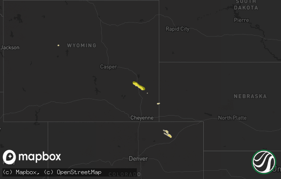
Hail Map in Wyoming on August 9, 2011
The weather event in Wyoming on August 9, 2011 includes Hail map. 24 states and 895 cities were impacted and suffered possible damage. The total estimated number of properties impacted is 0.

Hail
0
Estimated number of impacted properties by a 1.00" hail or larger0
Estimated number of impacted properties by a 1.75" hail or larger0
Estimated number of impacted properties by a 2.50" hail or largerStorm reports in Wyoming
Wyoming
| Date | Description |
|---|---|
| 08/09/20115:50 PM CDT | A local report indicates 1.00 inch wind near W LINCH |
| 08/09/20115:20 PM CDT | A local report indicates 1.00 inch wind near 3 ENE ROCHELLE |
| 08/09/20115:05 PM CDT | A local report indicates 60 MPH wind near 15 SE WRIGHT |
| 08/09/20115:05 PM CDT | 6-7 inch diameter cottonwood branches broken off |
| 08/09/20114:45 PM CDT | A local report indicates 1.00 inch wind near 10 SE WRIGHT |
| 08/09/20113:40 PM CDT | A local report indicates 1.00 inch wind near 1 NNW LUCERNE |
| 08/09/20113:34 PM CDT | A local report indicates 1.00 inch wind near 6 NNE THERMOPOLIS |
| 08/08/201110:55 PM CDT | A local report indicates 1.00 inch wind near 2 NE CHEYENNE |
| 08/08/201110:46 PM CDT | A local report indicates 1.00 inch wind near 10 N CHEYENNE |
| 08/08/201110:44 PM CDT | A local report indicates 1.75 inch wind near 8 NW CHEYENNE |
| 08/08/20118:48 PM CDT | A local report indicates 1.00 inch wind near 6 N LA GRANGE |
| 08/08/20118:35 PM CDT | A local report indicates 2.00 inch wind near HAWK SPRINGS |
| 08/08/20118:34 PM CDT | A local report indicates 1.00 inch wind near 8 SW TORRINGTON |
| 08/08/20118:31 PM CDT | A local report indicates 1.75 inch wind near YODER |
| 08/08/20118:30 PM CDT | Some windows broken. |
| 08/08/20118:27 PM CDT | Very heavy rain appx 2 inches. Ground is completly covered with hail. |
| 08/08/20118:24 PM CDT | A local report indicates 1.00 inch wind near 5 W YODER |
| 08/08/20118:00 PM CDT | A local report indicates 1.50 inch wind near 8 SSE GUERNSEY |
| 08/08/20117:57 PM CDT | Downed power lines. |
| 08/08/20117:51 PM CDT | A camper was blown over in the campground. Marble sized hail was reported also. |
| 08/08/20117:30 PM CDT | Five power poles knocked down starting at intersection of wyoming 320 and us highway 26 and going to the east. Golfball sized hail so deep highway department had to be |
| 08/08/20117:20 PM CDT | Hail fell at interstate 25 milepost 100. |
All States Impacted by Hail Map on August 9, 2011
Cities Impacted by Hail Map on August 9, 2011
- White Deer, TX
- Claude, TX
- Lewellen, NE
- Lemoyne, NE
- Wheatland, WY
- Glendo, WY
- Guernsey, WY
- Nova, OH
- Imperial, NE
- Wakeeney, KS
- Brownell, KS
- Ransom, KS
- Gray, GA
- Hillsboro, GA
- Sylvester, GA
- Lindsay, OK
- Landenberg, PA
- Montchanin, DE
- Pedricktown, NJ
- Salem, NJ
- Claymont, DE
- Wilmington, DE
- Bear, DE
- Chadds Ford, PA
- Woodstown, NJ
- Avondale, PA
- Penns Grove, NJ
- Yorklyn, DE
- Hockessin, DE
- Rockland, DE
- Kennett Square, PA
- Newark, DE
- Toughkenamon, PA
- Swedesboro, NJ
- New Castle, DE
- Pennsville, NJ
- Selden, KS
- Magee, MS
- Mendenhall, MS
- Vega, TX
- Carmi, IL
- Stratton, NE
- Pampa, TX
- Bloomville, OH
- Republic, OH
- Attica, OH
- Defiance, OH
- Wallace, NE
- Winslow, AR
- Chester, AR
- Venango, NE
- Julesburg, CO
- Pineland, SC
- Garnett, SC
- Grant, NE
- Holyoke, CO
- Jamestown, IN
- New Ross, IN
- North Salem, IN
- Lizton, IN
- Hunter, OK
- Morland, KS
- Forgan, OK
- Mount Vernon, IN
- Wadesville, IN
- New Harmony, IN
- Oshkosh, NE
- Mendon, OH
- Spencerville, OH
- Venedocia, OH
- Rockford, OH
- Ohio City, OH
- New London, OH
- Beaver, OK
- Maysville, OK
- McCook, NE
- Proctor, OK
- Stilwell, OK
- Trenton, NE
- Culbertson, NE
- La Crosse, KS
- Alexander, KS
- Rush Center, KS
- Nekoma, KS
- Douglas, WY
- Midville, GA
- Twin City, GA
- Perryton, TX
- Wapakoneta, OH
- Inman, KS
- Power, MT
- Poteau, OK
- Spiro, OK
- Bokoshe, OK
- Shady Point, OK
- Cameron, OK
- Collyer, KS
- Indianapolis, IN
- Greenwood, IN
- Keota, OK
- Wakarusa, IN
- Bremen, IN
- Mishawaka, IN
- South Bend, IN
- Atwood, KS
- Meridian, MS
- Cushing, OK
- McDonald, KS
- Panhandle, TX
- Green Springs, OH
- Crook, CO
- Benkelman, NE
- Parks, NE
- Hill City, KS
- Penokee, KS
- Lenora, KS
- Gay, GA
- Brule, NE
- Oberlin, KS
- Norcatur, KS
- Indianola, NE
- Danbury, NE
- Lebanon, NE
- Wauneta, NE
- Palisade, NE
- Arthur, NE
- Ashland, OH
- Greenwich, OH
- Chapin, SC
- Hayes Center, NE
- Dix, NE
- Potter, NE
- Harrisburg, NE
- Canehill, AR
- Hawk Springs, WY
- Independence, OH
- Cleveland, OH
- Oklahoma City, OK
- Edmond, OK
- Maywood, NE
- Hoisington, KS
- Russell, KS
- Soperton, GA
- Elsie, NE
- Garrett, WY
- Paxton, NE
- Anton, TX
- Leesburg, GA
- De Soto, GA
- Thermopolis, WY
- Enders, NE
- Lyons, KS
- Hazlehurst, GA
- Swainsboro, GA
- Balko, OK
- Turpin, OK
- Mustang, OK
- El Reno, OK
- Yukon, OK
- Ellis, KS
- Hays, KS
- Paden, OK
- Goshen, IN
- Bonifay, FL
- North Baltimore, OH
- Norton, KS
- Herndon, KS
- Allen, OK
- Holdenville, OK
- Atwood, OK
- St John, KS
- Waynetown, IN
- Okemah, OK
- Amherst, CO
- Hinesville, GA
- Ludowici, GA
- Fort Stewart, GA
- Purcell, OK
- Larned, KS
- Wilmot, OH
- Dundee, OH
- Morrow, AR
- Evansville, AR
- Lincoln, AR
- Gillette, WY
- Hardesty, OK
- Hooker, OK
- Homerville, GA
- Buhler, KS
- Apple Creek, OH
- Farwell, TX
- Texico, NM
- Bovina, TX
- Chappell, NE
- Plainville, KS
- Bluffton, IN
- Monroe, IN
- Decatur, IN
- Metter, GA
- Kimball, NE
- Lyons, GA
- Collins, GA
- Reidsville, GA
- Fremont, OH
- Crescent, OK
- Arcadia, OK
- Dimmitt, TX
- Gorham, KS
- Palco, KS
- Ogallah, KS
- Hoxie, KS
- Victoria, KS
- Barnwell, SC
- Quinter, KS
- Sherwood, OH
- Mark Center, OH
- Wildorado, TX
- Keystone, NE
- Sedgwick, CO
- Wawaka, IN
- Cheyenne, WY
- Westville, FL
- Quitman, MS
- Alpine, TX
- Mooreland, OK
- Chester, OK
- Big Springs, NE
- Ovid, CO
- Vicksburg, MS
- Satartia, MS
- Strasburg, OH
- Dover, OH
- Sugarcreek, OH
- Orrville, AL
- Glenrock, WY
- Logan, KS
- Stockton, KS
- Glade, KS
- Champion, NE
- Enterprise, MS
- Peetz, CO
- Wellington, OH
- Spencer, OH
- Laurel, MS
- Hutchinson, KS
- Charleston, AR
- Cecil, AR
- Ozark, AR
- Otis, KS
- Jennings, KS
- Clayton, KS
- Garfield, GA
- Wadley, GA
- Millen, GA
- Continental, OH
- New Bavaria, OH
- Collins, OH
- Wakeman, OH
- Anna, OH
- Hillsdale, MI
- Osseo, MI
- Lincoln University, PA
- Oxford, PA
- Yoder, WY
- Woodward, OK
- Fort Supply, OK
- Claflin, KS
- Sidney, NE
- Perry, OK
- Spearman, TX
- Spencer, OK
- Osborne, KS
- Waldo, KS
- Torrington, WY
- Veteran, WY
- Adrian, TX
- Hereford, TX
- Lodgepole, NE
- Van Wert, OH
- Convoy, OH
- Masterson, TX
- Channing, TX
- Clinton, AR
- Jerusalem, AR
- Ludell, KS
- Middlebury, IN
- Bristol, IN
- Seville, OH
- Bogue, KS
- Damar, KS
- Calvin, OK
- Lima, OH
- Saint Marys, OH
- Edgerton, OH
- Gibsonburg, OH
- Tiffin, OH
- Clyde, OH
- Borger, TX
- Madill, OK
- Shubuta, MS
- Crawfordsville, IN
- Bedford, OH
- Moultrie, GA
- Alger, OH
- Ada, OH
- Harrod, OH
- Fargo, OK
- Dumas, TX
- Norwalk, OH
- North Fairfield, OH
- Jacksonville, GA
- Broxton, GA
- Homosassa, FL
- Ridgeville, SC
- Ravenel, SC
- Summerville, SC
- Little Rock, MS
- Union, MS
- Wellfleet, NE
- North Platte, NE
- Dennison, OH
- Bowerston, OH
- Talbotton, GA
- Estill, SC
- Minter, AL
- Lavaca, AR
- Skellytown, TX
- Gurley, NE
- Kingman, KS
- Lakeview, OH
- South Bloomingville, OH
- Ladoga, IN
- Pittsboro, IN
- Sasakwa, OK
- New Philadelphia, OH
- Ottawa, OH
- Dickens, NE
- Laurelville, OH
- Bunker Hill, KS
- Greenfield, IN
- Stafford, KS
- Sherrodsville, OH
- Pryor, OK
- Alma, GA
- Maud, OK
- North Vernon, IN
- Butlerville, IN
- Granger, IN
- Rushsylvania, OH
- Bellefontaine, OH
- Macksville, KS
- Sutherland, NE
- Ringwood, OK
- Baxley, GA
- Ashland, KS
- Englewood, KS
- Goodwell, OK
- Newnan, GA
- Sharpsburg, GA
- Moreland, GA
- Senoia, GA
- Greenville, GA
- Luthersville, GA
- Catharine, KS
- Natoma, KS
- Westville, OK
- Dalton, NE
- Angola, IN
- Tahlequah, OK
- Union City, OK
- Park Hill, OK
- Sterling, KS
- Paulding, MS
- Canadian, TX
- Bristow, OK
- Raleigh, MS
- Laverne, OK
- McCracken, KS
- Gruver, TX
- Ashley, IN
- Waterloo, IN
- Hamilton, IN
- Paulding, OH
- Castle, OK
- Locust Grove, OK
- Pachuta, MS
- Elmer, NJ
- Shipshewana, IN
- Sunray, TX
- Forsyth, GA
- Barnesville, GA
- Inola, OK
- Skiatook, OK
- Ramona, OK
- Grove City, OH
- Dresden, KS
- Fostoria, OH
- Porum, OK
- Chase, KS
- Macedonia, OH
- Brecksville, OH
- Northfield, OH
- Ogallala, NE
- Madrid, NE
- Max, NE
- Dorrance, KS
- Bronwood, GA
- Dawson, GA
- Hulbert, OK
- Archbold, OH
- Ridgeville Corners, OH
- Napoleon, OH
- Buffalo, OK
- Rosston, OK
- Pawnee Rock, KS
- Urbana, OH
- Lamar, OK
- Burrton, KS
- Halstead, KS
- Saint Clair Shores, MI
- Eastpointe, MI
- Blackville, SC
- Tecumseh, OK
- Shawnee, OK
- Sayre, OK
- Botkins, OH
- Sardis, AL
- Selma, AL
- Saint Paris, OH
- Mechanicsburg, OH
- Cable, OH
- Kirk, CO
- Brownsburg, IN
- Kaycee, WY
- West Fork, AR
- Thomaston, GA
- Burgoon, OH
- Old Fort, OH
- Bradner, OH
- Risingsun, OH
- Bettsville, OH
- Helena, OH
- Willard, OH
- Kansas, OH
- Bellevue, OH
- Fort Jennings, OH
- Grover Hill, OH
- Middle Point, OH
- Columbus, IN
- Rozel, KS
- Bazine, KS
- Williamson, GA
- Needham, IN
- Franklin, IN
- Groom, TX
- Lavina, MT
- Plains, GA
- Smithville, GA
- Stigler, OK
- Ashby, NE
- East Liberty, OH
- Zanesfield, OH
- Glennville, GA
- Carlisle, SC
- Cope, CO
- Bingham, NE
- Elk City, OK
- Carter, OK
- Uvalda, GA
- Pawhuska, OK
- Sperry, OK
- Portal, GA
- Brandon, MS
- Mansfield, OH
- Shiloh, OH
- Shelby, OH
- Roundup, MT
- Chouteau, OK
- Lewistown, OH
- Jackson Center, OH
- Waverly, KY
- Mcloud, OK
- Woodland, GA
- Lagrange, OH
- Anton, CO
- Wilsonville, NE
- Bridgeport, NE
- Eufaula, OK
- Martin, SC
- Tulsa, OK
- Sapulpa, OK
- Milford, MI
- Logan, OH
- Rockbridge, OH
- Canadian, OK
- Tyler, AL
- Shelbyville, IN
- Hershey, NE
- Harrah, OK
- Wellston, OK
- Luther, OK
- Kremlin, OK
- Mize, MS
- Ellsworth, NE
- Denton, GA
- Nicholls, GA
- West Green, GA
- Memphis, TX
- Curtis, NE
- Bartley, NE
- Stamford, NE
- Beaver City, NE
- Ellinwood, KS
- Woodston, KS
- Alton, KS
- Phillipsburg, KS
- Muenster, TX
- Saint Jo, TX
- Newcastle, WY
- Daleville, AL
- Cameron, SC
- Mcalester, OK
- Clinton, MI
- Tipton, MI
- Little Mountain, SC
- Prosperity, SC
- Port Jefferson, OH
- Maplewood, OH
- Sidney, OH
- Okmulgee, OK
- Rolling Fork, MS
- Ada, OK
- Ligonier, IN
- Bison, KS
- Celina, OH
- Weleetka, OK
- Welling, OK
- Natural Dam, AR
- Bunch, OK
- Prairie Grove, AR
- Boggstown, IN
- Fairland, IN
- Whiteland, IN
- Beech Grove, IN
- Cobbtown, GA
- Vidalia, GA
- Oakwood, OH
- Sylvania, GA
- Fritch, TX
- Boley, OK
- Depew, OK
- Wauseon, OH
- Homerville, OH
- West Salem, OH
- Chancellor, AL
- Flat Rock, IN
- Bird City, KS
- Hamilton, GA
- Sullivan, OH
- Chugwater, WY
- Lizella, GA
- Macon, GA
- Britton, MI
- Milan, MI
- Saline, MI
- Wilmore, KS
- Melvin, AL
- Gilbertown, AL
- Wewoka, OK
- Bushton, KS
- Holyrood, KS
- Geneseo, KS
- Lorraine, KS
- Mount Sterling, OH
- London, OH
- Pomaria, SC
- Stroud, OK
- Drumright, OK
- Skipperville, AL
- Indianola, OK
- Amarillo, TX
- Lower Peach Tree, AL
- Griffin, GA
- Milner, GA
- Wooster, OH
- Jones, OK
- Marion Junction, AL
- Butler, AL
- Jachin, AL
- Roanoke, IN
- Norwich, KS
- Seminole, OK
- Cleo Springs, OK
- Plymouth, OH
- Coldwater, KS
- Polk, OH
- Cunningham, KS
- Billings, OK
- Garber, OK
- Covington, OK
- Wellington, KS
- Angora, NE
- Lisman, AL
- Heidelberg, MS
- Vossburg, MS
- Bluffton, SC
- Lakeland, GA
- Valdosta, GA
- Naylor, GA
- Mena, AR
- Mccurtain, OK
- Haskell, OK
- Porter, OK
- Enigma, GA
- Alapaha, GA
- West Chester, PA
- Wadsworth, OH
- Rittman, OH
- Howe, IN
- Choctaw, OK
- Sea Isle City, NJ
- Thomasville, GA
- Paradise, KS
- Little River, KS
- Wilson, KS
- Raymond, KS
- Prairie View, KS
- Ellsworth, KS
- Alden, KS
- Pfeifer, KS
- Walker, KS
- Cecil, OH
- Woodbury, GA
- Chelsea, OK
- Claremore, OK
- Naubinway, MI
- Fort Gibson, OK
- Muskogee, OK
- Kingfisher, OK
- Auburn, IN
- Madison, FL
- Manchester, MI
- Hendley, NE
- Kinta, OK
- Lakewood, OH
- Shiloh, GA
- Manchester, GA
- Bellaire, MI
- Sparks, OK
- Chandler, OK
- Prague, OK
- Medina, OH
- Lodi, OH
- Mooresville, IN
- Early Branch, SC
- Mulberry, AR
- Navarre, OH
- South Vienna, OH
- Jesup, GA
- Cloverdale, OH
- Stuart, OK
- Vassar, MI
- Caro, MI
- Plevna, KS
- Millington, MI
- Otisville, MI
- Newkirk, OK
- Tifton, GA
- Grass Range, MT
- Forest Grove, MT
- Remus, MI
- Weidman, MI
- Olmitz, KS
- Stringer, MS
- Taylorsville, MS
- Bay Springs, MS
- Ozark, AL
- Aline, OK
- Round O, SC
- Walterboro, SC
- Mason, MI
- Okemos, MI
- Albion, IN
- Lingle, WY
- Fort Laramie, WY
- Allen, MI
- West Bloomfield, MI
- Dellroy, OH
- Sentinel, OK
- Galloway, OH
- West Jefferson, OH
- Greensburg, IN
- Hope, IN
- Columbia City, IN
- Deford, MI
- Cass City, MI
- Milan, GA
- McRae Helena, GA
- Tillman, SC
- Tyrone, OK
- Commerce Township, MI
- Walled Lake, MI
- Social Circle, GA
- Mansfield, GA
- Huntsville, OH
- Black, AL
- Geneva, AL
- Hartford, AL
- Beatrice, AL
- Coweta, OK
- Deshler, OH
- Lenox, GA
- Hartville, WY
- Orangeburg, SC
- Guthrie, OK
- Wetumka, OK
- Ridgeland, SC
- Varnville, SC
- Grosse Pointe, MI
- Stinnett, TX
- Alamo, GA
- Lula, GA
- Pleasant Lake, IN
- Hudson, IN
- Wayne, OK
- Fort Recovery, OH
- Coldwater, OH
- Cygnet, OH
- McComb, OH
- Van Buren, OH
- Bloomdale, OH
- Newalla, OK
- Meeker, OK
- Albin, WY
- Edgemont, SD
- Norman, OK
- Gate, OK
- Liberty Center, OH
- Lindon, CO
- Almena, KS
- Sedgwick, KS
- Haigler, NE
- Utica, KS
- Windom, KS
- Moundridge, KS
- Colby, KS
- Bayard, NE
- Corydon, KY
- Marietta, OK
- Elkhart, IN
- West Point, GA
- Wallingford, PA
- Glen Mills, PA
- Swarthmore, PA
- Cheyney, PA
- Media, PA
- Thornton, PA
- Aston, PA
- Brookhaven, PA
- Belle Center, OH
- Holton, IN
- Columbia, SC
- Brooks, GA
- Westport, IN
- Arcadia, OH
- Findlay, OH
- Lisco, NE
- Edison, GA
- Willacoochee, GA
- Clovis, NM
- Melrose, OH
- Bridgeton, NJ
- Lyman, NE
- Redbird, OK
- Amanda, OH
- Nickerson, KS
- Mendon, MI
- Arapaho, OK
- Norman Park, GA
- Ladson, SC
- Claxton, GA
- Briscoe, TX
- Jonesville, MI
- Doerun, GA
- Minco, OK
- Bryan, OH
- Gainesville, TX
- Whitesboro, TX
- Thackerville, OK
- West Liberty, OH
- North Lewisburg, OH
- Hogansville, GA
- Lagrange, GA
- Soso, MS
- Nashville, GA
- Abbyville, KS
- Canton, MS
- Kendallville, IN
- Corunna, IN
- Avilla, IN
- Lagrange, IN
- Mineral City, OH
- Magnolia, OH
- Mauk, GA
- Cary, MS
- Hamler, OH
- Leipsic, OH
- Lawton, OK
- Elgin, OK
- Lancaster, OH
- Sugar Grove, OH
- Rose Hill, MS
- Wellington, TX
- Turon, KS
- Custer City, OK
- Clinton, OK
- Bartow, GA
- Kite, GA
- Fairhope, AL
- Carmen, OK
- Helena, OK
- Piedmont, OK
- Saint Francis, KS
- Konawa, OK
- Joes, CO
- Fountaintown, IN
- New Palestine, IN
- Mount Pleasant, MI
- Huntsville, AR
- Hindsville, AR
- Cashion, OK
- Rutledge, GA
- Silverwood, MI
- Mayville, MI
- Ray City, GA
- Hawkinsville, GA
- Jerome, MI
- Waynoka, OK
- Henryetta, OK
- Sweet Water, AL
- Columbus Grove, OH
- Butler, IN
- Sycamore, OH
- McCutchenville, OH
- Pearson, GA
- Pond Creek, OK
- Enid, OK
- Payne, OH
- Woodburn, IN
- Antwerp, OH
- Springfield, GA
- Rincon, GA
- Marlow, OK
- Dardanelle, AR
- Galena, OH
- Edinburgh, IN
- Rockwood, MI
- Flat Rock, MI
- Yale, OK
- South Whitley, IN
- Elkton, MD
- Bluffton, OH
- Topeka, IN
- Ellisville, MS
- Sterling, OH
- Poulan, GA
- Hartsville, IN
- Athens, OH
- Peggs, OK
- Spivey, KS
- Onsted, MI
- Omega, GA
- Statesboro, GA
- Wolcottville, IN
- Miami, TX
- Williamston, MI
- Quinton, OK
- Kellyville, OK
- Stockville, NE
- Forestburg, TX
- Rocky River, OH
- Protection, KS
- Silas, AL
- Waynesboro, MS
- De Graff, OH
- Broadview Heights, OH
- Saint Henry, OH
- Ney, OH
- Hartsfield, GA
- Bargersville, IN
- Whitney, NE
- Hudson, KS
- Chunky, MS
- Stonewall, MS
- Garryowen, MT


