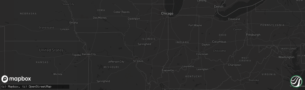
Hail Map in Massachusetts on August 8, 2023
The weather event in Massachusetts on August 8, 2023 includes Hail, Wind, and Tornado maps. 19 states and 553 cities were impacted and suffered possible damage. The total estimated number of properties impacted is 0.
Want more than just the map?
Turn this storm into a full workflow.
- Owner + property data so you know who to knock
- OnDemand branded weather history reports to win the "did we even have hail?" argument
- RoofTrace estimate so reps stop guessing numbers at the door
Bought this map? Upgrade within 7 days and we'll credit the $230. (10-15 min setup call)
Hail
Wind
Tornado
0
Estimated number of impacted properties by a 1.00" hail or larger0
Estimated number of impacted properties by a 1.75" hail or larger0
Estimated number of impacted properties by a 2.50" hail or largerStorm reports in Massachusetts
Massachusetts
| Date | Description |
|---|---|
| 08/08/20233:05 PM CDT | A small ef-1 tornado touched down in the town of mattapoisett massachusetts at 11:20 am edt. The storm was on the ground for approximately 3 minutes. The storm moved to |
| 08/08/202311:51 AM CDT | Numerous trees down in the tinkham lane area as well as on acushnet road and stoney hill road. |
| 08/08/202311:15 AM CDT | Tree down along rt 6 near exit 68. Relayed by amateur radio. |
| 08/08/202311:05 AM CDT | Several reports of trees and wires down and trees blocking the road on west barnstable road in osterville and on commerce road at main street. |
| 08/08/202310:52 AM CDT | A small ef-0 tornado touched down in the town of barnstable... Near the village of marstons mills... At 11:52 am. The storm tracked ene from evergreen drive for approxi |
| 08/08/202310:20 AM CDT | Trees and wires down on north street around eldorado dr. Relayed by amateur radio. |
| 08/08/202310:20 AM CDT | Trees down on acushent rd. Relayed by amateur radio. |
| 08/08/202310:20 AM CDT | Corrects previous tornado report from 2 wnw mattapoisett. A small ef-1 tornado touched down in the town of mattapoisett massachusetts at 11:20 am edt. The storm was on |
| 08/08/202310:20 AM CDT | Trees and wires down on hereford hill rd. Relayed by amateur radio. |
| 08/08/20239:25 AM CDT | Large tree and wires down on ashland street. |
All States Impacted by Hail Map on August 8, 2023
Cities Impacted by Hail Map on August 8, 2023
- Seymour, TX
- Mena, AR
- Enid, OK
- Fairmont, OK
- Garber, OK
- Covington, OK
- Lucien, OK
- Douglas, OK
- Perry, OK
- Hennessey, OK
- Dover, OK
- Mulhall, OK
- Marshall, OK
- Bison, OK
- Crescent, OK
- Kingfisher, OK
- Cashion, OK
- Guthrie, OK
- Orlando, OK
- Coyle, OK
- Waukomis, OK
- Fairhaven, MA
- Mattapoisett, MA
- Portland, AR
- Hamburg, AR
- Wilmot, AR
- Parkdale, AR
- Crossett, AR
- Eudora, AR
- Isola, MS
- Wilmar, AR
- Lake Village, AR
- Montrose, AR
- Dermott, AR
- Oak Grove, LA
- Jones, LA
- Monticello, AR
- Fountain Hill, AR
- International Falls, MN
- Kabetogama, MN
- Orr, MN
- Gary, MN
- Mahnomen, MN
- Bejou, MN
- Crane Lake, MN
- Sheridan, WY
- Angora, NE
- Alliance, NE
- Bridgeport, NE
- Bayard, NE
- Sterling, CO
- Otis, CO
- Akron, CO
- Byron, GA
- Warner Robins, GA
- Centerville, GA
- Fort Valley, GA
- Albany, GA
- Leary, GA
- Dawson, GA
- Bronwood, GA
- Leesburg, GA
- Shellman, GA
- Morgan, GA
- Sylvester, GA
- Warwick, GA
- Poulan, GA
- Oakfield, GA
- Ty Ty, GA
- Ashburn, GA
- Tifton, GA
- Doerun, GA
- Sumner, GA
- Chula, GA
- Omega, GA
- Baconton, GA
- Lenox, GA
- Hawley, MN
- Norman Park, GA
- Moultrie, GA
- Pavo, GA
- Berlin, GA
- Adel, GA
- Barney, GA
- Ellenton, GA
- Sparks, GA
- Hahira, GA
- Valdosta, GA
- Morven, GA
- Willacoochee, GA
- Ray City, GA
- Alapaha, GA
- Enigma, GA
- Nashville, GA
- Oshkosh, NE
- Lake Park, MN
- Broadwater, NE
- Rebecca, GA
- Ocilla, GA
- Sycamore, GA
- Fitzgerald, GA
- Douglas, GA
- Pearson, GA
- Lakeland, GA
- Broxton, GA
- Wray, GA
- West Green, GA
- Ambrose, GA
- Nicholls, GA
- Homerville, GA
- Axson, GA
- Lakeside, NE
- Yuma, CO
- Ellsworth, NE
- Millwood, GA
- Tucson, AZ
- Audubon, MN
- Troy, AL
- Goshen, AL
- Andersonville, GA
- Oglethorpe, GA
- Dry Branch, GA
- Maybell, CO
- Eastman, GA
- Perry, GA
- Milan, GA
- Chauncey, GA
- Borup, MN
- Union Springs, AL
- Gay, GA
- Molena, GA
- Concord, GA
- Fleming, CO
- Chambers, AZ
- Fosston, MN
- Georgetown, MN
- Frazee, MN
- Richland, GA
- Arabi, GA
- Lapine, AL
- Montrose, GA
- Danville, GA
- Eufaula, AL
- Green Valley, AZ
- Aragon, NM
- Rock Springs, WY
- Cochran, GA
- Montgomery, AL
- Lumpkin, GA
- Cordele, GA
- Columbia, AL
- Abbeville, AL
- Blakely, GA
- Shorterville, AL
- Mandeville, LA
- Covington, LA
- Hawkinsville, GA
- Camden, AL
- Pine Apple, AL
- Midway, AL
- Hurtsboro, AL
- Hitterdal, MN
- Hayneville, AL
- Hope Hull, AL
- Newton, AL
- Slocomb, AL
- Daleville, AL
- Dothan, AL
- Georgetown, GA
- Brantley, AL
- Glenwood, AL
- Glyndon, MN
- Bonaire, GA
- Jeffersonville, GA
- Abbeville, GA
- Rochert, MN
- Detroit Lakes, MN
- Osage, MN
- Pittsview, AL
- Grady, AL
- Ramer, AL
- Pompano Beach, FL
- Luverne, AL
- Rutledge, AL
- Pinehurst, GA
- Byromville, GA
- Ogema, MN
- Macon, GA
- Ulen, MN
- Hatchechubbee, AL
- Roberta, GA
- Dublin, GA
- Irwinton, GA
- Omaha, GA
- Felton, MN
- Smithville, GA
- Preston, GA
- Americus, GA
- Plains, GA
- Leslie, GA
- De Soto, GA
- Woodbury, GA
- Highland Home, AL
- Hardaway, AL
- Tuskegee, AL
- McRae Helena, GA
- Alamo, GA
- Bushnell, NE
- Morris, GA
- Cuthbert, GA
- Fitzpatrick, AL
- Rhine, GA
- Pineview, GA
- Forest Home, AL
- Callaway, MN
- Buena Vista, GA
- Montezuma, GA
- Marshallville, GA
- Newville, AL
- Iliff, CO
- Eckley, CO
- Simla, CO
- Matheson, CO
- Limon, CO
- Hugo, CO
- Karval, CO
- Gordon, NE
- Joes, CO
- Merriman, NE
- Martin, SD
- Kirk, CO
- Vernon, CO
- Idalia, CO
- Haswell, CO
- Kit Carson, CO
- Burlington, CO
- Kanorado, KS
- Goodland, KS
- Quitaque, TX
- Clarendon, TX
- Lakeview, TX
- Childress, TX
- Memphis, TX
- Hedley, TX
- Lelia Lake, TX
- Wellington, TX
- Quail, TX
- Turkey, TX
- Mclean, TX
- Shamrock, TX
- Quanah, TX
- Hollis, OK
- Dodson, TX
- Flagler, CO
- Kearney, NE
- Odessa, NE
- Minden, NE
- Heartwell, NE
- Crook, CO
- North Platte, NE
- Arriba, CO
- Socorro, NM
- Pleasanton, NE
- Baxley, GA
- Lyons, GA
- Padroni, CO
- Barnesville, MN
- Pelican Rapids, MN
- Ludowici, GA
- Colorado Springs, CO
- Sabin, MN
- Bingham, NE
- Rushville, NE
- Hay Springs, NE
- Hemingford, NE
- Sutherland, NE
- Hershey, NE
- Los Lunas, NM
- Peetz, CO
- Sidney, NE
- Woodrow, CO
- Deer Trail, CO
- Rothsay, MN
- Wolverton, MN
- Haxtun, CO
- Huachuca City, AZ
- Tombstone, AZ
- Vidalia, GA
- Manor, GA
- Waycross, GA
- Concho, AZ
- Riceboro, GA
- Midway, GA
- Lumber City, GA
- Moorhead, MN
- Lakeside, AZ
- Gurley, NE
- Lewellen, NE
- Tuthill, SD
- Reidsville, GA
- Glennville, GA
- Cobbtown, GA
- Riverdale, NE
- Nahunta, GA
- Harrisburg, NE
- Lisco, NE
- Boone, CO
- Yoder, CO
- Odum, GA
- Estancia, NM
- Nelson, NE
- Oak, NE
- Dalton, NE
- Lodgepole, NE
- Brunswick, GA
- Jesup, GA
- Benson, AZ
- Saint David, AZ
- Collins, GA
- Albuquerque, NM
- Pena Blanca, NM
- Puposky, MN
- East Dublin, GA
- Ashby, NE
- Marana, AZ
- Agate, CO
- Willcox, AZ
- Thomasville, GA
- Pembroke, GA
- Screven, GA
- Peralta, NM
- Fellsmere, FL
- Sahuarita, AZ
- Savannah, GA
- Fort Stewart, GA
- Claxton, GA
- Pima, AZ
- Edgar, NE
- Allenhurst, GA
- Hinesville, GA
- Sedona, AZ
- Coolidge, GA
- Show Low, AZ
- Bloomingdale, GA
- Clay Center, NE
- Hazlehurst, GA
- Amherst, NE
- Saint Johns, AZ
- Maxwell, NE
- Cleveland, ND
- Medina, ND
- Pingree, ND
- Woodworth, ND
- Twin City, GA
- Swainsboro, GA
- Metter, GA
- Anton, CO
- Lindon, CO
- Gibbon, NE
- Kenesaw, NE
- Gould, OK
- Vinson, OK
- Eldorado, OK
- Mangum, OK
- Duke, OK
- Parker, CO
- Cheyenne Wells, CO
- Elizabeth, CO
- Kiowa, CO
- Granite, OK
- Willow, OK
- Erick, OK
- Carter, OK
- Elk City, OK
- Sayre, OK
- Canute, OK
- Dill City, OK
- Sentinel, OK
- Lone Wolf, OK
- Blair, OK
- Olustee, OK
- Altus, OK
- Hobart, OK
- Roosevelt, OK
- Clinton, OK
- Foss, OK
- Rocky, OK
- Cordell, OK
- Gotebo, OK
- Corn, OK
- Bessie, OK
- Bennett, CO
- Ramah, CO
- Mountain View, OK
- Binger, OK
- Lookeba, OK
- Colony, OK
- Hydro, OK
- Carnegie, OK
- Gracemont, OK
- Fort Cobb, OK
- Anadarko, OK
- Weatherford, OK
- Minco, OK
- Hinton, OK
- Great Bend, KS
- Hoisington, KS
- Olmitz, KS
- Alexander, KS
- Burdett, KS
- Nekoma, KS
- Bazine, KS
- Otis, KS
- Larned, KS
- Pawnee Rock, KS
- Rush Center, KS
- Rozel, KS
- Ness City, KS
- La Crosse, KS
- Albert, KS
- Bison, KS
- St John, KS
- Hudson, KS
- Miller, NE
- Genoa, CO
- Grant, NE
- Venango, NE
- Carleton, NE
- Hazard, NE
- Crawford, NE
- McCracken, KS
- Hays, KS
- Sabetha, KS
- Lemoyne, NE
- Cozad, NE
- Eads, CO
- Arapahoe, CO
- Sheridan Lake, CO
- Deshler, NE
- Davenport, NE
- Hebron, NE
- Gilead, NE
- Fairbury, NE
- Hubbell, NE
- Reynolds, NE
- Endicott, NE
- Ellis, KS
- Morrowville, KS
- Winona, KS
- Ransom, KS
- Scott City, KS
- Leoti, KS
- Weskan, KS
- Wallace, KS
- Tribune, KS
- Sharon Springs, KS
- Overton, NE
- Hollenberg, KS
- Hanover, KS
- Lexington, NE
- Ogallala, NE
- Aurora, CO
- Fairfield, NE
- Littlefork, MN
- Wakeeney, KS
- Quinter, KS
- Healy, KS
- Pfeifer, KS
- Seibert, CO
- Elm Creek, NE
- Barnard, KS
- Ravenna, NE
- Winkelman, AZ
- Dighton, KS
- Washington, KS
- Morrill, KS
- Ong, NE
- Big Springs, NE
- Grinnell, KS
- Kingman, KS
- Pretty Prairie, KS
- Utica, KS
- Collyer, KS
- Thayer, KS
- Galesburg, KS
- Ellinwood, KS
- Viola, KS
- Clearwater, KS
- Yellville, AR
- Hiawatha, KS
- Arlington, KS
- Partridge, KS
- Hutchinson, KS
- Huntsville, AR
- Raymond, KS
- Lyons, KS
- Chase, KS
- Rose Hill, KS
- Derby, KS
- Russell, KS
- Liebenthal, KS
- Beeler, KS
- Brownell, KS
- Arnold, KS
- Berryville, AR
- Schoenchen, KS
- Claflin, KS
- Fall River, KS
- Howard, KS
- Ganado, AZ
- Conway Springs, KS
- Augusta, KS
- Turon, KS
- Cunningham, KS
- Douglass, KS
- Murdock, KS
- Stuart, NE
- Atkinson, NE
- Altoona, KS
- Benedict, KS
- Fredonia, KS
- Isabel, KS
- Goddard, KS
- Colwich, KS
- Andale, KS
- Chanute, KS
- Green Forest, AR
- Mulvane, KS
- Surrency, GA
- Newport, NE
- Cheney, KS
- Garden Plain, KS
- Bluejacket, OK
- Lead Hill, AR
- Harrison, AR
- Omaha, AR
- Hindsville, AR
- Leon, KS
- Atlanta, KS
- Latham, KS
- Oswego, KS
- McCune, KS
- Oronogo, MO
- Pratt, KS
- Iuka, KS
- Cherokee, KS
- Saint Paul, KS
- Parsons, KS
- Highlandville, MO
- Jasper, MO
- Mount Hope, KS
- Baudette, MN
- Williams, MN


