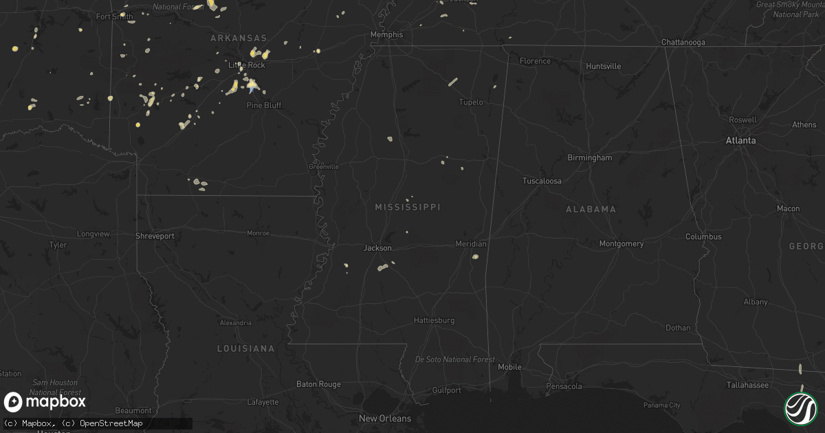
Hail Map in Mississippi on August 8, 2022
Get this storm
August 8 map
$229
one time, instant access
Download today. No call, no setup
Keep the $229
Bought the map and want the full workflow? Apply the entire $229 to a subscription within 7 days. None of it is wasted.
Every map, not just this one
This buys you this map. Subscription and you get every map we run, in the markets you choose from a few cities to whole states to nationwide. Plus real-time alerts the moment a storm fires.
Contact data
Name, contact info, occupancy, even credit band for addresses in the footprint. You go from where it hit to who to call.
Become the source they trust
Unlimited branding weather history reports on demand. You already have the documented answer ready for the property owner, and you are the one who showed up with it.
Property data and RoofTrace estimates
Pull up any address you have got, its value and the exact code rules for that jurisdiction, straight from One Click Code. Then RoofTrace estimates the squares, pitch, and roof value, priced the way you price.
Storm reports in Mississippi
Mississippi
| Date | Description |
|---|---|
| 08/08/20226:38 PM CDT | Multiple powerlines down. |
| 08/08/20222:42 AM CDT | At 742 PM CDT, a severe thunderstorm was located over Reganton, or 17 miles southeast of Vicksburg, moving north at 10 mph. HAZARD...60 mph wind gusts and quarter size hail. SOURCE...Radar indicated. IMPACT...Hail damage to vehicles is expected. Expect wind damage to roofs, siding, and trees. This severe thunderstorm will be near... Rocky Springs around 745 PM CDT. Reganton around 755 PM CDT. |
| 08/08/20221:26 AM CDT | At 626 PM CDT, a severe thunderstorm was located near Hopewell, or 9 miles east of Crystal Springs, moving west at 15 mph. HAZARD...60 mph wind gusts and quarter size hail. SOURCE...Radar indicated. IMPACT...Hail damage to vehicles is expected. Expect wind damage to roofs, siding, and trees. This severe thunderstorm will be near... Hopewell around 635 PM CDT. Crystal Springs around 705 PM CDT. |
| 08/07/20227:50 PM CDT | One tree downed along natchez trace parkway in ne claiborne county. |
| 08/07/20227:34 PM CDT | A tree was reported down on natchez trace pkwy. |
All States Impacted by Hail Map on August 8, 2022
Cities Impacted by Hail Map on August 8, 2022
- Calico Rock, AR
- Van Buren, AR
- Alma, AR
- Noble, IL
- Ironton, MO
- Fredericktown, MO
- Villa Ridge, IL
- Pulaski, IL
- Olmsted, IL
- Oblong, IL
- Robinson, IL
- Walnut Grove, MO
- Morrisville, MO
- Des Arc, MO
- Yellville, AR
- Centerville, MO
- Golden City, MO
- Bunch, OK
- Hornbeak, TN
- Marshfield, MO
- South West City, MO
- Mountain View, AR
- Parma, MO
- Malden, MO
- Gideon, MO
- Dover, AR
- Pelsor, AR
- Bolivar, MO
- Brownsville, TN
- Cecil, AR
- Charleston, AR
- Lavaca, AR
- Fort Smith, AR
- Hereford, TX
- Martin, TN
- Diamond, MO
- Sarcoxie, MO
- Carthage, MO
- Miami, TX
- Joplin, MO
- Neosho, MO
- Stockton, MO
- Subiaco, AR
- Desha, AR
- Batesville, AR
- Witts Springs, AR
- Jerusalem, AR
- Hector, AR
- Deer, AR
- Parthenon, AR
- Sulphur Rock, AR
- Cord, AR
- Cave City, AR
- Fulton, KY
- South Fulton, TN
- Scheller, IL
- Waltonville, IL
- Sesser, IL
- Bauxite, AR
- Sheridan, AR
- Prattsville, AR
- Jackson, TN
- Beech Bluff, TN
- Pinson, TN
- Mountain Grove, MO
- Norwood, MO
- New Athens, IL
- Altamont, IL
- Effingham, IL
- Beecher City, IL
- Saint Elmo, IL
- Greenfield, MO
- Lockwood, MO
- Van Buren, MO
- El Dorado Springs, MO
- New Raymer, CO
- Grover, CO
- Weldona, CO
- Briggsdale, CO
- Gainesville, MO
- Amarillo, TX
- Mound City, IL
- Barlow, KY
- Aurora, MO
- Branson, MO
- Pampa, TX
- Hartville, MO
- Niangua, MO
- Grovespring, MO
- Campbell, MO
- Stilwell, OK
- Salem, MO
- Little Rock, AR
- Hensley, AR
- Clarksville, AR
- Ozone, AR
- Kosciusko, MS
- Kingman, AZ
- Galena, MO
- Highlandville, MO
- Ponce De Leon, MO
- Spokane, MO
- Sweetwater, OK
- Westcliffe, CO
- Gainesville, FL
- Congress, AZ
- Fairburn, GA
- Palmetto, GA
- Des Arc, AR
- Cape Coral, FL
- West Liberty, IL
- Watson, IL
- Ellington, MO
- Caseyville, IL
- East Saint Louis, IL
- Oran, MO
- Oklahoma City, OK
- Willard, MO
- Ash Grove, MO
- Bois D Arc, MO
- Springfield, MO
- Chestnut Mound, TN
- Elmwood, TN
- Strafford, MO
- Jerico Springs, MO
- Sheldon, MO
- Annapolis, MO
- Vulcan, MO
- Piedmont, MO
- Oakwood, OK
- Williamsville, MO
- Ozark, AR
- Elkins, AR
- Combs, AR
- Saint Paul, AR
- Chandler, OK
- Waynesville, MO
- Evening Shade, AR
- Half Way, MO
- Mount Airy, NC
- Du Bois, IL
- Lutz, FL
- Minden, LA
- Ada, OK
- Evergreen, AL
- Seligman, AZ
- Walnut Ridge, AR
- Realitos, TX
- Hot Springs National Park, AR
- Miller City, IL
- Charleston, MO
- Sidney, AR
- Watonga, OK
- Cherry Valley, AR
- Kingfisher, OK
- Clarkridge, AR
- Mountain Home, AR
- Fort Morgan, CO
- Farmington, MO
- Floral, AR
- Locust Grove, AR
- Rosie, AR
- Stotts City, MO
- Pierce City, MO
- La Russell, MO
- Miller, MO
- Avilla, MO
- Wentworth, MO
- Reeds, MO
- Mansfield, AR
- Grand Chain, IL
- Alton, MO
- Doniphan, MO
- Thornfield, MO
- Girard, KS
- Pittsburg, KS
- Seymour, MO
- Dadeville, MO
- Fair Play, MO
- Aldrich, MO
- Fifty Six, AR
- Briscoe, TX
- Cairo, IL
- Newport, AR
- Ellsinore, MO
- Grandin, MO
- Savannah, TN
- Tecumseh, OK
- Shawnee, OK
- Oakland, TN
- Somerville, TN
- Hollister, MO
- Timbo, AR
- Fox, AR
- Edgemont, AR
- Traskwood, AR
- Humansville, MO
- Dunnegan, MO
- Guffey, CO
- Ullin, IL
- Reeds Spring, MO
- Pocahontas, AR
- Mathiston, MS
- Ackerman, MS
- Saint Petersburg, FL
- Nashville, AR
- Mineral Springs, AR
- Gilbertsville, KY
- Perry, OK
- Bloomfield, MO
- Essex, MO
- Hardin, KY
- Benton, KY
- Clinton, AR
- Dennard, AR
- Seneca, MO
- Wyandotte, OK
- Rockville, IN
- Eufaula, OK
- Mcalester, OK
- Canadian, OK
- Vega, TX
- Konawa, OK
- Dumas, TX
- Starkville, MS
- Faunsdale, AL
- Gallion, AL
- Hodgen, OK
- Walnut Shade, MO
- Chestnutridge, MO
- Cutler, IL
- Hoxie, AR
- Nashville, IL
- Hoyleton, IL
- Newark, AR
- Folsom, NM
- Rogersville, MO
- Steele, MO
- Clever, MO
- Marionville, MO
- Billings, MO
- Republic, MO
- Brookline, MO
- Crane, MO
- Nixa, MO
- Bokoshe, OK
- Keota, OK
- Taloga, OK
- Putnam, OK
- Vian, OK
- Lamar, MO
- Ozark, MO
- Muldrow, OK
- Hattieville, AR
- Collins, MO
- Lenzburg, IL
- Deerfield, MO
- Fort Scott, KS
- Fayetteville, AR
- Hindsville, AR
- Mosquero, NM
- Oil Trough, AR
- Amity, AR
- Magnolia, AR
- Conchas Dam, NM
- Hornsby, TN
- Okolona, AR
- Arkadelphia, AR
- Meeker, OK
- Gurdon, AR
- Cherokee Village, AR
- Ash Flat, AR
- Christiana, TN
- Rockvale, TN
- Murfreesboro, TN
- Ina, IL
- Whittington, IL
- Julian, CA
- Boulevard, CA
- Arcadia, FL
- Sherrill, AR
- Antlers, OK
- Morgan, GA
- Crowder, OK
- Cleveland, AR
- Scotland, AR
- Norman, AR
- Mena, AR
- Thomasville, AL
- Waldron, AR
- Austin, AR
- Cabot, AR
- Lonoke, AR
- Jacksonville, AR
- Dragoon, AZ
- New Albany, MS
- San Manuel, AZ
- Broken Bow, OK
- Little Rock Air Force Base, AR
- Sherwood, AR
- Holcomb, MS
- El Dorado, AR
- Utica, MS
- Wheatley, AR
- Redfield, AR
- Punta Gorda, FL
- Clayton, NM
- Chino Valley, AZ
- Prescott, AZ
- Butler, AL
- Lisman, AL
- Mabelvale, AR
- Morton, MS
- Lena, MS
- Hot Springs Village, AR
- Malvern, AR
- Emerson, AR
- Roff, OK
- Fitzhugh, OK
- Cement, OK
- Chickasha, OK
- Perryville, AR
- Pearcy, AR
- Trenton, FL
- Bell, FL
- Port Charlotte, FL
- Hermanville, MS
- Payson, AZ
- Quitman, MS
- Meridian, MS
- Brinkley, AR
- Sells, AZ
- Bismarck, AR
- Langley, AR
- Umpire, AR
- Caddo Gap, AR
- Braxton, MS
- Brandon, MS
- Greenville, FL
- Madison, FL
- Valdosta, GA
- Quitman, GA
- Alexander, AR
- Hazlehurst, GA
- Denton, GA
- Mooringsport, LA
- Oil City, LA
- Glenwood, AR
- Kirby, AR
- Newhope, AR
- Lonsdale, AR
- Benton, AR
- Canyon, TX
- Maben, MS
- Palm Harbor, FL
- Oldsmar, FL
- Clearwater Beach, FL
- Jachin, AL
- Paducah, KY
- Brookport, IL
- Smithland, KY
- Ledbetter, KY
- Calvert City, KY
- Fulton, MS
- Golden, MS
- Crystal River, FL
- Corrigan, TX
- Stuart, OK
- Carthage, TX
- Baconton, GA
- Doerun, GA
- Flippin, AR
- Booneville, AR
- Sallis, MS
- Birch Tree, MO
- Cashion, OK
- Hennessey, OK
- Prescott, AR
- Valliant, OK
- Leola, AR
- Newnan, GA
- Myakka City, FL
- Wickes, AR
- Macomb, OK
- Florence, MS
- Selma, AL
- Marion Junction, AL
- Whiteville, TN
- Campo, CO
- Walsh, CO
- Monett, MO
- Benson, AZ
- Hudson, FL
- Sarasota, FL
- Watson, OK
- England, AR
- Tucker, AR
- Jefferson, AR
- Murfreesboro, AR
- San Jon, NM
- Grady, NM
- Happy, TX
- Animas, NM
- Wesley Chapel, FL
- Tampa, FL
- Land O'Lakes, FL
- Clayton, OK
- Snyder, TX
- Bonnerdale, AR
- Clayton, AL
- Seminole, FL
- Parrish, FL
- Alamo, TN
- Halls, TN
- Stillwater, OK
- Duncan, OK
- Chiefland, FL
- Stoneham, CO
- Lorain, OH
- Sheffield Lake, OH
- Amherst, OH
- Elyria, OH


